• While Stormtrack has discontinued its hosting of SpotterNetwork support on the forums, keep in mind that support for SpotterNetwork issues is available by emailing [email protected].

2025-06-06 EVENT: CO/TX/OK/KS/MO/AR/TN/KY/AL/MS/

Joined
Mar 23, 2013
Messages
433
Location
Denver, CO
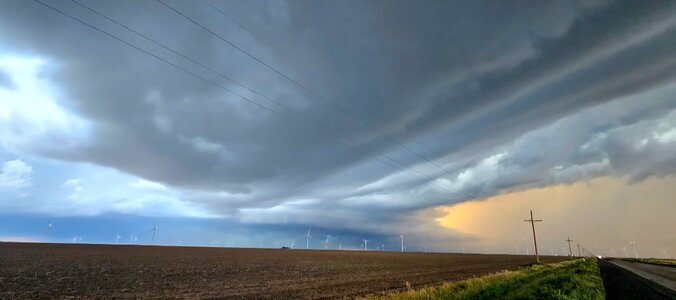
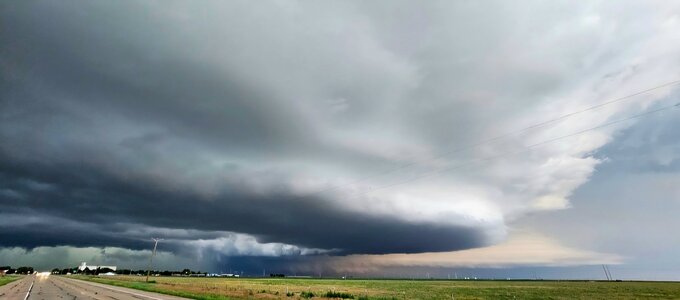
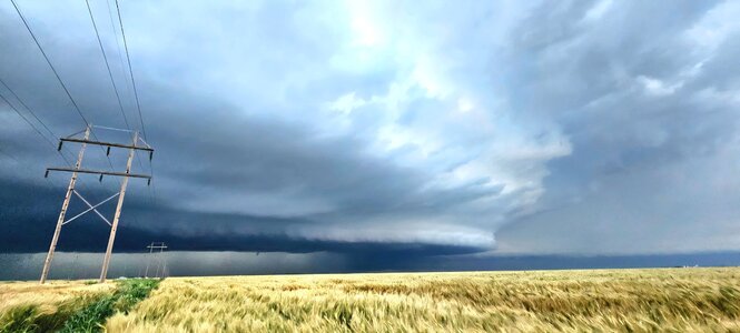
Tomorrow looks like a nice setup across Tornado and Dixie Alley.

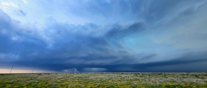
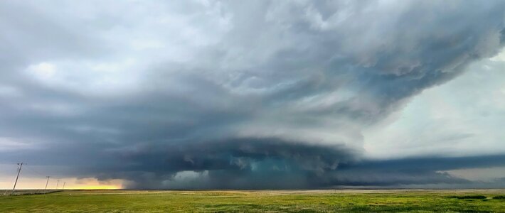
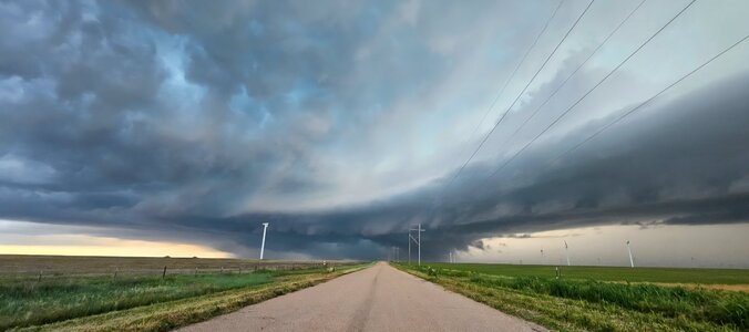
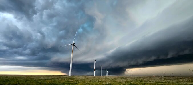
I'll be targeting somewhere between La Junta and Kim, CO. A classic Raton Mesa day setup looks to be in order.

On the 12z + 33 GFS run, models show 50-70 kt bulk shear, steep lapse rates and ample 50-60° dews for moisture with sfc temps in the 80's. The CAPE could be a little higher but in Colorado, 1000-1500 is more than enough to get things going. Low LCL's and the models show a beautiful helicity streak with a decent lifted index (similar to what got things going in Colorado on 5-23-2025). The hodograph isn't overly impressive but again Colorado doesn't need as much as other places do. SPC has this in a 2% tornado hatched but I suspect this may be upgraded to 5% by tomorrow.

Little to no capping should make this a very fun day. I'll revisit the models in the morning and adjust from there.

IMG_2477.pngIMG_2478.png

Oklahoma looks to have a big day as well but that is out of my range with work obligations. Good luck to those of you out chasing tomorrow.

Please feel free to DM constructive critique or corrections.
 
Haven’t looked too much at the northern risk area as we are down in Lubbock for a rinse and (hopefully) repeat today. Uncanny how similar the bi-modal setup is today compared to yesterday - I almost thought SPC had failed to update the Day 1 page LOL.

Currently hanging out in LBB monitoring OFB location. Think it’s likely to migrate further north than yesterday as the air on the cool side is much warmer today than yesterday. Instability on the whole not as great as yesterday in the southern target, but plenty to work with, especially if one storm dominates. Maybe warmer air north of the boundary will be a positive factor compared to yesterday, but it’s hard to imagine any over-performance vs yesterday. Negatives are weak LLJ (similar to yesterday) and higher temp/dewpoint spreads LCLs than yesterday.
 
Woke up in Plainview, went back and forth all morning, but opting for the north play. I'll undoubtedly miss something down south, but my gut is telling me to play the secondary northern target, so I pen this enroute to Boise City, OK.

The Meteorolgy is perfectly valid for a north play, and I definitely think that'll own up a solid showing, and while I think southern play looks better on paper, I just have 'that' feeling...

Yesterday was among one of the biggest chaser conglomerates I've been in recently. And while those in my immediately bubble were well behaved minus a couple quick WTF moments, it proved to be a huge factor in decision making. Twice I had to wait several minutes til I could safely merge/turn onto main roads because of the endless parade of vehicles.

Fortunately the back roads, many unpaved, were in solid condition and not only offered a bit more mobility with much less traffic, it afforded me optimal viewing.

Today, I imagine that option to be much less accessible. If those same roads aren't flooded out, are likely complete mud pits. Even if drivable with AWD, will be much slower with ample risks attached. And if yesterday was any indication, I'd expect similar numbers of people on less available roads.

So, that was my northerly tipping point. Not sure I'd make the same decision if there wasn't a legitimate secondary play within range, but fortunately today there is and my gut is telling me to NOT be south.

So here I go, leaving a perfectly good target for another. I'll see ya in 12 hours...
 
Last edited:
So here I go, leaving a perfectly good target for another. I'll see ya in 12 hours...
Meh... exchanged a few picturesque birdfarts near Lubbock for an intense storm/lower end tornado experience in Spearman. Actually, from a relaxing standpoint, it was kinda nice to be on a storm for five hours, although the southeast movers don't exactly allow for a ton of enjoy time unless you get way the hell out in front, and I did a couple times, both times when it produced a low-contrast, but visible tornado. Ah well...

After Morton the day before, I was hard pressed to be impressed with anything out of this day, and that alone just earns a shoulder shrug for missing the tubes/structure down south.

Onward!
 
I played the northern target yesterday, too, largely because I needed to be back to Pagosa Springs, CO today and did not want to have to drive all the way from Lubbock or maybe somewhere even farther. I chased the first storm that formed near Kim from northwest of Boisie City southeast to west of Griggs where I may have gotten a birdfart through the rain (not picturesque). But I had a much shorter drive home today than I would have if I had stayed near Lubbock. A second storm after dark followed the same track as the first one in daylight, and I would guess that my video of the intense, wind-driven rain with the sirens blaring is better than anything I got in daylight. (Haven't had time to look yet.) BTW, Boise City handled the sirens almost as badly as St. Louis did a couple weeks ago, not sounding them until 10-15 minutes after the TOR warning was issued, when it was pretty evident the circulation was passing east of town, then blaring them for 15-20 minutes, mostly after the threat had passed. There was a tornado reported with the night storm 9 miles east/NE of Boise City, and I am guessing EM decided to sound the sirens when they knew there was a tornado. But by then, the threat of a tornado no longer existed for Boise City.
 
Back
Top