2017-03-26 EVENT: KS/OK/TX

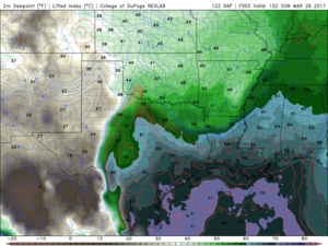
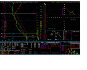
the RAP is the most aggressive with moisture return. And due to the higher moisture, it paints some nice conditions in S Okla near 00z. See sounding from near red river.

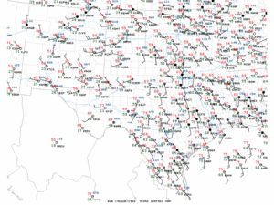
Rap shows low 60 tds to the red river by 17z. It does look like the RAP is currently somewhat close advection compared to current surface obs. See 15z obs below. 60 isodrosotherm is just SW of forth worth.

So, I will be keeping an eye on the Mesonet since that 60 line will be likely getting there as advertised by 17z.

I used to have a nice loop of mesonet maps on my virtual machine using linux but somehow lost all the data. On days like today a loop of Tds across Okla would be fantastic. Anyone know of a place with mesonet loops?

Last, if HRRR verifies then today could exceed expectations.

RAP data:

1c6c8ef09cfb111c95567f77ae92ed25.gif

9155a87226789719f579e29434cfc15b.png


Red River Sounding (8pm):

8464ce282109544d91feba4c42ebf7d0.png
 
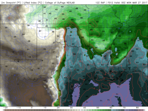
I guess i should have posted a game time map as well to show RAP forecast. Low 60 Tds throughout the warm sector in Oklahoma. This leads to higher than forecast tornado potential. But it still is only low 60s. If we see mid 60s then oh boy. Time will tell.

Here it is:

34f479914aa2b1950c763fedc863098b.png
 
Data is suggesting that the LP is going to enhance the degrading of cap sooner than expected. Can anyone confirm the new Cape in Ardmore for the 2100-2400z timeframe. The HRRR runs yesterday suggested top of 1.5k. I've seen some posted models suggesting 2.2-2.6 by 2200z. That would be a significant hike in instability. This thing seems to be getting positioned for a real tornado possibility. As stated yesterday, the Ardmore residents better be prepared about 630_700pm CT for a major hail and heavy rain maker. DP are forecasted for 63 in this area with a reasonable cape escalation.
 
The trend on the RAP is less encouraging generally trending surface moisture down. It has convection breaking out around 21Z with DP in OKC at around 56* a few runs ago, the 10Z RAP had this at 60* that's a huge difference and makes a significant difference in the tor threat.

Current moisture return is ahead of the NAM, about on par with the GFS judging from the Mesonet. It also appears that we're slightly ahead of the 3k NAM forecast for moisture. Basically on par with the RAP. The RAP holds moisture basically flat for the next several hours so we'll see if reality can make up some ground on the model forecast.
 
Kinematics:

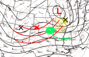
There is a shortwave moving across the southern plains today and tonight.

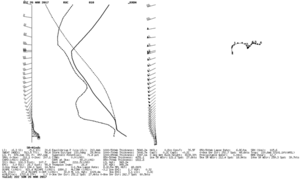
Tracking the shortwave vort max over the last 24 hours and assuming that it deepens somewhat and follows a similar path of its predecessor, I think we can count on very nice west-southwest flow aloft, which will work together with the low level response from the SE to provide extremely favorable wind fields for dangerous tornadic supercells. The sounding below is for Ardmore, OK at 22Z, which shows a classic loaded gun sounding for discrete supercells..
upload_2017-3-26_11-11-22.png

Red is 00Z assumed:
upload_2017-3-26_11-11-16.png

The center of the surface low is a couple mb’s stronger and slightly southwest of where the RAP predicated it at this time…therefore, I believe low level backing may be even better than anticipated as the day progresses and that low tracks ESE across the southern Plains.

Moisture:

Moisture was a concern ever since we started looking at this day. The question of whether or not moisture advection was going to be adequate is becoming clearer.

12Z soundings for CRP show a pretty shallow moisture layer, dropping off quickly at 925mb. We can probably expect that the model forecast is a few degrees above reality, for a variety of reasons. But after performing some hand analysis, I found that it can be reasonably expected to have 55F DPs at the red river by 22Z, and 60F DPs in the Dallas area in that same time frame. This is more than adequate given the other parameters. These numbers are confirmed by SREF. If there was more moisture, this would probably be a high end tornado forecast.

Instability:

The modest low level moisture would typically be a problem for buoyancy, since we would be on a less favorable mixing ratio…BUT this is countered today by a really robust 8.5-9 mid-level lapse rates (and no early convection!) that will span over most of the warm sector. The result: MLCAPE values of 1500-2000 that reaches through southern Oklahoma predicted by a majority of the SREF ensembles.

Lift & Initiation:

According to my 500mb analysis, the greatest PVA will be occurring around E or NE OK this evening…this will not help us much with initiation. There’s not a potent upper level speed max to work with. The cold front will not be surging (thank God). So the dryline will likely be the prime focus for initial ascent. There is some uncertainty between models with regard to the sharpness of the dryline, but all convective allowing models show a necklace of discrete and semi discrete cells forming between the 22 and 24Z time frame, which confirms what the RAP and NAM forecast soundings suggest. Lid strength index shows negative values in the Witchita Falls area first… before overtaking the entire target area shortly after.

Storm Mode:

Due to the wind fields perpendicular to the dryline and the adequate amount of CINH, expect discrete supercells at first, transitioning to semi-discrete and then MCC after sunset due to interactions and lack of robust instability.

If I were chasing today, I would drive to Bowie, TX and monitor from there. I really wish it were closer to KC, MO.
 
Last edited:
Just drew target forecast maps based on latest HRRR and RAP. Both take me to Comanche, OK. I will probably drive to Bowie, TX from DFW and reeval there. Wish I had time to explain my reasoning in detail, but I need to go now. There seems to be a good mix of cape, SRH, lack of a cap, and Td in that area. Some of the more northern areas of the SPC Enh area may be on the wrong side of a shortwave ridge at least initially.
 
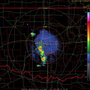
Early initiation underway along the warm front. Severe cell headed through norman. I wonder what this will do for later. Could through out a couple of favorable outflow boundaries.

6cccf500c769b08aa526570e259b72fc.gif
 
Early initiation underway along the warm front. Severe cell headed through norman. I wonder what this will do for later. Could through out a couple of favorable outflow boundaries.

I would hesitate to call this warm frontal convection. It initiated within the cloud band associated with the synoptic scale lift with the incoming cyclone and along the leading edge of MUCAPE, not SBCAPE. Definitely elevated stuff. I think we may get lucky that it's pacing the leading edge of MUCAPE such that it's not really expanding too much in coverage or intensity, but locally intense convective cores are definitely putting out cold outflow. At this point the storms are probably far enough out ahead of the moist sector so as not to severely hamper further destabilization back to the southwest, especially given the strong surface winds. ANy cold pools will likely advect well off to the north and out of the way.

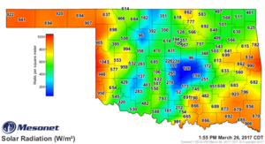
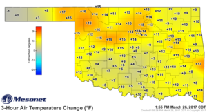
What's really concerning me right now is the thickness of the cirrus band over OK/TX right now. It is severely hampering insolation and heating right now:
current.SRAD.grad.png
current.TAIR_03H.grad.png

A lot of areas of SW OK with downward solar flux of < 500 W/m2 at peak heating in March with fairly restricted temperature increases does not excite me. However, temperatures have already managed to climb into the mid-70s across much of the southern tier of counties in OK so there is sufficient warmth and advection should help compensate for the reduced heating back west. Just gotta hope there's enough lift and convergence along the dryline later on to get storms to fire. I suspect things will go, but coverage and interference are still possible flies in the ointment, as well as chase terrain. SC OK is hilly and forested and there are not always great road options.
 
The more I look at LCL's, the more discouraged I am about tornado potential. RAP doesn't show any sig tor values for the target area because of high bases.

I find it interesting that the SPC mentioned the cirrus as potentially helping to prevent mixing out of the PBL moisture. I would not have thought of that.
 
The early wave of convection across Central Oklahoma already is somewhat concerning to me for later convective chances. I have no doubt that storms will fire, however I can think of a couple days off the top of my head, where an early wave of storms in the early to mid PM caused evening storms to not really reach their ceiling in the tornado department. I believe 4/8/15 across Western Oklahoma was one of those days where early convection left some cold pools around and killed off a couple discrete supercells that fired off the DL. Will that happen today? Don't know. Also of concern, as mention before by other members, is the cirrus deck that is currently spreading across the target area. This could help out mixing issues as moisture depth right now doesn't seem extremely great with the 850mb moisture on mesoanalysis appearing somewhat "narrow" and not really the deepest. So I think if we had full solar insulation, our T/D spreads would be much much higher. As for how this impacts instability and later convective chances, that isn't clear just yet to me. Certainly a complex setup. I didn't make the drive last night because of such uncertainties. Right now I'd be more optimistic about the potential for large to potentially *very* large hail later on versus a significant tornado threat (owing to the issues I outlined in the aforementioned text)....before convection congeals into a linear MCS after dark and moves across Eastern OK and perhaps into Western AR. Not saying the tornado threat isn't there, but I think it is secondary to the large hail threat and will be dependent on a lot of things (moisture, storm mode, and whether storms can stay isolated). Good luck to those chasing today.


FWIW.....if I were chasing today I would probably be sitting somewhere off I-35 near Pauls Valley in South Central Oklahoma. I also like the area from OKC east toward Shawnee off I-44 for a secondary area of tornadic potential later on, but that is again owing to potential moisture and moisture depth issues further north. Tornado potential will probably be maximized around the 00z-01z time-frame in the aforementioned regions based on what I've seen.
 
The triple point/warm front along the KS/OK border has been an intriguing secondary target for quite some time, with the CAMs really picking up on that area's potential in the past 24 hours. If I were chasing this, I thing I would give that a shot. The main drawback I see with that area is that the storm will likely initiate in mid 40s DPs, and it may be toward/after sunset before it and the better moisture (55F+) reach each other.

As for the primary target area along the Red River, I'm concerned about that persistent cloud deck.
 
Back
Top