2017-03-26 EVENT: KS/OK/TX

Tim that is an excellent point regarding forcing and coverage. Forcing does look weaker down there.

Your point about mixing is also a good one and not something I had really given any thought to but it beats keeping in mind as we think about tomorrow.

Sent from my Pixel XL using Stormtrack mobile app
 
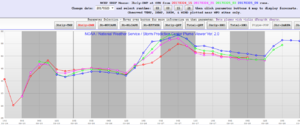
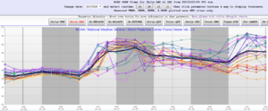
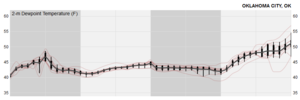
There's been a significant uptick in SREF moisture over the last several cycles. I'm still skeptical on it verifying, though. Also, the 03Z SREF is significantly at odds with the 00Z NCAR ensemble, which keeps moisture well reduced compared to the NAM:

SREF_OKC.png

03Z_SREF_OKC.png

NCAR_OKC_qv.png
 
If OKC only makes it to the low 50s you can scratch any tor threat, it'll be wind/hail. Ultimately we have to find a way to open the window to the gulf and get some moisture here...

Jeff what do you make of the uptick in moisture showing up on the models the last few runs? You said you're a bit skeptical, why is that? Is it as simple as the models have been over forecasting moisture with system after system for a long time now?
 
DP's in south Oklahoma look to be 55-60 around 0z according to latest models I looked at. Gambling that ML moisture pushes through the DFW area to OK earlier than anticipated - Cape 1.5k. Not chasing yet this year but if I were tomorrow, I'd center around the Ardmore area and see what happens to SPC warnings along the I-35 corridor.
Troy


Sent from my iPhone using Stormtrack
 
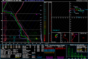
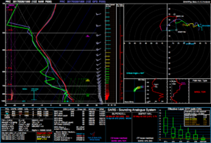
After perusing the 12 UTC NAM and GFS forecasts, there are a few primary differences that I've noticed. I much more like the GFS 18-00 UTC forecast, as it has a much stronger lower level wind field than the NAM, which seems to be nearly doubling the 0-3 km SRH at 21 UTC in southern Oklahoma. Deep layer shear looks good in both forecasts and there is sufficient CAPE (>1000 J/kg MLCAPE) in southern Oklahoma. In addition, at 21 UTC the GFS at Purcell, OK has stronger lift throughout the column (see first image), which has the benefit of eroding the capping inversion by 21 UTC. This is related to the fact that the GFS solution has precipitation break out at 21 UTC, where as the NAM has the precipitation holding off till 3 UTC. Although I should add that the NAM doesn't have any sufficient moistening in the mid levels after 21 UTC, which needed to activate the BMJ convective parameterization.

Pairing forecast soundings from ahead and behind the dry line from the GFS and NAM forecasts suggest that the dry line circulation will be sufficiently deep enough to get parcels ahead of the dry line past their MLLFCs, which is a very good thing if we are questioning the possibility of convection initiation. From this, I am optimistic that storms will develop, but the issues of NWP recently under-doing the mixing Tim Supinie has brought up here and on Twitter constantly nag me and push me to adjust the NWP low-level moisture forecasts to be drier. However, right now I can see 1-2 supercells developing from this setup in southern OK/northern TX, at least from the GFS forecast. In particular, the Ardmore, OK 21-00 UTC GFS forecast soundings look incredible. Now, if the surface dew point drops below 55 F tomorrow, I will be very worried about whether or not storms will actually develop and sustain themselves. I can be a little pessimistic about the moisture quality, but right now I'm feeling cautiously optimistic about tomorrow.

One thing that does stand out is that the NAM at 16-18 UTC has an odd moisture profile (with rapid moistening and drying with height near 850 mb in second image, although the 17 UTC sounding looks better) near the top of the boundary layer that stands out to me as suspicious. My guess is that this must be due to some of the parameterizations in the NAM, and given how unrealistic the profile is (I've never seen something like that in nature), I suspect that the NAM's moisture evolution may be highly dependent upon the parameterization schemes.

P.S. With respect to the NCAR ensemble run, I wouldn't pay too much attention to it, as most if not all of the members have already busted the 18 UTC 2-m dewpoint temperature in southern Texas by nearly 10-20 F, and suggests that any moisture advected from that area northwards during the day or tomorrow will be drier than reality. Per other forecasts, the moisture in southern Texas plays a critical role in moistening up the southern Oklahoma/northern Texas areas as it gets advected northwards by the low-level jet stream. Another thing noted by Tim Supinie (who I've been discussing the forecast with for the past few hours) is that the 2-m dewpoint at Brownsville is running above the mean of 9 UTC SREF forecasts. This may also suggest that the 9 UTC SREF members may be also under-doing how moist the source region is for our moisture.

2017032621_PRC.png

2017032618_PRC.png
 
Last edited:
After perusing the 12 UTC NAM and GFS forecasts, there are a few primary differences that I've noticed. I much more like the GFS 18-00 UTC forecast, as it has a much stronger lower level wind field than the NAM, which seems to be nearly doubling the 0-3 km SRH at 21 UTC in southern Oklahoma. Deep layer shear looks good in both forecasts and there is sufficient CAPE (>1000 J/kg MLCAPE) in southern Oklahoma. In addition, at 21 UTC the GFS at Purcell, OK has stronger lift throughout the column (see first image), which has the benefit of eroding the capping inversion by 21 UTC. This is related to the fact that the GFS solution has precipitation break out at 21 UTC, where as the NAM has the precipitation holding off till 3 UTC. Although I should add that the NAM doesn't have any sufficient moistening in the mid levels after 21 UTC, which needed to activate the BMJ convective parameterization.

Pairing forecast soundings from ahead and behind the dry line from the GFS and NAM forecasts suggest that the dry line circulation will be sufficiently deep enough to get parcels ahead of the dry line past their MLLFCs, which is a very good thing if we are questioning the possibility of convection initiation. From this, I am optimistic that storms will develop, but the issues of NWP recently under-doing the mixing Tim Supinie has brought up here and on Twitter constantly nag me and push me to adjust the NWP low-level moisture forecasts to be drier. However, right now I can see 1-2 supercells developing from this setup in southern OK/northern TX, at least from the GFS forecast. In particular, the Ardmore, OK 21-00 UTC GFS forecast soundings look incredible. Now, if the surface dew point drops below 55 F tomorrow, I will be very worried about whether or not storms will actually develop and sustain themselves. I can be a little pessimistic about the moisture quality, but right now I'm feeling cautiously optimistic about tomorrow.

One thing that does stand out is that the NAM at 16-18 UTC has an odd moisture profile (with rapid moistening and drying with height near 850 mb in second image, although the 17 UTC sounding looks better) near the top of the boundary layer that stands out to me as suspicious. My guess is that this must be due to some of the parameterizations in the NAM, and given how unrealistic the profile is (I've never seen something like that in nature), I suspect that the NAM's moisture evolution may be highly dependent upon the parameterization schemes.

P.S. With respect to the NCAR ensemble run, I wouldn't pay too much attention to it, as most if not all of the members have already busted the 18 UTC 2-m dewpoint temperature in southern Texas by nearly 10-20 F, and suggests that any moisture advected from that area northwards during the day or tomorrow will be drier than reality. Per other forecasts, the moisture in southern Texas plays a critical role in moistening up the southern Oklahoma/northern Texas areas as it gets advected northwards by the low-level jet stream. Another thing noted by Tim Supinie (who I've been discussing the forecast with for the past few hours) is that the 2-m dewpoint at Brownsville is running above the mean of 9 UTC SREF forecasts. This may also suggest that the 9 UTC SREF members may be also under-doing how moist the source region is for our moisture.

View attachment 15348

View attachment 15349


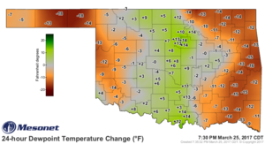
Greg, we have seen some very nice DP readings in OK since the start of the year, 70 in Feb. Do the models bias towards a normal for time of the year? If they do would it be a bias towards under estimating the levels?
 
Jeff what do you make of the uptick in moisture showing up on the models the last few runs? You said you're a bit skeptical, why is that? Is it as simple as the models have been over forecasting moisture with system after system for a long time now?

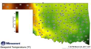
@Greg Blumberg is right that the 00Z NCAR ensemble has severely underpredicted dewpoints in southern TX as of this afternoon. However, going by the math, the winds are only forecast to switch around to "return" flow sometime this evening (perhaps late) and winds in that area are not forecast to be particularly strong (generally 10 kts or less through 12-15Z tomorrow). So the math on advection allows for movement of the higher moisture isodrosotherms of about 250-300 mi northward progression from where they are when winds switch around, which, based on current obs, puts the leading edge of moisture somewhere near the I-20 latitude (DFW area) by 00Z tomorrow, or AT BEST (assuming moisture coming from Houston switches around at the same time) the Red River. The sensitivity of my math to errors in the wind speeds or timing for return does leave a window where moisture gets into southern Oklahoma, however. Also, I have seen moisture return even faster than suggested by the NAM in recent times, so it's not impossible that moisture could make it, although if I recall, those types of events were later in the spring after green-up was long since completed and full ET was in place. This being only late March and it being so dry across much of the southern Plains lately makes me wonder if ET is going to have as strong an impact as it would later in the year.

We'll see if I'm wrong. I certainly could be. But my argument above is mathematically and scientifically defensible.
 
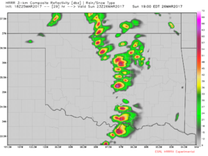
HRRRx has had nice 12z and 18z convective runs for C/E OK.

View attachment 15350

While pretty to look at, these 3km NAM and HRRR graphics don't mean anything if the moisture they are advertising doesn't make it up in time for the main show. The latest run of the HRRR which goes out to 10am tomorrow, shows the nearest 60 degree dew points about 3-4 counties south of the Red River. Will this translate into moisture making it at least into Southern Oklahoma by 00z? Who knows, and even then with such a rapid moisture return, the depth of the moisture is likely going to be coming into question. I'm about 40/60 on chasing this event right now as it is, normally I wouldn't consider a one-day haul for such an event, however Monday may be decent in Arkansas and that would be.......sorta.....on the way home lol. Or I may hold out for the next system on TUES-WED which looking at guidance taken at verbatim, holds chase potential as well, especially over the Western Texas/Caprock region....but that is a discussion for another thread.
 
While pretty to look at, these 3km NAM and HRRR graphics don't mean anything if the moisture they are advertising doesn't make it up in time for the main show. The latest run of the HRRR which goes out to 10am tomorrow, shows the nearest 60 degree dew points about 3-4 counties south of the Red River. Will this translate into moisture making it at least into Southern Oklahoma by 00z? Who knows, and even then with such a rapid moisture return, the depth of the moisture is likely going to be coming into question. I'm about 40/60 on chasing this event right now as it is, normally I wouldn't consider a one-day haul for such an event, however Monday may be decent in Arkansas and that would be.......sorta.....on the way home lol. Or I may hold out for the next system on TUES-WED which looking at guidance taken at verbatim, holds chase potential as well, especially over the Western Texas/Caprock region....but that is a discussion for another thread.

I agree 100%. My confidence in moisture return with decent depth is not that high and the HRRRx is really the only one depicting that type of convection.
I just posted it as it was two runs in a row and gave me a little hope, LOL..

I'm 50/50 on chasing tomorrow. We'll be working on buddies chase vehicle tomorrow afternoon at his house and I'll have mine there so we'll play it pending how it looks around 3 tomorrow and head out from Tulsa if it looks decent.
We have some new tech we're wanting to try so we're antsy to get out on something good.
 
Biggest issue still appears to be how fast strong return flow can get set up. The winds in SE Texas are turned to out of the ESE but they're weak and still being negatively influenced by the wave to the east. The CRP sounding (below) looked pretty good on moisture depth, but assuming a bit of attrition traveling over very dry regions along with return still being delayed would make me think the Red River and southward is going to be the safest bet even though it's slightly displaced from the stronger forcing.

167c47c691c3192d29691962787bc97e.gif
 
Initial thoughts given the 00 UTC data and the short-term forecast:

1.) Wow. I love the moisture quality shown by the CRP sounding. Not sure if that's an isolated pocket that the sounding was able to capture, as the BRO sounding shows a much shallower layer of moisture, and a drier layer aloft that probably contributed to some of the decrease in dew points near the extreme southern Texas border via convective mixing. I do agree with the math put forth by @Jeff Duda, especially given the surface winds (see additional points for more on this). The lapse rates out west near EPZ and ABQ suggest very steep lapse rates are present out west, which should be advected towards OK/TX once the 700-500 mb winds become a little more favorable. Such steep lapse rates should also facilitate additional deepening of the surface low.

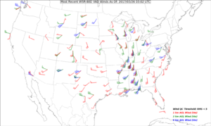
2.) Per my real-time WSR-88D VAD winds map, the winds in south Texas have gradually rotated to have more of a southerly component, and have accelerated to nearly 15-20 knots (see below for map and also sharp.weather.ou.edu/blumberg/vad.png for the 20-min updating map) which should help begin advecting the moisture northward. This is encouraging, although the advection will be slow. Surface winds in south Texas as of 3 UTC are generally southeasterly, which would also promote advection, but the wind speeds are only near 5 knots. We need to get the pressure gradient field to tighten more and get the winds to increase down south.

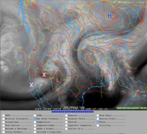
3.) Increase of the winds will be facilitated by the further development of the low out in NM (see annotated figure of water vapor satellite, red lines-potential temperature, and yellow-MSLP). Upstream of the low are two vorticity maxima (denoted by the X), which should help further deepen the low. Per the 850 maps and the VAD winds, there should also be weak warm air advection (WAA) ahead of the low. The combination of the WAA and differential vorticity advection ahead of the vorticity maxima would suggest further deepening, however the 3-hour pressure tendency data do not seem to show this is occurring, which is odd and has left me puzzled. However, I do need to add that the surface MSLP pattern in NM/CO/AZ has what I would informally term "isobaric space", which means that any isobaric patterns (low pressure centers the such) seem to be ill-defined and the spacing between the isobars are rather far apart. A good way of explaining why this is good is that it's often difficult to move an isobar (e.g. 1012 mb) in a particular direction if the isobaric gradient is high given weak pressure falls. It's been my experience that isobaric patterns like this facilitate rapid deepening, especially given the preexisting temperature gradient given by the potential temperature gradient. The question of when is a big one though, especially since QG diagnosis doesn't seem to be providing a valid answer for why the low isn't deepening at this time.

4.) A further complication is that per the MSLP field, it is apparent that tonight's 00 UTC NAM and NAM 3-km do not have a solid handle on the initial conditions of the NM surface low. This evening's 00 UTC forecast initialized the low's central pressure to be roughly 3-6 mb too low. These are the largest errors I can find in the NAM's forecast for right now. A delay in the development of the low pressure center may also delay the advection of the moisture. It seems like the GFS though does have a better handle on the central pressure of the low at the initialization time and evolution of the low. Something I've also noticed is that the GFS has the run-to-run consistency with the moisture and pressure fields.

5.) The 3-km NAM updraft helicity tracks and forecast soundings in NW OK also hinted that cold core convection near the surface low might be fruitful. Anyone going to get suckered north?

Screen Shot 2017-03-25 at 10.08.41 PM.png
vad-1.png
 
00Z ECMWF's depiction of surface dewpoints at 12Z ties in quite nicely with the obs. It suggests dews around 60F into S Cent OK by 21Z, and around OKC by 00Z, with around 1500 J/Kg of CAPE. It also breaks out thunderstorms by 21Z along the dry line too. So there is support for thunderstorm development along the dry line from several models. Moisture may be an issue for lower cloud bases and tornadoes, but I think it will be sufficient, coupled with strong lifting from the approaching upper system helping to weaken the cap, for supercells. Perhaps some gorgeous structure on some LP hail-producers! Personally, if I were out there I'd probably head to somewhere like Paul's Valley, OK, for a starting point, and see what evolves!
 
Back
Top