• While Stormtrack has discontinued its hosting of SpotterNetwork support on the forums, keep in mind that support for SpotterNetwork issues is available by emailing [email protected].

2016-05-08 EVENT: KS//OK/TX/MO

Joined
May 18, 2012
Messages
292
Location
Gaines, MI
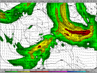
Potent upper level trough ejecting out into the central Plains on Saturday will push further east on Sunday with attendant surface low/triple point to centered over the OK/TX panhandle near 0Z Monday. Boundary layer surface dews are progged to be in the 60s with ample instability through most of the warm sector extending north up to the KS/NE border. A sharpened DL will also move east and will provide additional lift to produce surface based storms beginning 20-21Z. SPC has a 15% out for D5 but that could increase by showtime. Fully expect all modes of severe to be ongoing near dark and into the overnight Sunday. Targeting SC KS near the triple point for now and with this being five days out I will probably adjust as the event draws closer.

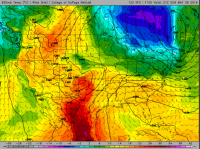
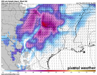
500 Mb Winds:
500.PNG

850 Mb Temps:
850 Temps.PNG

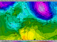
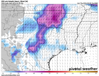
700 Mb Temps:
700.PNG

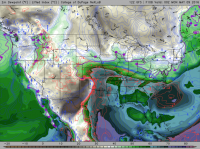
Surface Dews:
Dews.PNG

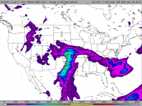
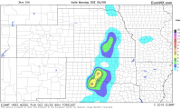
MUCAPE:
MUCAPE.PNG

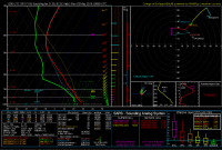
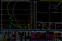
Sounding at KICT 0Z Monday:
KICT.PNG
 
Last edited:
For those hoping for a more "classic" chase setup than Saturday, Sunday might be it. The 12z Euro looks pretty solid too with deep layer shear and plenty of instability. I really like the look of the 500mb jet around that trough as well.
 
Veer-back pretty common in the warm sector of this guy as well:

GFSSGP_700_spd_108.png

I don't understand why the 700 mb winds are so ageostrophic, but there they are. Such a troll-job, too, as winds actually stay backed BEHIND the dryline, although that may be the result of mixing at that point.

The ONE place I found 700 mb flow satisfactory was SC KS. Hodographs there actually looked pretty nice, so I guess we should assume there will be an extra 800 people in Kingman and Harper Counties, KS taking up residence for the day.

Some of the hodographs in C OK are actually only favorable for LEFT movers, as the right mover SMV is on the friggin' hodograph.
 
Finally have this one in the NAMs range. I think the big question will be quality of moisture. Tds > 64 might be do able, but I am not too optimistic. We could be looking at some high LCLs. That said... winds look pretty stout. VBV pops its head up the further north you get.

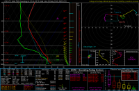
Grabbed this sounding from NAM somewhere in western OK along the border with TX. GFS is showing 50 kts at 850 mb!!! NAM is putting DL as little further west than GFS and is a little slower with the upper air support.

Regardless, Sunday has my attention.

4dc1f666a7d170c015dcfea876fd92c1.png
 
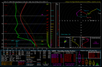
Starting to see a pretty enhanced DL bulge on the 5/5 12Z NAM (84 hr) east of Childress. Having not chased a DL set up before, it would seem that would provide an elevated source of lift in the region near Altus AFB/Wichita Mts/Lawton. Of course this is the NAM and it is picking up some of the VBV you mention @Brian. 700 Mb temps are borderline high, but with over 3,000 j/Kg of SBCAPE I don't think the cap is going to be an issue. Noticed that the Euro and NAM are pretty close on EHI too. It'll be interesting if this holds up over the next few runs. Starting to remind me of Elmer day last year..

Sounding is for Frederick:
Frederick.PNG

Euro EHI:
Euro - EHI.PNG
 
At the current moment SW Oklahoma looks prime. The only lacking item is deep quality moisture. Two things that really popped out for me were the 850 mb and 925 mb winds. Reminds me of 4/14/12 where the LLJ was screaming all day long in KS/OK.

Here are the GFS and NAM 850 winds for 00z.

6c8c117faa57ff6016d402e94819bd56.png

7490753a3c14800a7afa0771fa62948a.png
 
Does this sounding from the NAM mean that we could be seeing potential night time tornadoes? Very little CINH.

SOmewhere in SW Oklahoma.

de9b5b6962a1247e6d9c0802cc63ffd8.png
 
Looking pretty favorable on most fronts in the 00z model suite. The Euro came in with stronger WSW 500 mb flow (50-60 kts) overlapping the dryline by 00z Monday with strongly backed surface winds leading to plenty of convergence and a 35+ kt LLJ. We have 30 m 6 hour height falls at 500 mb, which is quite substantial. The upper level venting is also quite impressive with 80-100 kt flow in the left exit region at jet level.

Dewpoints are getting into the mid 60s this run (and in other models as well). I can't say the VBV concerns me too much the way it looks now, since most of the backing is in the level above 500 mb, which is typically less problematic (and this is mostly a symptom of the slow ejection of the 00z NAM as opposed to the 00z GFS or Euro).

Here's a sample forecast sounding near Canton at 00z Monday off the GFS. If you add a bit more surface backing (like what should occur with a deep surface low over the KS/CO border or even closer) into this picture and further lengthen that low level hodograph, it gets more impressive.

gfs_2016050600_072_36.25--98.5.png

As far as things to nitpick, obviously it would be better to have no VBV and slightly better BL moisture, but this is looking like a pretty good chase day right now, all things considered. I like the potential for a reasonably sustained supercell storm mode as well, given the shear vector orientation to the dryline.

Should probably also mention there might be some after dark potential here, with the LLJ quickly intensifying to near/over 50 kts by 03z and continued low level moistening, the boundary layer is probably going to be reluctant to decouple.
 
Last night's Euro looked pretty solid, at least from what I could make of it. This morning's NAM has trended more in line with the GFS. The GOM is finally in recovery mode. I am interested in the quality/depth of moisture which develops in the next 48 hours.
 
Western Oklahoma may be a good chase target for reasons I will describe shortly. Warm front dry line intersection in Kansas will struggle with ongoing rain. Even the Kansas outflow boundary farther south may have relatively low temps/dews right on the other side. I prefer more recovery both sides of the boundary, which is in question.

Western Oklahoma should have higher instability even if midday showers develop in central Oklahoma. Upper level winds are stronger in Oklahoma. Stout low level wind fields are forecast. Timing of short-waves creates intermittent VBV but the NAM does not have it all hours. Euro has VBV in a higher layer around 500 mb vs 700 mb deal killer. GFS still has somewhat harsh VBV. However those said short-waves create the opportunity for a DL bulge, esp if a mesolow can develop in southwest Oklahoma. At this time I favor the DL in western Oklahoma.
 
Western Oklahoma should have higher instability even if midday showers develop in central Oklahoma. Upper level winds are stronger in Oklahoma. Stout low level wind fields are forecast. Timing of short-waves creates intermittent VBV but the NAM does not have it all hours. Euro has VBV in a higher layer around 500 mb vs 700 mb deal killer. GFS still has somewhat harsh VBV. However those said short-waves create the opportunity for a DL bulge, esp if a mesolow can develop in southwest Oklahoma. At this time I favor the DL in western Oklahoma.

Not sure I agree with that especially looking at the 12z run in the favorable parameter space in W/central OK.

These are no garden variety low level shear profiles either, something that was a big issue on 4/26. >65 kts of effective shear is also getting into the upper echelon as far as that quantity is concerned.

gfs_2016050612_060_35.5--98.25.png
 
I know I can't target the whole state of OK, but this is reminding me a lot of Elmer last year, and if I was hedging my bets I'd be targeting Lawton at this point. The 60 hr sounding near there looks a lot like the one above @Andy.
 
I can understand some of the concerns for moisture return tomorrow, but in May and after wetting rains across most of Texas recently, I have a really tough time thinking that we won't see mid 60 dew points along the red river by Sunday evening. Most of the models don't paint extremely low LCLs, but an LCL of 1km is going to be just fine.
 
Back
Top