Okay...I'm going to bring some of my expertise from a mesoscale analysis standpoint to try to bring some light into why I reject the higher dewpoint values being forecasted by the NAM/GFS and the higher resolution models. In my expert opinion, these solutions are out to lunch in forecasting 65+ F dewpoints for tomorrow at 00 UTC. Keep in mind that this critique is associated with the ingredient of moisture...since that seems to be a key question.
I present the first part of my argument: the 18:15 UTC visible satellite loop in the Gulf of Mexico:
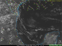
Looping the satellite, you'll shallow-open cell convection scattered across the Gulf. This is associated with the latent and sensible heat fluxes (thanks to Tim Supinie for helping me remember that terminology of the cloud pattern). However, in particular you'll see a couple of fine cumulus lines within the western Gulf. Looping these shows that deeper convection is attempting to develop along these lines, but all air being transported upwards is unable to develop any deep convection. This is evident by the orphan anvils/cirrus shield that get transported eastward, which also suggests that the moisture ahead of these lines are being transported upwards. These boundaries are being advected into the region where NWP suggests we'll get better moisture, and if you look behind the boundaries, there's less cumulus convection, which suggests drier and more stable air may be replacing our "moister" air source. I don't know much about the properties of these boundaries...I can't find much literature on them. However, the observations seem to support my hypothesis. These features are unable to be resolved or analyzed by NAM/GFS, and correctly analyzing them in the storm scale models may be possible, however with limited observations in the Gulf, it's unlikely they are able to correctly initialize them. My guess is that largely given the small scale nature of these boundaries, they may wreck havoc in NWP moisture forecasts as they are unable to a) correctly analyze these features and b) their existence and modification are largely dependent upon the boundary conditions of the model/parameterization schemes. Scientific literature suggests that in severe storm environments, water vapor has the largest variability compared to other variables (e.g. temperature, wind), and therefore it may be more of a failure mode than other variables.
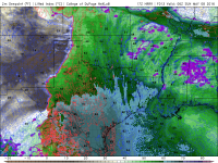
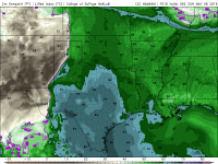
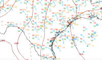
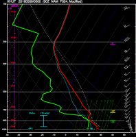
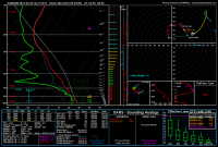
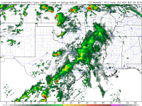
Second, the 12 UTC NAM and GFS ( shown below) are severely over estimating the surface dewpoints within the northwestern Gulf. Per the observations above, much of the Gulf is characterized by dewpoints in the 50s, with very little cumulus convection occurring. If we look at todays lower-resolution NWP runs, we'll see that by 18 UTC they are advertising lower 60s surface dewpoints. Both models are generally running too high in surface dewpoints 24 hours before the said event in that air behind the aforementioned boundaries. Although this is not considered to be our moisture source region given the synoptic scale features, satellite observations don't seem to show any significant differences in the air mass characteristics both in the northwestern Gulf and the air behind the southwestward moving outflow boundaries.
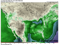
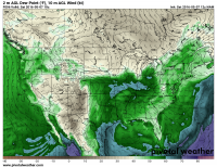
That being said, I'd tend to go on the lower end the model guidance with surface dewpoints (e.g. lower 60s) rather than the excessive 65+ F being advertised by the NAM/GFS for tomorrow. If we want higher moisture, I get the sense we'll have to consider other sources. At least from my diagnosis, the current observations suggest that there aren't many processes that could help increase Gulf moisture in the near-term (~6 hour forecast).
Consequences of this modification to the NWP forecast may lower the tornado threat for tomorrow evening, but I would say that other forms of severe weather are certainly possible with lower moisture content. Ingredients can work to support one another in forming and maintaining storms. If you discuss weaknesses in a forecast, please be sure to clarify the consequences of said weaknesses! Weaknesses in the ingredients may cause issues in storm initiation, maintenance, and demise. It's important to specify where in the forecast such weaknesses may play a role.

