Quincy Vagell
EF4
After a relatively quiet work week for severe weather, it looks like the next notable threat in the central U.S. will probable return in time for the weekend on Saturday.
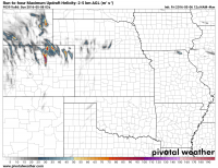
Around this time, there is good model agreement that the omega blocking pattern will break down, allowing for the next trough to eject eastward from the Southwest/Four Corners region. Moisture return looks modest with low to mid-50s dew-points progged over much of the High Plains, but this should be enough given steep mid-level lapse rates to generate marginal to locally moderate instability. Look for storm potential in two zones, just ahead of a dryline from western Kansas into the OK/TX panhandles and closer to the triple point, somewhere near the CO/KS/NE border vicinity.
My guess is that the hot spot ends up being western Kansas, but this is far enough out that details, including low placement, can change. Colorado may be on the western fringe of this threat, but if the lee cyclone parks itself over eastern CO, we could see a narrow corridor of instability nudge into the northeastern part of the state. Likewise, if the system remains a bit farther south, appreciable instability may have trouble penetrating north into western Nebraska. Either way, those states have been included for forecast uncertainty and the fact that they were outlined in the 5/3 day 5 convective outlook by SPC.
Other caveats to be considered:
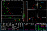
Sizable temperature/dew-point spreads with southward extent, limited shear (looks marginal along the dryline), 00z TUE ECMWF showed issues with VBV in the wind profiles.
After a week off from chasing, I've been eyeing for a return to the Plains on Saturday and as the event draws closer, confidence continues to increase.
Last edited:


