11/05/05 FCST: MO/IL

Status
Not open for further replies.
One thing to be careful of is the Td increases. The winds may be out of the S or SW in the Ohio Valley, but "the air isn't of Gulf origin yet" as Dr. Smith said this morning. The real question here is going to be can the air get juicy enough in time to generate anything of interest. In the lower MS valley, sure. I'm not convinced as of right now that the Ohio Valley north to the Great Lakes will be moist enough to support severe convection this weekend.


BC
 
Originally posted by Ben Cotton
One thing to be careful of is the Td increases. The winds may be out of the S or SW in the Ohio Valley, but \"the air isn't of Gulf origin yet\" as Dr. Smith said this morning. The real question here is going to be can the air get juicy enough in time to generate anything of interest. In the lower MS valley, sure. I'm not convinced as of right now that the Ohio Valley north to the Great Lakes will be moist enough to support severe convection this weekend.

BC

Low-level wind trajectories are pretty favorable (current obs show southwest flow across this region) for deep moisture advection into the Missip. valley through the next 48hrs... By Sat., I don't find the progged 60F SFC Tds too hard to believe. As for later this weekend, I don't think the great lakes/Ohio valley will see much at all -- if anything -- as models have been absolutely clueless and completely inconsistant from run to run on how to handle the evolution of this trough once it lifts out of the Missip. valley by late Sat.
 
Latest 0z NAM run shows more hope for the area... Steep lapse rates and warm/moist boundary layer is forecast to support strong instability by early afternoon across northern AR/southern MO. Forecast soundings continue to indicate favorable low-level shear/thermodynamic profiles for rotating updrafts with a threat for large hail. I would expect initiation shortly after 21z across northcentral AR/southcentral MO -- imediately east of the surface low -- where a favorabley backed surface flow pattern exists (and gradually veering with height). Low-level shear is still rather modest, with 200-250m2/s2 overlapping the stronger low-level instability. Deep-layer shear profiles will support long-lived updrafts... While low-level shear is marginally supportive of an isolated tornado.

This looks to be a >8hr drive for me... So, I'll have to wait and see.
 
Nick,

You better watch that NAM. It hasn't been initializing well from the bouy data of TD's in the western Gulf. Wayyyy too high on initialization. I am not really buying too much of a severe setup attm. I think some isolated torandoes may be possible in N AR given SFC Low placement and maybe some deeper moisture advection.
 
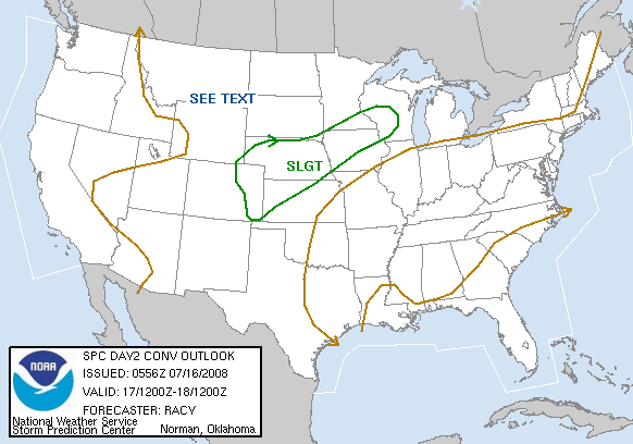
Well looking at the latest 00z GFS with a nicely negatively tilted trough developing in MO and slamming into central IL/IN the SPC had this to say in SWODY 2.

STRONG VERTICAL
SHEAR WILL LIKELY SUPPORT SUPERCELL STRUCTURES...ESPECIALLY OVER THE
MS VALLEY REGION...BUT EVOLUTION INTO LINES IS ALSO PROBABLE.
INITIAL SEVERE THREAT SHOULD BE OVER THE MS VALLEY...SPREADING NEWD
INTO THE TN AND OH VALLEYS OVERNIGHT. AN UPGRADE TO HIGHER
PROBABILITIES AND POSSIBLY A SIGNIFICANT SEVERE AREA MAY BE
WARRANTED IN LATER OUTLOOKS ONCE UNCERTAINTIES REGARDING THE TIMING
AND EVOLUTION OF THE UPPER TROUGH HAVE BEEN MITIGATED.


day2otlk_0800.gif


They obviously are going with the 00z GFS.
 
Originally posted by Dan Cook
What's that showing?

Looks like vorticity at 500MB... It shows a rather sharp negatively tilted trough axis, with good vorticity. That would suggest rapid deepening of the SFC based system, and an increased threat for severe weather (possibly "strongly forced" convection, given the associated low SFC based stability).

Not that I got ALL of that from that single image, but I am remember bits and pieces of the 00Z and 06Z GFS run.
 
This situation is very intriguing. While I'm not sure I agree with the language of the SPC discussion (a little strong IMO and what a change from yesterday), I'm finding this forecast much more fun than a guaranteed outbreak.

At the surface it looks as if some higher dew points are sneaking their way up the Mississippi R. Valley on the west side of the surface high that's been sliding east and currently is over GA. That's good news for moisture, especially considering the 150mb deep moist layer on some soundings near the Gulf and just east of the Mississippi. However, just on the other side of the River, the moisture is much more shallow. The biggest problem I see is that wind profiles (except the surface) are all from the west-southwest all over the place, blowing that drier air towards the moisture and target area. Further, soundings in the target area are dry and any more dry air is not going to help. However, if a nice 50-100mb moist BL can set up in the target area, given the 40-45 kts shear (00Z GFS), I don't see a problem with some nice sfc based convection. It'll be fun to look at the 00Z soundings to see what happened through the day.
 
I will be headed out tonight, and will get a hotel somewhere in central IL... The 0-3km SRH is pretty good across a broad area (150-300m2/s2 overlapping moderate-strong SFC based instability) and it looks pretty darn good immediately south of the NAMs surface low placement across central IL. With the 30-40kt SSW 850mb flow, we'll see some pretty good low-level shear south of the frontal boundary. If we could have gotten some extreme instability and some 70F SFC Tds, I could have seen a high risk... As of now, it could indeed be a moderate risk day based on the latest runs. As inhibitation continues to weaken as strong short wave trough pushes through... Rapid severe thunderstorms are anticipated around 21z along/south of the front, as instability increases to widespread >2000J/KG and low-level convergance will support a few isolated intense and tornadic thunderstorms. Very favorable veering with height will result in very sufficiant deep-layer shear profiles for long-lived updrafts (35-50kts), while low-level shear (and low LCLs) is supportive of tornadoes.

Overall, the best threat for tornadic supercells exists across central/southern IL... Where strong SFC based instability will be coinsident with very sufficiant vertical/low-level shear profiles and surface moisture pooling. I will probably head to the Peoria area tonight...
 
I would agree with what Nick is laying out here, if the NAM verifies. It is showing EHI of 3.4 southeast of St. Louis, which certainly is plenty for supercells. However, it often tends to overstate this a day ahead. Also - the GFS shows a rather different picture, with the system farther north, and quite a bit of the precip north of the front over the cold air, not in the warm sector. No convection around STL until after dark. Now, if the GFS moves toward what the NAM is predicting, it could be an interesting day. Latest Day 2 outlook from SPC has backed off a bit on the strong language. Since I am smack in the middle of the area of interest, it looks like a potentional local chase for me, if things go as the NAM is suggesting - I will have my gear ready go go, and will have one eye on football and one on the developing weather pattern!
 
Ever the pessimist, I'm going to say I'm still not convinced for tomorrow. Despite what the models say, I don't think there will be sufficient moisture to support convection worth driving any great distance for. Below is the observed and model initializations of 850mb mixing ratio for 12Z this morning. The upper-left panel is observed mrat, with NAM in the upper-right, GFS in the lower-left and NGM in the lower-right.
850_mrat_init_4p.gif
Note that each plot has the same contour base and interval. You'll see right off that the GFS is totally out to lunch on the moisture issue. Dynamically, it appears to over-develop the 300mb trough coming off the Rockies. Therefore, the GFS solution isn't likely to be too reliable. The NAM and NGM also seem to overmoisten the air, although the coarser resolution of the observed data makes this harder to determine. Still, it is cause to believe that the models are expecting more moisture in the next 24-36 hours than the actual conditions can provide.
Right now, KILX looks pretty shaky for convection (of course this may change in the next 24 hours).
skewt-kilx.gif

Even along the Gulf at KLCH, the moisture is pretty scant.
skewt-klch.gif
Since the low-level winds are still more southwesterly than southerly, I don't buy any great moisture advection in the next 24 hours.
Assuming the NAM solution is close enough to be reliable, there might be the chance of convective entertainment along and north of I-64 in the early afternoon, but I'll take my chances watching Purdue lose to Michigan State ( :cry: ) instead of making the drive to southern IL.


BC
 
I don't really see why you are talking moisture problems... There is already SFC Tds into the mid 50's into southern IL (with near 60F readings in the bootheel area)... This is compared to SFC Tds in the upper 30s and low 40s across this same area by this time yesterday (that is a 15-20F rise in Tds in less than 24hrs). I don't see why moisture would be "shallow" across this region by tomorrow... Forecast soundings indicate a fairly deep moist layer across the upper Mississipi valley (AR, MO into IL) tomorrow afternoon - and given the present conditions, I find this totally believable. If the models continue to indicate SFC Tds into the low 60s -- when they are currently in the mid 50s across the same area (and continuing favorable low-level wind trajectories) -- I have NO reason to doubt it (and neither does SPC or any WFOS across this area). It sure as heck looks pretty on the money to me...

NAM forecast for 18z (now):
<img src=http://www.rap.ucar.edu/weather/model/eta06hr_sfc_dewp.gif>

Current SFC obs:
<img src=http://www.rap.ucar.edu/weather/surface/2005110419_metars_lit.gif>
 
I love November, however this is not going to be anything to get excited about. IMO, there will be some decent thunderboomers over southern Ill. but thats about it. My prognostication is that there will be no tornadoes with this one. I'm more concerned with what is going to come over the Rocky's in the next few days. I'm gonna take some photo's of our mini-blizzard outside right now.

Cheers and good luck,

Jared
 
I think it's also important to remember that moisture also advects along an isentropic surface, so using the 850MB level might not be completely accurate.

Besides that, the system will be deepening rapidly - even if Td's don't reach the lower 60's, the strong forcing and speed shear should make up for it (especially tomorrow night across the Lakes). Although, most people don't chase lines, so it would probably be considered a "bust" anyway...
 
Status
Not open for further replies.
Back
Top