• A student is looking for help on tropical cyclone prediction. Please fill out the survey linked to this thread: https://stormtrack.org/threads/storm-and-hurricane-intensity-prediction-survey.32957
  • After witnessing the continued decrease of involvement in the SpotterNetwork staff in serving SN members with troubleshooting issues recently, I have unilaterally decided to terminate the relationship between SpotterNetwork's support and Stormtrack. I have witnessed multiple users unable to receive support weeks after initiating help threads on the forum. I find this lack of response from SpotterNetwork officials disappointing and a failure to hold up their end of the agreement that was made years ago, before I took over management of this site. In my opinion, having Stormtrack users sit and wait for so long to receive help on SpotterNetwork issues on the Stormtrack forums reflects poorly not only on SpotterNetwork, but on Stormtrack and (by association) me as well. Since the issue has not been satisfactorily addressed, I no longer wish for the Stormtrack forum to be associated with SpotterNetwork.

    I apologize to those who continue to have issues with the service and continue to see their issues left unaddressed. Please understand that the connection between ST and SN was put in place long before I had any say over it. But now that I am the "captain of this ship," it is within my right (nay, duty) to make adjustments as I see necessary. Ending this relationship is such an adjustment.

    For those who continue to need help, I recommend navigating a web browswer to SpotterNetwork's About page, and seeking the individuals listed on that page for all further inquiries about SpotterNetwork.

    From this moment forward, the SpotterNetwork sub-forum has been hidden/deleted and there will be no assurance that any SpotterNetwork issues brought up in any of Stormtrack's other sub-forums will be addressed. Do not rely on Stormtrack for help with SpotterNetwork issues.

    Sincerely, Jeff D.

Not so scary storm images.

  • Thread starter Thread starter Mike Hollingshead
  • Start date Start date
Wow - these are AWESOME ... nice work folks!

April, 2004 - Falls City, Nebraska:

122_2220.jpg


122_2245.jpg
 
Hi,

Awesome pictures!

Aaron, it would be great if dates can be supplied as I am interested what days those images were taken. Same goes to others who haven't - it would be great as it helps give a different perspective!

Regards,

Jimmy Deguara
 
Great thread! Here are a few of mine:

May 29, 2001 - Texas Panhandle supercell


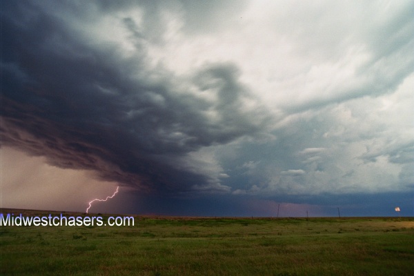
July 15, 2003 - Scott Depot, WV lightning


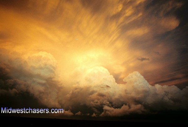
June 1, 2004 - Charleston, WV congestus with pileus


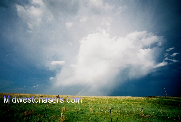
December 10, 2004 - Fayette County, WV rainbow


August 8, 2001 - Hurricane, WV lightning


June 12, 2004 - Rock, KS tornado rope-out


June 9, 2005 - Rooks County, KS tornado rope-out


June 7, 2005 - Kadoka, SD CG with LP supercell


And one of my favorites of all-time, a chaser's dream scene, though just a video frame shot:

June 12, 2004 - Mulvane, KS double CG with tornado
 
Hi Dan,

The angle of the South Dakota supercell suggests you were not too far away from where we were. We actually were on top of a shooting range embankment which gave us an excellent view of the storm without obstacles. I recall the staccato lightning so I would say that I have it on video and will get a still later. Did you get a good timelapse of the storm? It rotated beautifully! To keep on track with the thread - perhaps send a private reply.

Back on track, thanks for the locations etc - absolutely incredible pictures. Once can really appreciate what storm chasing is all about when you see the variety of the images displayed here and of course on other galleries.

Regards,

Jimmy Deguara
 
Well, these aren't mine (I have to develop my photos someday!), but I'm quite fond of them.
nssl1051.jpg

Somewhere in the plains, mid–late 1970s, by the NSSL Storm Intercept Project. (See the wall cloud down the bottom?)
nssl1154.jpg

Another one from the '70s sometime, this one by Steve Tegtmeier.
 
Great thread, awesome pics.

It isn't anything of mine, but I feel that a thread like this simply wouldn't be complete without a link to these incredible pictures.
Here's a taste:
LP9.JPG

This astounding LP updraft and tornado occured on 3/21/05 in Marlin TX, where it was photographed by Bill Purcell. Simply amazing.
 
Back
Top