cdcollura
EF5
Good day all (Mods please adjust and feel free to add any other states if applicable)...
This is my chase summary for April 4, 2023 in Iowa (including the tornado in Marion County late in the day): On April 4, I looked at data in the morning, and decided on Iowa City and points south as an initial target area, with a second target farther west and south of Des Moines and eastward from there. A warm front was draped across southern Iowa, with a low pressure area entering the western part of the state by afternoon. I pretty much headed east on I-80 to Iowa City, then south on I-380 / Highway 218 towards Mount Pleasant, which was south of the warm front. A near 30 degrees F temperature gradient was encountered with this boundary, with Iowa City in the upper 50s, and upper 80s near Mount Pleasant. The atmosphere remained capped until late afternoon, with small storms firing east of the area (near the Quad Cities area), and a second complex farther west south of Des Moines. I did not want to cross the Mississippi River for the first storms, so I opted to head back west, mainly on SR 92, targeting the "tail-end" storms south of Des Moines. The SPC also issued mesoscale discussion 462, and subsequent tornado watch box 115, valid until 10 PM CDT for all target area(s). I headed west on SR 92 through Sigourney and continued west for about an hour, for a long-range intercept of the "tail-end Charley" storm south of Des Moines in the second target area, mainly in Marion County. This storm became severe, then tornadic by 7 PM, with a large tornado observed near Knoxville. The chase then turned north along SR 14, and east again towards Pella. The storm cycled again, and a possible large tornado (even wedge?) was observed northeast of Pella in darkening light near SR 102 and 163 and north of New Sharon. I wrapped up the chase at dark, taking Highway 63 north to I-80, then west into Des Moines for the night.
Full on-going chase log for 2023 (including this one) can be found here: www.sky-chaser.com
Details (on April 4, 7:00 PM): Interception and observation of an extremely severe (and tornadic) thunderstorm from Marion County near Knoxville / Pleasanton, Iowa and north and east towards Poweshiek County and along SR 92 / 12 and eventually towards SR 102 and Highway 63. The storm was a classic supercell storm, intercepted from the east long-range. A large elephant-trunk / rope tornado was encountered once close to the supercell storm, which listed rapidly northeast and dissipated near Lake Red Rock. A second, and larger possible tornado was also observed near Sully and Pella looking northeast after dark. The storm core was not penetrated, and hail hail up to 3". Rain, strong winds, and frequent lightning was observed with this storm as well. The storm had an impressive visual appearance, with RFD clear slot and striated updraft. Conditions causing the storm were surface heating, a low pressure area, warm front, and powerful upper-trough. Documentation was digital stills and HD video. A 2023 Hyundai Santa Fe was used to chase the storm. A tornado watch was in effect for the area until 10 PM CDT.
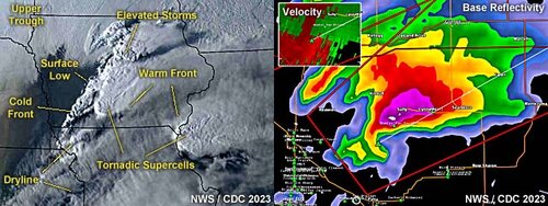
Above: These are two images, visible satellite for 23z on April 4 to the left, and a radar image of the Marion County, Iowa supercell at roughly 7:30 PM CDT to the right. The annotated satellite image shows the important synoptic features pertaining to storm development, as well as two areas of tornado-producing storms (south of Des Moines, Iowa and west-central Illinois). To the right, the base-reflectivity radar image (DSM) of the tornadic storm racing NE out of Marion County can be seen as it was cycling back up to produce a second tornado north of Sully, Iowa. The inset to the upper-left shows the velocity couplet of the supercell storm.
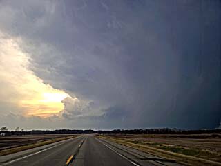
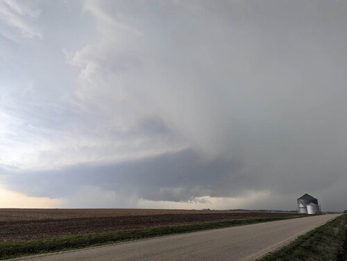
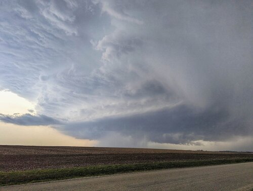
Above: Looking west along SR 92 and headed towards Marion County, Iowa, a "tail-end" supercell can be seen looming over the horizon. This is the storm being targeted at roughly 6:30 PM CDT. The view is to the west near Sigourney, Iowa. Note the impressive anvil blow-off - This storm was along the "triple-point" and warm front near the surface low, and experienced nearly 200 MPH of bulk wind shear from the low levels to 10km altitude (east winds at 35 Kts near surface 925 mb and WSW at 150 Kts with jet stream at 250 mb level)!
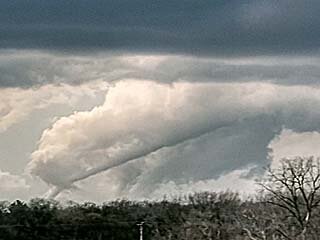
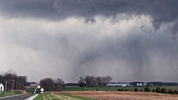
Above: View of rope tornado looking WNW out of the Knoxville / Pleasanton area in Marion County, Iowa at roughly 7 PM CDT. Wish I was closer in and had better view. But it is what it is.
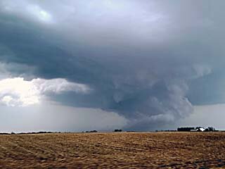
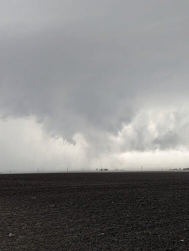
Above: The storm quickly cycles up again, and produces another possible tornado (at least a rapidly developing wall cloud) near Sully, Iowa before 8 PM. The image has been brightened as it was getting dark, and the view is to the NE from near Pella, Iowa. This storm was moving NE at 50 to 60 MPH, so there was little chance of catching it at this point. I will justify using the term "Possible Tornado" in this case
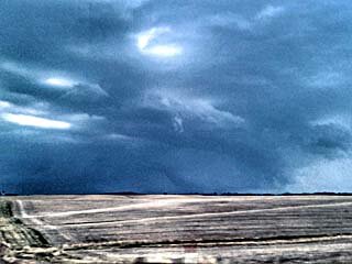
Above: Highly enhanced (after dark) view of a possible large tornado from near Sully, Iowa. Lightning provided some illumination. This was another confirmed tornado according to emergency management, fortunately, over open country, but few chasers were on it. The view is to the NE, and I quickly lost sight of it after this and ended the chase.
This is my chase summary for April 4, 2023 in Iowa (including the tornado in Marion County late in the day): On April 4, I looked at data in the morning, and decided on Iowa City and points south as an initial target area, with a second target farther west and south of Des Moines and eastward from there. A warm front was draped across southern Iowa, with a low pressure area entering the western part of the state by afternoon. I pretty much headed east on I-80 to Iowa City, then south on I-380 / Highway 218 towards Mount Pleasant, which was south of the warm front. A near 30 degrees F temperature gradient was encountered with this boundary, with Iowa City in the upper 50s, and upper 80s near Mount Pleasant. The atmosphere remained capped until late afternoon, with small storms firing east of the area (near the Quad Cities area), and a second complex farther west south of Des Moines. I did not want to cross the Mississippi River for the first storms, so I opted to head back west, mainly on SR 92, targeting the "tail-end" storms south of Des Moines. The SPC also issued mesoscale discussion 462, and subsequent tornado watch box 115, valid until 10 PM CDT for all target area(s). I headed west on SR 92 through Sigourney and continued west for about an hour, for a long-range intercept of the "tail-end Charley" storm south of Des Moines in the second target area, mainly in Marion County. This storm became severe, then tornadic by 7 PM, with a large tornado observed near Knoxville. The chase then turned north along SR 14, and east again towards Pella. The storm cycled again, and a possible large tornado (even wedge?) was observed northeast of Pella in darkening light near SR 102 and 163 and north of New Sharon. I wrapped up the chase at dark, taking Highway 63 north to I-80, then west into Des Moines for the night.
Full on-going chase log for 2023 (including this one) can be found here: www.sky-chaser.com
Details (on April 4, 7:00 PM): Interception and observation of an extremely severe (and tornadic) thunderstorm from Marion County near Knoxville / Pleasanton, Iowa and north and east towards Poweshiek County and along SR 92 / 12 and eventually towards SR 102 and Highway 63. The storm was a classic supercell storm, intercepted from the east long-range. A large elephant-trunk / rope tornado was encountered once close to the supercell storm, which listed rapidly northeast and dissipated near Lake Red Rock. A second, and larger possible tornado was also observed near Sully and Pella looking northeast after dark. The storm core was not penetrated, and hail hail up to 3". Rain, strong winds, and frequent lightning was observed with this storm as well. The storm had an impressive visual appearance, with RFD clear slot and striated updraft. Conditions causing the storm were surface heating, a low pressure area, warm front, and powerful upper-trough. Documentation was digital stills and HD video. A 2023 Hyundai Santa Fe was used to chase the storm. A tornado watch was in effect for the area until 10 PM CDT.

Above: These are two images, visible satellite for 23z on April 4 to the left, and a radar image of the Marion County, Iowa supercell at roughly 7:30 PM CDT to the right. The annotated satellite image shows the important synoptic features pertaining to storm development, as well as two areas of tornado-producing storms (south of Des Moines, Iowa and west-central Illinois). To the right, the base-reflectivity radar image (DSM) of the tornadic storm racing NE out of Marion County can be seen as it was cycling back up to produce a second tornado north of Sully, Iowa. The inset to the upper-left shows the velocity couplet of the supercell storm.

Above: Looking west along SR 92 and headed towards Marion County, Iowa, a "tail-end" supercell can be seen looming over the horizon. This is the storm being targeted at roughly 6:30 PM CDT. The view is to the west near Sigourney, Iowa. Note the impressive anvil blow-off - This storm was along the "triple-point" and warm front near the surface low, and experienced nearly 200 MPH of bulk wind shear from the low levels to 10km altitude (east winds at 35 Kts near surface 925 mb and WSW at 150 Kts with jet stream at 250 mb level)!

Above: View of rope tornado looking WNW out of the Knoxville / Pleasanton area in Marion County, Iowa at roughly 7 PM CDT. Wish I was closer in and had better view. But it is what it is.

Above: The storm quickly cycles up again, and produces another possible tornado (at least a rapidly developing wall cloud) near Sully, Iowa before 8 PM. The image has been brightened as it was getting dark, and the view is to the NE from near Pella, Iowa. This storm was moving NE at 50 to 60 MPH, so there was little chance of catching it at this point. I will justify using the term "Possible Tornado" in this case

Above: Highly enhanced (after dark) view of a possible large tornado from near Sully, Iowa. Lightning provided some illumination. This was another confirmed tornado according to emergency management, fortunately, over open country, but few chasers were on it. The view is to the NE, and I quickly lost sight of it after this and ended the chase.

