Nacreous Clouds, Overshoots and Tornadoes

Joined
Feb 1, 2006
Messages
87
Location
Garland, TX
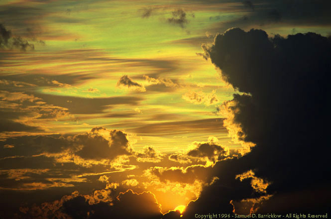
On May 26, 1996, Chuck, Al, Bruce and I witnessed a rare display of Nacreous clouds south of Midland, Texas. Instability was extreme that day, resulting in large overshooting tops. I suspect that the deposition of ice crystal clouds into the stratosphere was a byproduct of cirrus splashes when overshoots collapsed.

nacreous.jpg


Judging from the visual appearance of the storm's structure, I have no doubt that the storm was a cyclic supercell. From what I recall, David Hoadley may have been in the area, perhaps a bit farther west. Was anyone else on this storm, and if so, were any tornadoes observed?

More images are at:

http://www.fredmiranda.com/forum/topic/423762
 
Sam,

I'm curious as to how you were able to determine these as Nacreous clouds as opposed to some other form of cloud iridescence? Since the sun clearly has not set in the image you showed, it is difficult from a single image without much spatial reference to tell the height of the clouds. I would assume you had some way of distinguishing it and was hoping you could share how you did so, as the image alone isn't really enough information to distinguish if the iridescent cloud you captured was in the stratosphere or not.

Glen
 
Interesting... Roger Edwards made a "cool image" page about a supercell near Amarillo a couple years ago (HERE). The storm's overshooting top was so persistent that cloud ice from the overshoot advected downstream. I assume that the equilibrium level was the tropopause that day and that there was strong CAPE, which means that the overshoot likely extended a decent ways into the stratosphere. This isn't necessarily the same as your image, but I would imagine that if the winds in the lowest stratosphere were from a significantly different direction than those at the troposphere (or EL I suppose), the cloud ice from the overshooting top could advect into an otherwise cloud-free region, which sounds similar to what I understand from your post.
 
Glen, Jeff,

The storm repeatedly put up large overshoots, followed by cirrus splashes. From what I remember, the Nacreous clouds appeared to be above the level of the anvil.

I shot several rolls of film and also consumed at least two 60 minute Hi-8 tapes on the storm. When time permits, I'll take another look.

I've seen numerous examples of iridescence over the last 30 years of chasing and general sky watching. This display was unique, both in the amount of sky covered by these clouds, and by their appearance.

Al Moller, Chuck Doswell and Bruce Haynie also witnessed this display. Maybe one of them will chime in.
 
Back
Top