Landspout or Gust Tornado ?

Yes very interesting to read. Otherwise, I haven't mentioned, but the storm itself that created this tornado was fairly unusual in the genre. I explained it in Part 2 of my reportage http://www.meteobell.com/__orage_070430_2.php with the arrival of this multicellular storm (in fact I think also a cluster) and in Part 5 with a discussion of some parameters (but it is not as detailed as what you can access in the USA), but I don't think many here speak French, and not an intent to bring it all in English ^ ^ For example, it is very unusual here a storm arrives in a stream of East while moving towards a convergence line located to the west. I also think there was a dry line in the history. But this is relative. When I say "unusual", it is for France. In USA all your storms are more spectacular than here.
 
Last edited by a moderator:
Yes it is. Witnesses nearest reported seeing this tornado touch the ground. In the links I set, you will see more pictures, at other times

Example 3 minutes after:
070430_20h41_tornade1.png


Are there several different types of landspout? what category it would rank? wikipedia is very empty : http://en.wikipedia.org/wiki/Landspout

I have some pictures of storms like this one. Such cloud formation is usually seen when there's a gust front or a shelf cloud and the cloud condensation can be seen from the ground up (or almost) just in front of the first wave. Damien, i don't think it is "une tornade de front de rafale". And the picture you attached doesn't show much for a tornado case. At best it looks like a good updraft before the gust front in a very humid area - allowing the condensation to form near the ground. Yet, i was not there to judge and can only based on two pictures. Scuds near the ground can take the shape of a definite funnel - that could be misleading.

Here's some pictures of a similar situation (or more accentuated as it goes very near the ground) - that is from 2008/07/31 (Province of Quebec)

This picture looks like a wall cloud... I wish it was, but it's not. It's the ''lip'' of the gust front from the side at distance, starting to take shape. And it's not a funnel at the base , just another scud.
img9167f.jpg


Few minutes later, scuds are forming and can be seen closer and closer to the ground
img9199j.jpg


img9190l.jpg


And then almost to the ground
img9204am.jpg


The front eventually passed over us, but we were able to catch it back. And here's a photo that is showing ''semi'' funnel alike - these are only scuds as explained above.
img9223c.jpg
 

Attachments

  • IMG_9167.jpg
    IMG_9167.jpg
    9.6 KB · Views: 71
  • IMG_9199.jpg
    IMG_9199.jpg
    9.4 KB · Views: 69
  • IMG_9204.jpg
    IMG_9204.jpg
    6.9 KB · Views: 68
  • IMG_9223.jpg
    IMG_9223.jpg
    8.4 KB · Views: 63
Last edited by a moderator:
Damien, i went on your web site - section 4 about that storm.

The pictures on that page are very similar to a developing wall cloud (at a very early stage) or one trying to form - but never formed and all you got is the scuds from that ''more intense'' section of that storm.

Here's what i mean. See the picture below - it looks like plain scud :
img9741.png


Yet few minutes later, if you look at the sequence of picture below - it ended up with a very well formed wall cloud with rotation. But at the beginning it's only very sparse scuds.
wcformseq1.png


I'm not saying it is this or that you saw on that day. Just proposing some hypothesis for what you saw.

For other commentators on that subject - Damien did not said it was a ''confirmed tornado with damages'' he said, other witness said the cloud touch the ground. Low scuds can often be mistaken with tornado for untrained people and i'm suspecting it could be the case - no offense intended.
 
Interesting but your photos show absolutely no rotation or funnel cloud and even fewer tornado, it seems to me therefore not comparable.

And no wall cloud to me.


I see nature tornadic or not is still under debate. I understand there will always be people skeptical.

For other commentators on that subject - Damien did not said it was a ''confirmed tornado with damages'' he said, other witness said the cloud touch the ground. Low scuds can often be mistaken with tornado for untrained people and i'm suspecting it could be the case - no offense intended.

No, I didn't say that. Witnesses say they see a "bush" and see the wind to stir, attract and turn the vegetation "above" the scuds clouds (they don't say "scuds clouds" but "growths cloud"). This shade is important and evidence specific enough. For dommages it is simple, there is no research, which therefore allows no conclusion. Maybe dommage, maybe not. Nobody can know and it's too late. I really regret now not having done any research, but today I can't do anything. The affected area was rural and uninhabited, so it has interested nobody and the tornado was probably a small touch and go (with my photos, maybe 1 to 3 mn max, hard to say). I can't blame you for your intimate conviction, and you can always act as if witness were lying or mistaken, but it would really show the dishonesty of the participants in this debate. I would give even more credit to a direct witness, rather than an outsider commentator, doubting the word of witness. So it was a tornado (implied: touches the ground). End of this debate, if you have nothing to bring more objective. No need subjective intimate conviction, thanks.
 
Last edited by a moderator:
Interesting but your photos show absolutely no rotation or funnel cloud and even fewer tornado, it seems to me therefore not comparable.

And no wall cloud to me.

That is exactly the point - a photo stays a photo and doesn't necessarely show what someone describe unless you witnessed it. You said, you don't see a wall cloud - yet there's one, it was in rotation... An produced two tornado few miles farther (not showned here). Good luck with your research.
 
I mean, no wall cloud in my storm.

Sorry I don't have a very large vocabulary in English and it's not easy to write exactly what I mean. So I can imagine I seem too crude. Here, I spoke about my storm.
 
Last edited by a moderator:
I appreciate that this thread is now pretty much historical. I nevertheless have taken the time to read all the post within it before my comments!

Whilst Eddy Whirlinds 'EW's'(or 'Gustnadoes') under the leading edge of the storms are categories as non tornadic. Could the classification for EW's be erroneous or at best misleading? Whilst the current explanations say that EW's are not in contact with the cloud base . Maybe in fact on very isolated occasions they actually do get entrained upwards into the cloud within the forward baroclinic zone? If we imagine a plan view of the leading edge of a storm we might see that the gust front outflow can be very irregular indeed hence the tendril type scud we often see. Likewise this irregularity could just as easily create rotation on a horizontal axis. The baroclinic zone can sometimes create a strong lifting motion up and over the forward gusts that reach the surface. So whilst the updraft core of any storm has nothing to do with this process we can nevertheless see that there is in fact scope for a lifting and stretch of vorticity and ultimately a weak condensation funnel is born.

Contrary to what we are taught regarding catagorising these events; There will continue to be events like this that are contrary to the rule! Most gust front tendrils that I have witnessed do not rotate, BUT some did!
 
Last edited by a moderator:
After rereading this thread, I would have to agree the feature in question is a gustnado/landspout hybrid, as others have already labeled it. That‘s if you absolutely have to have a category for it. Some events just aren’t going to be 100% classifiable as being precisely this type or that type of tornado.


Contrary to what we are taught regarding catagorising these events; There will continue to be events like this that are contrary to the rule! Most gust front tendrils that I have witnessed do not rotate, BUT some did!

Yep, they sometimes do, and I’ve seen enough weird spin-ups over the years to make me think this kind of thing happens more often than you might think. For instance, I once observed an advancing gust front that had several low hanging fingers of condensation, kinda like the 2nd picture in Rejean Boudreau’s post above, the one labeled “Few minutes later, scuds are forming…†There was no rotation in the tendrils at first, but one of the scud fingers was bigger and out ahead of the others, enough to make me take notice of it and watch for a while. This finger became almost stationary as it began to thicken, eventually becoming a stout cylinder of condensation that reached from the cloud base all the way to the ground... But clearly NOT rotating, not to begin with. To my amazement, as I watched it began to rotate cyclonically, extremely slowly at first, but with increasing speed. The rotation began at the top part of the finger, right at the cloud base, and gradually worked its way down, so that in a few minutes the whole formation was spinning - in fact it soon began to spin quite fast! Almost before I knew what was happening, I realized I was staring at a violently rotating column of air attached to both the cloud base and the ground: the textbook definition of a tornado. I was quite close, and at that time I had little experience being around tornadoes, so even though there was minimal forward motion I became concerned for my safety. I got back into my car intending to drive to a safer position, but as I drove away heavy rain began to fall, and when I tried to look back to see what was happening the formation had vanished in the rain. I was unable to spot it again, despite some rather frantic driving around, so probably it dissipated when the rain came. I subsequently spoke to someone who had been watching the same feature from a different direction, and he confirmed the evolution and strangeness of the thing. He saw exactly what I saw, but what was it?

What do you call a big scud finger that’s all the way in contact with the ground but clearly not rotating, that then begins to spin as you watch it? I would say it’s not a gustnado, despite occurring on a gust front, because it was almost stationary. Gustnadoes typically form from eddies, but this gust front had stalled, there simply wasn’t enough motion to generate an eddy of that type. So, landspout, then? Perhaps, but only if you use a definition of exclusion, where landspout means any non-mesocylonic tornado. There was no rotating wall cloud that I could see, the parent cloud was pretty clearly a shelf cloud, and not even an RFD shelf - at least I don’t think it was, back then I was pretty ignorant when it came to storm structure. Looking back now, I would have to guess it was a relatively disorganized forward-flank shelf cloud. The parent cell was part of a line of storms, not especially violent, and very unlikely to have been supercellular, although I can’t say for sure there wasn‘t a transient hidden mesocylone. As for the vortex itself, I don’t know what you would call it, it started as a gust front tendril but at the end it absolutely fit the definition of a tornado. Heck, at that point it was scary enough to make me fear for my safety. It sure looked like a tornado, once it got going... It’s only the strange way it evolved that calls the tornadic classification into question. I never reported it, although someone else may have, as I mentioned there were other witnesses. To my knowledge there was never any damage reported. A very strange event, one that I’ll probably never know the truth about, but clearly it doesn’t fit comfortably into any of the known categories of tornadic vortex. I would guess the spin-up in France is similarly unclassifiable.
 
Yes agreed, Dave. I would say the majority maybe accept that there will always be some events which will easily go into a number of categories. Though through the years I have noted that some are uncomfortable with storm research when such events cannot be accurately attributed to one single category. My response to that is to maybe not treat storm events as an exact science; There are just too many variations! Even if we are blessed with experience and qualification, an open mind will always be a good asset to quantifying such occurance. ie, to say blatantly that, such an event could not have occurred because I studied the models and obs that day could be regarded as at best, 'tunnel vision' and at worst 'ignorance'.
 
Indeed, men love putting things in boxes precise. But nature often reminds us, she likes to be in all possible variations between the boxes. This is also true in meteorological conceptual research with mesoscale. The important thing is that it has to remain in the physical basis of science, and it can be explained. The circulation of a complex thermodynamic fluid doesn't like always conceptual boxes.
 
Last edited by a moderator:
Hello,

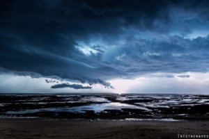
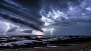
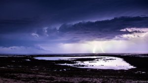
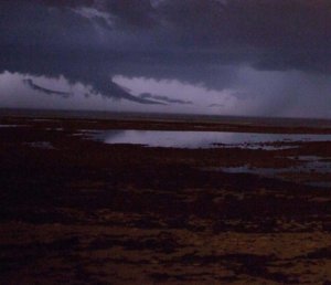
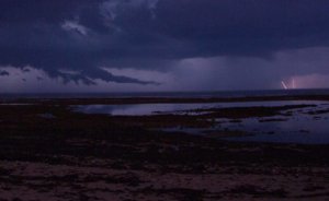
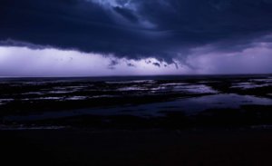
10 years later, I come back with another case almost similar. We have no idea whether it hit land, because it's taken from an island over the ocean, so it may be juste a funnel cloud. Regardless, it is the conceptual aspect that is interesting.


9308f76f9bb13e5871091ae2aef30d67.jpg


d98819f3e66cade553da6c5b0fcdcec7.jpg


c9cea763f017d59c6042c1a9dc2a48c1.jpg


33857e5d12a38bbc268df8d6d43bbb04.jpg

dff23a27c38110aa8d8cc64a129f548b.jpg

94627e410f228649543b0ee798ec9787.jpg


Again this is formed from the corner of the shelf cloud (arcus). A landspout-gustnado from a scud cloud. May be we can classify this as a special case among the shear funnel. I don't know.

Photos are not mine. Gaël Contal de Intothewaves : https://www.facebook.com/Intothewaves-474127665996384/ (I have his permission)
 
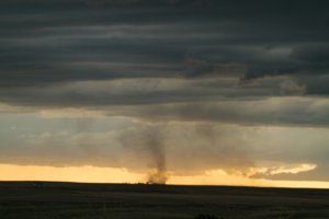
The Gustnado or landspout that I was hit by on May 26th was:
1) Rotating rapidly (It was strong enough to push my rental car)
2) Occurred under the leading edge of the shelf cloud
3) Right before it happened when there was very little wind
4) Had debris in the form of stalks, plants, dust, dirt embedded in it

This was a picture of what hit me taken by one of to other friends who were driving along side of each other during the chase.

By official definition there are 2 (two) possibilities
Based on Aviation Weather reports: 7900.5b
https://www.faa.gov/air_traffic/publications/at_orders/media/SWO.pdf

a. Well-Developed Dust/Sand Whirls (PO). Particles of dust or sand, sometimes accompanied by small litter, raised from the ground in the form of a whirling column of varying height with a small diameter and an approximately vertical axis.

c. Tornado (+FC). A violent, rotating column of air touching the ground. It forms a pendant, usually from a cumulonimbus cloud, nearly always starts as a funnel cloud, and is accompanied by a loud roaring noise.

I'm going to assume the loud roaring noise is subjective with the observers location. I do find it interesting that they use the descriptor of loud roaring noise, since many times tornadoes cannot be heard due to ambient noise.

A gustnado is probably more related to a tornado, due to it being connected in some way with a CB Cloud, and being a column of violently rotating air touching the ground.


18738327_10158737858775111_838328930691442976_o.jpg
 
I should clarify that a well developed Sand or Dust swirl is something you see in desert areas more often, cause by surface heating and not associated with a CB Cloud.

I suppose my entire point is: If a weather observer sees this phenomena they are going to report it as a +FC (Tornado). That would be the lowest common denominator definition.

Still remembering that this is not like a Mesocyclone Tornado.

Maybe we can start labeling Gustnados as "covfefe funnels"
 
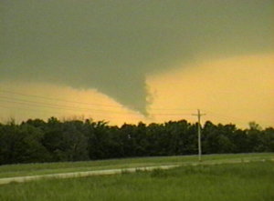
Here's another one for you. This is from May 12, 1998 near Palmyra, IL. This formed on the north end of a forward flank gust front. I could not really see rotation so just thought it was an odd lowering on the end of the shelf cloud. However, about 15 minutes later a tornado did damage a short distance east of where this feature was when I photographed it. By then I had moved and rain was blocking my view, so not sure if it was the same feature or not. Agree with others that there are some things that just don't fit neatly into the categories we use.

67bd11e539947dee22d19d3998c2e369.jpg
 
Hello,

10 years later, I come back with another case almost similar. We have no idea whether it hit land, because it's taken from an island over the ocean, so it may be juste a funnel cloud. Regardless, it is the conceptual aspect that is interesting.


View attachment 15970


View attachment 15971


View attachment 15972


View attachment 15973

View attachment 15974

View attachment 15975


Again this is formed from the corner of the shelf cloud (arcus). A landspout-gustnado from a scud cloud. May be we can classify this as a special case among the shear funnel. I don't know.

Photos are not mine. Gaël Contal de Intothewaves : https://www.facebook.com/Intothewaves-474127665996384/ (I have his permission)

These are some excellent photos.
 
Back
Top