Dan Robinson
EF5
I observed this strange tornado deep within the main RFD of the Hays, Kansas supercell on May 26, 2021. This happened at close to the same time as, possibly during, the main large tornado that most chasers documented this day south of Hays. I only saw it because my road network ended to the south and east as I tried to keep up with the main meso/tornado to the north, and I had to backtrack west to Highway 183. This would have been southwest of the main tornado, occurring just west of Highway 183 about a mile north of Schoenchen.
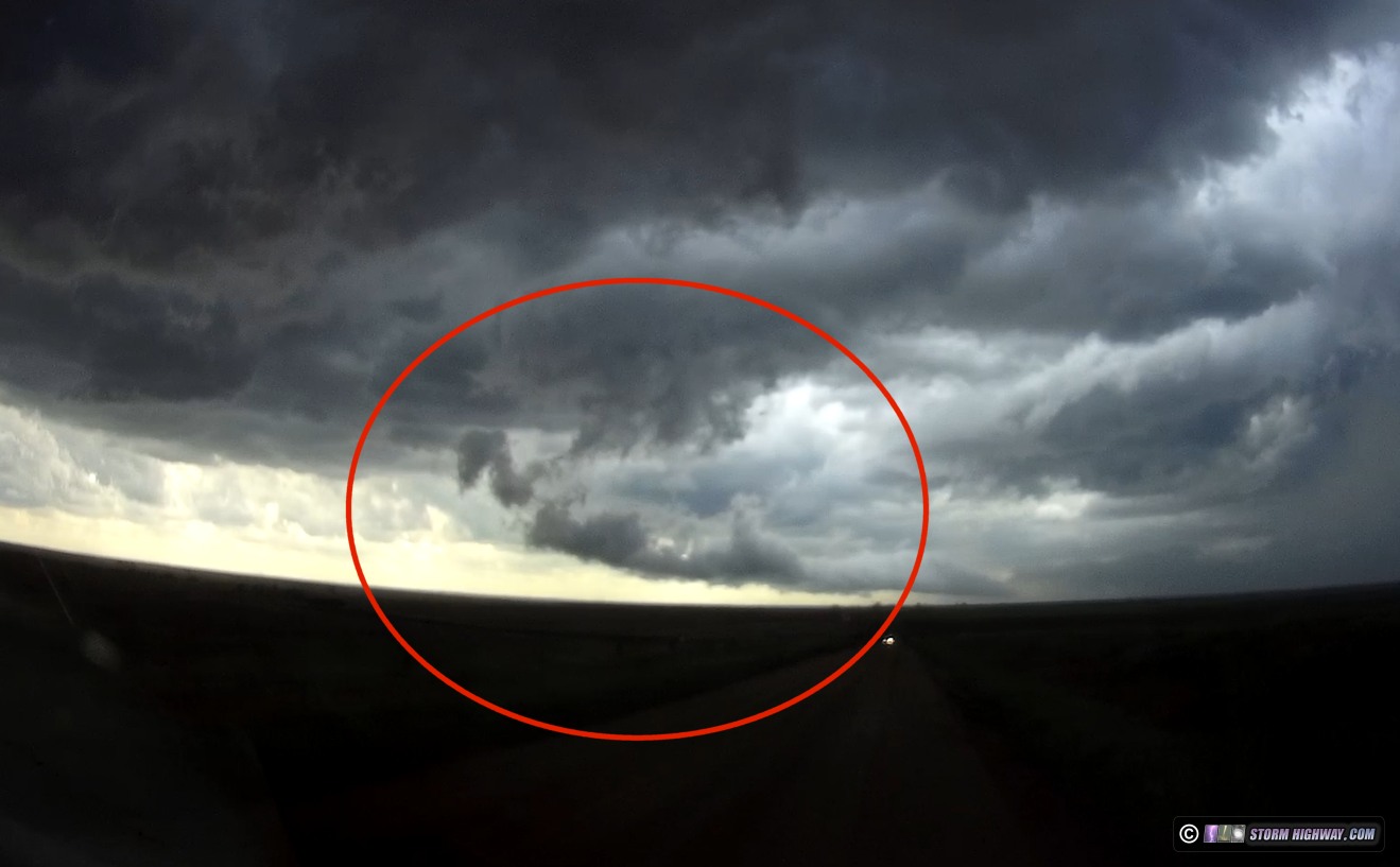
This is the feature out of which the tornado would develop, about a minute prior, looking due west about 3 miles east of Highway 183.
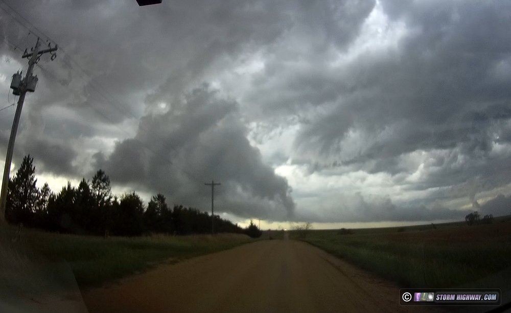
Condensation reached the ground for about 20 seconds. Dashcam wide-angle of the tornado:
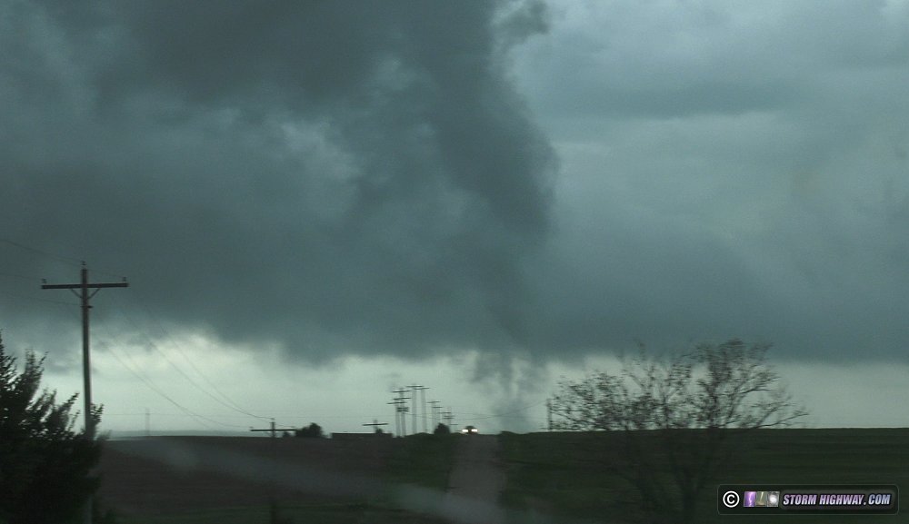
Video camera zoomed in:
I would have never seen this without being forced to backtrack west.
The cloud feature clearly is marking another RFD gust front curling north into where the tornado formed, right where you'd expect one to be if this had an updraft above it. You can even see what looks like a clear slot above it. But there is no updraft overhead, and this doesn't look like a typical occlusion with a dying tornado cyclone that re-condenses as it ropes out. No, this looks like a *new* tornado circulation that developed entirely within the RFD of the main storm. The feature also appears very shallow, not connected with a deep meso or anything above it but originating from something horizontal along the RFD-like gust front, like a horizontal tube that tightened at one end and spun down to the ground. I'm really not sure what to make of this, I've never seen anything like it in any other chase account. Curious to hear any thoughts and if anyone else saw this?
Video:
This is the feature out of which the tornado would develop, about a minute prior, looking due west about 3 miles east of Highway 183.
Condensation reached the ground for about 20 seconds. Dashcam wide-angle of the tornado:
Video camera zoomed in:
I would have never seen this without being forced to backtrack west.
The cloud feature clearly is marking another RFD gust front curling north into where the tornado formed, right where you'd expect one to be if this had an updraft above it. You can even see what looks like a clear slot above it. But there is no updraft overhead, and this doesn't look like a typical occlusion with a dying tornado cyclone that re-condenses as it ropes out. No, this looks like a *new* tornado circulation that developed entirely within the RFD of the main storm. The feature also appears very shallow, not connected with a deep meso or anything above it but originating from something horizontal along the RFD-like gust front, like a horizontal tube that tightened at one end and spun down to the ground. I'm really not sure what to make of this, I've never seen anything like it in any other chase account. Curious to hear any thoughts and if anyone else saw this?
Video:
Last edited: