• A friendly and periodic reminder of the rules we use for fostering high SNR and quality conversation and interaction at Stormtrack: Forum rules

    P.S. - Nothing specific happened to prompt this message! No one is in trouble, there are no flame wars in effect, nor any inappropriate conversation ongoing. This is being posted sitewide as a casual refresher.

2015-04-24 REPORTS: KS/OK/TX

After busting the day before in the TX Hill Country, I turned back north and stayed overnight in Dallas. Waking up on the 24th, decided to choose the northern target in KS despite moisture issues. Arrived in Hays, KS early afternoon and watched initiation near there. I was on the early tornado warning but due to road choices missed the first tornado north of Victoria. Caught up to the storm in good position SW of Paradise where I viewed a possible rain wrapped tornado (can't confirm). Followed the storm to near Salina just hoping for structure and hail after it was apparent it was outflow dominant. Then started the long track home to Houston.042415s.jpg 042415b.jpg
 
Got owned by straight line winds and hail in Stephenville. Overall a disappointing day with messy storm modes. I was expecting supercells for longer, but that didn't pan out.

 
We left Kansas City around 11am and headed to our target of Russell Kansas. We got on the cell just North of Hays and stayed with it for the next few hours. We were able to dodge the large hail but received a call from a friend that had not. We returned to help them out in Lucas Kansas where we saw 3” deep hail and up to baseball size hail an hour after it fell.
 

Attachments

  • 3 Hail Core.jpg
    3 Hail Core.jpg
    194.5 KB · Views: 1,216
  • 5 Hail Cover.jpg
    5 Hail Cover.jpg
    86 KB · Views: 208
  • LucasRadar.jpg
    LucasRadar.jpg
    86.4 KB · Views: 186
  • 6 Hail in Hand.jpg
    6 Hail in Hand.jpg
    176 KB · Views: 687
  • 8 Tundra.jpg
    8 Tundra.jpg
    111.1 KB · Views: 211
Busted super hard at the northern target in KS. I couldn't make it out of Norman before 1 which already put me at a huge disadvantage and meant I couldn't make it anywhere close to Hays in time for the show. Ended up ditching west off of I-35 at Braman and continued north on US 81 before cutting west through Anthony and heading up to Pratt. The dryline/cold front was an absolute mess and no towers seemed to be able to get going through the stupidly high upper-level winds. Gassed up in Pratt as a tower actually managed to take hold right over town. It started hailing within the first 15 minutes of it's life and we began to pull out back east before heading north towards Preston to get in front. The storm initially looked like it'd be an awesome little LP as it drifted off to the northeast.

11055308_997054593653214_8768085606418357196_o.jpg


11149614_997054570319883_5112372961611515247_o.jpg


But almost immediately after cutting out of Preston, the base began to rapidly shrink and the anvil was rapidly blowing off to the east.
11141130_997054646986542_5964019351961062507_o.jpg


10987504_997054716986535_2379028021454037017_o.jpg


The storm didn't have enough instability present to get through the higher winds aloft and slowly began to lose out. Idled on Kansas 61 as it died and decided against sticking around to see if anything behind it got going and made our way to Hutchinson for dinner. Made the long drive back to Norman, managing to hit and nearly severe the gas line of Tyler's Subaru on a spare tire in the middle of the highway while being blocked in on the right by a semi.
 
Been lurking on here forever, but finally decided it was time to become more active in the community. Me and a buddy left Joplin, MO Friday morning with an initial target of Russell, KS. We wasted a bit extra time on the way up, and were just approaching Russell as the storm was going tornado warned north of Victoria. We managed to see the first tornado touch down just to west, although I didn't get my camera out quick enough to catch a picture while it was still down.russel tornado 2.jpg
We continued a short way up the road and started heading east when my buddy saw the second tornado touch down a short ways behind us, so I stopped and did manage to get some better shots of that one. russel tornado.jpg
After that lifted we got one more little funnel a short time later, but I never saw it touch down, although I did see a report of a brief touchdown that matched up with the time of this.russel tornado 3.jpg
After those three, we stayed ahead of the storm and out of the hail, while getting some good structure shots. Finally, we ended our day near the south side of Salina after everything had went linear and turned into a large shelf cloud. Although all the tornadoes were very brief, it was still a pretty good day all around.russell wall cloud.jpg hp russel storm.jpg the beast.jpg
 
Ignored the TX hype because the forecast lapse rates were just awful, and stuck with the original Kansas target I had been eyeing for a couple days.

Got on the storm of the day a little late, catching a very low contrast tornado from the RFD core. I do have the funnel on video though. Continued north through the core and got our windshield taken out by wind driven tennis ball size hail, an 80mph gust was measured near our location at the time. Overall a pretty intense chase day that felt rewarding given choosing the right target. Ended the day in Salina with an awesome shelf. Only thing we did wrong was arrive a few minutes too late.

Full log: http://www.aerostorms.com/april-24th-2015-hays-fairport-kansas-hp-supercerll/

11193356_801839413244932_5697572775734282787_n.jpg


Salina-Kansas-Shelf-600x278.png
 
Last edited:
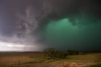
What a fun ass day this was. I drove to OKC Thursday night and stayed overnight, still not sold on our KS target. Even though I wasn't sold on that target, I was way more sold on it than north TX. Things looked to be washed out down south, so we stuck with the original plan. Russell, KS was my original target. We arrived in Russell about an 30 minutes before the storm near Hays went up. All I can think was bingo, the HRRR nailed it again. We sat until the storm went SVR warned. By that time we flew west towards the storm. As we approached, we noted a very nice rain free base. We stopped just shy of Hays and went north on a paved backroad. About 10 minutes later, the storm went tornado warned, and we were suddenly greeted with the sounds of tornado sirens, birds chirping, and a wall cloud (see video).

IMG_8231-X2.jpg


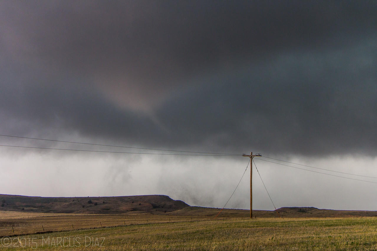
We then got onto the dirt grids and caught up with the new circulation north of Victoria/west of Paradise. We pulled off north when my peripheral vision caught something. I'll be damned, a tornado behind us! I got the camera out and snapped several pics.

IMG_8311-2-X2.jpg


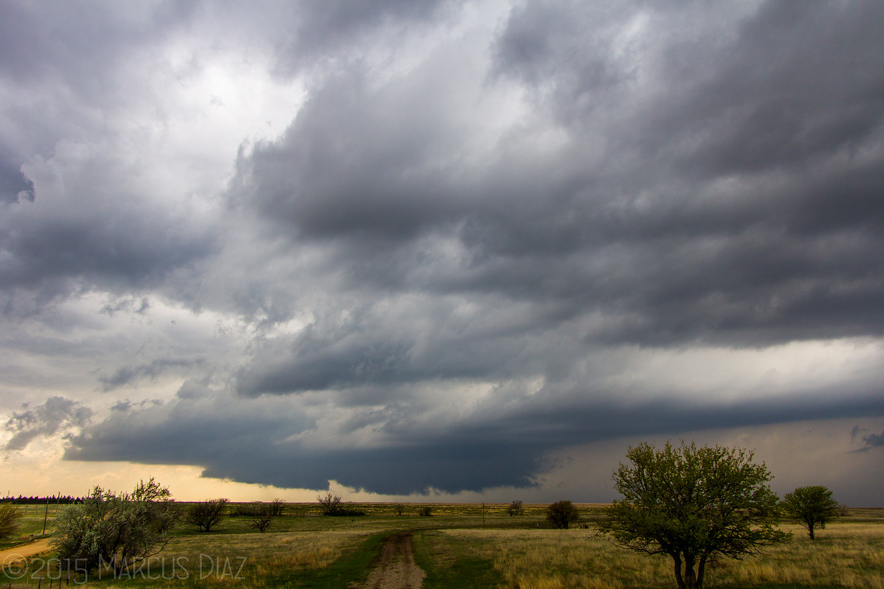
In the video, we were still watching the wall cloud where this tornado had developed. It was rotating but not by much. Then, suddenly, another spinup right next to us. Like, literally 50 yards away! At first I wanted to leave (so did everyone else), but then I noticed the tornado was stationary and weak. So we stuck around for a few more seconds before deciding to bail east. The "Ghost Train" had clasted our back window and I thought it was about to get big. But we traveled east and south, and lost sight of everything in the rain. So, we drove to Russell and back north again on the dirt roads. The storm teased us with some rotation and suspicious wall clouds, but no more tornadoes. We stopped west of Lincoln, KS to get some of the awesome structure!

IMG_8436-X2.jpg


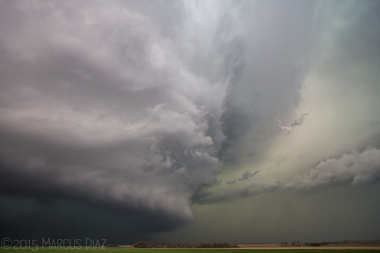
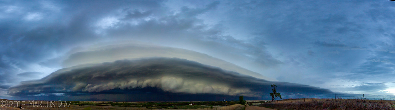
After getting back to I-70, I noticed clear skies to the southwest. Figured, hell, the stucture should be nice asthis thing gusts out. Nailed it again. Went to Brookville, KS to watch the AMAZING shelf cloud roll in. Celebrated with steak in Salina, and some beers in Wichita. All in all, really fun chase!

pano_small-X3.jpg


VIDEO:

More pics of this chase can be seen HERE!
 
Back
Top