Dan Robinson
EF5
The problem with all available targets this day was extensive cloud cover and precipitation. However, a nice area of clearing had developed in southern Missouri, with that air mass in line to move into the St. Louis area. The warm front itself to the north was completely socked in with clouds and precip, and didn't appear that it would be an option. I initially drove up to Wentzville to await the development of storms that models suggested would start on the eastern edge of the area of stratiform rain. This indeed did happen, and the first storm ramped up quickly to the southwest. I moved down to Dardenne Prairie to get my first look at it;
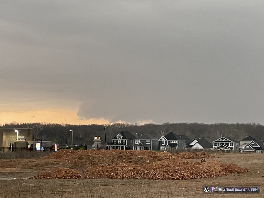
The storm continued to organize and turn hard to the right, with the mesocyclone tracking just south of Highway 40 (I-64). This was the view at Chesterfield.
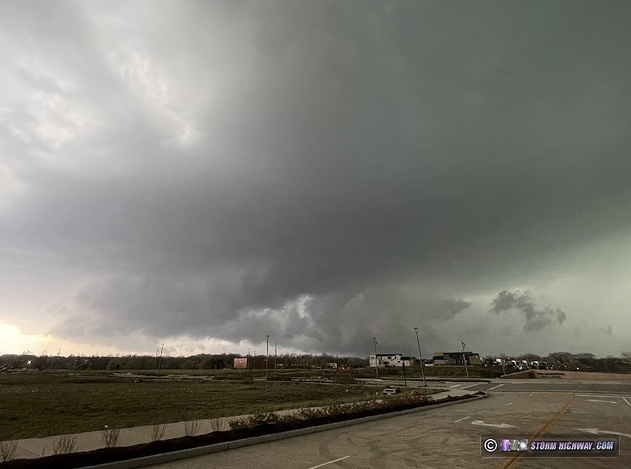
I moved ahead of the storm to Ladue as the strengthening circulation prompted a tornado warning. An occlusion was visible here, but I had to use my drone to get a view of it. A tornado was confirmed to have just ended or possibly still be in progress at the time of this image.
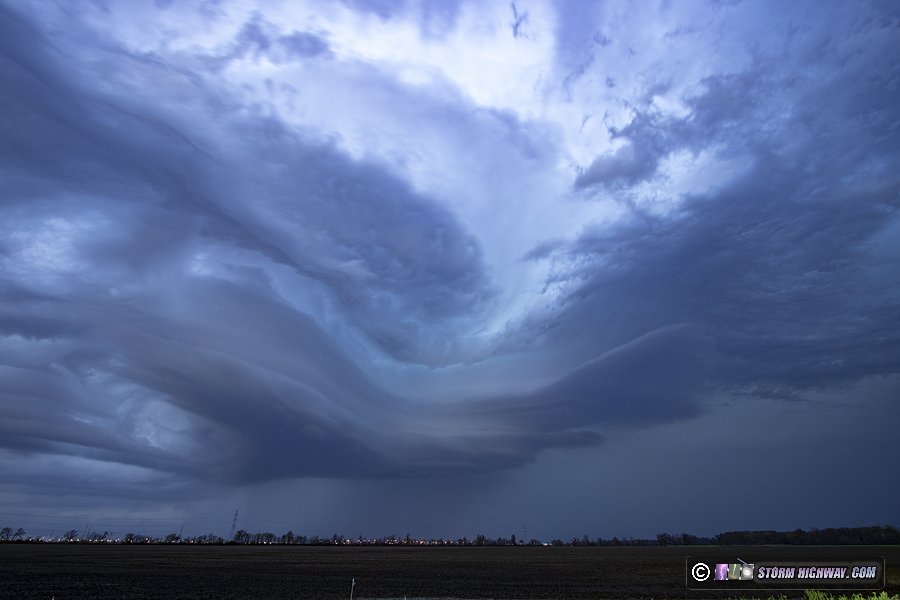
The storm was moving a little faster than I expected, so I decided to go into Illinois to get ahead of it again. I accomplished this via I-255 at Pontoon Beach. The storm's low-level meso had weakened, but it had some interesting laminar stacked plates:
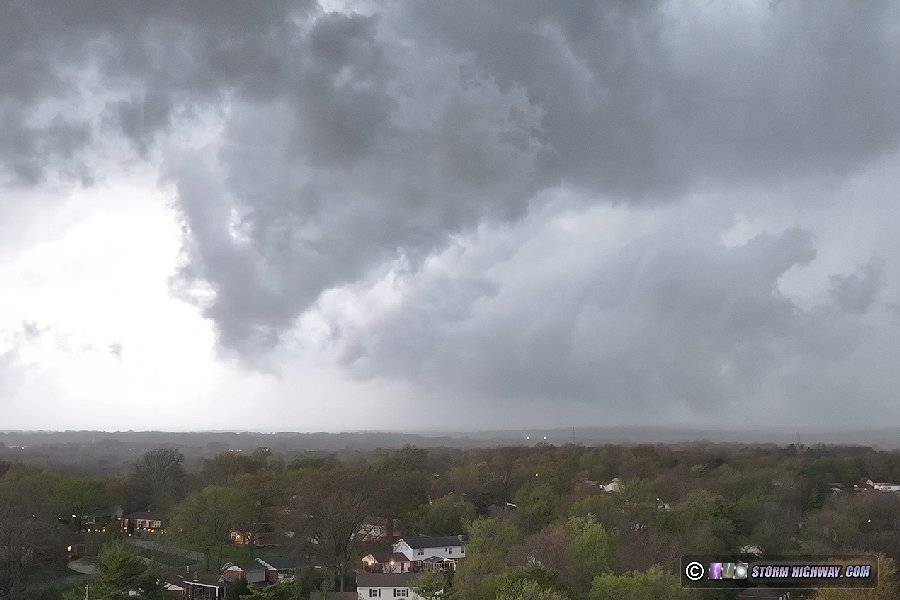
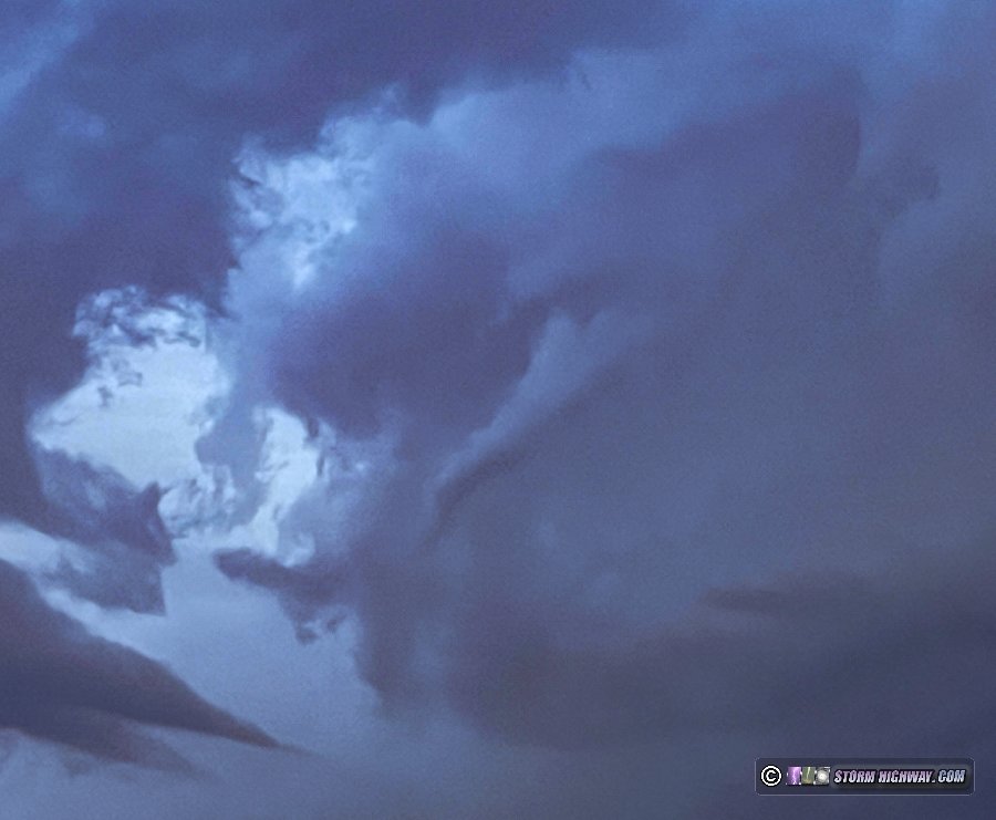
A midlevel funnel appeared on the western side of the storm:
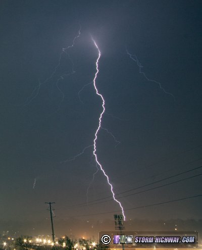
I went back to Brentwood for a short dinner break at sunset, then headed to the parking garage to shoot lightning.
With the next day looking to be a long all-day trip, I needed to get home to sleep. I packed up at 11:30pm before the arrival of the last round of electrified stratiform that would be arriving sometime well after midnight.
The storm continued to organize and turn hard to the right, with the mesocyclone tracking just south of Highway 40 (I-64). This was the view at Chesterfield.
I moved ahead of the storm to Ladue as the strengthening circulation prompted a tornado warning. An occlusion was visible here, but I had to use my drone to get a view of it. A tornado was confirmed to have just ended or possibly still be in progress at the time of this image.
The storm was moving a little faster than I expected, so I decided to go into Illinois to get ahead of it again. I accomplished this via I-255 at Pontoon Beach. The storm's low-level meso had weakened, but it had some interesting laminar stacked plates:
A midlevel funnel appeared on the western side of the storm:
I went back to Brentwood for a short dinner break at sunset, then headed to the parking garage to shoot lightning.
With the next day looking to be a long all-day trip, I needed to get home to sleep. I packed up at 11:30pm before the arrival of the last round of electrified stratiform that would be arriving sometime well after midnight.
Last edited:

