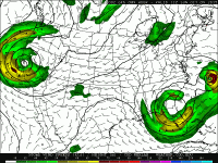
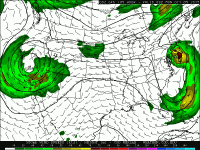
Could Joaquin be a threat to the Bahamas and the East Coast?

Should the Northeast be concerned about Joaquin?

  • Yes

    Votes: 5 45.5%
  • No

    Votes: 6 54.5%

  • Total voters
    11

Tim Paitz

EF2
Joined
Apr 27, 2015
Messages
190
Location
St. Louis, Missouri
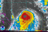
Currently, Tropical Storm Joaquin is at 65 mph moving slowly to the southwest, but the official NHC forecast track has it moving northeast in a couple days, possibly paralleling the east coast.

Currently, the northwest side of the storm is being sheared off but with excellent outflow to the south of the center.
4ca4730fe94448554b426307a30dbe22.gif

The problem is, the forecast models diverge on where it's going to go because it varies from landfalling near the Virginia tidewater to simply heading out to sea. It's also dependent on where an upper level trough with an attendant cold front moving through the northeast will end up and this will influence how much Joaquin will recurve. Regardless, it'll still bring heavy rain to the northeast as Joaquin interacts with the front.
 
First, one thing for the larger perspective. Joaquin is a home grown TC (western Atlantic not the in deep
tropics). This is what is to be expected in a strong El Nino year.

The most intense system for sustained winds that formed in the general area of Joaquin (southwestern Atlantic
N of 25 deg latitude...i.e. outside the tropics) I believe is Diana from Sep 1984. Max sustained winds reached
130 mph (min pres 949 mb) while is was just offshore SE of Wilmington NC (33.9N/-77.7W).

http://weather.unisys.com/hurricane/atlantic/1984/DIANA/track.gif


For Joaquin's future track?

I think a lot depends on what the developing disturbance E of Joaquin (ex-Ida) might do.
Fujiwhara effect could occur. If the other system gets reasonably strong (say a 50 kt TS)
and moves close enough to get within Fujiwhara range of Joaquin, that could pull Joaquin more
E or slow/stall its trek N or NW for a time. It highly conditional here, and yes, even more complex
than Sandy. Once two TCs are within about 850 miles of each other. The rotation effect
accelerates once within 400 mi of each other. It appears that the two systems
will have no problem getting within 850 mi of each other, and might get within
400 mi.

Look at the example attached for the Fujiwhara effect. In the NHEMI, the E system moves NW,
and the W system moves SE. In this case the E system is much stronger. We will have it the
other way around for Joaquin's case, but the point is a pull back to the NW from the baroclinic
trough may not be as 1-2-3 as it looks, and I think any deviation from a steady progression
of Joaquin N or NW for even a short period of time once the flow is established could mean the
difference between a Norfolk VA landfall, a Long Island one, or out to sea!

Additional factor that makes it not so much like Sandy?, yes, you have a strong negatively titled trough
over the Mid-Atlantic/SEUS moving in, but unlike Sandy, the CONUS upper air pattern is split flow with
the subtropical jet only, not a beast of a polar jet with lots of cold air with a full baroclinic phase that
will occur independent of Joaquin, so a wrap back in as sharp as Sandy may not be as likely. A more
gradual arc N and then NW I see as a possible scenario now, or one that ends up with it out to sea
even!

I see the 00z GFDL has come around to the HWRF, but we are still talking 4 days away from
landfall near Norfolk if these verify. Notice that the 00z ECMWF has it way out with no recurvature!
Yes, it is the only outlier, but given the ECMWF track record, you can't just summarily dismiss
it either. I think that shows nothing is etched in stone yet, far from it!

fujiwharaexample.jpg
 
First, one thing for the larger perspective. Joaquin is a home grown TC (western Atlantic not the in deep
tropics). This is what is to be expected in a strong El Nino year.

The most intense system for sustained winds that formed in the general area of Joaquin (southwestern Atlantic
N of 25 deg latitude...i.e. outside the tropics) I believe is Diana from Sep 1984. Max sustained winds reached
130 mph (min pres 949 mb) while is was just offshore SE of Wilmington NC (33.9N/-77.7W).

http://weather.unisys.com/hurricane/atlantic/1984/DIANA/track.gif


For Joaquin's future track?

I think a lot depends on what the developing disturbance E of Joaquin (ex-Ida) might do.
Fujiwhara effect could occur. If the other system gets reasonably strong (say a 50 kt TS)
and moves close enough to get within Fujiwhara range of Joaquin, that could pull Joaquin more
E or slow/stall its trek N or NW for a time. It highly conditional here, and yes, even more complex
than Sandy. Once two TCs are within about 850 miles of each other. The rotation effect
accelerates once within 400 mi of each other. It appears that the two systems
will have no problem getting within 850 mi of each other, and might get within
400 mi.

Look at the example attached for the Fujiwhara effect. In the NHEMI, the E system moves NW,
and the W system moves SE. In this case the E system is much stronger. We will have it the
other way around for Joaquin's case, but the point is a pull back to the NW from the baroclinic
trough may not be as 1-2-3 as it looks, and I think any deviation from a steady progression
of Joaquin N or NW for even a short period of time once the flow is established could mean the
difference between a Norfolk VA landfall, a Long Island one, or out to sea!

Additional factor that makes it not so much like Sandy?, yes, you have a strong negatively titled trough
over the Mid-Atlantic/SEUS moving in, but unlike Sandy, the CONUS upper air pattern is split flow with
the subtropical jet only, not a beast of a polar jet with lots of cold air with a full baroclinic phase that
will occur independent of Joaquin, so a wrap back in as sharp as Sandy may not be as likely. A more
gradual arc N and then NW I see as a possible scenario now, or one that ends up with it out to sea
even!

I see the 00z GFDL has come around to the HWRF, but we are still talking 4 days away from
landfall near Norfolk if these verify. Notice that the 00z ECMWF has it way out with no recurvature!
Yes, it is the only outlier, but given the ECMWF track record, you can't just summarily dismiss
it either. I think that shows nothing is etched in stone yet, far from it!

View attachment 9930


Ah. I was thinking that ex-ida was unlikely to redevelop but now it has a red X with a 70% chance in the next 5 days. That'll make it even more complicated.
 
Looking potentially interesting. The latest HWRF takes a ~945mb storm into the outer banks, as does GFDL. CMC and GFS both bring a powerful storm into the outer banks as well. At this point only the euro is the major outlier, still insisting that the storm goes offshore.
 
Hearing the same with an outlier from Euro at 11pm. So nobody is going to the outerbanks to chase it yet?
 
Latest guidance (5AM 10/1) moves the track to the east and keeps Joaquin offshore; the last forecasted position is at 2AM Tuesday, just off the southern NJ coast. The NHC discussion notes continuing model variability and spread, and says that the official track is to the west of all guidance. Not sure why they kept it to the west, maybe just trying to limit how much they shift it in one forecast cycle and keep the east coast on guard? This thing seems to be trending offshore and could end up validating the Euro.

The last couple of NHC forecasts also slow down the storm's eventual northward progression. It now looks like Joaquin's center won't be impacting NJ over the weekend, as it appeared just 24 hours ago. I live in the Philadelphia area so was looking forward to driving out to the Jersey shore and checking out the scene if it was the weekend. I wouldn't call this true hurricane "chasing," I'm not going to fight with cops and roadblocks or set up shop in some Atlantic City hotel that gets evacuated. Hurricane chasing just seems like a tough thing to do in a populated area such as NJ (or maybe I just don't know enough about how to do it properly ). I'm not going to take a day off from work on Monday just to mess around and see some heavy surf (given the current track, the center would make landfall, or its closest pass, in the darkness anyway).

Boris, interesting analysis, wonder why the NHC discussion doesn't mention this effect?
 
Now the 06z GFS has trended quite a ways east and keeps the brunt of this storm offshore. Just a gut feeling tells me that most solutions may start trending eastward towards the Euro solution, but obviously gut feelings don't count for anything. If this thing speeds up some, or the timing of the southeastern US trough changes just a little, I think that would make a western solution, and landfall, much more likely. Looking at the 00z run of the GFS last night, man, if that is to verify, it will be quite an interesting time for the northeastern states...
 
I have a feeling it'll run to the east and verify the euro. I'm from CT and always looked forward to a hurricane coming up, however they just don't. They tend to run off east just about every time

Sent from my SCH-I545 using Tapatalk
 
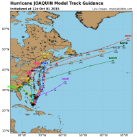
From what I can see of the spaghetti maps, there is almost no chance that the storm follows anything close to the official NHC track - it either makes landfall in the Carolinas OR goes OTS.


Sent from my iPhone using Tapatalk
 
With the 01/12Z models in, the HWRF has now flipped to the offshore solution, leaving CMC/GFDL with tracks into the outer banks and GFS/EURO/HWRF far offshore. Still plenty of disagreement/uncertainty.
 
What effect does the cutoff low have on the hurricane?

Sent from my SCH-I545 using Tapatalk

I really know very little about tropical weather but I would think that this trough is going to swing down into Florida at just the right time and and push the storm out to sea and away from the coastal regions of the southeast. If this trough weren't swinging through right now I imagine that Joaquin would just ride the trade winds and slam into Florida somewhere, or possibly even enter the Gulf.
 
What effect does the cutoff low have on the hurricane?

Sent from my SCH-I545 using Tapatalk


The thought was that the trough would "capture" the hurricane and help bring it in northwest toward the coast - envision it moving counterclockwise up and around the cutoff low - I think this is known as a fujiwara effect. But I am not sure what makes the difference between this occurring, OR the trough instead kicking the hurricane offshore as Mike suggested. I assume it has something to do with the exact timing/phasing and position/orientation of each feature when the trough and hurricane are close enough to each other to interact.

I am no expert either, just passing along the impression I got from reading the applicable PhillyWx.net thread, but my understanding is at best inadequate and at worst incorrect


Sent from my iPad using Tapatalk HD
 
With the 01/12Z models in, the HWRF has now flipped to the offshore solution, leaving CMC/GFDL with tracks into the outer banks and GFS/EURO/HWRF far offshore. Still plenty of disagreement/uncertainty.


Yep. Like I said in the post just above yours, there's almost no way this is an event that I will get to experience along the NJ coast. It's as if the NHC track is between the two likely solutions, with no actual chance of being itself a viable solution. Probably a poor metaphor, but almost seems like a coin flip that could be heads or tails, so let's just officially predict that the coin is going to land on its edge and stand vertically.


Sent from my iPad using Tapatalk HD
 
The thought was that the trough would "capture" the hurricane and help bring it in northwest toward the coast - envision it moving counterclockwise up and around the cutoff low - I think this is known as a fujiwara effect. But I am not sure what makes the difference between this occurring, OR the trough instead kicking the hurricane offshore as Mike suggested. I assume it has something to do with the exact timing/phasing and position/orientation of each feature when the trough and hurricane are close enough to each other to interact.

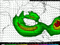
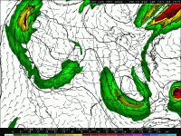
Yes, I agree, I think timing is everything. If you look at previous model runs of the GFS, you can see this capturing of the Hurricane by the trough.

64b759b196dbeef30f38515892171874.gif
8f5d6d109f3509e5eff7bc6269feeca6.gif
1a83ecd80db384a2975e0112ce35f74c.gif

This solution could have been pretty bad for the northeast, although the storm would be in a much weaker state than it is now by the time it made landfall. I guess it is still not impossible for this track to verify, but it is looking more likely that the trough timing and interaction with the storm will be perfect for residents cheering against landfall.
 
From what I can see of the spaghetti maps, there is almost no chance that the storm follows anything close to the official NHC track - it either makes landfall in the Carolinas OR goes OTS.


Sent from my iPhone using Tapatalk


Generally speaking, the NHC official track is a combination of several of the computer models. Had it been any other model besides the GFS, CMC, NAM or Euro that was the outlier, it would likely have been disregarded. However, the Euro is better at handling tropical systems while the GFS is better at handling mid-latitude systems. The CMC tends to be too aggressive with tropical systems as well.
 
Back
Top