6/18/06 NOW: WI

rdale

EF5
Joined
Mar 1, 2004
Messages
7,562
Location
Lansing, MI
Strange activity around Milwaukee -- have two cells, one north of the city with broad, weak (but persistant) rotation and another near Stoughton that had a few brief spots of rotation with a TOR reported by spotters.

Closest TAMDAR sounding is up at ATW and that's certainly not impressive - minimal low-level directional shear but nothing that's a red flag.

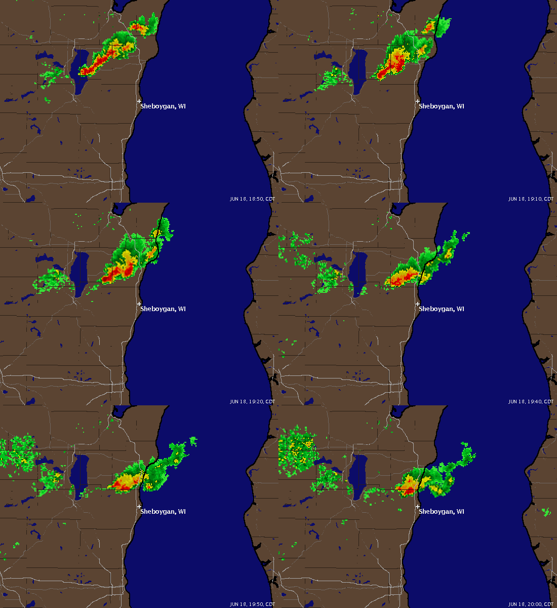
Nice overhang on the northern cell, WER right over Hartford with rotation looking a little stronger now...
 
Dunno about this - here's where NWS MKX plotted a trained spotter's report. Seems like something doesn't match up with what most of us call "reality" (backed up the radar to match the time of the report)

http://radioweather.us/mkx.png

Really strange - this is a law enforcement report of a funnel cloud at 1943Z just east of Watertown. Wouldn't surprise me if skies are clear there!

http://radioweather.us/mkx2.png
 
Well one common mistake will be for them to tell the NWS there position and not where the report should be made. That would definately be something with the law enforcement report that could be the problem. One thing is why would the NWS confirm these if they were too far off, I guess they'll just have to wait and see what comes of the report.
 
Looks like this thing ended as quickly as it started... MKX still saying a possible tornado near Edgerton, but that's a 35dbZ shower with tops of 8000feet and we'd need to rewrite some textbooks if that thing has a tornado on the ground ;>
 
TOR warning for Montgomery and Boone Counties. As of 7:02pm a thunderstorm west of
Ross, IN which is southeast of Crawfordsville indicated rotation. Currently in Crawfordsville, IN watching the storm and packing up gear to head towards it. Heavy rain, lightning, and nikle size hail are associated with this storm. More later if I get anything good.
 
Trained weather spotters are reporting a wall cloud and doplar radar is indicating a possible tornado. Destructive winds in essess of 70 MPH is also possible with this storm and possibly large hail. SVR storms are just west of indianapolis and moving NE.

EDIT: New TOR warned storm for Calumut county WI. Radar indicating a possible tornado.
 
I happen to be in Madison on business and went for the storm after the tornado warning was issued. It was pretty much just a shower when I reached it north of Janesville. There was alot of low hanging clouds, almost tropical like, in and around the storm and wonder if some of these were the 'numerous' reports of funnels. Even the last tornado warning issued was strange. It stated the storm was moving east at 10 mph and would be near Edgerton at 3:10, near Janesville and Beloit at 3:25. Unless my Rand McNally road atlas is misprinted, Janesville is 15 miles due south of Edgerton and Beloit is 15 miles due south of Janesville.
 
Small tornadic storm in Sheboygan County just to the NW of Sheboygan has a 'large rotating wall cloud' with it per an NWS Co-op Observer according to the latest SVS. Impressive day in Wisconsin.

CASFA3UG.gif
 
"It stated the storm was moving east at 10 mph and would be near Edgerton at 3:10"

They were issuing that warning as a blanket for the entire area, so that was a line of showers being pathcast.

"Well one common mistake will be for them to tell the NWS there position and not where the report should be made."

Did a little more research and just like the last big event - the MKX office picks a seemingly random location somewhere in the vicinity of the report and plot that as the lat/long. The text of the report spells out the exact location, so they know where it is, they just don't place it there. Seems a little strange, maybe the software is not user-friendly (although I've not noticed any problems from other offices.)
 
I'm not expecting street corners ;> But if you look at my first link, the text says the touchdown was 2SW of Soughton. It was plotted approx 2-3 miles north of Stoughton. So if the software takes 2SW and plots it 2N, there's a BIG problem. And it's not an issue I've seen with other offices.

Link 2 was supposed to be plotted 2E of Watertown, instead it was plotted over the center. I still don't think 2E is valid based on the radar, but clearly something is going wrong in the plotting if the locations are this far off.
 
Back
Top