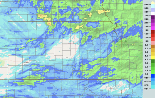
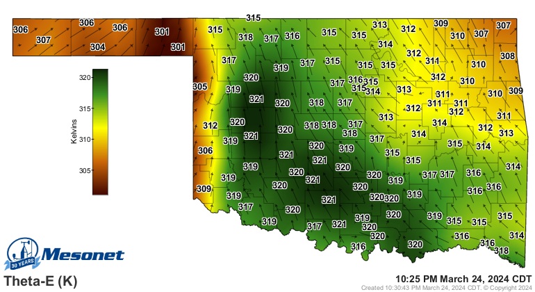
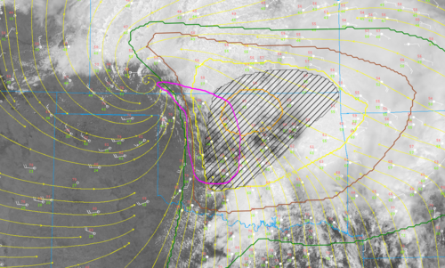
Starting this up- impressive wind shear profiles forecast in OK and KS. The biggest question for me is storm mode. Not sure the storms will stay isolated enough for tornadoes especially if they’re training. Major flooding seems like a distinct possibility and from a chasing perspective a lot of washed out roads. Definitely one to watch though.

-
A friendly and periodic reminder of the rules we use for fostering high SNR and quality conversation and interaction at Stormtrack: Forum rules
P.S. - Nothing specific happened to prompt this message! No one is in trouble, there are no flame wars in effect, nor any inappropriate conversation ongoing. This is being posted sitewide as a casual refresher.
-
A new feature has been added to the Xenforo software - Shoutbox. A quick chat platform
- Weather and Chasing
- Target Area
5/02/22 EVENT: OK/TX/KS/MO
- Thread starter E Hale
- Start date
Similar threads