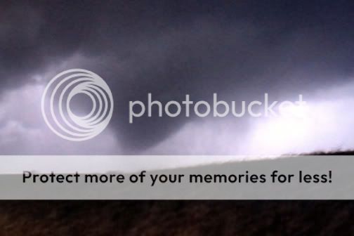
3/30/2006 REPORTS: KS,NE,OK,TX

Joined
Dec 22, 2005
Messages
232
Location
Chapman, KS
Figured I'd start the report thread, figured this would be the best place to put this.

Just got home from school at Hutch Highschool where they sent us to the tornado shelters when the sirens blew here in town. Tornado reported doing damage in Hutchinson at 11th by the Mall and at the hospital and on the north side of Hutch on Lucille and 43rd street. all this was reported by a "local off duty law enforcement officer". I havent look at the damage myself yet (which I may still do) but from what I have heard it was mainly just windows blown out and other minor damage on the east side of town. I couldnt see it my self because I was hiding in the Hutch High bathrooms with about 100 other students in the dark, but I'm pretty sure it was a non-mesocyclone/ landspout type of tornado similar to the one that knocked out car windows in Newton Kansas back on January 28th of this year.

So that was an interesting experience to say the least, I was amazed at how badly our schools tornado plan worked out, We had students still walking the halls at least 10 minutes after they announce to go to our tornado shelters, that could be bad if we get a tornado actually strike the school ever. Anyway we still have shingles and branches blowing down all over town at this very minute as the westerly winds behind the dryline are blasting in at 50-60 mph so still some interesting weather around. Guess I will be repairing roof tommorow :(
 
Observed two tornadoes today in SC Oklahoma, one just east of Duncan and a second north of Velma.

I saw a storm on radar near Hobart that caught my attention, and decided to go after it, owing to the fact there was still plenty of time/daylight left should the first "wave" crap out. I left OUN at 10:45 and drove to Chickasha. Took US81 south to OK19, and sat there for a while listening to the play-by-play between spotters and WX5OUN. Resisted the temptation to try and fly north to intercept the early cell along I-40 which was a nice supercell for a time. Kept myself to the game plan and gradually drifted south along US81, watching the approaching cluster of storms. Caught my first view of a base northwest of Marlow, and watched that linear storm do nothing as it moved by to the northwest. Another core was southwest of it, so I drfited south into the north side of Marlow and watched this base produce a non-rotating (but persitant) wall cloud. Eventually rain became an issue, so I moved south through town. Once on the south side of Marlow, it was obvious this storm was outflow-dominant as well, and reports of nickel to golfball hail around town began to pour over the scanner. I briefly considered heading north back to OK29 and going east to target the Marlow storm, but a report of a new storm still further southwest near Duncan got my attention.

I moved through town, and as I came to my east option (OK7), I broke free of the rain and saw a high, flat base. There was an intense precip core north of it, and while the storm itself didn't look too spectacular, I notcied it was the last in line. I moved east a few miles, then stopped to observe and shoot a bit of video. The storm was still looking like all the others; outflowish and linear. However, it was still ther last storm in the line, so I stayed with it. I got back on the road and continued east. After a mile or so I looked in the rearview and saw a rapidly rising scud bomb flowing into the RFB. I stopped, set up the tripod, and rolled video. The evolution of this was incredible to watch. Rapid rising motion was occuring all along the base of the wall cloud, and I looked almost overhead to see the eastern edge of the rotation. The mesocyclone gradually tightened, as after a few more minutes, strong rotation was noted within the wall cloud itself. Surface winds picked up dramatically, to where I had to hold my tripod to keep the vidcam from blowing over. Rotation became violent, and a large cone funnel began to descend. The RFD began to wrap around, which was filled with black-as-night precip. The funnel was over halfway down and rotating violently, as a few small tendrils tried to reach for the ground. Before I could see full condensation to the ground, the rain curtain wrapped around, completely obscuring the tornado. I packed it up and blasted east, until the rain curtains parted and I could once again see a large cone tornado (actually it looked like a Hershey's Kiss). I couldn't see condensation to the ground, but based on the violent rotation, persistence, and all the rain around it, I assumed it was a tornado the entire time. As I pulled over to set up the tripod after it reappeared, it finally condensed fully to the ground, in a classic "SKYWARN" logo tornado shape. It rapidly roped out in the "vaporized" style, as the next mesocyclone strengthened east of it. I moved east and stopped again near Velma. The wall cloud/lowering looked kind of ragged, but had chaotic motions. Within a few minutes a large cone funnel developed and dipped halfway to the ground. It persisted, and came about 3/4 of the way down, as pieces of scud were lifted off the ground and pulled into the funnel. This tornado persisted for a few minutes, until the RFD crashed in, wrapping the tornado in precip. I could barely make out the shrinking funnel within the rotating rain curtains as the tornado dissipated. During the second tornado I ran into Jeremy Wilson and Aaron Hughes.

After the second tornado ended, I flew east on OK7 to OK76, then went north. South of Pernell I ran into other chasers who were braver than I, as they headed north into the rotation while I turned around and headed back south. I was blasted with RFD as I heard a report of a tornado west of Pernell. I drove south until I got away from the intense RFD winds (took both hands to keep the car on the road at speed), then stopped and turned around to face north. I never saw the tornado. I turned back south and continued back to OK7, where I once again blasted east to I-35, all the while slowly losing the storm. My miscalculation and subsequent "escape" south of Pernell had been a fatal navigational error; I never coulld get back in front of it and, despite knowing it would continue for several hours, I let it go to concentrate on a new storm west of Pauls Valley. This storm was ingesting the previous stale air from the first one, and never could get its act together. After being delayed just north of Pauls Valley by an accident (which you'll see shots of on KOCO-TV because they rolled up on it), I headed home.

A great way to get on the board in 2006. I'm miffed I let the storm get away, but happy I was able to observe a few tornadoes before it did. There was no tornado warning on this thing the entire time I was seeing tornadoes. I tried to call in the rapid rotation near Duncan just prior to the first tornado, but of course my phone had no coverage. I will be submitting a report and video to OUN tomorrow.

Did it all while driving with one hand, LOL. My car kept popping out of 5th gear all day, so I had to hold it in. That made for a hectic chase.
 
I'll keep it short. We left for NC Oklahoma at about 11, targeting the strong jet max and intense deep layer shear progged to round the base of the trough near 18Z. Bad idea. Got sucked in by a crappy storm near Kingfisher which exhibited some brief lowerings, then moved over to attempt to intercept a storm near Guthrie, but it was moving way too fast for us to catch up with it. Gave up on the chase in Stillwater, but it appears that the cell produced at least one tornado in SE Kansas around 4:00. We decided not to attempt to blast down I35 to catch up with the tornado producers in SC OK and instead came back here and watched on TV. Congrats to those who were successful, and better luck next time to those who were not.
 
I was on ... actually, kind of "in" a tornado tonight north of Savannah, Missouri. This was completely accidental, and I know I'm going to get raked over the coals for it (probably rightly so) ... I came through the hail core of a severe cell that came over into Missouri from Kansas, and as I rounded the corner onto 71 highway north of Savannah, I immediately spotted a tornado just off to my west. It was dark, but the lightning was like daytime, so it was easy to see (pics coming) ... anyway as I'm standing there I start hearing this roar ... at first it just sounded like wind, but it was coming over the hill toward me and I realized suddenly that I was really close. This sounded like I was standing under a jet engine going full blast ... when I realized that it was getting louder and louder I jumped back in the car and headed south as fast as I could, flashing my lights at the northbound traffic. This was just way too close. My heart is still beating a million beats a minute as I type this. The outer bands of rotation passed over my car, but I would say the core of the funnel was probably about 1000-2000 yards to my west. I wish I could describe the sound more than anything. This is the FIRST time in all these years that I've ever heard it. Before you start lashing me (which I know I deserve) ... the storm was NOT tornado warned when I came around the south side of the core, and I had no way of determining there was a tornado until I turned the corner. I'm just so glad I got off the first road, because the tornado passed right over it.

Pics coming within 30 mins or so. Hopefully I'll calm down a bit.

---------------------------

Here are the vid caps:

SavannahTor3.jpg


SavannahTor1.jpg


SavannahTor2.jpg


Damage photos and more explanation on this storm can be found: http://www.stormtrack.org/forum/index.php?showtopic=10796

One more quick note ... I gave the nuttiest report to EAX tonight I've ever given, but they called the tornado warning immediately ... which was cool. These were taken as the tornado was moving across the top of that ridge ... I was actually not in any real danger as it was moving more north than east at the time, but it did cross the road I had been on not more than a minute before. Tor was moving fast - - - I'd say around 50 mph or so at the time.

EDIT - damage reports now coming in from two miles north of Savannah ... ambulances were called, a silo rolled in a ball ... and the road that I barely escaped from is closed with telephone polls and trees across it. If I had been one minute later on that road, I wouldn't be writing this right now.

EDIT 2 - I'm getting a little more shaken up ... there are now multiple injuries reported on this tornado. I honestly tried my best to get traffic going northbound on 71 to stop, but the cars kept going and now I'm getting upset because I know they were driving right into this. It sounds like the injuries so far were minor. 4 homes were destroyed or damaged, however.
 
No tornadoes here either. I played the surface low today, needless to say it was a tough chase. I left Omaha about 12:45PM and was initially heading for Hebron but wound up in Beatrice trying to intercept the Tornado warned cell coming up from Concordia. Successfully intercepted it just south of Beatrice as it began to bow. Got some interesting downburst pictures near Courtland, NE. Followed to bow northward through Lincoln and all the way back to Omaha. As I got back into the Omaha suburbs sirens went off for a public report.
I did a brief damage survey this evening and IMHO it looks like we had some straight line winds but I could find no evidence of any tornadoes. Damage consisted of a few uprooted trees, a few flattened signs, some large hay bails tossed about, a demolished horse barn and part of a metal roof torn off of a church. While the debris was blown all in the same direction it appeared that the damage path was very narrow, only about 100yards wide, and along a straight line.
 
I wasn't able to get out and chase this afternoon, but it seems (according to public reporting atleast) that a tornado decided to come along my way anyway. It seems the majority of the activity was in Papillion, Nebraska this afternoon. I went through while there was still some light outside and there were numerous fences torn down, trees torn out as well as downed powerlines.

My girlfriend, who works at InfoUSA in Papillion, claims the building might have been hit on the SE corner of the building by this tornado. She gave me all the characteristics of a tornado (debris cloud, sounds like a fright train, etc..). The damage looks insignificant, but there were obvious signs of fatique and cracks in the foundation of the building.

I have my doubts that it may have been a true tornado. If there was, it would have been impossible to see with the large amount of precip. The ornado would have ben rainwrapped.

No pictures... camera battery is dead. :(
 
Chased the Papillion/ Omaha activity after leaving school.... pictures to follw but headed west on highway 370 to witness a large shelf cloud with winds reported to 60 mph behind it. The precip was right up on this thing and many of my shelf cloud pictures have the extremely thick precip right behind them. decided to head back east on 370 when the new circulation formed just to the SSW of Papillion. I observed a lowering and extremely fast moving horizontal rain curtains being wrapped around this feature. The church with the roof damage is in my nieghboorhood and we saw some small limbs down near my home as well as some shingles from nearby roofs. This was an extremely compact circulation but i thinK the damage was cause by an rfd or strong downburst...it actually does have a fairly long path though...

EDIT*** Confirmation of an F0 Tornado in Papillion, NE by OAX. Tracked right through my neighborhood.
 
Well looks like everyone was up north today.
For some reason this day had the song "Always" by Saliva running in the back of my head the entire chase.
Well I left Norman at around 11:30 shortly after the 2nd TORN WW went up. Headed for the southern cell round Chikeshea. Watched it do its thing then crap out as the one out of Lawton toward Duncan starting picking up steam. Raced south on 81 toward Duncan out of Chikeshea. Had to flip the bouy switch on the truck as street flooding was widespread in Duncan. At that point the storm starting getting its act together and tightining up as was not only visible on radar but also visually. So we booked it east on 7 out of Duncan and came up to the backside of the cell as the area of roation was to our north and east. Then somewhere between Countyline and Ratliff City, the thing started dropping as went tornado but just briefly. Almost simultaneouly OUN blarred the warning on the 2meter frequencies. Coming into Ratliff City I saw Shane Adams on the side of the road in his blue hatchback looking completely dumbfounded so as I screamed by I leaned on the car horn like a train. But anyway we came to the intersection of highway 7 and I-35 pulled over at fillin station and sat and watched the cell went thru a splitting process looking totally unorganized in doing so. Then after about 10 minutes WX5OUN came on and wanted chaser on the eastern cell toward Pauls Valley as that one was becoming the dominant one. So we headed north on I-35 toward Pauls Valley and headed east on 19 out of Pauls Valley but didnt go far as the western cell then took over as dominant cell. So we went toward Pauls Valley.............................errrrr anyway that went out and was on this cell that time knows what we ran into. Yep thats right THE WALL of magenta 70dBZ zero visibility water and pea sized hail. After much panic looking for an awning, we found shelter and waited out 5minutes as the cell passed. So we back east out of Pauls Valley. After dawning our scuba gear and rafts through the heart of Pauls Valley (and who said the burn bans should be put back??) we did, as Gary England would say, a "jump back" in time to December as we ran into white out conditions on the road and all throughout the fields. In my life I have never seen so much pea sized hail covering the road. And not only that, it was like this for a good 10 to 12 miles on the road east. Hell, the cows were up on the levis as their fields were under 3 feet of water. At this point we were getting into hills and crap toward Ada and decided to call it quits as the terrain was becoming what is known as Eastern Oklahoma.

But all in all it was a fun chase, nothing to write home about but honestly I didnt walk out the door expecting to see a tornado anyway. Walked out the door at approx 11:30, walked back in at approx 7pm. So thats how it went.

Looks like I might doing this all over again here this weekend or next week even.

[attachmentid=52]

[attachmentid=53]

EDIT: Norman Dome 5,534,349,589,358 Tornadoes 0

"I see, the blood all over your hands
Does it make you feel, more like a man?
Was it all, just a part of your plan
The pistol's shaking in my hands and all I hear is the sound

I love you, I hate you, I can’t live without you
I breathe you, I taste you, I can't live without you
I just can't take anymore, this life of solitude
I guess that I'm out the door and now I'm done with you"
 
Today was a bit frustrating at times, but I enjoyed myself. I headed out with Greg Stumpf a little bit before noon, and when we first headed out, it looked like the storm that was going to hit near Guthrie was becoming discrete, whereas everything to the south still looked linear, so we headed north on 35 to almost Edmond. However, it started to kind of crap out, and the storm to the south started to become discrete and started looking really good as it was approaching the Norman area (where as the storm to the north seemed like it was dying). So, we abandoned that storm, and went for the one closer to Norman, which also kinda crapped out. Byt that time, we were down on Highway 9.

Tail end Charlie (the one that produced the tornados that Shane saw) started looking really nice, so we headed south on 177 towards that storm but trying to stay east of it. It had become tornado-warned by that time, but we were too far east trying to get in position for (hopefully) more tornados that didn't happen, so we didn't see the tornados. Wound up intersecting the storm about 5 miles East of Wynnewood and followed it up to Ada. By that time, there were actually 2 storms, and the one behind the first looked a lot better, but it turned out to be this massive HP bomb, so even if there had been a tornado with that storm, we would have had a really hard time seeing it because it would have been surrounded by a nasty-looking HP core. We went south on 3 since the storm was moving more E'ly rather than NE'ly to get out of the way, and then headed north for a little while on 48 near Lula (and easy on some county road...I think 1600 or something). Ran into Gene Rhoden and RJ Evans while stopping to get a last glimpse of this storm before letting it go into the jungle that is better known as SE. Oklahoma. Chase humor story of today (for us) was that there was a marijuana plant growing on the side of the road right where we pulled off to watch the storm/talk to RJ and Gene. I guess someone threw some seeds out the window dodging the cops or something!

Anyway, Greg and started to head back to Norman, and decided to drop south on 99 briefly near Ada to catch a smaller cell that was moving through the area, hoping to get a last glimpse of something before heading back. Not too much luck, other than some CG's.

All in all, it was a pretty good chase. Would have been better to see a tornado, but I was perfectly happy :). I'll put a few pictures up in a bit but first I need food.
 
I didn't get to see any tubes, or anything else at all that exciting. Most of the day was spent praying for the Stratus Deck of Doom to start burning off so we could get some instability going (although MLCAPE values were around 1200j/kg which was more than sufficient once something got started).

I witnessed cells firing to my west and east all day, but was confined to work all day. At one point one of the cells to the east started showing organization and there was visible circulation in the mid levels at least.

The one cell that did completely roll on us was part of that line that was tor. warned in Concordia. By the time it got to Beatrice it had turned into a grungy bow beast. The shelf cloud that came rolling over had some interesting motions to it. At one point there appeared to be some rotation to an especially lowered portion, but I can't verify. As the storm rolled over Beatrice it started off with light rain, lightning, and the ominous green sky. I gave my co-workers an off-hand estimate of nickel size for the largest stones and was proven right a few seconds later. The light rain and hail turned to a blinding deluge that was driven by 70 MPH gusts according to OAX. I can't verify that because I could not see out any windows at work during the time, but I would believe it.

I really wish I could have snagged pictures of the shelf cloud as it came roaring into town. It really was grungy.

Later in the afternoon I got bored while the dry slot was rolling over Nebraska, so I decided to try my hand at some photography. I wanted to capture the storms on the western edge of the slot as they rolled over town, but the whole system was cranking east at about 60 MPH at least (I was doing 60 and it was overtaking me). I did manage to snag a shot of a supercell to my southeast (somewhere in Kansas) by the shot came out as a blurry mess. I did get a shot of the line just a little farther north of it. I also got a picture of the storm on the western edge of the dry slot as it started passing overhead.

Photography from the day may be found at: http://www.thespiralingshape.org/img/wx/060330/

Nothing of MikeH quality, but then, what is?
 
Mike Gribble and I left Wichita around 10:30am heading south toward our initial target Wellington Ks. After resetting XM and checking data we turned around and headed back north towards the cell near Wichita that was going up ahead of the line that was south into Oklahoma. The cell finally went tornado warned around Potwin Ks and was showing some rotation and a wall cloud.

The storm motion was around 50mph so it was hard to stay with it. Heading towards highway 77 we tried to cut over on a dirt road but it was very muddy and had to go back to the paved road that went over to highway 77. This is when the chase started to go down hill.
03302006chase19pf.jpg


Took a quick stop to get cameras ready right before the highway, just got back into the explorer and a Butler Co sheriff dove up and was storm spotting. So we had to follow him until we got to Florence Ks and jumped on highway 50 heading north, well the traffic was so bad could not catch back up with the cell. We turned north towards Council Grove trying one last attempt to catch the cell but it was moving to fast. We broke off the chase because there really was no good road network and the speed of the storm. So we headed back west on highway 56 heading towards Herrington trying to intercept the line that was showing rotation coming out of Reno Co. The storm lost its punch right before we got to it so we decided to call it a day.


On the way back got a flat so had to change it in the wind, rain and muddy road. It was not a bad chase day no tornados but car, equipment problems (had to reset XM three times) and the speed of the storms made it stressful.

Also I got to meet fellow Stormtrack member Ryan Shirk and his brother in law they caravaned with us.
 
Just a short report. Walt Gish and I saw the same two tornadoes as Shane. As such too much further description etc. would simply be repeating what has already been posted.

We left Cordell a bit behind the game but managed to get ahead of the line of storms and worked our way south on Hwy 81 to tail end charlie which we had to core punch at Duncan in order to get into position. As we neared the southern edge of the core, we heard spotters reporting rotation along Cherokee road--I thot--here's yet another example as to why it is unwise to core punch!!. We were lucky I guess and got into position in time to see the first tor east of Duncan and then the second NNE of Velma. With trees and low contrast the video isn't really worth much so I won't bother to post any captures. No time to get out and tripod, and both tors were brief in any case.

Broke off the chase a bit after the cell crossed I-35. It didn't seem to be able to get itself re-organized to produce anything other than some weak rotation.

Wondering why the tors aren't on the SPC report page. The spotters were all over them even tho the cell wasn't tornado warned....

Good chase for the first time out this year and my first time out from my new location.

Gene
 
Darin Brunin, Eric B' Hymer and I witnessed a rope tornado near Buffalo KS earlier this evening. Will post a pic and chase report later.
 
Just a quick chase encounter...

Initially targetted Hebron NE out of Lincoln, but ended up doing as many others did, chasing the tor warned cell from Concordia toward Beatrice. Saw a decaying wall cloud with possible funnel in a cell before this and farther to the Northwest, but was really not that impressive. When we finally got ahead of the targetted cell, stopped for about 2 minutes and took pictures of a wall cloud with weak rotation present SW of Beatrice. RFD QUICKLY flew in on us as it was in the process of rapidly bowing out. The road network to the east of US77 was weak so we were basically screwed. Pulled into a pasture to take the full onslaught of the storm. Saw ~8 in. diameter tree branches fall close in front of the car ( the 70 mph wind estimate from OAX was actually called in by me) as we took ~ golfball sized hail. Most of the stones were smaller, but there was one right next to my car door that was up to that size. I was seriously thinking my car windows were going out, but got lucky. It was an exciting chase, but without tornadoes. Congrats to those who had better luck today.
 
Couldn't get out of work until 3 but decided to head north and intercept the Osage county storm in Oklahoma. Never could get close enough to see anything as it went through Independance, Ks. but there was a bunch of emergancy vehicles headed there as I continued up 75.
I ended up catching up to a cell coming into Wilson county and got these pics as it dropped east of Buffalo, Ks.
0330061901.jpg


0330061902.jpg


0330061904.jpg


0330061906.jpg


More are on the blog

I'll add some video tonight or tomorrow
 
Back
Top