• While Stormtrack has discontinued its hosting of SpotterNetwork support on the forums, keep in mind that support for SpotterNetwork issues is available by emailing [email protected].

2025-05-18 REPORTS: TX/OK/KS/CO

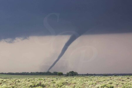
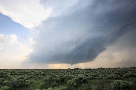
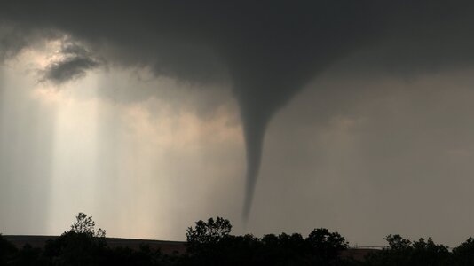
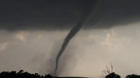
Wow, Sam! Just wow! Clearly you saw something in the data that the vast majority of us did not. Coming down from KS, I got on the storm way too late, after the real show was over. A disappointing chase for me, although I cannot call it a total bust when I did get a nice barberpole LP-ish storm near Freedom, OK from what was left of the Arnett storm.

IMG_7070-e-4x6-upl.jpg

By the time I finally got to the storm near Vici, which continued to be the case thereafter, haze was a real issue for visibility. This pic would have been way better without it. That does not seem to have been an issue farther west near Arnett. Guessing the temperature-dewpoint spread was bigger down there, but it was very hazy later.
 
I started the day in Junction City. Two main target areas were evident at first data check: the dryline bulge from Dodge City to Woodward, and the surface low vorticity region in northwest Kansas/southwest Nebraska. I liked the northern target better, as it was more of a secondary target (though still good) and I liked the idea of having storms more to myself (as most chasers were targeting the dryline bulge). The problem this day was that persistent low clouds, outflow and stable air were hanging out in all of these target areas through the morning. I decided to hedge between these two areas and position in Kinsley, Kansas to start out.

Upon arriving in Kinsley, I was still not out of the low clouds and cooler temperatures. I became concerned that the warm sector for storms to thrive would be too narrow here and to the south, which made the in-full-sunlight northern target area much more attractive (spoiler: I was wrong about that). I made my final call for the northern target, making it to Kanorado (the Kansas/Colorado border town on I-70) right after storms began forming south of the interstate. The storms were high based and were not doing much with low-level organization. I also could not see any sign of an RFD developing anywhere among several of the updrafts. I stopped to do a data check at Goodland, initially intending to continue following the storms north into Nebraska. But then I saw the tornado warning go out for a storm near Scott City, about 50 miles to my southeast. This supercell, and others near it, all had strong-looking couplets on radar from their start, unlike the ones I was on up here. I quickly made the call to abandon the Goodland storms and intercept the better ones to the south.

Right away, I realized I had a road problem for this maneuver. There were only north-south paved roads available at Goodland, Oakley and Grainfield. Between these was the unpaved rural road grid, but the forward flank cores of the supercells had been raining on them for almost an hour now. I considered those unpaved roads complete no-gos. Even the ones with gravel aggregate are treacherous when wet, and the gravel often ends suddenly at unpredictable spots the farther you go. The pure mud is a expensive chase-ender if you end up on it, no matter how big of a 4x4 behemoth you have! These mud roads are like driving on the slickest black ice from freezing rain. Not only can you get stuck on them right on their centerlines as your wheels gradually sink deeper, the bigger risk is losing control and sliding into the water-filled bar ditches. When that happens, you will need a farm tractor to get out - even professional tow companies won't even try. You also risk flooding your car if the water in the ditches is deep enough. And in this case, I'd be dealing with all of that in the vicinity of violent wedge tornadoes. It all adds up to a completely unacceptable risk to even attempt it. My point being, these unpaved roads are just out of the question for me when they are wet. Sure, some chasers risk it and do OK (sometimes) - but I just won't.

Out of my paved options south from I-70, only one was viable for intercept. The storms were already east of Highway 37 out of Goodland. The mesos/tornadoes were already right on Highway 83 south of Oakley, and I would not make it there before they crossed that road and moved east of there onto the unpaved grid. That left Highway 23 south of Grainfield as the only one. But by the time I reached Grainfield, I was back in the stable low-level air with thick fog and stratus completely obscuring any view of the storms to the east. This did not improve as I headed south on Highway to Gove City. I figured that the storms would dissipate rapidly after encountering the stable air, and was resigned to a bust. But as the lead storm south of Grinnell continued north, the couplets on radar weren't showing any sign of slowing down. I decided it would be worth heading back to Grinnell to see if maybe the RFD would carve out a gap in the low clouds and fog so I could see something.

I sat at the Grinnell I-70 interchange waiting for the storm. Eventually, I could see what looked like a forward flank shelf cloud emerging from the fog to my west, feeding south into the mesocyclone with bright skies behind it. To the southwest, a darker area emerged where the tornado should be, and radar showed it was still there and still quite strong. I was shocked to see how the stable air apparently was not hindering this storm at all.

At this point I was getting an uneasy feeling. The couplet was only a couple miles south of me and moving north-northeast, which I initially judged to be heading east of Grinnell. I as of yet had no visual on the tornado. Should I go west or east to get out of its way? I initially chose to go west out of Grinnell on the first available road north of I-70 (I did not want to use the interstate as there is no safe place to stop or turn around if needed). But upon reaching the southwest corner of the town, east-southeasterly winds began ramping up continuously to alarming levels, and I looked south to finally see the tornado emerging out of the fog, coming right at me.

I turned the car around, pausing for a moment to watch the tornado as I faced it, confirming its motion as my next move was of critical importance. East! East! As I made the move eastward, winds turned southerly as the tornado passed less than a half mile behind me. I kept going until I was out of that stronger wind field, at which point I watched it go through Grinnell as a tall, narrow stovepipe with an audible roar:


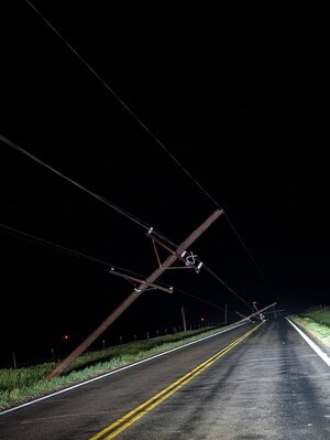
I went back to check on the town, but the power lines were down blocking every road/street going north into town. A couple of police and fire vehicles were already on the scene, so I didn't feel like I was going to be able to be of much help. I got back on I-70 easbound, making it through before it was shut down.

I intercepted the next supercell at Grainfield. It was in a much weaker state with not much of a couplet on radar as I watched it pass by just to my east. As I continued west, the sun was beginning to break out in between gaps in the low clouds, revealing that the stable fog/low cloud layer was very shallow - explaining how the storms were able to drill down circulations through it without it affecting them much. I intercepted another storm at Wilson after sunset, but it was in a much weaker state than the first two and I did not see any visual signs of a low-level meso.

During this time, the storm down by Greensburg was producing tornado after tornado as it too appeared to be into the stable layer, but able to overcome it. With a 2-hour drive to intercept, I felt like it would likely weaken before I arrived on it, so I did not divert south. I once again headed for on overnight stop at Junction City.

Chase log page with more details and imagery:

 
Last edited:
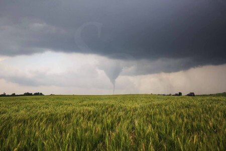
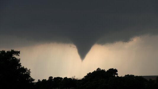
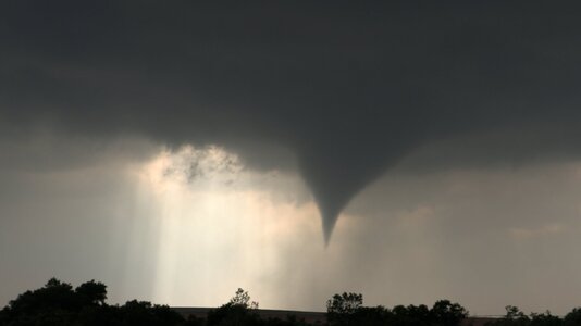
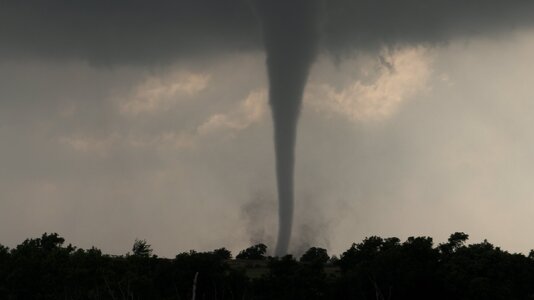
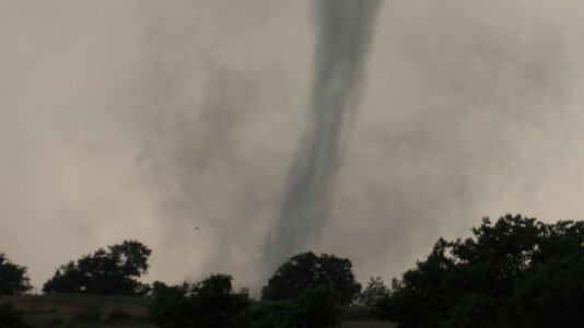
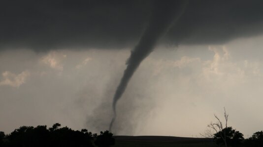
Stellar day that took a while to develop. My original target was somewhere near Manchester, OK or Kiowa, KS but it was socked in cool cloud cover up until early afternoon. I had reached Highway 412 and decided to go west to find clear sky and warmer temps as the warm front didn't seem like it was budging. Met a friend in Seiling, OK and traveled north through Woodward and up to almost Buffalo when the cell in the Texas Panhandle fired off. Decided to commit to that cell and met it in Arnett where it went bonkers for a short while. I've captured more tornadoes near Arnett than any other place over the years. Beautiful country and a great area to watch a tornado rumble in open space.

Tor1.JPGTor2.JPGTor3.JPG
 
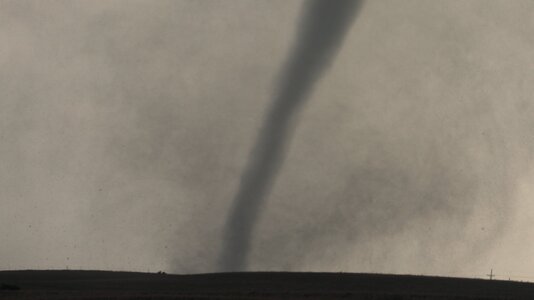
We wanted to avoid hordes (and evidently, they were bad), so we also missed the tornadoes. However, I, for one, loved the LP structure later. It was maybe the tallest/skinniest I have ever seen. YMMV.
 

Attachments

  • IMG_4970.jpg
    IMG_4970.jpg
    69 KB · Views: 5
  • IMG_4990.jpg
    IMG_4990.jpg
    60.8 KB · Views: 4
  • IMG_4947.jpg
    IMG_4947.jpg
    57.9 KB · Views: 4
  • IMG_4951.jpg
    IMG_4951.jpg
    100.5 KB · Views: 5
  • IMG_4938.jpg
    IMG_4938.jpg
    87.3 KB · Views: 5
  • IMG_4959.jpg
    IMG_4959.jpg
    114 KB · Views: 7
After disappointments on Friday (wasn't able to leave home early enough) and Saturday (targeted I40 corridor near Clinton, OK where nothing materialized), yesterday was a banner day. Starting out from Weatherford, I headed north to an initial target area of Waynoka - Alva. After checking out the observation deck at the Little Sahara State Park amidst an aggressive mist, I decided to head initially west towards Buffalo and then south towards Woodward, where the warm front and clearing lifted northward around 3 PM. I waited in Woodward until I noticed the cell initiating in the TX Panhandle and so headed SW to Arnett. Ended up positioning a few miles south of Arnett where I was treated to a spectacular show of several tornadoes, including a rope followed by a larger one. The structure was really photogenic as well. I followed (well attempted to with all the convergence traffic) it back towards Waynoka, where I got a couple nice shots at dusk, over the Cimarron River and then just north of town.
 

Attachments

  • 20250518_201754.jpg
    20250518_201754.jpg
    65.6 KB · Views: 6
  • IMG_8397.JPG
    IMG_8397.JPG
    75.1 KB · Views: 8
  • IMG_8395.JPG
    IMG_8395.JPG
    171 KB · Views: 8
  • IMG_8393.JPG
    IMG_8393.JPG
    102.2 KB · Views: 8
  • 20250518_174009.jpg
    20250518_174009.jpg
    164.9 KB · Views: 8
  • IMG_8387.JPG
    IMG_8387.JPG
    64.2 KB · Views: 7
  • IMG_8386.JPG
    IMG_8386.JPG
    66.6 KB · Views: 7
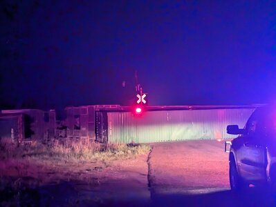
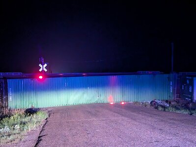
Left Hutchinson around 10:00 a.m. and initially targeted the Medicine Lodge, KS area but really wasn't liking the ongoing stratus and cold pool so opted to drop back south towards Alva, OK and watch the first storms of the day fire in eastern Texas. When it became clear these were going to move into better parameters @Ethan Schisler and I pushed towards Woodward and then south towards Arnette. Missed the first big cone but caught the last few tornadoes east of Arnett. We stayed with that storm until until a new cell went up to the northwest of that that would become the Greensburg to Plevna beast. We saw at least 5-6 tornadoes with this, including the big wedge and massive stovepipe that illuminated itself as it crossed in front of us on US 183 narrowly missing Greensburg. After navigating some downed power lines, we were able to get gas in Pratt and catch back up to it as it was entering Plevna. Ended up coming across a large segment of rail cars on the Union Pacific line that were flipped over between Greensburg and Pratt off of US 400

We watched initially as the cell occluded and had a handoff 8 Mile Southwest of Greensburg when the first tornado dissipated and what would become the wedge was a nascent stovepipe in no time flat. I could feel it in my bones as the inflow screamed to the NW to the point that I'm not a small person and I had trouble getting the door closed and you could hear the distinct, eerie waterfall and screeching howl that I've only heard a handful of times and that's when the atmosphere is absolutely pissed. 1000015140.jpg1000015139.jpg1000015138.jpg1000015128.jpg1000015129.jpg1000015111.jpg1000015116.jpg1000015123.jpg
 
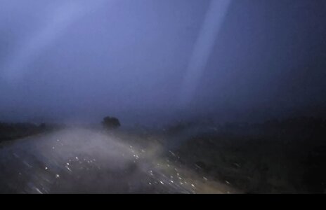
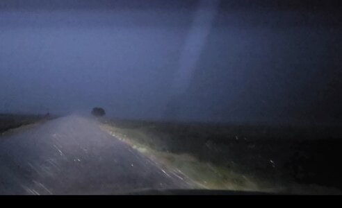
I didnt catch anything during daylight, but boy howdy did the nighttime produce! I wasted the whole day fighting absurdly dense fog, and took the scenic tour of the KS/OK border region. I was indecidedly split between the south isolated storm and the moisture toungue impinging on left exit region, and not able to catch anything.

Did the stupid loop, and initially targeted Greensburg, then Pratt, then Medicine Lodge, then Coldwater, then Greensburg again, then Coldwater, Freedom OK, Alva OK, Medicine Lodge, Pratt again, Greensburg for the 3rd time, then through Pratt for the 3rd and final GD time!

I was on it west of Praat, and then rode it east to Hwy 61. Took that towards Hutchinson, and as I was driving, decided to punch north for an intercept north of Preston, KS. Drove about 5 miles north, and looking around, the air was eerily still. The main tornado had occluded north and the new super wedge started forming to my due west. Realizing this only after seeing some power flashes way too close to my WNW, I decided I might try to book it north to beat it.

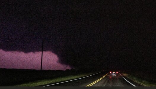
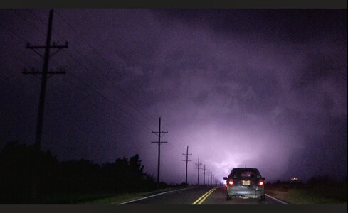
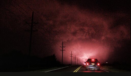
Thank God I didn't keep going! After turning to the north, I got blasted by some of the strongest RFD/inflow I've ever felt, and the panic started setting in. Luckily I was by myself on this road (somehow avoided the hordes, or maybe they were smart enough to not get this close), so was able to do the Copic shuffle and back up about a mile directly into the inflow. It was so strong that at one point the vehicle started sliding forward and sideways while I was trying to back up and almost went into the ditch.

After backing up enough to see the left edge through the lightning flashes, I figured, I'd backed up enough and probably wouldn't die, so then I started filming. And thats where this video starts:


Also, after looking through footage, I seem to have captured the satellite tornado on this one too. See images1000009836.jpg1000009834.jpg
 
Last edited:
What a day. Got the beauty near Arnett. Original target was south-central Kansas roughly halfway between Wichita and Dodge City, but when I got to Pratt around 2 PM and looked over satellite, observations and mesoanalysis it was apparent the cloud cover was holding firm and I needed to get into northwest Oklahoma. I initially plugged Seiling into my GPS, as it appeared to be roughly downstream of some small blips appearing on radar in the northeast Texas Panhandle...

Eventually I began to encounter breaks in the clouds, the reading on my car's outside thermometer shot up into the 80s, and low, ragged clumps of clouds were racing across the sky - the same look I've encountered when arriving to the target area on big tornado days such as April 26, 2024 and March 31, 2023. A chaser who used to be active on here in the mid-'00s called it the "tornado sky" and it certainly seems to hold true.

Meanwhile, those "blips" on radar were undergoing the classic clustering/amalgamation of updrafts that often precedes tornadic supercell development. It soon picked up a severe thunderstorm warning. It became apparent it was moving slowly, and I would need to push further west than Seiling to make the intercept. Frustratingly, I got stuck behind a truck going 5 under the limit westbound on US 60 as the tornado warning went out, with no opportunities to pass on the hilly road. I made it to the pull-off at the junction of US 60 and 283 just in time to watch a snaky funnel emerge from the base, and disappear before I could get my camcorder tripoded and rolling.

It was here I almost made a bad mistake. Used to fast storm motion days like the two dates I mentioned, I automatically packed up and jumped on 60 eastbound again, away from the storm, thinking I needed to position downstream for the next cycle. I turned left (north) onto the first dirt road and went about a half-mile, before coming to my senses, stopping and checking radar. The action area was clearly still back to the southwest, and I turned around and returned to where I'd been. The base loomed in the sky to the southwest, a new wall cloud soon began to churn underneath with little tendrils of condensation extending toward the ground.

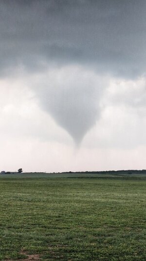
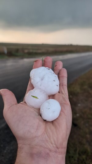
I was getting pelted by hail, the largest I've personally been in (some stones about half-dollar size, but the chaser standing next to me said he saw a golf ball-sized one fall). I decided to relocate a bit south to get out of the hail, and as I pulled over again (from the looks of it, pretty close to @sdienst) a perfectly symmetrical cone funnel appeared almost instantaneously under the base and the show was on. This is my Rozel (and 12 years later, to the day!). It even did that thing where the funnel becomes partially transparent and you can see little vortices whirling furiously inside.

Much more to say about this day, but that and a full collection of imagery/video will take many days (at least) to put together. Not least of which, long after I thought the day was done, I found myself somehow, against all my better judgement, trying to intercept a violent tornado after dark on Kansas dirt roads. However I was on the storm as it was merging and re-cycling north of Cullision, and quickly decided I'd had quite enough of that. I was booking my room for the night in Pratt as the storm pulled away to the northeast, wrapping up to produce the Plevna beast.

These are just some raw frame snaps from the 4K camcorder video.

MVI_0043.MP4.11_03_56_17.Still001.jpgMVI_0045.MP4.11_07_04_11.Still001.jpgMVI_0045.MP4.11_07_27_04.Still002.jpgMVI_0045.MP4.11_09_59_29.Still003.jpgMVI_0045.MP4.11_10_07_27.Still004.jpgMVI_0045.MP4.11_10_54_07.Still005.jpgMVI_0045.MP4.11_10_57_13.Still006.jpgMVI_0045.MP4.11_11_08_02.Still007.jpg
 
Last edited:
Ed Grubb and I departed Oklahoma City the morning of with an initial target of Great Bend, Kansas. Upon our arrival, low clouds and cool temps greeted us. After a delayed lunch stop (Wendy's took the fast out of fast food) and fuel, we quickly decided we were going to dive southwest on US-56 and aim for the Dodge City area. Moments after making that turn, I flipped us north on a dirt road to connect back with K-96 west of Great Bend and said I was going to "drive west til we see the sun".

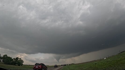
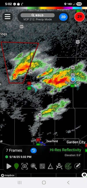
So west we went through Rush Center, Ness City, and as we approached Dighton, SUN! We made it. A surface analysis showed an arcing dryline, curving from west-east to almost north-south with a few blips starting to pop. With Scott City being a bigger town, we opted to hop over there for a final fill-up. About this time, our blips were becoming full-fledged storm, with the western storm becoming tornadic. Our focus was the eastern storm as it was not going to be sucking in the air of a sibling like the western storm.
1000022231.jpg

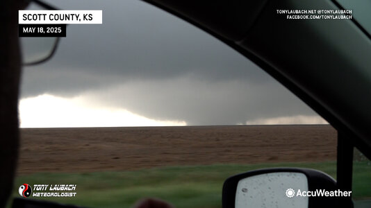
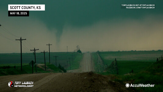
We drifted a few miles north to maintain a view of the base... inflow was massive and while the view of the updraft wasn't great due to clouds, we would occasionally see a massive barber pole in the breaks. The storm was far enough west where we didn't have the greatest contrast, it quickly became evident 'something' was happening. I was relaying info via NWS chat to Dodge, giving them a textual play-by-play as several funnels would tease their way down, when finally, the first tornado, a briefy, dropped shortly after 5:30pm north of Scott City.
20250518tor1a.jpg

This tornado lifted, and we continued north to stay with the cell. The area where the initial tornado formed underwent a new cycle (you could see the ragged wall cloud give way to a much smoother look before a new round of fingers began to develop. Shortly thereafter, we saw multiple funnels, before seeing a couple start to tickle the ground.
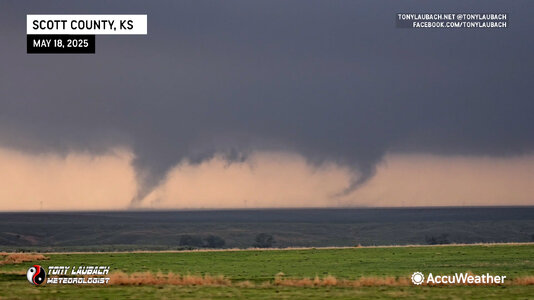
fbTwins2.jpg

These funnels played around with each other for a moment or two before merging (so it appears from our vantage point) and combining into what would become the (assumed) long-track wedge.
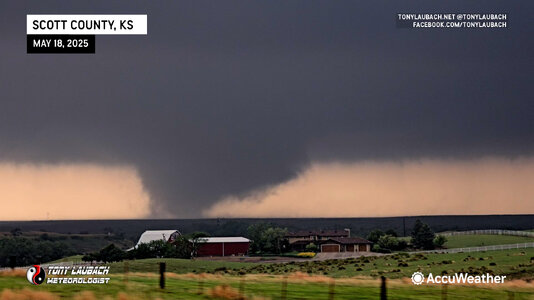
20250518tor3b.jpg

It grew to a wedge very quickly, a wide tornado with a very low base. We basically had the easiest viewing of this along US-83 northbound, stopping occasionally to collect imagery as we kept pace with it. US-83 has a short jog northeast north of K-4 that gave us a little extra time as it was almost parallel to the tornado's path. Occasionally, a satellite would rotate into view before being absorbed by the main tornado.
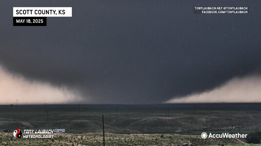
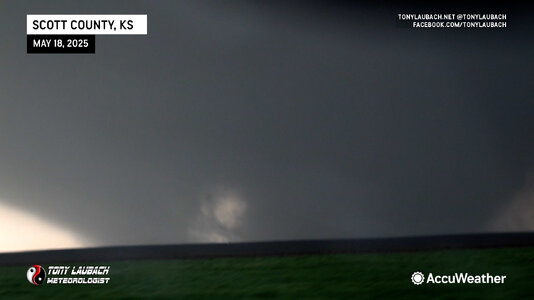
20250518tor3c.jpg
fbTwins1.jpg

TonyTornado.jpg

We continued north of Scott Lake State Park, stopping at a Historical Marker with a good view over looking the valley. By this time, our wedge was losing contrast, and with the hail core to our north and the tornado approaching US-83 into an area with NO roads, we noticed a cell immediately to its south that also had a look. We decided, "hey, we got all we can out of this, lets give the south cell a shot so we can see other tornadoes".

So we left it, yes, we left a WEDGE IN PROGRESS... we dropped south, virtually into the same place we saw the tornadoes before. And boom, new tornadoes.
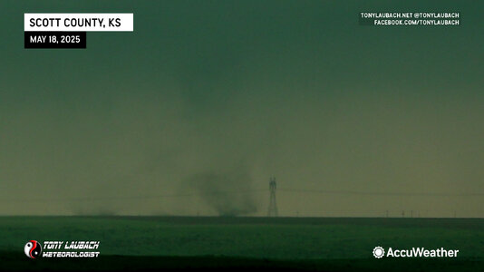
20250518torn5.jpg

After a couple briefies, a larger tornado developed south of the State Park. I noticed on the map that K-95 spurred off US-83 at the northeast dogleg and having never been on the road, I thought, "hey, there's a road that would put us closer for a time!" And I was right! Buuuuuuuttt...

It was all pretty much in a canyon, no view looking west. None, zero, zilch... we spent about 10 minutes hauling around up into the park, eventually turning back east and connecting us with US-83. As we finally got back to US-83 and had a view back to the west, we watched the tornado end. We have no imagery of this, but assume the tornado we saw starting before we dropped into the canyon was the tornado we saw end as we got back to US-83.

I was annoyed, bad choice... cost us views of that tornado. We continued north on US-83, letting the business end pass us with no further tornadoes. From where K-95 rejoins US-83, we had a 30-mile drive north to catch I-70 at Oakley. Both storms were over no-man's-land east of US-83 around the Monument Rocks area. With no legit east-west options, it was going to be I-70. The plan was to get up there and cut east, possibly skirting the south side of the southern cell to get east, then north to get back in front of the storms.

We got to Oakley, and radar indicated the the northern cell still had a tornado ongoing (what we could assume to be the wedge we were on 45 minutes prior). We figured that cell was going to cross I-70 at Grinnell, and with only about 10 miles separating us from the tornado, we figured we may have a shot. We were concerned the core of the southern cell may cut us off, but if we could "shoot the gap", we could get in front of the circulation.

As we approached Grinnell, we were hook-slicing from the west, definitely not my favorite move, particularly since we had the core of the southern cell inhibiting any real cleaner view of the hook. As we approached mile-marker 83, two miles from the Grinnell exit, we slowed to an eastbound crawl, buried in heavy rain and some small hail. We continued slowly, many cars on the shoulders waiting out the storm. We kept moving. Ed in the passenger seat calling out the views as I navigated us east.

(NOTE: we were now re-intercepting what we assumed to be the same tornado we had abandoned 45-minutes earlier and saw other tornadoes on the other cell before returning)

Passing Mile Marker 84, things began to change... still no real view of what was going on, but the wind directions indicated we were still okay. Suddenly, Ed observed atomized rain in the field to our south, and the air began to fill with light field debris, thickening up very quickly from north to south. We were nearly stopped, basically a 1mph coast. The debris field was thickening, and we stopped. Suddenly the precip curtains parted and there it was, 150 yards in front of us...


Seconds later, a semi we passed a few miles back flew by us, absolutely oblivious to the now VERY apparent tornado on the round. He drove straight in, and we watched him hit the tornado, flip on his side, and get THROWN off the interstate into the field on the south side of the interstate. As the tornado cleared the interstate, we raced up to where the tornado crossed, seeing another semi half-off the interstate, and the one we watched get thrown sitting in the field, surrounded by a handful of vehicles scattered about.

Ed and I pulled off on the shoulder, me immediately calling 9-1-1 to let officials know what had happened and that Grinnell was badly hit (we could see the west side of town in shambles as the tornado was roping out) and geared up, me racing down to the truck driver who was somehow alive, buckled into his seat which was completely exposed as the cab around him had been shredded and was virtually non-existent. I confirmed with him that he was alive, albeit bloodied and likely concussed. I wasn't able to get to him as there was nothing I could safely climb up. By this point, other people began to show up. I handed him a towel to wipe himself off, telling him to stay put as I focused my attention to the nearest vehicle to the semi. I ran up to it, stopping before I peaked in to take a breath, figuring I was about to see something awful. When I looked in, the car was empty.

The driver of the semi started yelling "those are my cars, those are my cars". The covered trailer he was towing had six Ferraris, all of which were ejected from the trailer and were the vehicles we saw scattered about. The sigh of relief I had was so massive. We returned full attention to the driver, who was slowly getting himself oriented. Others were on the scene and one being a fire fighter, took over the scene. We could hear sirens filling the surrounding air, both at our location and in town.

We finished what we could do before returning to our vehicle, and as more crews arrived, we moved on to get ourselves out of the way. Meanwhile, we saw a fleet of emergency vehicles heading into town, so we figured we were good to move on at this point.
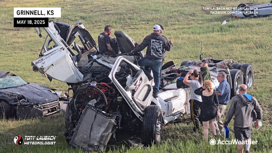
20250518Trucker.jpg

The rope out was beautiful from the images I saw, but given we were neck deep in assisting, neither of us ever got any shots. I remember seeing it in passing glances as I was moving around, at one point tripping and face-planting into the mud over what was left of a fence. It was a sobering scene, and one filled with huge angst as we got our first view down the embankment at the multitude of cars. I remember thinking, "oh my God, everyone's dead". It was such a massive relief to know all the vehicles were empty. The driver was injured, but alive, and I don't know what came about after we left. But I was happy we were there to at least get things rolling.

20250518Main.jpg


We called the chase from this point, heading east on I-70 toward Salina as cells to our south began to die off. Lots of discussion of the event, between the highs of the incredible tornadoes, to the experience there on the interstate. All-in-all, a chase neither of us will ever forget, both for the good and bad.
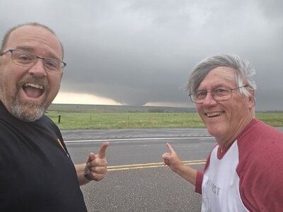
20250518_174323.jpg
It only took us 18 years to finally get a shot of us together in front of a tornado... May 18, 2025 Scott County, Kansas
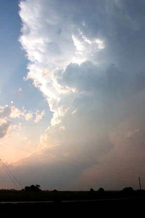
 
Unpacking some more things from this chase.

After the Arnett tornado appeared to rope out, I (and at least 100 other chasers) packed up and started heading north on US 283 back to 60. What I thought was the "remnant" base with RFD cut was still visually quite apparent, with a tree line obscuring the ground beneath it. Then as I cleared the tree line another condensation funnel rapidly snaked to the ground, retreating and recondensing a couple of times before finally contorting and roping out for good. Not sure if this was a completely new tornado or a reintensification of the original, which has been known to happen.
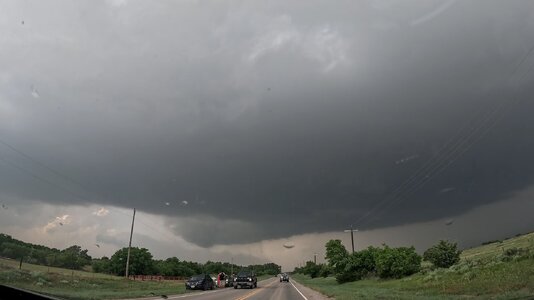
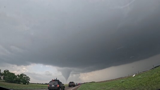
I managed to botch all my camcorder video of this portion (focus was off), but my front-facing dashboard GoPro caught the whole sequence, looking north along 283.

GX010450.MP4.18_41_29_24.Still001.jpgGX010450.MP4.18_43_24_08.Still002.jpgGX010450.MP4.18_44_51_16.Still003.jpg

I attempted to pursue the storm northeast, but the chaser conga line traffic was insane (at least as bad as the Mangum day in 2019) and I finally got fed up and broke off, especially in light of the storm's quickly obvious struggles (both visually and on radar) to become tornadic again.

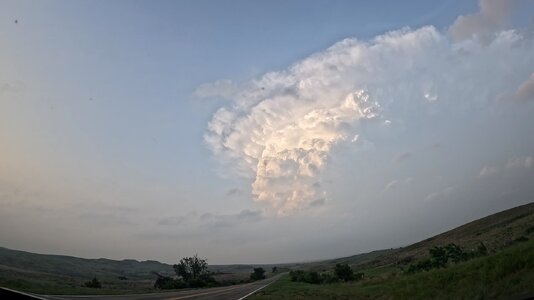
I doubled back to the north edge of Woodward for gas, then leisurely followed the storm northward on SR 34. The convective tower, front-lit by the now setting sun, became quite photogenic. I pulled over and just watched it for a while, the footage from the front-facing GoPro here will make for another neat timelapse. Too bad even squeegeeing off the windshield at every gas stop doesn't completely eliminate the bug splatter stains.

GX010464.MP4.20_47_19_13.Still001.jpg

About the only thing to come out of my ill-advised attempt to tangle with the Greensburg/Plevna monster after dark was some anvil crawlers captured by the GoPro, this was looking north on one of the dirt roads north of 54/400 between Pratt and Cullision:

GX010478.MP4.23_34_02_29.Still001.jpg
 
Wanted to regale the group of my experience. First storm chase in 2 or 3 years. Left CO front range at 6am.. after pouring over models the night before had tentatively decided to drive to Dodge then reassess. Did this without checking AM models. Dodge City at around noon and was optimistic about the cold/clouds erosion and decided to go east to Greensburg because I thought it would be a better place to sit. It was cold there, foggy, and it wasn't changing... honestly felt like it was getting worse, so decided to go south some a little closer to the clearing and sit there, so dropped down to Coldwater (more like cold, freezing, fog/mist and drizzle). Conditions weren't changing and while I was there I observed several storm chasers flying N from Coldwater and they got in my head as I was thinking.. "this cold isn't changing, this isn't working, they're probably bailing on this and heading N for the NW KS target" and at that point I was conflicted and wondered if that was the better play based on conditions... so went back N to Greensburg to sit so at least the northern target would be in play for me as I didn't know if this initial target was going to do anything. Got tired of the cold and decided to head SW into Oklahoma where there had been clearing... reluctantly because I didn't love the parameters going on down there as much as if S/C KS had cleared, but did that and to my peril, decided to go east first then south, because I didn't want to drive to Coldwater again after going back and forth. TX Panhandle storm blew up right after I left, reinforcing my decision to head in that direction and somewhere around the KS/OK border, south of Minneola I think, the storm looked awesome on satellite and I wanted to be there and pushed it too fast and got pulled over by a cop going 80mph in a 65... which took 30 minutes of my time. Then continued to the Arnett storm and arrived just as the tornado roped out. Literally I got the visual of the tornado roping out and it was gone. Then the storm fell apart. So missed that whole storm. Followed it briefly NE and took dirt roads to avoid the crowds and measured 4.5" diameter hail NE of Arnett so that was cool. But apart from that, didn't even take a picture with my dslr. Headed back to Colorado next AM as I decided the smoke was too bad anyway to consider staying out another day. So like $260 in gas, and a $260 speeding ticket which literally cost me the one moment of the one storm being good, zero pictures, and hypothermia in south central Kansas. Sounds like a bust to me!
 
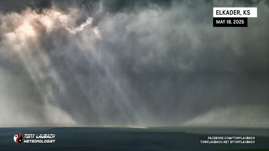
20250518Elkader.jpg

NWS Goodland has confirmed that the Scott County wedge was NOT the same tornado that hit Grinnell. The image above was one of the final images of the Scott County wedge we have before it vanished from view, likely making its left turn before it died out south of Little Jerusalem Badlands State Park. I had forgotten about this sequence as I snapped a couple photos after we stopped at the overlook, then was immediately digging in to our next move (which was to jump south on the next cell where we saw a couple more tornadoes).

This tornado was rated by Dodge City as an EF-2; likely wider than the 300 yards that's shown in the assessment given we were a couple miles east of this. So our unconfirmed tally from Sunday now sits at 6; we've yet to go through all the media to finalize that count.
 
Back
Top