• After witnessing the continued decrease of involvement in the SpotterNetwork staff in serving SN members with troubleshooting issues recently, I have unilaterally decided to terminate the relationship between SpotterNetwork's support and Stormtrack. I have witnessed multiple users unable to receive support weeks after initiating help threads on the forum. I find this lack of response from SpotterNetwork officials disappointing and a failure to hold up their end of the agreement that was made years ago, before I took over management of this site. In my opinion, having Stormtrack users sit and wait for so long to receive help on SpotterNetwork issues on the Stormtrack forums reflects poorly not only on SpotterNetwork, but on Stormtrack and (by association) me as well. Since the issue has not been satisfactorily addressed, I no longer wish for the Stormtrack forum to be associated with SpotterNetwork.

    I apologize to those who continue to have issues with the service and continue to see their issues left unaddressed. Please understand that the connection between ST and SN was put in place long before I had any say over it. But now that I am the "captain of this ship," it is within my right (nay, duty) to make adjustments as I see necessary. Ending this relationship is such an adjustment.

    For those who continue to need help, I recommend navigating a web browswer to SpotterNetwork's About page, and seeking the individuals listed on that page for all further inquiries about SpotterNetwork.

    From this moment forward, the SpotterNetwork sub-forum has been hidden/deleted and there will be no assurance that any SpotterNetwork issues brought up in any of Stormtrack's other sub-forums will be addressed. Do not rely on Stormtrack for help with SpotterNetwork issues.

    Sincerely, Jeff D.

2025-04-01 EVENT TX/OK/KS/NE/MO/IA

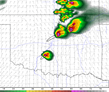
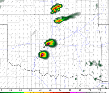
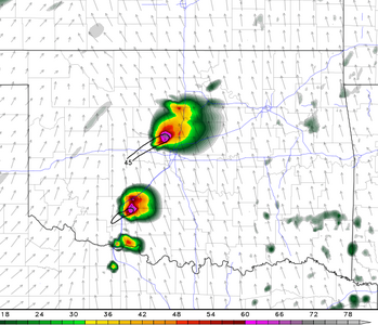
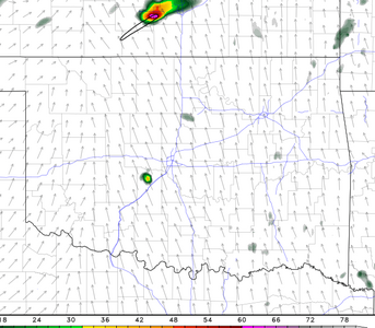
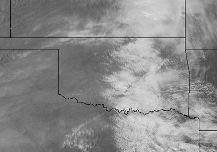
My chase partner can't leave the DFW area until 4:20, so we are planning to leave then and head to OK and hope it convects and that we are not too late. I've been glancing at several models a few times today, and I waffle on if it is worth going. One runs looks good, another not so great. The latest HRRR run (17z) doesn't convect in an area I can get to in time, but the the 5 runs before it did. One could take this as a bad sign. My experience is the HRRR often over convects, but when it doesn't convect the chance for blue sky bust is high. However, when I look at a model sounding on the latest run that doesn't convect, the parameter space looks good other than the CIN. We will see what the next runs bring, but this could be a case where the HRRR actually is somewhat self aware of it's bias (which beats it being clueless to it bias). It may not convect today, but if it does it could be a good chase day, so I am going. Here is a model trend for 0z:
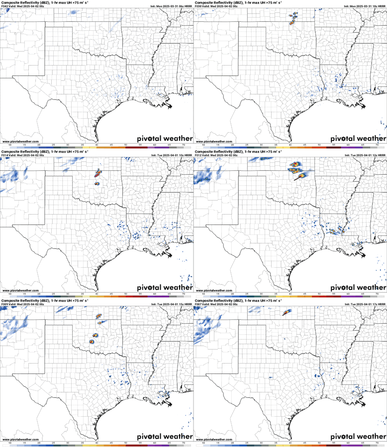
trend-hrrr-2025040117-f007.refcmp_uh001h.us_sc.gif
 
HRRR Progression (from top to bottom) (Runs from12-17Z) all Valid @ 00Z ..

1743532679926.png

1743532708128.png


1743532741761.png


1743532767928.png


1743532797929.png


1743532827692.png


relative consistency in timing.. there was shift to the right a bit timing wise, and location of CI further south as the runs progressed

1743533150281.png

1743534637152.png


1743533419324.png
 
Warn on Forecast is running today. If you haven't looked at it, it is worth a look for today: WoFS

A couple of viable targets on it. Given I haven't left DFW yet, I will have to target the Texas side of the Red River and it actually has a glimmer of hope in the WoF.
 
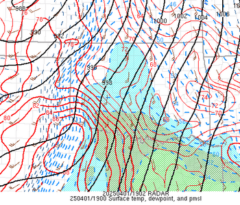
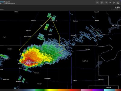
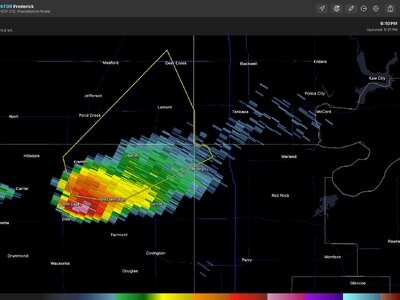
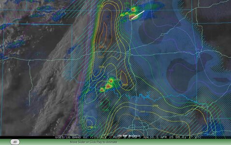
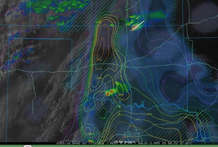
The HRRR has done a decent job with the northern Oklahoma storm, placing it well east of the dryline and very close to the eastern edge of the deep moisture plume. The way models portrayed/placed that storm seemed like it was going to be at risk of outrunning the warm sector. It's now heading into upper 50s DPs.

I decided I didn't like the look of this and did not chase (bad terrain, fast storm motion, logistics of getting home for tomorrow). I I did, I'd likely be on that Tonkawa storm with everyone else, but would be seriously considering bailing south now for the activity down on the Red River.

Edit 8:50pm: I'd be heading home now.
 
Last edited:
The HRRR has done a decent job with the northern Oklahoma storm, placing it well east of the dryline and very close to the eastern edge of the deep moisture plume. The way models portrayed/placed that storm seemed like it was going to be at risk of outrunning the warm sector. It's now heading into upper 50s DPs.

I decided I didn't like the look of this and did not chase (bad terrain, fast storm motion, logistics of getting home for tomorrow). I I did, I'd likely be on that Tonkawa storm with everyone else, but would be seriously considering bailing south now for the activity down on the Red River.

Edit 8:50pm: I'd be heading home now.
I’ll be interested in seeing reports on the “Tonkawa Storm”. Not sure mine would be worth reading but I’ll sleep on it.
 
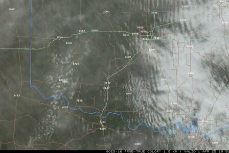
it will be interesting to hear the after thoughts, while storms broke the cap in places, as the higher res models predicted. the evolution of the storms to generate spin ups, has me wondering, was it over shear? lack of moisture to drop LCL's low enough? (though I've seen tornado-genesis with higher LCL's) was it too much canopy, did they migrate into an area that was more CIN with the already strong cap that effected cycling?

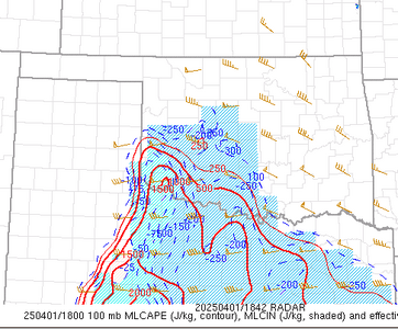
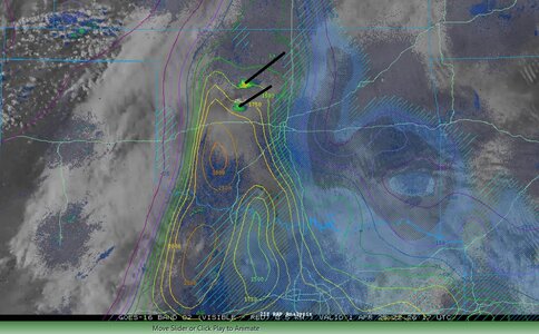
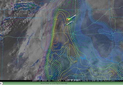
it's hard to call it a bust.. storms did fire, they were limited in coverage, as predicted, but the environment (STP) wise was pretty maxed out, and nothing happened. so it's a bust in that sense? I attached some visuals from the CAPE/CIN from RAP trends, it just made it seem like the storms were riding too close to the line of good vs bad dynamics.

(the frame times from top to bottom are 2226Z to 0031Z. I made sure to pick the times where the RAP posted new updates.)

2226Z.jpg
2301Z.jpg

0001Z.jpg


0030Z.jpg
 
Thanks for these nice graphics! I need to go over my notes and consider what it was I was seeing from the ground, which was not much, by the way. (I was on the "Tonkawa Storm", as @Dan Robinson called it.)
 
Last edited:
it will be interesting to hear the after thoughts, while storms broke the cap in places, as the higher res models predicted. the evolution of the storms to generate spin ups, has me wondering, was it over shear? lack of moisture to drop LCL's low enough? (though I've seen tornado-genesis with higher LCL's) was it too much canopy, did they migrate into an area that was more CIN with the already strong cap that effected cycling?

If I had to give an answer now, it would be not enough moisture. The primary cell had a decidedly LP character as viewed on radar, but that is based on what I was seeing during the chase. High cloud base, LP-character...but I need to review stuff to make sure that assessment makes sense, though. (Kinda looking for more experienced chasers to chime in.)
 
Yeah, a lot of the thinking I heard yesterday was "If only storms are able to fire, they'll go nuts producing tornadoes with those hodographs."

...but that's not what happened. Storms fired, then struggled to produce.
 
Back
Top