2024 Tropical Season Discussion

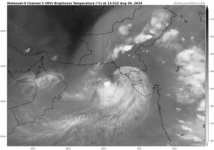
One of the things I watch very carefully as we move into September is how the upper level shear is setting up / trending over North America. These trends will have a big impact on the rest of the hurricane season.
 
Hi Boris - for my own understanding, how does this…

… reconcile with your earlier post about lower RH around Ernesto? Is it just a localized difference?
That's just how the moisture was in the western part of the Atlantic, not very favorable for a strong TC> Not a local difference, more synoptic-scale for that period of time.
 
I would argue it is no longer “too early” now to start asking serious questions. August 20 marks the start of the most active period for TCs in the Atlantic, nothing currently, and nothing for at least the next 5 days. That brings us into Sep, and Sep 1-10 is the absolute climo max for TC activity on the Atlantic.

And August is no stranger to many TCs and intense ones. Take Allen in the first part of August 1980 – a long-tracked Cabo Verde hurricane that was the second lowest pressure in the Atlantic up to the time (899 mb) and the strongest for wind (some debate on that, but still one of the strongest). It cycled up and down between Cat 3 and Cat 5, reaching Cat 5 on three separate occasions -- find me another Atlantic hurricane that did that. So, shouldn’t we be seeing multiple TCs like this in 2024 by this given how super favorable is? Yes, we had Beryl as an example, but that was nearly two months ago -- one intense hurricane does not a hyperactive season make, esp. with this “gap” we are seeing! This is not the hallmark of a true epic or historical hurricane season IMHO, and begs the question, do we really have things all figured out as we claim we do (not just for foreacsting TC seasons, but all weather and climate)?

I put it this way, earlier in 2024, did anyone think that at this point in late August, this is all what we would have to show for (5 named storms), given the across-the-board hyperactive forecasts? In the end, this may not matter from a public POV (one intense hurricane landfalls all it takes), but from a scientific POV, it does IMHO b/c you would expect a season *so* favorable (most aggressive forecasts on record) would *not* be like this. Look at 2005, started early and never really stopped. What has been going on in the Atlantic so far is not typical of a hyperactive season.

This doesn’t mean 2024 will not end up very active for the Atlantic, but given 5 named storms through the end of August, getting the 25+ named storms that three forecasts are going for? -- something truly extraordinary would have to happen. And 20+ for all others?, the longer we go, the less likely this becomes. The Atlantic basin only has so much room for multiple TCs at once -- this is not the NW Pacific.
 
From another group:

"The Southern Hemisphere - we are currently experiencing a Sudden Stratospheric Warming event which aren't common at the South Pole, the southern polar vortex is displaced and the jet stream has been wildly exhibiting oscillations over a good 50 degrees in latitude the past few weeks pulling a huge amount of heat to the south both on land and over the South Pacific. The highs have been very high pressure and the lows very low. We've just had our hottest winter day ever in Australia and we had record high pressure over land a couple of weeks ago. So all this is related right - when the polar vortex is off center, the Rossby waves are unstable and these patterns do push up north. That blocking high which is part of this pattern in the south Atlantic at the moment is strong and elongated, impacting the ITCZ and location of the monsoon trough to its north. We're here on a sphere, the fluid gets the wobbles sometimes and things don't play out as per climatology."


As you can see, there are other things going on across the globe that may explain why the Atlantic hurricane season is struggling so far.

Concerning the sudden stratospheric warming at the South Pole which is not common, some may blame anthropogenic climate change, but the elephant in the room, which I see summarily dismissed in some circles b/c it "interferes" with current prevailing "all warming now is due to humankind,” is the Hunga-Tonga very large volcanic eruption in January 2022. This event ejected an enormous amount of water vapor into the stratosphere, which is something we have never witnessed/recorded. This is truly uncharted territory, and we do not know yet the full extent of what this will do to global climate in the short/medium-term. Some preliminary studies have shown it has resulted in the global warming spike in the last year, and unlike SO2, this excess water vapor is not likely to be all out of the stratosphere until the end of decade.

Common scientific sense and what we know about water vapor says the impact here is non-trivial, and to say otherwise is being closed-minded. What goes on in the stratosphere, esp. for temp, does impact the troposphere and its sensible wx. Water vapor has a very high heat capacity, is by far the most common “greenhouse gas,” the most important factor as to modulating global temp since it varies so much in the atmosphere (0 to 4% -- 4% is about 100x the current CO2 concentration), and is changing phase on a very large scale constantly.

The Hunga-Tonga volcanic eruption provides us with an excellent opportunity for a global natural "experiment" – we will see how the normally very dry stratosphere reacts to having a significant amount of water vapor, and the downstream impacts to short/medium-term global climate, furthering our understanding of the entire Earth’s system. How it impacts TC activity/forecasts is just one many things to consider, observe, and at times, *adjust* our scientific knowledge because science is always evolving, it is never settled.
 
I am really getting concerned now about the Atlantic's lack of activity. Something is
definitely off still. Yes, I see the global models showing a more favorable overall pattern
next 10 days, but I am not impressed, given what we expected and global conditions of
things showing great in the large-scale.

Just looking at the operational GFS/ECMWF/GDPS the last 3 days, they are not
consistent. One run has a hurricane a 5-8 days out, then the next run loses
it, then it comes back, and loses it again next run. It's been like this for all 3
models.

I know ensembles are better, however, we are taking within 10 days, and from
my empirical observations following the operational runs and TC development, if
the pattern is truly favorable, they will show good consistency on developing a
particular disturbance(s) within 10 days, or at least one model will. The GFS does
this most often, and still seems to have a problem being too aggressive day 7 and
beyond, but even this model is lacking given its bias in the longer ranges. If the
GFS is this "tame," given its TC bias, what does that say about the synoptic
environment as a whole in the Atlantic? These global models must be detecting
something that is putting the brakes on things?!

Even if the wave currently in the central Atlantic develops into a strong hurricane
eventually, it seems like it may be the only one for good ACE in the next 10 days,
and we are at the most climo favorable time of the year. One strong hurricane is
not going to cut it Aug 20 to Sep 7. If the most active period climo is taken out?

I know any season can be back-loaded (2020 was like this) and we still may verify
165% ACE (that defines a hyperactive season I think), but that doesn't mean there is
not a problem, at least in the forecast science realm. The typical indicators we rely
on in the large-scale failing this bad when on the surface, they look great?

I was afraid of this pre-season b/c I have come to expect the unexpected, events/seasons
we simply have not witnessed in the modern era. It's like last season, strong El Nino
means suppressed ACE in the Atlantic, and it had ACE unheard of for strong El Nino! So the
Atlantic SSTs "won" over El Nino. Now, who is to say it can't work in reverse, or some
atypical form? Slight La Nina now, and even warmer Atlantic mean SSTs?

What I was thinking is that Atlantic mean SSTs so high, that could result in feedback not
expected, after all, this is "uncharted" territory, so in that case, odds of the unexpected
would be higher. Now of course, this is speculation, not the same as the reliable indicators
and observations from past seasons we use for forecasts, so I would never run with
mere speculation for an official forecast. Just something I would keep in the inner circles
of the field!

And the more I read about the Hunga-Tonga water vapor in the stratosphere and it impacts?,
well, that is thought to have caused the spike in global temps the last 2 years (as much
warming as we would expect in 10), so in some ways, I think this may be messing with things.
How much as to TC activity around the globe is still unclear, but food for thought.

It has been two months since Beryl. With a hurricane like that so early breaking
many records, why *wouldn't* one think, "if it is *this* favorable now, just wait
until the climo peak of the season!" But we can't think linearly all the time
when it comes to the atmosphere, esp. for the longer-term (seasonal and longer).
 
Also, of interest, TC Asna is in the Arabian Sea currently. Not that strong (40 kt), but it is very rare to have a TC in the
Arabian Sea in August. In, fact is has only happened two other times (1983 and 2022) since geostationary satellite
records began for the Indian Ocean (~1980). So this atypical event, is this a by-product of the this current pattern in
the Northern Hemisphere, and any way related to as why the Atlantic is so suppressed? These are the kind of
questions that need to be asked and investigated a lot more IMHO, since global patterns/cycles, large and small,
and the sensible wx they produce, are all connected in some form in the end. Usually when something rare
happens on the synoptic-scale or larger, there is solid reason. Not always obvious or even to determine after much
research, but there nevertheless. And I frown on the intellectually lazy excuse, "it's all due to climate change." We
owe it to ourselves and the sciences to be inquisitive and keep questioning to push things forward, not rest on our
laurels.
 

Attachments

  • asna.jpg
    asna.jpg
    153.1 KB · Views: 1
I was thinking similarly that we sure shouldn’t think linearly and expect to get a good forecast. In fact, I was surprised to see just how fast some organizations upped their numbers after Beryl. I foresee a couple of tears in a few beers for some people! 😢 But, I would like to get at least a few wide shots of some hurricane rain bands; it’s been a while.
 
Regardless of the nation, I believe the public would be just fine with zero hurricanes the rest of the season. That's, of course, not a prediction.

That said, there's nothing I'd like more than the ridiculous forecasts based on a single variable (water temperature) due to "climate change" bust bad. The extremely simplistic approach to climate forecasting (temperature changes only) will only stop when some of the practitioners are shamed into it.
 
Yup. And empirical evidence shows that rolling the warmer Arctic winters, urban heat-islands’ warmer nights…and more… into a phantasmagorical & excessive tropical prediction remains foolhardy.
One must always look for the connective physical-process.
Judith Curry, in her latest book, explains the extraordinary challenge, impossibility of forecasting regional weather based upon watered-down and hyped-up global averages.
 
Notice the hurricane the ECMWF has developed on approximately every other run for the last two days is gone again.

This is why we should not be in the business of attempting to forecast tropical system ms more than seven days in advance.
 
Notice the hurricane the ECMWF has developed on approximately every other run for the last two days is gone again.

This is why we should not be in the business of attempting to forecast tropical system ms more than seven days in advance.
I've notice this with the GFS and GDPS as well, On again, off again each run with showing a hurricane, and it is always 7 or more days out (keeps getting pushed back). I don't have to look at ensembles to tell you this is not a favorable pattern for hurricane development.
Something is obviously going on here that we did not expect!
 
Regardless of the nation, I believe the public would be just fine with zero hurricanes the rest of the season. That's, of course, not a prediction.

That said, there's nothing I'd like more than the ridiculous forecasts based on a single variable (water temperature) due to "climate change" bust bad. The extremely simplistic approach to climate forecasting (temperature changes only) will only stop when some of the practitioners are shamed into it.
*Far* too much emphasis on ocean temps IMHO. That is just one part of a huge and complex system across the globe. But it is unfortunately chic to dumb it down and make simplistic and vapid correlation = causation (a logical fallacy) quips and statements that politicians and global elites can lecture us on. And I think a significant part of the scientific community has fallen prey to the social/economic pressures of this -- comply/adhere or you will be made a pariah and lose your support/funding. This is not how science and science-based issues are supposed to work/be handled.
 
Back
Top