Jesse Risley
Staff member
We might as well get a discussion thread going for Tuesday since it's been quiet here.
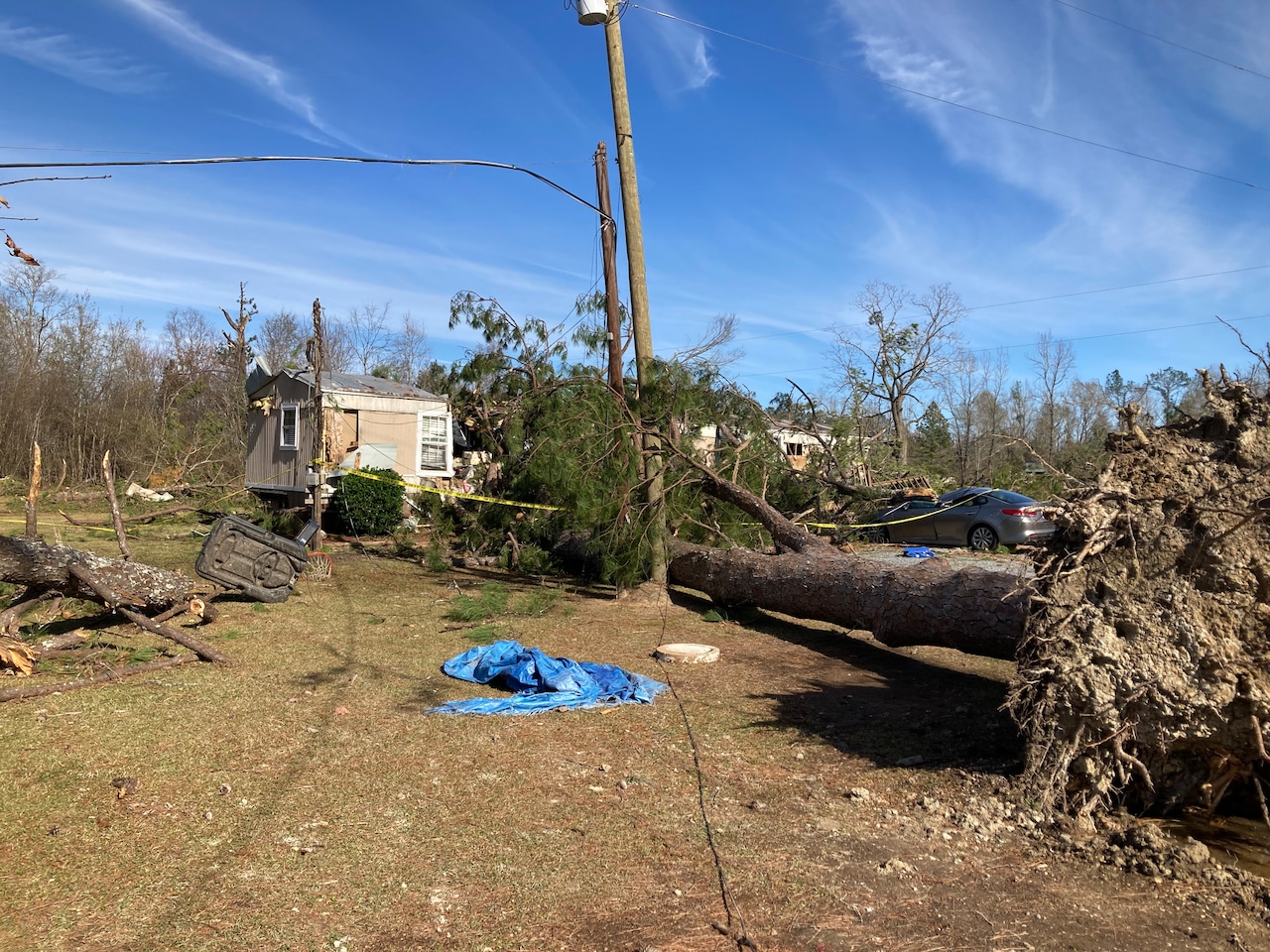
Classic upper-level energy currently diving into the NW CONUS will pivot a trough that begins its negatively tilted phase across the southern plains with a split-stream flow. As the upper-level energy begins to approach the western Gulf Coastal plains into the mid-Mississippi Valley a strong area of low pressure looks to develop over eastern KS and gyrate into the mid-Mississippi Valley reaching the I-35 corridor by midday Tuesday. A particularly potent SSW H85 LLJ will coincide with ambient upper-level split stream flow as strong surface flow transports ambient Gulf moisture into the warm sector ahead of the main surface forcing. Models do show an EML sticking around throughout the day until convection looks to erupt across the warm sector closer to the 22-23z timeframe. Ambient mid-level lapse rates of 6-7 C/km, MLCAPE > 1000 J/KG, and forecast vertical and directional shear profiles suggest that the potential for all modes of severe weather are possible, with some higher end tornadic potential not out of the question given deep layer shear profiles, 0-3 SRH AOA 400 m2/s2 and MLCAPE values in excess of 1500 J/KG in some locales. CAMs indicate that eventually the threat congeals into a more linear-based mode late into the period and overnight where the threat of damaging winds and QLCS-type tornadoes becomes the more predominant hazards.
Classic upper-level energy currently diving into the NW CONUS will pivot a trough that begins its negatively tilted phase across the southern plains with a split-stream flow. As the upper-level energy begins to approach the western Gulf Coastal plains into the mid-Mississippi Valley a strong area of low pressure looks to develop over eastern KS and gyrate into the mid-Mississippi Valley reaching the I-35 corridor by midday Tuesday. A particularly potent SSW H85 LLJ will coincide with ambient upper-level split stream flow as strong surface flow transports ambient Gulf moisture into the warm sector ahead of the main surface forcing. Models do show an EML sticking around throughout the day until convection looks to erupt across the warm sector closer to the 22-23z timeframe. Ambient mid-level lapse rates of 6-7 C/km, MLCAPE > 1000 J/KG, and forecast vertical and directional shear profiles suggest that the potential for all modes of severe weather are possible, with some higher end tornadic potential not out of the question given deep layer shear profiles, 0-3 SRH AOA 400 m2/s2 and MLCAPE values in excess of 1500 J/KG in some locales. CAMs indicate that eventually the threat congeals into a more linear-based mode late into the period and overnight where the threat of damaging winds and QLCS-type tornadoes becomes the more predominant hazards.