Jeff House
Supporter
My target area has shifted out of Mississippi, though I do not plan a real chase. Virtual target is north of my thoughts yesterday. Dyersburg, Tenn. esp the flatter area west of is my target. Lunch in Dyersburg would have been nice!
Mississippi dewpoints are under-achieving, not a shock given MCS. Also 800mb is warm on most soundings and fcst soundings (between standard constant press level charts). That means Miss has to work even harder to recover surface T/Td. Yes it'll hit 80 deg. However it might not be enough.
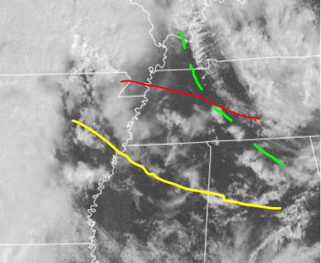
Meanwhile outflow boundary OFB lifts north into northwest Tenn. 800mb will cool sooner there. Temps and Dews will almost match those Mississippi, perhaps up to Paducah. In fact dews could recover better West Kentucky and West Tenn, circumnavigating the mixed air over Miss.
Dotted green is edge of the more pronounced lower T/Td. Yellow line is the chaser's OFB. It is forecast to lift into the red position by late afternoon. Prefrontal trough is not drawn, but I expect the red OFB to intersect it in northwest Tenn. Maybe West Kentucky. Hence chase target near Dyersburg.
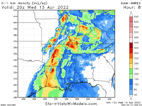
1KM SHR below satellite, numerical models NWP shows my conceptual model. However NWP could misplace the OFB. NWP has robust cells on its intersection with the pre-frontal trough. Chaser would follow the boundary, not the NWP. Just good to see the conceptual model confirmed.


