• While Stormtrack has discontinued its hosting of SpotterNetwork support on the forums, keep in mind that support for SpotterNetwork issues is available by emailing [email protected].

2017-05-18 EVENT: KS/OK/TX

Joined
May 6, 2005
Messages
292
Location
Moore, OK
Overview

SPC already has a day 2 Moderate. Negatively tilted trough moves through target area starting around 21. Rich surface moisture and strong LLJ should yield long track supercells and strong tornadoes.

Surface

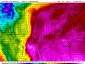
Lots of abundant gulf moisture for this system. Tds should be in the upper 60s and may see a few 70s. Theta-E values look impressive with >350 K common throughout the warm sector. Tomorrow should really be up there on the Tornado Feel Index (you know that nasty warm muggyness, btw... TFI is not a real index :) ).

cbcd8ead8a533a58fde6bfb65b1a538f.png

Upper

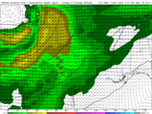
A 500 mb jet streak (60+ kts) rotates around the trough and overspreads the area during peak heating.
7a58f0262ada723187788f7ad50d9c8d.png

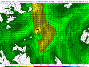
At 850 mb the LLJ greater than 40 kts from the SSE at 21z strengthens to 45-50 by 00z and backs even further to almost SE. At 03z there are pockets of 70+ knots!!!!
1b63040734d4b3b684d65e1fc0b5e973.png

Conclusion

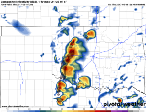
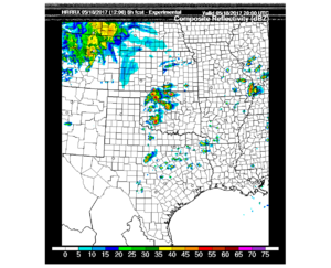
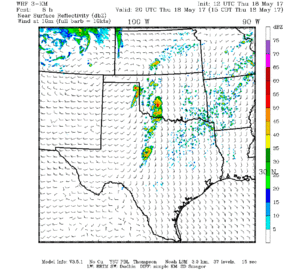
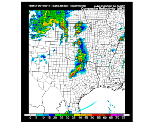
We should see a line of supercells develop around 4pm on the DL and move east. 12z 3km NAM has this line much further west than the 12z HRRRx. I'd like to note that i think the HRRRx performed well on Tuesdays storms so I am leaning toward their solution attm.

Special Treat

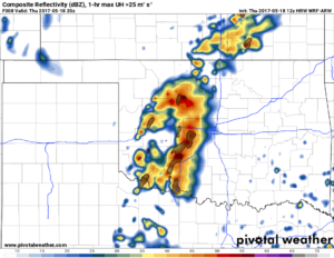
HRRRx at 00z
f2f458514f8b4b41a5613b9b44221af2.png
 
I think tomorrow is the first chase day of the spring where we don't have to really worry about moisture. There are upper 60s to 70 degree dew points well into Texas and we have more than 24 hours till event time. Those low level jet winds will pour moisture along the dryline and the surface low that forms will only help as well as back winds along the front. My general idea is to head toward the OK/KS border and probably just hang out there and monitor how things evolve. I don't really like the idea of chasing storms on the warm front as they're likely to be HP. After missing the Kansas tornado machine on May 29, 2008 because I stuck with warm front storms, I'm always hesitant to stick with the front. Besides, there should be a row of supercells develop off the dryline and move east.
 
Lifting warm front in Kansas should have excellent shear, and some CAMs show string of pearls on that WF. Solution is conditional on the sups riding the front; however, risk is they cross into the cold sector.

Northwest Oklahoma may be on the north side of a dry line bulge. Surface low won't be too far away and low level winds will be backed nicely. One might call this the most classic DL target, but risk is convection to the southeast. On the plus side, I bet the cells do not go to slop as fast as some of the CAMs show.

I would not be surprised if a tornado or two is as far south as the Red River, or even in Texas. Probability of tornadoes is lower down there. However maybe a better chance of a right mover given upper level winds. South target is a gamble on a big payoff or a mess. It rained in South Texas Wednesday. If any kind of boundary can remain until Thursday, it would lift north toward the Red River.

Three targets are not necessarily ranked. I went north to south. Gut likes Kansas but HP risk is there on WF. West OK is arguably the classic pick. Again, Texas could surprise. Maybe chasers will be a bit spread out. Be safe and good luck!
 
For what it's worth, this day surprisingly troubles me a bit. The timing of the mid-level vort lobe currently seen digging on water vapor in northern Arizona seems, from my pedestrian perspective, to be poorly timed... rounding up into Kansas by lunchtime... suggesting some subsidence for most of the afternoon. With a low-level wind field that (partly in response) won't be extremely backed, I'm a little surprised it's quite a tornado high risk. Certainly storms will go up with the thermodynamics in place, but would think they'd be a bit stunted, especially once they get removed from the dryline. With that vort lobe passing north, and the upper level jet digging, reminds me more of the days where you get a more inconsistent hodograph too (not saying veer-back-veer, and my dynamical understanding of such is weak, but just not the continual/increasing shear all the way through the column that seems best).

If the vort lobe is a little slow in rounding the base and heading north, maybe it'll further open possibilities along the warm front in central\northern Kansas and on along into SE Nebraska\Iowa... though storm motion so far doesn't look to keep storms rooted on the boundary as much would be appreciated. But I think I'd still rather be east of that washing out vort lobe, than south in its wake.

Personally, even if the vort max isn't quite as quick as forecast (seems it may be that way looking at water vapor), I'd think NW Texas or western Oklahoma could potentially be better areas. Subsidence due to mid-level vorticity would seem to diminish there first, and then it'd be a race to see if it could be enough of a non player by near initiation time so as to sync with the otherwise quite healthy environment. (Any little additional shortwave that managed to develop in behind that main lobe would just be an added tweak). I might even be thinking it might work out to wait on the first storm area or two to pop along the dryline, even in my (large latitudinal) target area in TX\OK fairly near US 283... as slightly later development could prime it to be just enough better at initiation. But that'd require carefully watching the environment evolution during the afternoon. If I had free reign to be wherever I wanted, I might not even be too averse to playing any dryline bulge, even down more into west Texas. Though certainly you're giving up a lot in the wind field being down that far, the slightly more easterly storm motion hinted at by convective models... and the potential for a little less chaser-congestion... wouldn't make me too unhappy to be the relative loner!

And that of course leaves me the least interested in... southwestern Kansas!?! Shows what I know! All generally based just on the midlevel flow??? Sometimes I obsess a little too much over one feature. Just seems it should be a big differentiator tomorrow.

But I always thought outside the box when it came to chasing... haven't been out in a few years... and certainly have been wrong plenty enough through the years. And indeed far too obsessed with vorticity features on water vapor!

So certainly don't take my word for much, and for those hoping for a good day, do hope it goes well! :)

To God be all glory alone,
Shane Young
 
Last edited:
For what it's worth, that previous post should of course discuss central\northern Kansas into northern Missouri (not Iowa or Nebraska), upon looking at the front position. Pays to not overlook taking a quick peak at the surface map before discussing an area! (and doesn't appear I can edit the post after a certain point)?

Seems the HRRR so far is showing an interesting (yet maybe troubling??) evolution, as storms initiate down near Abilene around noon, then seem to quickly throw up a cluster of storms moving almost due-north into Oklahoma and nearing Kansas by 6 PM CDT? Strange evolution, can't say I've seen that one before. Guess a 40 kt low-level jet with less upper-level support than in some other events could do that? But hodograph seems to have clockwise curvature to it, so wouldn't seem to favor left-movers particularly well? Will be interesting to see if that comes to any fruition whatsoever. If it did, the tail-end charlie looks rather interesting down in Texas, but it might make Oklahoma a tough chase. Hard to envision the evolution looking quite like the morning HRRR is painting?

Regardless, 70 dew points in Dallas, and relatively clear skies over target area... going to be a rather unique day!
 
Last edited:
Frankly I'm surprised to see the confidence in SPC's wording and the magnitude of the threat given a lot of the trends I'm seeing. Some of this doubt comes from the wording of the most recent SWODY1 itself:
SPC SWODY1 said:
A note of caution on this forecast: Some uncertainties still exist,
however, precluding any greater probabilities at this time -- mainly
involving density and timing of convection. Initiation of too many
cells in early/middle afternoon (before warm-sector hodographs and
CAPE each are biggest), and/or too close to each other at once, is
possible in some parts of the current moderate/high risks.

Why does this level of uncertainty still justify a high risk? Anyway, that's partially beside the point.

The CAM ensembles participating in the Hazardous Weather Testbed 2017 Spring Forecasting Experiment are all indicating serious chaser bust potential in the form of early initiation and very quick transition to a linear storm mode. The calibrated NSSL ensemble guidance suggests tornadoes will be at a premium and that C KS will be the hot spot. The HRRRE initiates not only early (19-20Z) but also way east...almost on top of I-35. Granted there is quite a bit of uncertainty within these ensembles, but a lot of ensemble members suggest this type of behavior problematic for chasers.
 
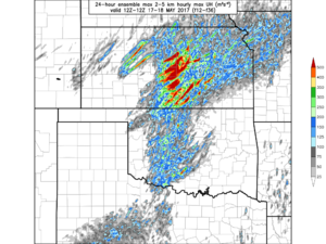
I will go ahead and post some eye candy. My research group at OU is running an experimental storm-scale ensemble for the HWT experiment. It is NMMB-based and tends to run a little hot with UH in particular, but this plot is pretty incredible even so:

MAP_MAY18_ens_max_UH.png

FWIW, the NCAR ensemble shows basically the exact same thing regarding the concentration of highest UH values being in KS rather than OK as well as the magnitudes themselves. The NSSL ensemble places the maximum in a similar location, but with much less magnitude and with overall fewer UH tracks/concentration. The HRRRE seems like an outlier and places the highest UH in storms in W KS along the combined dryline/warm front near the surface low. It also develops storms further east in OK.
 
I will go ahead and post some eye candy. My research group at OU is running an experimental storm-scale ensemble for the HWT experiment. It is NMMB-based and tends to run a little hot with UH in particular, but this plot is pretty incredible even so:

View attachment 15761

FWIW, the NCAR ensemble shows basically the exact same thing regarding the concentration of highest UH values being in KS rather than OK as well as the magnitudes themselves. The NSSL ensemble places the maximum in a similar location, but with much less magnitude and with overall fewer UH tracks/concentration. The HRRRE seems like an outlier and places the highest UH in storms in W KS along the combined dryline/warm front near the surface low. It also develops storms further east in OK.
So many models... which one will be right? Which models performed well on Tuesday? Even though the HRRRx is an outlier along with TTU Wrf, they have been fairly consistent. So, again time will tell.
 
I will go ahead and post some eye candy. My research group at OU is running an experimental storm-scale ensemble for the HWT experiment. It is NMMB-based and tends to run a little hot with UH in particular, but this plot is pretty incredible even so:

View attachment 15761

FWIW, the NCAR ensemble shows basically the exact same thing regarding the concentration of highest UH values being in KS rather than OK as well as the magnitudes themselves. The NSSL ensemble places the maximum in a similar location, but with much less magnitude and with overall fewer UH tracks/concentration. The HRRRE seems like an outlier and places the highest UH in storms in W KS along the combined dryline/warm front near the surface low. It also develops storms further east in OK.
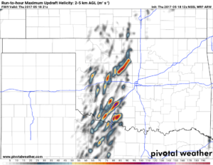
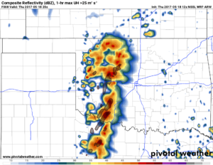
NSSL WRF is coming in. It looks like it is trending with the HRRRx and putting lots of storms in SW Okla.

d024cb45916f1e7424a3306e47b5cbc0.png
 
So many models... which one will be right? Which models performed well on Tuesday? Even though the HRRRx is an outlier along with TTU Wrf, they have been fairly consistent. So, again time will tell.

I'm actually equipped to answer that question, as I have also been doing a subjective evaluation of the experimental CAM ensembles each day of the experiment so far. I cannot comment on individual deterministic models like the HRRRX or TTU WRF, however. I do not follow the TTU WRF.

The ensemble that my group runs actually did extremely well progging the two or three dominant supercells on Tuesday. Granted it had some major false alarms up north, too, but in W OK/E TX PH, it did better than the NCAR, NSSL, HRRRE, and even SSEO ensembles. However, in a more general sense this season, the SSEO and HREF (the upgraded version of the SSEO set to become operational later this year) tend to do the best. SSEO graphics can be found here: http://www.spc.noaa.gov/exper/sseo/
 
Not sure any convective model did all that absolutely great (though that last HRRX plot seems was reasonable). But the midlevel vort feature was a bit slower and broader which seemed to help, and then storms grew more in Kansas after it departed more. Once the HRRR started showing a bit less vigorous widespread development, it seemed to look more potent, and it seems to have overall come through on that?
 
Back
Top