2017-05-10 EVENT: TX, OK, KS, MO, IA, IL

Jeff Duda

site owner, PhD
Staff member
Site owner
Supporter
Joined
Oct 7, 2008
Messages
3,787
Location
Denver, CO
I'm sure many of you have been paying attention to the one feint gleam of hope for active weather in Tornado Alley in the foreseeable future. Wednesday appears to have potential for severe weather across the southern Plains.

The GFS has been pretty consistently showing a cut off low oozing eastward across the southwest US and eventually getting re-ingested into the main flow (northwesterly of course, because 2017). It contains sufficient mid-level flow and advects enough for typical synoptic scale cyclogenesis to occur and for adequate shear for supercells. There are potential phasing issues, but it appears Wednesday, rather than Thursday, will be the day for the traditional region of W TX/W OK/KS to see the greatest threat. Moisture is more than adequate for severe weather; lapse rates are pretty good (not much of an EML, so no huge issues with capping); and low-level shear looks okay (not great).

The biggest fly in the ointment for this system (did I mention VB showing up in soundings?) is persistent convection covering the warm sector throughout the day. This convection is probably the result of the weak capping, as it looks like CIN will erode by 18Z, and there isn't very strong low-level WAA to suggest any other reason for widespread convection so early. I've been watching successive GFS runs hoping it changes its tune as to the degree of coverage of precip during the day, but it has remained annoyingly consistent with it. However, in spite of the forecast widespread coverage, I was actually able to find a PDS TOR forecast sounding from the GFS, so maybe there's hope.

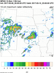
The event is actually in range of the MPAS, and the MPAS offers a more hopeful solution, progging multiple rounds of somewhat less widespread convection across mainly TX and OK throughout the day. However, it goes a little crazy with a cellular storm outbreak across the N TX PH, OK PH, and ext. SW KS, including some rotating storms. So maybe...

MPAS eye candy. Get a good look now because it will probably not look this good later on (pessimism speaking):
hwt2017.refl10cm_max.central.hr119.png
 
I've also had my eye on Wed 5/10 for the past couple days. I've been slightly surprised at the lack of chatter in the chase community, given there's nothing else concrete to look at right now. While the large scale pattern with a trough in the eastern U.S. is far from screaming tornadoes, the closed low forecast to move into the Plains during this period is worth watching nonetheless, given that it's May. Low-level moisture may not be exceptionally great, given surface ridging over the eastern GoM, but models are in good agreement that we can still expect mid 60s surface dew points up to the dryline in TX/OK/KS. As of now, neither instability nor LCLs look like serious limiting factors, where you can avoid overturning from early/ongoing convection.

Ignoring the synoptic scale pattern and focusing just on the southern Plains, Wednesday looks a bit like a less impressive version of the Elmer (2015-05-16) setup, to me. Some of the same issues from that setup, such as early/widespread convection and a strong meridional component of mid-level flow, are also likely to modulate Wednesday's potential. Low-level shear is on track to be a tier or two lower than the Elmer setup, as things stand. Overall, I can envision the chase day playing out somewhat similarly, in terms of early/ongoing convection mitigating potential over much of W OK and shifting the main focus down to the Red River Valley and NW TX. My expectations for storm quality and tornado potential are seasonably modest, but there's still room for this setup to get fairly interesting in that southern zone, I think.
 
e618d9303e3a0a95cd14c2e039175646.png

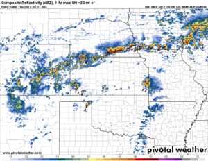
Latest NAM 3km. Isolated action along the dryline in the panhandles. Leftover crapvection pushing into SE KS, and lots of action (however likely HP modes) along the warm front. TD's in SE NE, SW IA are forecast to be in the 70's with good backing winds, however convection will likely be ongoing all day, setting up a potential bust / meso-only chase.
 
The NAM from yesterday at 12Z came in and really reduced the convection during the day, thus making the entire event look much more appealing. It also seemed to really emphasize the TX&OK PH/SW KS sector for coverage.

Now the 12Z NAM this morning has come in and shows something that resembles more of a multi-round day-long event, tracking multiple waves of precip from the TX PH through KS and surrounding areas. While it looks like the synoptic scale warm front is located close to the KS-NE border, morning storms will probably lay down some OFBs, thus providing for multiple areas of coverage. Capping further east may be enough to hold down storms over C OK/C KS and points east, thus helping to keep the entire warm sector from being wiped out early on as the GFS was indicating. Last night's MPAS run shows something of a crapshoot anywhere along the OK-KS border from well west to near I-35.

FWIW, the GFS has slightly backed off on precip coverage during the day across OK, too. So maybe this event will actually come together. Aside from some weaknesses in shear and the potential for early overturning, there isn't a lot not to like about this setup relative to how quiet it has been this year.
 
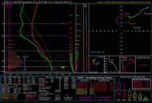
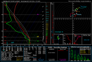
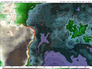
This is from tonight's NAM for 7pm Wednesday in southwest Oklahoma. I really like this environment if we can get sustained supercells. My biggest concern is subsidence in wake of early/midday convection. Love that low LCL/LFC.


00zTHU_MAY11.jpg
 
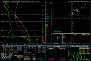
There is a very southerly component to the 500 mb flow early in the day that creates some nasty VBV, but there might be a slight glimmer of hope.

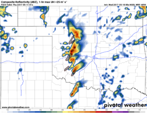
As the upper low lift toward the NE, the 500 mb flow veers slighly more westerly. This coincides with backing of the 850 mb winds and surface winds. So, if storm hold off until closer to 0z then we have a chance. The 12z HRW WRF-ARW puts out a nice supercell right along I-44. I choose to believe this model for now since it meets all of my wishcasting needs.

03070848d856a7b43455651bbebb4da0.png

a3d916ff8f7949e9e7f0f5b55a4abe31.png
 
Overview

Upper level low finally ready to eject toward the NE after hanging out in NM for a few days. Deep gulf moisture streaming north into OK and TX panhandle ahead of approaching jet. Expect supercells to fire near TP between 20-21z.

Surface

A meso-low will form in NW TX by this evening which will help keep winds backed from the SE. Mid to Upper 60 Tds are already widespread across OK (minus rain cooled air regions). We could even see a few pockets of 70 Tds.

579723f93f000ba16b32894cbdd9c84e.png

Upper

A concern exist with 700 and 500 mb winds being too sourtherly at the onset of storm initiation. However, it does appear that these winds will veer more SW as we get closer to 00z. This should help storms organize more since they won't be fighting that VBV. See previous post with soundings from Altus.

The LLJ ramps up after 00z too (as expected). Nothing insane but a healthy 30-40 kts. So after 00z expect 0-1km helicities to exceed 200 m2/s2.

Conclusion

I expect storm to fire by 3-4pm in SE TX panhandle and NW TX. I'd expect them to mature and strengthen futher as the head into SW OK. I think it is definitely possible that some of these bad boys could hang on all the way to central OK between 8-10 pm. In fact several runs of the HRRR show a cell riding I-44 this evening.

Special Treat

Maybe this will happen?????

997c999ea0fed397039f371ffee3cbca.png
 
I've been watching close to home across southeastern IA and parts of west central and northwestern IL proximal to the warm front. CAMs are initiating quasi-discrete convection near the surface boundary in conjunction with a disturbance aloft and low pressure migrating through the region later this afternoon.

Today's 00z NAM and ECMWF/GFS were painting different scenarios in regards to placement of key surface features later today, as were the 3km NAM and other high resolution CAMs in regards to placement and organization of convection. Nevertheless, adequate 0-1 km shear profiles would provide an ambient environment for storm updrafts that are able to take advantage of the presence of the surface boundary this afternoon, perhaps paralleling the WF in an otherwise moderately moist, unstable environment.

Ongoing convection may determine eventual latitudinal placement of the frontal boundary later today, which presently lies somewhat transverse, south of the US 136 to I-72 corridors as of 13z. The eventual location will be key to the most optimal tornadic threat. However, forecast skew-T profiles also indicate effective shear and lapse rates to facilitate some large hail and damaging wind events too. The only two assuaging factors to an otherwise heightened tornadic threat, if storms are able to effectively interact with the boundary, may be relatively paltry surface flow, as 12z data seems to be indicating rather meager profiles on the order of 5-10 kts at best, along with a secondary issues of possible congealment into clusters, versus monolithic discrete storms.
 
Based on satellite imagery and other near-term trends, the northern portion of the southern Plains target looks cooked. Convective overturning, extensive cloud-cover and weak 850-750mb field fields.

Down across northwest Texas and far southwestern Oklahoma, it may be a different story by early evening, especially as wind profiles improve toward 00z.
 
If you're a ham and you'll be in SW OK this afternoon, we'd love to take your reports. Be safe and hope to hear you on the air!
Repeaters
These repeaters are part of the link system.

  • 442.525 +5 PL 123 Lawton, OK
  • 444.450 +5 PL 123 Cement, OK
  • 442.200 +5 PL 123 Grandfield, OK
  • 443.300 +5 PL 123 Hedrick, OK
In case of failure on the link system, we'll fall back on these machines in order:

  1. 444.075 +5 PL 123 Lake Lawtonka
  2. 442.175 +5 PL 123 Big Rock
  3. 444.450 +5 PL 123 SE Lawton
 
Back
Top