Ethan Schisler
EF5
I chased the long track supercell that developed NW of Macomb, IL and eventually dissipated near the IL/IN border.
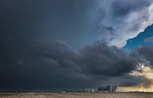
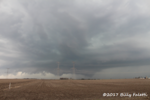
Incipient supercell in Fulton County, IL....taken from my Iphone 7+
I got on the storm initially outside of Cuba, IL where I noticed a large rotating wall cloud and a possible funnel cloud. I had to punch the RFD core because of poor road options and encountered quarter size hail. It appears I skirted the extremely large hail as there were reports of nearly BASEBALL size hail just to the north outside of Canton, IL.
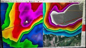
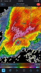
I included some radar grabs for perspective. The largest hail we saw during the chase was probably 1 to maybe 1.25" in diameter. We certainly lucked out when it came to skirting that huge hail core.
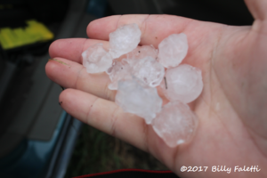
That is some seriously large hail for Illinois. Part of me regrets staying ahead of it, and just core punching it to see such large hail. Anyway we followed the storm further east to near Glasford where it tried to wrap up again, however surface winds weren't favorable for near storm inflow to have tornadogenesis in my opinion.
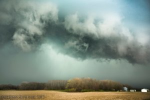
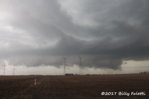
HP supercell with partial RFD cut near Glasford, IL. There was hail up to tennis ball size behind that!!
I got I-474 and followed it east to near Roanoke in Woodford County where I decided it probably wasn't going to produce a tornado and I headed home, getting back to my house by 5:30PM. Overall an excellent chase day, given what I expected. My target panned out, 1 single beasly supercell formed and tracked for a long time in an isolated fashion. Just would have been nice to have it spit a couple out, because it was such a beautiful storm.
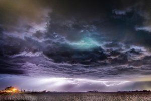
I got this image earlier in this morning hours when a series of elevated severe thunderstorms pushed across the area around 4AM. Made for some beautiful lightning photography....


Incipient supercell in Fulton County, IL....taken from my Iphone 7+
I got on the storm initially outside of Cuba, IL where I noticed a large rotating wall cloud and a possible funnel cloud. I had to punch the RFD core because of poor road options and encountered quarter size hail. It appears I skirted the extremely large hail as there were reports of nearly BASEBALL size hail just to the north outside of Canton, IL.


I included some radar grabs for perspective. The largest hail we saw during the chase was probably 1 to maybe 1.25" in diameter. We certainly lucked out when it came to skirting that huge hail core.
That is some seriously large hail for Illinois. Part of me regrets staying ahead of it, and just core punching it to see such large hail. Anyway we followed the storm further east to near Glasford where it tried to wrap up again, however surface winds weren't favorable for near storm inflow to have tornadogenesis in my opinion.

HP supercell with partial RFD cut near Glasford, IL. There was hail up to tennis ball size behind that!!
I got I-474 and followed it east to near Roanoke in Woodford County where I decided it probably wasn't going to produce a tornado and I headed home, getting back to my house by 5:30PM. Overall an excellent chase day, given what I expected. My target panned out, 1 single beasly supercell formed and tracked for a long time in an isolated fashion. Just would have been nice to have it spit a couple out, because it was such a beautiful storm.
I got this image earlier in this morning hours when a series of elevated severe thunderstorms pushed across the area around 4AM. Made for some beautiful lightning photography....
