Jesse Risley
Staff member
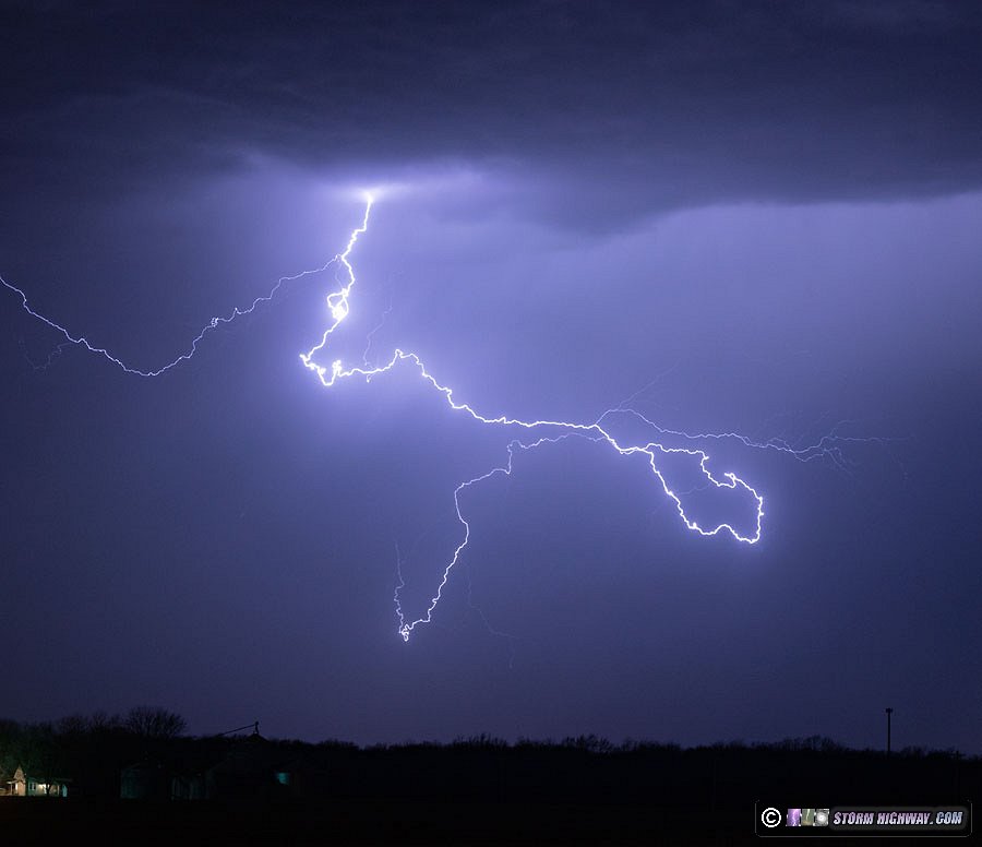
I initially targeted Geneseo, IL due to the position of the surface low, dryline bulge and moisture influx. When I first exited I-80 to start the chase I was literally less than a mile from where a tornado would later pass.  I really didn't have high hopes for this area but figured LCLs would improve closer to 0z given otherwise ambient shear profiles. When the first severe warning of the day was issued I drifted north up towards Tampico, IL and played with a SVR warned storm for about 35 minutes. I initially wrote off the discrete sups south of Moline given that the airport was reporting Tds <45F and figured they were behind the dry punch and likely just going to be hailers (a closer look at surface data afterwards shows that these storms were likely pooling on the far western fringe of the deepest Theta-e feeding into the surface low and had I taken a closer look I would have seen this, but I was chasing by myself). When the first TOR warning was issued for Henry County I blasted back down IL Rt. 40 as the storm was approaching west of Annawan. Not wanting to be trapped on I-80 I opted to drift west on US Route 6 and passed through Mineral. I have video of a well defined lowering and plenty of low-level rotation that was the tornado in progress, although with it being dark I cannot discern a clear funnel or tornadic feature though there was visible dust at times beneath the lowering (I was approaching from the west but initially started at 6+ miles away).
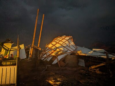
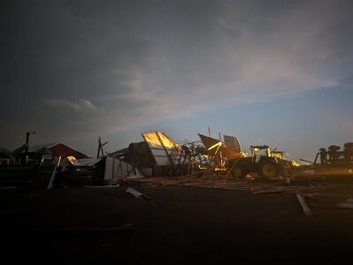
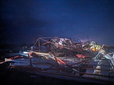
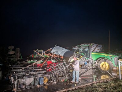
Either the tornado was not fully condensed or it was obscured from my vantage point due to rain and it being dark, but the video clearly shows the circulation and cloud features associated with the pendant cloud. I observed the storm north if I-80 near Annawan, IL and observed some suspicious fingers twisting around between lightning flashed but could not definitively confirm a tornado for the NWS at that juncture, though there likely was still one ongoing. The circulation became rain wrapped as the surging RFD overtook the prior clear slot and the storm weakened shortly thereafter. Hearing on the scanner that a semi was overturned on I-80 I took US 6 west and came upon a damaged farmstead 3-4 mi NW of Annawan on the way to Atkisson. The farmhouse and several buildings across the highway were damaged. After checking for injuries the owners gave me permission to take some damage photos which I immediately relayed to the NWS via Slack. This is the first time I've successfully intercepted an actual tornado in progress in February.
I really didn't have high hopes for this area but figured LCLs would improve closer to 0z given otherwise ambient shear profiles. When the first severe warning of the day was issued I drifted north up towards Tampico, IL and played with a SVR warned storm for about 35 minutes. I initially wrote off the discrete sups south of Moline given that the airport was reporting Tds <45F and figured they were behind the dry punch and likely just going to be hailers (a closer look at surface data afterwards shows that these storms were likely pooling on the far western fringe of the deepest Theta-e feeding into the surface low and had I taken a closer look I would have seen this, but I was chasing by myself). When the first TOR warning was issued for Henry County I blasted back down IL Rt. 40 as the storm was approaching west of Annawan. Not wanting to be trapped on I-80 I opted to drift west on US Route 6 and passed through Mineral. I have video of a well defined lowering and plenty of low-level rotation that was the tornado in progress, although with it being dark I cannot discern a clear funnel or tornadic feature though there was visible dust at times beneath the lowering (I was approaching from the west but initially started at 6+ miles away).Either the tornado was not fully condensed or it was obscured from my vantage point due to rain and it being dark, but the video clearly shows the circulation and cloud features associated with the pendant cloud. I observed the storm north if I-80 near Annawan, IL and observed some suspicious fingers twisting around between lightning flashed but could not definitively confirm a tornado for the NWS at that juncture, though there likely was still one ongoing. The circulation became rain wrapped as the surging RFD overtook the prior clear slot and the storm weakened shortly thereafter. Hearing on the scanner that a semi was overturned on I-80 I took US 6 west and came upon a damaged farmstead 3-4 mi NW of Annawan on the way to Atkisson. The farmhouse and several buildings across the highway were damaged. After checking for injuries the owners gave me permission to take some damage photos which I immediately relayed to the NWS via Slack. This is the first time I've successfully intercepted an actual tornado in progress in February.