Dan Robinson
EF5
This event looked like a legitimate tornado opportunity for northern Illinois in the days leading up to it, but when the morning of the event arrived, I was pessimistic. Moisture was not moving north fast enough, and it was so cold in the St. Louis area by mid-morning that I needed a jacket (this was some of the upstream air for the setup). Nonetheless, short-term models hinted at some storms along I-72 near Springfield in a decent environment for supercells. That would be close enough for me to go check out.
I left at 11AM, and drove north, stopping several times to look at data. Models backed off of the southernmost I-72 storms, but maintained healthy-looking supercells a little farther south than originally expected (down near Peoria/Bloomington). I decided to go the extra 90 minutes north to El Paso (east of Peoria).
I intercepted the first storm of the day west of Lacon on Highway 17. I waited for the updraft base to arrive, seeing a good downpour of hail larger than quarters.
The storm was moving much faster than I'd anticipated. It rapidly got away from me while I drove back east through Lacon. During that time, a large RFD cut developed over (or just north of) town. On the east side of town, I encountered large tree debris in the road. At the first clearing to the north, I could see a rapidly rotating bowl with a debris cloud in progress underneath.
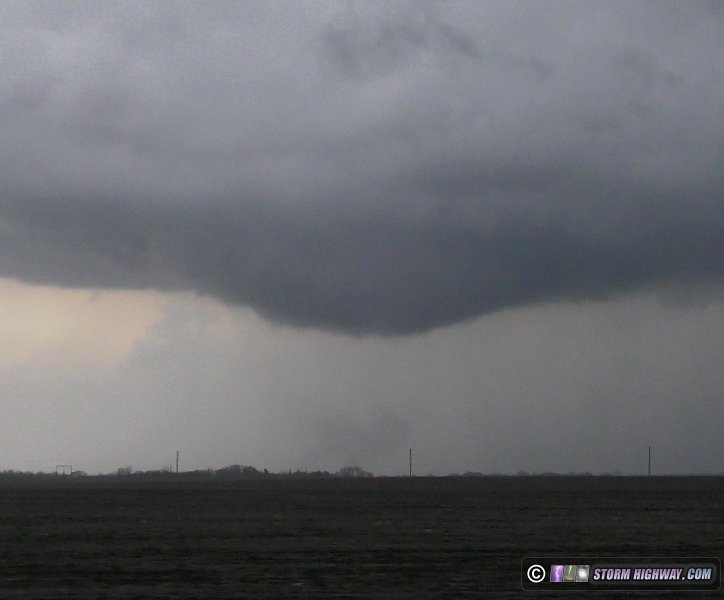
Due to the storm speeds, I didn't attempt to get/stay close. The visibility was good enough to watch it move away to the north-northeast. Several other significant lowerings developed with what appeared to be the same circulation, but were too far away to confirm rotation or ground contact.
I had originally planned to try to make it to Chicago for upward lightning once storms started lining out, but everything was moving much too fast for that to be possible. Instead, I parked near Varna and shot lightning stills and high-speed video until after sunset.
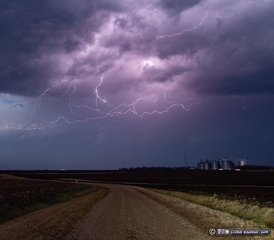
The departing storms at twilight were spectacular, but the clouds were blurring severely at even 3-second exposures with a 10mm wide-angle view - a testament to how fast the storms were moving. I arrived back home at 9:30PM, making it a just over 10-hour trip.
I'm happy to be on the board with a tornado already in 2024, but really wish I'd been in Chicago for the rare highly-branched upward lightning show there (see Nick Uliveri's shots of that on Twitter/X). To get that, I would have had to completely abandon the tornado play before it started and head into the city right about the time the first supercell was getting good.
I posted some additional images and a Youtube video on my site: Storm chasing and photography roundup from January 30 - February 29, 2024
I left at 11AM, and drove north, stopping several times to look at data. Models backed off of the southernmost I-72 storms, but maintained healthy-looking supercells a little farther south than originally expected (down near Peoria/Bloomington). I decided to go the extra 90 minutes north to El Paso (east of Peoria).
I intercepted the first storm of the day west of Lacon on Highway 17. I waited for the updraft base to arrive, seeing a good downpour of hail larger than quarters.
The storm was moving much faster than I'd anticipated. It rapidly got away from me while I drove back east through Lacon. During that time, a large RFD cut developed over (or just north of) town. On the east side of town, I encountered large tree debris in the road. At the first clearing to the north, I could see a rapidly rotating bowl with a debris cloud in progress underneath.
Due to the storm speeds, I didn't attempt to get/stay close. The visibility was good enough to watch it move away to the north-northeast. Several other significant lowerings developed with what appeared to be the same circulation, but were too far away to confirm rotation or ground contact.
I had originally planned to try to make it to Chicago for upward lightning once storms started lining out, but everything was moving much too fast for that to be possible. Instead, I parked near Varna and shot lightning stills and high-speed video until after sunset.
The departing storms at twilight were spectacular, but the clouds were blurring severely at even 3-second exposures with a 10mm wide-angle view - a testament to how fast the storms were moving. I arrived back home at 9:30PM, making it a just over 10-hour trip.
I'm happy to be on the board with a tornado already in 2024, but really wish I'd been in Chicago for the rare highly-branched upward lightning show there (see Nick Uliveri's shots of that on Twitter/X). To get that, I would have had to completely abandon the tornado play before it started and head into the city right about the time the first supercell was getting good.
I posted some additional images and a Youtube video on my site: Storm chasing and photography roundup from January 30 - February 29, 2024