2017-04-09 EVENT: OK/KS/MO/NE/IA

Would watch out for a mesolow forming in western N TX/SW OK. That's probably what I'll play. Anything else would not be worth the drive, but I say that and there will be some beautiful supercell up north.

I will say I don't think storm coverage is something you're gonna have to worry about. Strong capping will keep storm cvg low.
 
As of me waking up around 8am, I'm thinking today is NOT going to be worth the trip out to Western Iowa. The HRRR lacks any convective signal until after dark out there, when CIN has increased to high levels. The 3km NAM still shows a couple helicity tracks north of Omaha however these appear to be centered in the 00z-03z time-frame. Seems like an early season cap bust to me. Unless something changes, I'm staying home on this one, however I can reasonably wait until 11 or 12 to make my final decision.
 
Cap was hefty on this morning's OUN sounding but I'm feeling somewhat confident that the stoutest portion of the EML will advect to the east ahead of the dryline and hopefully make the cap more manageable with subtle forcing. Moisture pooling also appears to be occurring in Grady and Comanche counties, with mid-60s dewpoints (63-65) sticking around. How long that moisture stays comparatively unmixed though with the cirrus deck breaking up over us is up in the air.

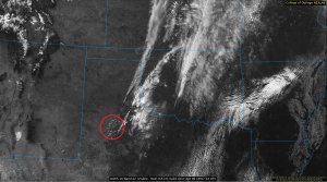
Also just wanted to add in a neat loop from GOES16 this morning. Can see the continued moisture transport in Texas with a hint of the trough's influence in the clouds over Childress/SW OK.

nVauZo0.gif
 
Three of the ten NCAR ensemble members from last night's run blow up a storm in the southwest quadrant of OK, with one placing the storms very close to OKC and another progging a nice looking supercell along the KS-OK border. I tried really hard to find something on the mesoscale that distinguished those three members from the other seven, but alas I could not find such a feature. This leads me to think the uncertainty comes from subtle differences in the strength of the dryline circulation, meaning storm initiation could be very probable. Of course, it's also completely within the realm of possibility that not a single storm forms south of I-80 today, so meh.

I'll be looking for very small scale features (those possibly only resolvable by GOES-16 500 m vis satellite fields or possibly Oklahoma mesonet sites, to determine if and where to chase. Definitely looking at southwest Oklahoma, though.
 
As I stated with my 8am post, I sat out today. My Iowa target from yesterday is probably going to cap bust today though. If there were two areas that I would favor (which are well out of my reach right now), it would be 1) Southeast Kansas, HRRR has been hinting at a couple discrete cells firing up along the dry line later on and moving east into a favorable parameter space after-dark. Whether any tornado potential is realized will depend on the amount of SBCINH and of course the winds appear fairly veered in this area, so I think the main threat would be very large hail perhaps baseball size...2) Southwest Oklahoma....others have mentioned this target so I don't need to elaborate too much, its a conditional target, just like number 1, but if you get a storm it could be a good one. If the cap weren't so strong further north, one would target the triple point in NW IA/SW MN, however I'm afraid all that is going to occur up there is convection that fires on the cool side of the boundary (IE elevated). Reminds me somewhat of May 5, 2012 (erhghhhhh).
 
Looks like a new low/mesolow possibly forming up on the southern end of the Llano Estacado near Lubbock. Small popcorn Cu has been consistently showing up along with increased surface convergence. Moisture situation still looks pretty good across SW OK with ~1-2F negative or positive changes over the last 3 hours. The main impulse also appears to be hanging back a bit (as evidenced by cyclogenesis in the Panhandle) which should bode well for convective initiation later this afternoon.

257cbb51597c74d5e99eec4a1cabd91e.jpg
 
Back
Top