2017-04-09 EVENT: OK/KS/MO/NE/IA

Mike Marz

EF3
Joined
Mar 11, 2014
Messages
209
Location
Minneapolis, Minnesota
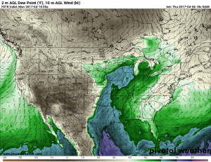
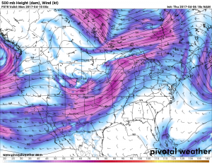
As of right now it appears that a pretty marginal event may be on tap for this upcoming Sunday across central portions of the country. However marginal it may appear at the moment (at least in terms of tornadic potential), I thought it would be good to start a thread and get smarter minds than mine chiming in on the setup. According to the NAM at 12z and 18z today, we should have double 500mb jet maxes approaching the target area from the southwest by Sunday morning. Dewpoints on the morning of look to be somewhere from the mid 50s to around 60 degrees anywhere from north OK through KS into parts of NE/IA. By afternoon/early evening it looks possible that mid 60s dewpoints may set up along a northeast-southwest oriented dryline.

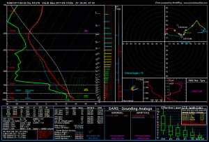
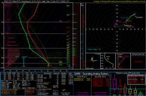
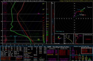
So far, I can only see negatives with this setup. The dryline orientation with the 500mb flow along with the major southwesterly component to the 850mb flow being at the top. There is a touch of veer-back in the forecast soundings along the dryline as well, but this type of veer-back doesn't bother me all that much. Also, all of the soundings are showing substantial capping, which may prevent storms all togother.

Overall, this setup doesn't appear overly favorable for a great chasing event. That being said, there is still some potential here, and some time for it to possibly get better. Also, being that it falls on a Sunday and in pretty favorable terrain, I will definitely be considering a chase. I am just not sure how far of a drive this warrants yet. In a perfect world I would play the dryline somewhere down on the KS/OK border, but again there are major capping concerns and SW 850 concerns... There could also be another target further north as somewhat of a triple point may set up near OAX.
ed56cb1bbd2183f7c16562f7ca44a218.png
ea48e45137e62b14d1d3722c7306f912.png
3c8a10a3b4ebe8f6a3e0ae636f0c782e.png
 
The double impulses in the mid-levels are screwing up this event. There almost seems to be a westerly low-level jet with this setup behind the dryline. Super veered flow between 850 and 700 mb resulting in a solid cap east of the front in the northern part of the area with VB also present in the southern part of the area. However, the triggering boundary is so extremely rotated that even S/SSW surface winds will be sufficient for convergence at the front. Moisture looks to be much better than I was seeing with earlier forecasts, so there is actually substantial CAPE. Mid-level flow certainly supports a fast evolution to linear storm modes regardless of initial storm mode, but upper level flow is basically out of the west in the southern part of the area, so I'm not sure about that.

Normally with such veered low level winds I wouldn't even give such a setup a second thought before throwing it in the trash. But this one is so messed up I feel like there's a spot along the front/dryline that might put out a show, at least briefly. Could be anywhere from Texas to northern Iowa, though.

Good thing I don't have to travel for this, because it's not worth it to me, but it will be fun to keep an eye on.
 
I've been watching the SW Iowa region, as CAMs have been breaking out convection between 21z and 00z just to the southeast of the surface low, right on the nose of the 850 mb Theta-e axis. The 0-1 km environment does appear favorable for rotating updrafts, and hopefully the forcing will be enough to overcome the CINH, although the more recent 00z/7th NAM run seemed drier than the 12z/6th run. The low does definitely take on a more elongated feature as it somewhat weakens with its northeastward progression, and has already been mentioned, shear profiles suggest discrete activity should be confined to a narrow window should it evolve as progged.

27f31ef2774ff8e84e773519470c1907.png
 
Looking at the 12Z NAM this morning - moisture appears to have improved somewhat, and inhibition seems like less of a threat as a failure mode than previously. However, I cannot find a forecast hodograph that doesn't contain an S-shape. The one Jesse posted above is about the best out there I think. I can find less VB-ed hodographs in Iowa where said hodographs are fairly unidirectional, but soundings near the front in IA also contain substantially stronger capping.
 
I've been watching this day for quite a while. Right now I don't have too much to say on it that hasn't already been said. I do agree with Jeff's comments from last night though, that there could be a diamond in the rough anywhere from Texas up into Iowa, its just too hard to say right now....especially with this type of setup. Moisture does look quite a bit better on some of the 12z runs I'm seeing, I would like winds to be better backed up toward the low in Iowa/Nebraska than what they are. Right now, Southeast Nebraska/Southwest Iowa is probably the main target that I am eying. The one thing I don't like with this setup is how the 850mb winds are so veered they appear to be coming out of the west initially, although they do switch toward the SW around 00z, still not optimal at all.
 
Looking at the 12Z NAM this morning - moisture appears to have improved somewhat, and inhibition seems like less of a threat as a failure mode than previously. However, I cannot find a forecast hodograph that doesn't contain an S-shape. The one Jesse posted above is about the best out there I think. I can find less VB-ed hodographs in Iowa where said hodographs are fairly unidirectional, but soundings near the front in IA also contain substantially stronger capping.

I grabbed that particular image from last night's 00z/07 run of the NAM, plotted just ENE of the progged convective initiation in SW IA.

The 12z/07 run has since come out, and it does appear that most of the 4-5 sites that I sampled for a hodograph forecast at 0z/10 have substantial S-shape profiles, suggesting that left splitting and slovenly storm modes could be commonplace with convection proximal to the low. It appears that the 12z/07 3km NAM is trying to initiate convection further west into SE NE with a quick evolution to more of a linear mode as the convection moves into IA. For what it's worth, the 12z/07 GFS is more unidirectional looking, albeit with some curvature in the lowest 1km, and a little less magnanimous with surface based moisture (dry bias?).
 
Looking at 12z NAM, I'm quite interested about Sunday after being suspect before. Storms look like they will initiate in SC or SE Neb and push into SW IA. Hodograph's here are forecast to be messy and VBV, with only 150 0-3 SRH. If the moisture pans out as planned, 65TD's will be available, lapse rates look good, and the positioning near the triple point and just south of the warm front could help fix the VBV issue along the boundaries.

Current local NWS forecast is for elevated showers with a rumble of thunder, which isn't even remotely close to what NAM is showing. I've got STP's of 3 and a 3600 MU cape in SE Neb. by 00z Sunday Evening with SB LCL at 600m. That's no elevated thundershower. NAM holds off on initiation until pretty late, which makes sense given the forecast CAP, but that may give a chance for the LLJ to help increase SRH late.

We also have some good theta-e advection forecast in that LLJ and some equally crazy moisture convergence in the triple point area. Jet is well positioned. DPVA is removed to the NW, but it's still increasing. Overall I'm giving this a 1 out of 5 DUDA on the Duda Scale. Meaning a 1 in 5 chance of busting. Best TOR chances in a line from SW IA, into SE Neb (close to the triple point), then down the dryline into N OK. If i was able to chase that far South, I'd be heading to Wichita or just across into the OK border. I might have to settle for Beatrice, NE instead.
 
I've been watching this one closely too as it of course is basically in my backyard and on a Sunday too. I've been hating the hodos for most of the runs especially the direction of the 850s and not real backed surface winds. That being said I'm hoping near the triple point and just east of the low to get some backing of the surface winds there. I'm a little pessimistic of the mid 60s dews being shown on the 3km NAM especially since as of this morning winds were still pretty much off shore at the Gulf and dews down there were only in the 40s. What are people's thoughts on dew points/moisture? SPC is going with only mid to upper 50s. 3kNAM does fire off a nice cell west of Lincoln with a pretty strong helicity track right towards Omaha. Also there are substantial differences between the GFS and the NAM at this point and where the surface low and cold front/dry line positions are.


Sent from my iPhone using Stormtrack
 
I've been watching this for a number of days on the GFS and then into NAM land and I have to say that I had a lot of hope, but all of my fears continue to show up each model run.

* First and foremost, the instability axis is about 2 counties wide and oriented SE to NE which never bodes well without SE storm motion.
* SW and Departing 850 winds are never good
* Capping concerns
* Negative SRH between 1-3km (Veer back) Profiles

What sucks is that I have a wedding to go to in Albuquerque on Saturday, so I will have to leave Saturday night and start heading home to be in place for this event. It's not ideal, but I still don't want to miss it. Moisture and shear seem ample for at least a couple supercells, I just feel like they may be further north. Either way, I'll be chasing if something fires in Oklahoma. Like @Jeff Duda said, I wouldn't travel very far for this event otherwise.
 
I was hoping for a Sunday chase along the warm front in Iowa, but as of right now that cap is just way too much. Models are in quite a bit of disagreement with eachother, the GFS is significantly less aggressive with the capping in western Iowa and places the low a bit further east than the two NAM's so a lot can still change.

As of right now I will probably have to sit this one out as the triple point looks like it's going to be too far west for me to chase on a Sunday and the warm front will do nothing because of the cap, if this was happening on a Saturday it'd be a completely different story.
 
Not too enthused with a lot of things that have already been stated in this thread. Wind profiles like Sunday have the tendency in my experience to have deviant ESE storm motion not be enough to throw off a left split seeding the right split along with negative SRH making mesocyclone maintenance a pipe dream. That said, NE to SW-oriented drylines have spit out some at least decent looking storms briefly before going linear and the mid-60s dewpoints combined with substantial MLCAPE on the order of 2500-3000 j/kg might make a drive to Kingfisher/Enid worth it for the likely brief semi-discrete period of convection along the dryline.
 
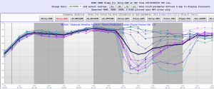
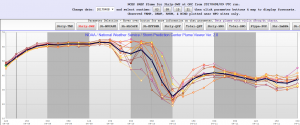
Ugh, the clustering with the moisture in this system is real. Both the SREF and NCAR ensembles show this:

You're gonna want the NMMB core's moisture forecasts to be right:
NMMB_td_OKC_SREF.png

The ARW's SREF members are only slightly less clustered. One or two members keep the dryline west of Norman:
ARW_OKC_td_SREF.png

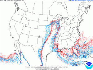
Here's what it looks like spatially:
SREF_td60_cluster.gif

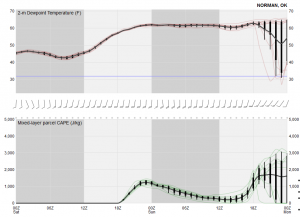
With the NCAR ensemble, it's either feast or famine it seems. No middle ground whatsoever!
NCAR_OUN_td.png
 
After pursuing some of the latest 12z data, I'm pretty interested in a target in Southeast/Eastern Nebraska into perhaps Western Iowa tomorrow evening. I wish 850mb winds were more backed, however CAMs are showing some impressive helicity tracks in this region along with possibly semi-discrete supercell structures. Its a Saturday, so it might be enough to lure me out...with nothing else to do.
 
Things improving on the 00z data with the HRRR starting to come in and show promising signs of better wind profiles owing to better backed 850mb winds. 3km NAM shows initiation in Northwest Iowa. I would probably target Denison, Iowa area maybe a bit further northwest. Basically just get southeast of the low and hope a storm can fire with such a strong cap, and if it does, you could get a show with such high instability/shear combination in an early season storm system. Its a 5 hour drive for me so I'll probably go out and take my chances, its chase season, might as well chase :)
 
Back
Top