• While Stormtrack has discontinued its hosting of SpotterNetwork support on the forums, keep in mind that support for SpotterNetwork issues is available by emailing [email protected].

2016-07-05 REPORTS: MN/SD/NE/WI/IA

Mike Marz

EF3
Joined
Mar 11, 2014
Messages
209
Location
Minneapolis, Minnesota
I targeted far western Minnesota on this day and a nice tail end supercell evolved near Appelton/Holloway Minnesota. The storm was able to produce this tornado before things grew upscale into quite the MCS that as I type this is still raging across central Wisconsin.


14220-fc29ec0c2aae180745776323dd02ec14.jpg


14219-403f61b6e3b349f4f58d7006e7c4a2cd.jpg
 
Last edited:
@Matt Magiera and I decided to take the risk on chasing SW Minnesota, taking the drive up from Illinois. It paid off.

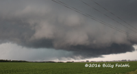
Within 15 minutes of getting onto the storm, it produced a sizable multiple vortex a few miles to our northwest that later fully condensed from our position into what looked to be at least briefly a wedge before getting completely obscured by rain.

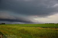
Wider angle structure shot as the tornado was a multiple vortex. RFD cut is extremely evident:
upload_2016-7-6_22-13-49.png

Original vs. contrast enhanced video frame grab, when it appeared as a wedge from our position:
upload_2016-7-6_22-9-45.png

Below is video of the tornado from our position. Not the best video, but you can definitely tell it's a tornado.

PLEASE tolerate my commentary; I think I say the word "wedge" about 999 million times...I REALLY need to learn to maintain composure when the condensation wisps touch ground...

One of many structure shots this beastly HP supercell had to offer long after the tornado:
upload_2016-7-6_22-18-40.png

Awesome chase! We pretty much expected to drive 9 hours for a shelf cloud, so it really exceeded expectations. First long haul chase for me. I've seen tornadoes locally in Illinois and eastern Iowa, but never 9 hours from home. Matt has some great stills of the tornado and structure that he may post on this thread.
 

Attachments

  • upload_2016-7-6_22-11-24.png
    upload_2016-7-6_22-11-24.png
    435.8 KB · Views: 113
Alright I'm going to finally be able to get around to posting about this day; and what a day it turned out to be. I drove to Minnesota not expecting much with @FalettiWx and walked out with what I believe to be a strong tornado. The NWS rated it an EF-0 without even surveying it; so we will never know the official path length/width, or even the actual strength of the tornado. I find it bad that the NWS wouldn't even survey.
Getting beyond my anger of that I'll start out with the beginning of the day. I woke up at 4:30am to get ready and make the long haul up to our initial target of Montevideo, MN. We had just started approaching the target area when the tornado watch came out, and then proceeded to gun it up US 59 until we got onto the storm, which was displaying some rather incredible structure.
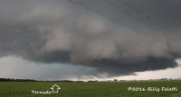
A short while after Billy spotted the tornado as it condensed almost immediately underneath the base, less than 15 minutes of us getting on the storm. It at first appeared multi-vortex, with some pretty incredible motion even at a relative distance.
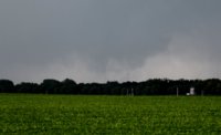
cone.JPG
It also grew rather large fairly quickly.
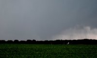
tornado.JPG
Here's a couple edited shots to bring out the contrast to show the size of the tornado. Obviously not how it really looked:
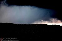
optimized.jpg larger.jpg
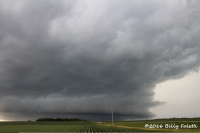
Aside from the tornado, this storm displayed some pretty incredible structure. This one had a pretty cool inflow tail.
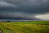
inflow.jpg
Some lightning for good measure as well ;)
lightning.jpg
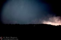
This storm had a variety of cool hues of blue/green as well.
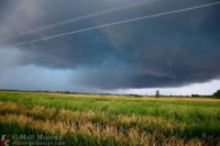
bluegreen.jpg

Overall this chase well exceeded my expectations. The mesoscale details worked out in favor to produce this long lived, well structured but very HP storm. This was my first Minnesota tornado, and tornado number 43 in my lifetime book. 2016 has been my best chase year thus far.
 
Last edited:
what I believe to be a strong tornado. The NWS rated it an EF-0 without even surveying it; so we will never know the official path length/width, or even the actual strength of the tornado. I find it bad that the NWS wouldn't even survey.
Getting beyond my anger of that I'll start out with the beginning of the day. I woke up at 4:30am to get ready and make the long haul up to our initial target of Montevideo, MN. We had just started approaching the target area when the tornado watch came out, and then proceeded to gun it up US 59 until we got onto the storm, which was displaying some rather incredible structure.
A short while after Billy spotted the tornado as it condensed almost immediately underneath the base, less than 15 minutes of us getting on the storm. It at first appeared multi-vortex, with some pretty incredible motion even at a relative distance.

I am also a bit disappointed that the NWS didn't get out to at least try and survey this tornado. I do think that it would have ended up being an EF-0 anyways, because I am fairly certain it hit almost nothing, including trees. From my vantage point though, this did appear to be a pretty potent tornado, as you said. My video really does not do it justice. To the naked eye, the motions on the little vortices dancing around under the bowl looked pretty nasty, as I mentioned in my video. I was actually still driving out of the RFD when out of the corner of my eye I noticed the tornado vortices dancing in a field directly north of me, so I didn't begin recording until about 30 seconds after that, it may have been a bit stronger right before I could pull over to record.
 
Last edited:
A month ago we had a severe warned storm in central Iowa. The storm destroyed a machine shed. A few weeks later I ran into the firefighter who reported the damage. He claimed it was a tornado, the weather service didn't do a survey and went with strong wind damage. I have not come up with conclusion, since I was not there until morning. Since it relates to the post above, I'm interested in comments, or move the post.

 
A month ago we had a severe warned storm in central Iowa. The storm destroyed a machine shed. A few weeks later I ran into the firefighter who reported the damage. He claimed it was a tornado, the weather service didn't do a survey and went with strong wind damage. I have not come up with conclusion, since I was not there until morning. Since it relates to the post above, I'm interested in comments, or move the post.


I am sure someone will likely move this discussion to another thread, but just based on your video of that damage, it certainly looks like a tornado to me. For example at 57 seconds in that video, and in a few other instances in the video, you can see debris lodged into things like missiles. Also, the way the grass is bent over in the video points to a tornado in my mind. I know a strong downburst can do quite a bit of damage, but I would lean towards a tornado here, especially with a report from an observer.
 
Back
Top