Ethan Schisler
EF5
I found some footage online from the tornado outbreak of May 13, 1995 recently. Some screen grabs from SD video were taken southeast of Abingdon, IL by a local farmer, Norm Wilcoxen. Sadly he has passed away upon trying to look him up.
I was wondering if anyone else had photos, videos, or experiences related to this outbreak in Illinois? It looks like it was a warm front setup across the area with very high CAPE (3000-4000 J/KG) and high helicity as well. The Storm Prediction Center went high risk for this event per the 05/13/1995 Day 1 outlook. Multiple strong to violent tornadoes impacted Western and Central Illinois during the afternoon hours including:
F4 tornado from Niota, IL to SW of Abingdon, IL
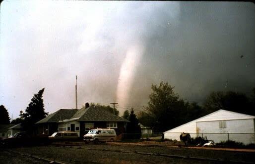
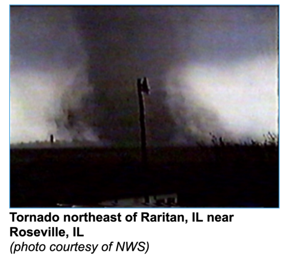
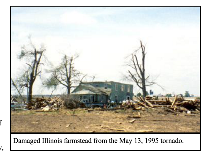
F2 tornado from SE of Abingdon, IL to Maquon, IL (pictured here)
F4 tornado near Lewistown, IL
F3 tornado near Manito/Goofy Ridge, IL
F1 tornado near LeRoy, IL
F1 tornado near Princeville, IL
There were a handful of others across Missouri, Indiana, and Kentucky but for now I just focused on Illinois.
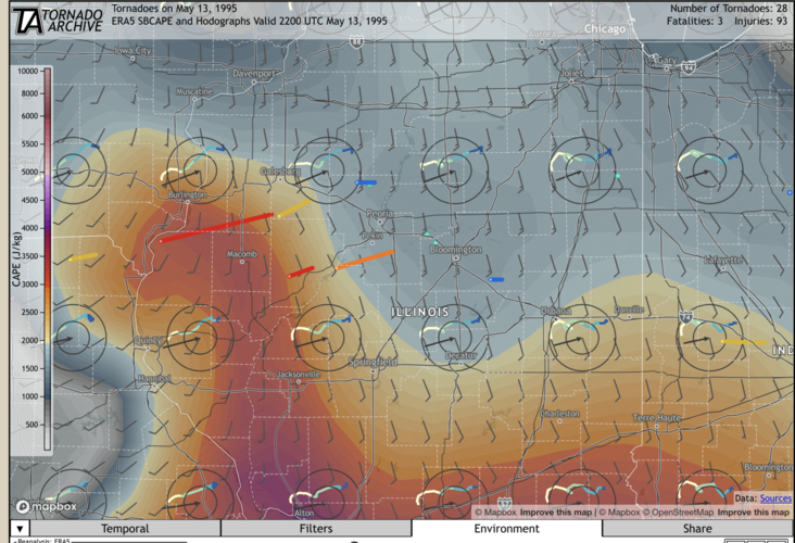
05/13/1995 Tornado Archive CAPE and hodograph plot overlaid with tornado tracks
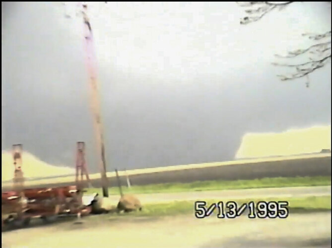
(Norm Wilcoxen) Hermon, IL F2 Tornado
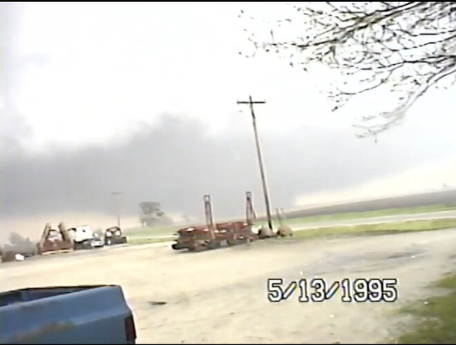
(Norm Wilcoxen) Hermon, IL F2 Tornado
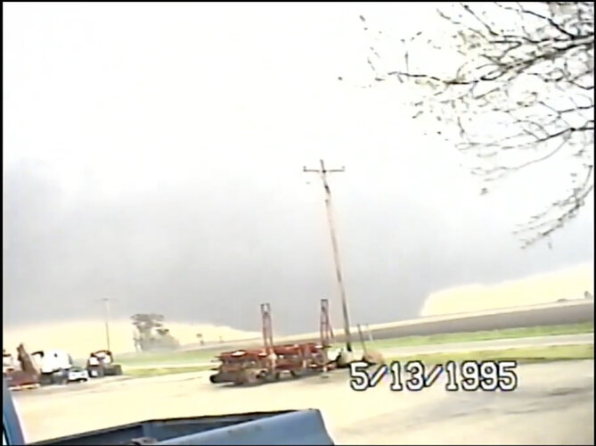
Photos near Hermon, IL (Southeast of Abingdon) taken by local farmer Norm Wilcoxen extracted from SD video. This was the third significant tornado produced by this supercell that fired in Northern Missouri
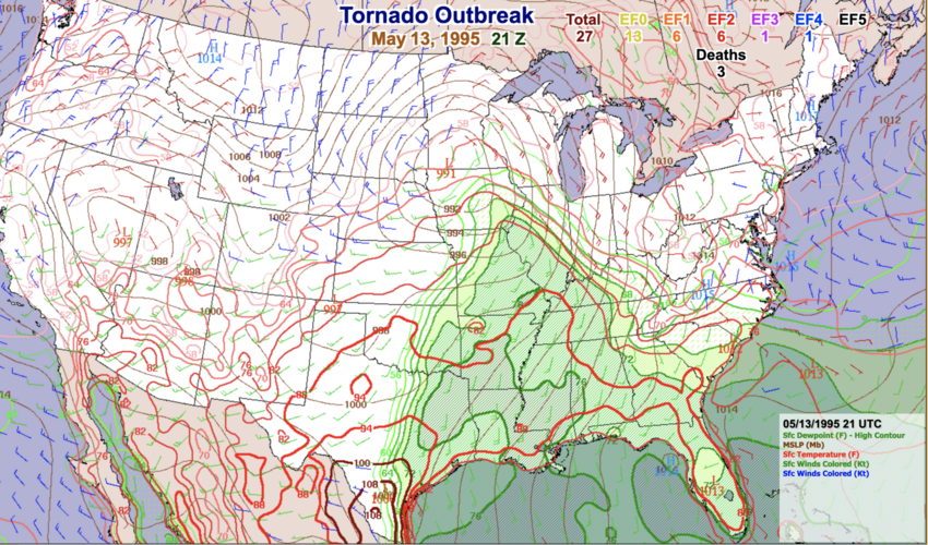
US surface contours at 21z on 5/13/1995 (SPC violent tornado page)
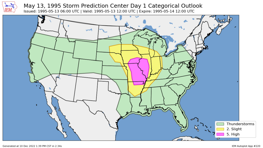
Storm Prediction Center 05/13/1995 06z outlook featuring a broad high risk across IA/IL/MO (Iowa Environmental Mesonet)
I was informed by a couple folks online that video of the long tracked F4 tornado from Niota to Abingdon was aired on The Weather Channel way back in 1995, however I can't find anything online from that. If someone else knows of the footage, I would LOVE to see it or hear about it.
Here is video footage by David Hoadley of the Manito/Goofy Ridge, IL F3 Tornado:
(Fulton County ESDA)
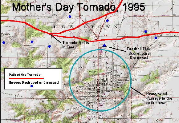
Above is a tornado track by Fulton County, IL ESDA after the May 13, 1995 F4 tornado that passed north of town. Ironically this intersected the path of the April 04, 2023 EF3 tornado that impacted almost the same exact area. I can not find any video footage of this particular storm. NCDC Storm Data shows it as an F4 and the parent storm initiated close to Macomb, IL producing softball sized hailstones. If anyone has more to add to this, I would love to hear about it.
I was a bit too young to remember this event first hand, but my parents have told me that we went out to my uncles house to seek shelter and the wedge passed less than a mile south of his place (F2 near Abingdon/Hermon). This event is something that drives my fascination with weather to this day.
I was wondering if anyone else had photos, videos, or experiences related to this outbreak in Illinois? It looks like it was a warm front setup across the area with very high CAPE (3000-4000 J/KG) and high helicity as well. The Storm Prediction Center went high risk for this event per the 05/13/1995 Day 1 outlook. Multiple strong to violent tornadoes impacted Western and Central Illinois during the afternoon hours including:
F4 tornado from Niota, IL to SW of Abingdon, IL
F2 tornado from SE of Abingdon, IL to Maquon, IL (pictured here)
F4 tornado near Lewistown, IL
F3 tornado near Manito/Goofy Ridge, IL
F1 tornado near LeRoy, IL
F1 tornado near Princeville, IL
There were a handful of others across Missouri, Indiana, and Kentucky but for now I just focused on Illinois.

05/13/1995 Tornado Archive CAPE and hodograph plot overlaid with tornado tracks

(Norm Wilcoxen) Hermon, IL F2 Tornado

(Norm Wilcoxen) Hermon, IL F2 Tornado

Photos near Hermon, IL (Southeast of Abingdon) taken by local farmer Norm Wilcoxen extracted from SD video. This was the third significant tornado produced by this supercell that fired in Northern Missouri

US surface contours at 21z on 5/13/1995 (SPC violent tornado page)

Storm Prediction Center 05/13/1995 06z outlook featuring a broad high risk across IA/IL/MO (Iowa Environmental Mesonet)
I was informed by a couple folks online that video of the long tracked F4 tornado from Niota to Abingdon was aired on The Weather Channel way back in 1995, however I can't find anything online from that. If someone else knows of the footage, I would LOVE to see it or hear about it.
Here is video footage by David Hoadley of the Manito/Goofy Ridge, IL F3 Tornado:

(Fulton County ESDA)
Above is a tornado track by Fulton County, IL ESDA after the May 13, 1995 F4 tornado that passed north of town. Ironically this intersected the path of the April 04, 2023 EF3 tornado that impacted almost the same exact area. I can not find any video footage of this particular storm. NCDC Storm Data shows it as an F4 and the parent storm initiated close to Macomb, IL producing softball sized hailstones. If anyone has more to add to this, I would love to hear about it.
I was a bit too young to remember this event first hand, but my parents have told me that we went out to my uncles house to seek shelter and the wedge passed less than a mile south of his place (F2 near Abingdon/Hermon). This event is something that drives my fascination with weather to this day.

