• While Stormtrack has discontinued its hosting of SpotterNetwork support on the forums, keep in mind that support for SpotterNetwork issues is available by emailing [email protected].

2016-05-24 EVENT: TX/OK/KS/NE/CO

I don't think its a stretch at all that the Dodge City (Bloom) EF3 would have created EF4 damage when compared to the Wynnewood Tornado. It was bigger and had horizontal vorticies. The Wynnewood, OK Tornado was definitely more of an eratic mover of the two, and had a lot more it could damage.
 
I do think it is a little risky to talk about potential EF ratings of tornadoes based on their appearance. That said, I think some of that wording may be based on the similarity in appearance of the first two strong tornadoes to the Rozel tornado (which was noted by a number of chasers at the time). The Rozel tornado was rated EF-4 and occurred in the same CWA.
 
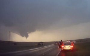
While I didn't chase this event, I don't think its a stretch that the first significant tornado of this sequence ("bloom" tornado per NCDC) was "violent" for at least a short duration of its life cycle based upon motion on video etc. Visual intensity is always a tricky area to judge as seemingly "weak" tornadoes can produce significant damage if they impact an area with higher end damage indicators at an "up" period during the tornado's life cycle. As for the W Dodge City tornado (rated EF-2), where NCDC mentions a short period of EF-5 intensity winds via mobile radar; based upon video, the motion for a large portion of this tornado's life cycle appeared fairly modest and somewhat lazy, struggling to keep balance at times with its condensation. I know this doesn't really say anything about the overall strength of the tornado, but in my opinion its not necessarily a halmark of most violent long lived tornadoes. Again, doesn't mean anything, as even it impacting a well built structure during that short time period could produce high end damage.

As for the overall tornado count, you could still argue either way in my opinion as for how you count. The main focusing point of this storm obviously being the 4 significant (EF2+) tornadoes that it produced (EF3, EF2, EF2, EF3), all by different cycles during its life-time. With the others being mainly satellite tornadoes surrounding these at different times during its life.

Again, just my opinions, I didn't chase this event, so I don't have any personal observations to add, other than what I've seen reviewing radar and other people's footage. Very interesting storm though I will say, considering its evolution and tornado tracks (mainly deviant to the NW)....a theme which overall saved Dodge City from a nightmare scenario.
 
There were several other notable tornadoes on the Dodge City day that I have not seen any photos or videos of, apparently from separate storms from the Scott City or Dodge City cells - namely to the east in the Kinsley area and up near Jetmore:

http://www.tornadohistoryproject.com/tornado/2016/5/24/map

These were all before sunset and supposedly would have been visible, yet I can't find any images or videos of these. The Scott City storm and of course the Dodge City one were well documented, but apparently no one was on these other storms - any imagery would have come from local residents.
 
Unfortunately we drove into that Kinsley mess on the way back to ICT. We'd left DDC on US-50 before dropping south from Kinsley (on 183) to Greensburg on US-54. We did not see any tornadoes near Kinsley, and were looking mainly for safety reasons, but encountered very heavy rain and lots of street flooding in Kinsley.

Apparently we should have stayed in DDC for dinner with just about everyone else who chased the day. Still a great day. We saw the marvelous sunset and the main tornado show earlier.
 
Back
Top