• While Stormtrack has discontinued its hosting of SpotterNetwork support on the forums, keep in mind that support for SpotterNetwork issues is available by emailing [email protected].

2016-05-16 EVENT: KS/OK/TX

It's not often that you see this, but the NAM appears to be converging on the GFS' solution with a more northerly placement of the warm front. The GFS has been rather consistent for many runs now on the placement of surface features and the general threat area. Looks like the NAM has a more SSE-NNW oriented dryline across the E TX PH and into far W OK, whereas the GFS is almost right along the TX-OK border. Looks to be a fairly narrow window of truly good deep shear - too far south or east and shear drops off pretty quickly, with some doubled-back hodographs. I was able to find one or two #PDSTOR soundings on the 12Z NAM.

Also been noting a substantially friendly setup in the SREF for several cycles now, as well. Solid, but not extreme, shear, instability, moisture, helicity etc. The SREF does seem to be stingy with precip, but as has been discussed in this thread, you can't always put much stock into the CPS, and the one used operationally has its biases that can be worked around.

Surprising consistency between models and inter-model run-to-run...this may actually happen.
 
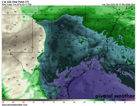
As Jeff noted the NAM has been converging on the GFS solution for moisture placement. The 06Z NAM and 4km HAM now both have the WF up near the OK/KS borders similar to the GFS. The GFS has been extremely consistent on its moisture placement for at least a couple of days. Tds AOA 65° seem very probable in the warm sector.

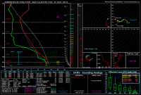
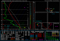
I pulled a sounding in the TX panhandle that look great but this time with the 4km NAM (GFS had been giving best soundings).

I would say there is a decent play near the triple point tomorrow. I would like a little bit stronger (or perhaps more robust in aerial coverage) mid-level flow but we could see near 50 kts at 500 mb near 00z. 850 mb flow is mediocre but we do have lots of directional shear.

I pulled this sounding for near the triple point in the TX panhandle. Will it verify? Likely not but fun too look at just the same

c10fd5466e715310a0d249b896d23c8c.png

906b66dcffbacc2e533d5026ccfb740c.png
 
A followup to my previous post. I think tomorrow will be pretty big in the TX panhandle but I'm just not seeing as much convergence to bring the system far enough east into Oklahoma. Some models are pointing to a strong return flow that could initiate convection in the warm sector, but lets be honest its not likely and will take a much stronger and faster shortwave than currently forecasted. What impressive direction shear and dynamics (neutral zonal trough and in MAY), even if moisture is lacking. I think a hatched tornado risk is warranted as the models get a better handle on CI (probably Amarillo to Guymon east into western OK) . That said a few of the NAM sounding in the warm sector in OK looked pretty impressive, so if storm can get rooted in the BL (extremely unlikely but possible) in Oklahoma.....


d42ead0580c27781da08d79a37ec70f7.png
 
I am also concerned that the best moisture won't reach the dryline before everything gets undercut by that front tonight. The most recent 14Z HRRR is showing the main convection starting near the OK/NM border and shifting eastward. This agrees fairly well with the 4km NAM. I am a little worried about the HRRR showing isolated development just north of Amarillo but it doesn't seem to do much. Hanging out in Amarillo but will likely head north toward Boise City. Watching that development N of Amarillo to see if it shows on additional runs of the HRRR.
 
I've seen setups like this before. THis event just screams utter disappointment. Morning CAMs are basically in lockstep with a storm blowing up in extreme NE NM early this afternoon and flying southeastward during the day and into the evening with a gradual transition to a squall line as it does. This has the looks of a non-tornadic HP cell bow echo that will produce ridiculous amounts of hail and wind.

Even more sad is the medium range models suggest there will be no other chaseable events in the southern Plains for the foreseeable future. This could very well be the end of the season in the southern Plains, so I may have to take a chance just to avoid not chasing after May 9th.

Just a garbage setup in a garbage weather pattern at this point.
 
Back
Top