cdcollura
EF5
Good day all,
Starting thread for April 27 storm reports (here's mine)...
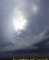
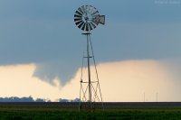
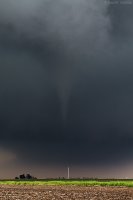
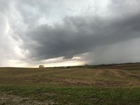
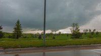
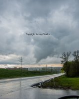
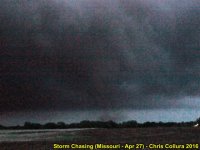
Above: LP storm developing near Shelby County, Missouri.
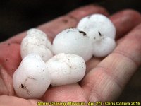
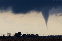
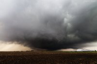
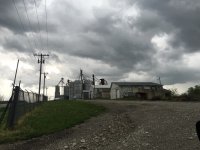
Above: Hail from LP supercell storm near Shelby County, Missouri south of Highway 36.
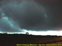
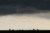
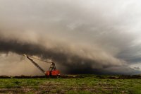
Above: Developing Tornado southwest of Emden, MO after dark (also in Shelby county and well north of Highway 36).
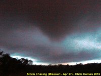
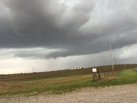
Above: Tornado nearing Emden, MO. Hearing cracking of trees, loud roar, and ears popping at this time!
Above: Tornado moving northeast (with debris) of Emden, MO, after I back away to safe distance to west. Sorry about the low light on these...
Chase Details For 4/27 Below:
On April 27, I woke up early (in Wichita, KS) and planned / forecasted for that days chase, which, fortunately, would be near my route back to Chicago. The dynamics were a lot more subtle than the day before, with a very large slight-risk outlook issued by SPC from the mid MS river valley southward to the Gulf coast. Initially, the tornado outlook was 2%, but later upgraded to 5% in a small area over NE Missouri and into SW Iowa. Wind and hail probabilities were 15%, with the hail coinciding near the 5% tornado outlook. The target for my chase was NE Missouri, which is where the warm front was draped. Another target area, farther west to near Kansas City and SW Iowa / SE Nebraska, was also east of an intense stacked (upper DVA and surface) low pressure area. This low pressure area even exhibited an eye-like feature on visible satellite over E Nebraska by 20z!
I left Wichita via 400 east and into the Flint Hills. Near Altoona, I took 47 east to near Franklin, and Highway 69 north to Fort Scott, and east for the long haul into Missouri and across the Ozarks to Jefferson City via Highway 54. The target area was pretty much north and northeast of Jefferson City, to and north of Mexico, MO. In this area, convergence would be maximized along the warm front, with backed winds, and at the time of peak heating. Signals pointed to a late initiation of storms here, and with a near-dusk low-level jet and boundary layer cooling causing much lower LCL's at that time. Storms farther west near the low also were producing tornadoes, but were well out of range and initiated very early, and were barely outside the 2% tornado outlook area. SPC issued mesoscale discussion 477 (east of 475) and subsequent tornado watch 116 for the target area in NE Missouri, valid until 9 PM CDT.
By roughly 6 PM, some LP supercell storms developed near and around Moberly, MO and points east. With the warm front nearly stalled, these storms became elevated over the cooler air mass to the north. Surface temperatures ranged from the upper 70's to low 60's across a short distance, with a S wind backing to ESE as one proceeded north. These LP supercells, developing well ahead of a squall line associated with the low to the west, had high bases and produced hail to at least an inch. By about 8 PM an LP storm developed east of Moberly and moved north. This storm weakened, but once it reached the boundary, it rapidly intensified and produced a tornado near Emden, Missouri after dark in Shelby County. I came within a few hundred yards of this tornado as it grazed Emden. After this tornadic supercell moved north, it eventually merged with the squall line coming in from the west near Quincy, IL.
From near Mexico and Moberly, I stuck with Highways 22, 64, and eventually 24 and 36. The Emden tornado was north of Highway 36 and crossed Highway 168. I continued east on 168 to 61 north, then 24 east towards Quincy and back across the Mississippi River into Illinois. Pretty much done with chasing, and dealing with a linear severe MCS now, I continued out of Quincy on 104 to I-174 north to Highway 110 near Carthage. I proceeded east on 136 to near Macomb for fuel stop, then north along 41 and eventually to I-74 north out of Galesburg. I took I-74 to I-88, which goes back NE to I-39 near Rochelle, and continued east on I-88 to Highway 59 north out of Aurora. This took me back to Hoffman Estates, IL and back to where I am staying in the NW suburbs by 4 AM on April 28. This terminated this successful (but long) chase trip.
Starting thread for April 27 storm reports (here's mine)...

Above: LP storm developing near Shelby County, Missouri.

Above: Hail from LP supercell storm near Shelby County, Missouri south of Highway 36.

Above: Developing Tornado southwest of Emden, MO after dark (also in Shelby county and well north of Highway 36).

Above: Tornado nearing Emden, MO. Hearing cracking of trees, loud roar, and ears popping at this time!

Above: Tornado moving northeast (with debris) of Emden, MO, after I back away to safe distance to west. Sorry about the low light on these...
Chase Details For 4/27 Below:
On April 27, I woke up early (in Wichita, KS) and planned / forecasted for that days chase, which, fortunately, would be near my route back to Chicago. The dynamics were a lot more subtle than the day before, with a very large slight-risk outlook issued by SPC from the mid MS river valley southward to the Gulf coast. Initially, the tornado outlook was 2%, but later upgraded to 5% in a small area over NE Missouri and into SW Iowa. Wind and hail probabilities were 15%, with the hail coinciding near the 5% tornado outlook. The target for my chase was NE Missouri, which is where the warm front was draped. Another target area, farther west to near Kansas City and SW Iowa / SE Nebraska, was also east of an intense stacked (upper DVA and surface) low pressure area. This low pressure area even exhibited an eye-like feature on visible satellite over E Nebraska by 20z!
I left Wichita via 400 east and into the Flint Hills. Near Altoona, I took 47 east to near Franklin, and Highway 69 north to Fort Scott, and east for the long haul into Missouri and across the Ozarks to Jefferson City via Highway 54. The target area was pretty much north and northeast of Jefferson City, to and north of Mexico, MO. In this area, convergence would be maximized along the warm front, with backed winds, and at the time of peak heating. Signals pointed to a late initiation of storms here, and with a near-dusk low-level jet and boundary layer cooling causing much lower LCL's at that time. Storms farther west near the low also were producing tornadoes, but were well out of range and initiated very early, and were barely outside the 2% tornado outlook area. SPC issued mesoscale discussion 477 (east of 475) and subsequent tornado watch 116 for the target area in NE Missouri, valid until 9 PM CDT.
By roughly 6 PM, some LP supercell storms developed near and around Moberly, MO and points east. With the warm front nearly stalled, these storms became elevated over the cooler air mass to the north. Surface temperatures ranged from the upper 70's to low 60's across a short distance, with a S wind backing to ESE as one proceeded north. These LP supercells, developing well ahead of a squall line associated with the low to the west, had high bases and produced hail to at least an inch. By about 8 PM an LP storm developed east of Moberly and moved north. This storm weakened, but once it reached the boundary, it rapidly intensified and produced a tornado near Emden, Missouri after dark in Shelby County. I came within a few hundred yards of this tornado as it grazed Emden. After this tornadic supercell moved north, it eventually merged with the squall line coming in from the west near Quincy, IL.
From near Mexico and Moberly, I stuck with Highways 22, 64, and eventually 24 and 36. The Emden tornado was north of Highway 36 and crossed Highway 168. I continued east on 168 to 61 north, then 24 east towards Quincy and back across the Mississippi River into Illinois. Pretty much done with chasing, and dealing with a linear severe MCS now, I continued out of Quincy on 104 to I-174 north to Highway 110 near Carthage. I proceeded east on 136 to near Macomb for fuel stop, then north along 41 and eventually to I-74 north out of Galesburg. I took I-74 to I-88, which goes back NE to I-39 near Rochelle, and continued east on I-88 to Highway 59 north out of Aurora. This took me back to Hoffman Estates, IL and back to where I am staying in the NW suburbs by 4 AM on April 28. This terminated this successful (but long) chase trip.

