• While Stormtrack has discontinued its hosting of SpotterNetwork support on the forums, keep in mind that support for SpotterNetwork issues is available by emailing [email protected].

2016-04-24 EVENT: OK/KS/NE/IA/MO

I'm leaving for a business trip for a week to North Dakota. This means there will be an outbreak Sunday and again on Tuesday. NE, KS, W IA all looking solid here. Best low level EHI is in E NE, but there is a ton of veer back veer crap going on, so although the TOR threat appears moderate, VBV will probably kill cell organization, so don't expect anything to last long. Meanwhile, I'm gonna say Gorilla Hail is looking to be the main threat for tomorrow. Good Luck Boys. Target because I won't be here to chase:......Palmyra, NE at 6pm.
 
Can't believe i forgot to look athe SPC 4km WRF earlier today. 12z run has a line of supercells all the way into SW oklahoma. It will be interesting to see if any other models put prceip that far south.

6c8e7f475c8eaa47f88a8351604c36d9.gif
 
Brian McKibben, PDS TOR means that the sounding has met the following 11 criteria:

1.) Effective STP with CIN is greater than or equal to 3.
2.) Fixed STP is greater than or equal to 3
3.) 0-1 km Storm Relative Helicity is greater than or equal to 200 m2/s2
4.) Effective Storm Relative Helicity is greater than or equal to 200 m2/s2
5.) Average 4-6 km storm-relative winds are greater than or equal to 15 knots.
6.) Surface to 8km shear is greater than 45 knots.
7.) Surface based parcel LCL is less than 1000 m above ground level.
8.) Mixed layer parcel LCL is less than 1200 m above ground level.
9.) 0-1 km lapse rates are greater than or equal to 5 C/km.
10.) Mixed layer parcel CIN is greater than -50 J/kg
11.) Effective inflow layer bottom is at the surface of the Earth.

The Possible Hazard Type box works off of parameter combinations to estimate potential hazards associated with the environment being displayed. Essentially it's looking for really high STP, really high storm-relative helicity, really high shear, and low LCLs, all which are associated with environments that produce strong tornadoes. It's a good redundancy tool, but it says nothing about the quality of the data going into the algorithm! Parameters like CAPE and STP are attempting to summarize all the structure of a single sounding into into a single and informative number, which means that sometimes it can leave out subtle yet important details about the environment.

With regards to the precipitation forecasted by the storm-scale models, the NCAR ensemble also has some precipitation far south.
 
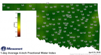
It seems to me the biggest question regarding the southern play today is moisture quality. That pesky ridge sitting over the NW Gulf has finally abated, and significant return flow has begun according to the latest obs. However, solid mid-60s dewpoints are still restricted to basically right along the Texas coast. While the wind field includes many trajectories that connect this rich moisture to western Oklahoma, I'm not confident that the magnitude of the wind speed will be enough to get moisture there in time. With that said, however, I've noticed a somewhat more apparent trend in convection-allowing WRF forecasts in this case. Soil across the central and southern plains is very moist, including all throughout Oklahoma, as a result of recent widespread heavy rainfall:

mesonet.daily.current.FW10S.grad.png

Coupled with insolation that is becoming rather strong now that we're in late April, I think ground surface moisture sources will play a critical role in enhancing the moisture return today. There's more than enough moisture for significant soil evaporation and plant transpiration (ET), and recent CAM forecasts have suggested moisture will basically just appear in the low levels as the day goes on...the result of that moisture source from high ET. Most of the NCAR ensemble members from last night suggested dewpoints would reach 64+ over a narrow corridor across W OK and into SC KS by this afternoon, which is what seems to be driving the vigorous convective development in the ensemble (some impressive UH values seen in OK).

I hate to talk down about people who are doing work in the same field as I am, and I don't feel the need to do so here. I do believe that those 2-m dewpoint forecasts may verify. If they do, it will be an interesting late afternoon on the southern/central Plains. If not, well, then it probably won't be very active. I will talk down to the RAP and HRRR, though, even though the HRRR is a convection-allowing WRF. I know of the heavy amount of tuning that goes on in that model, and I continue to see evidence that the PBL scheme overmixes, so I don't really believe the moisture forecast in morning HRRR runs, although the verifying atmospheric state may resemble more of a compromise between the NCAR ensemble and the HRRR. I think lower 60s dewpoints will probably still be good enough for a show in KS/OK today, provided such 2-m dewpoint values are accompanied by a well mixed PBL.

And FWIW, the somewhat coarser (but still mesoscale) SREF (09Z run) is also fairly confident that low-mid-60s dews will appear in NW OK by this afternoon. For SC KS, that event is less certain.
 
It seems to me the biggest question regarding the southern play today is moisture quality. That pesky ridge sitting over the NW Gulf has finally abated, and significant return flow has begun according to the latest obs. However, solid mid-60s dewpoints are still restricted to basically right along the Texas coast. While the wind field includes many trajectories that connect this rich moisture to western Oklahoma, I'm not confident that the magnitude of the wind speed will be enough to get moisture there in time. With that said, however, I've noticed a somewhat more apparent trend in convection-allowing WRF forecasts in this case. Soil across the central and southern plains is very moist, including all throughout Oklahoma, as a result of recent widespread heavy rainfall:

View attachment 12870

Coupled with insolation that is becoming rather strong now that we're in late April, I think ground surface moisture sources will play a critical role in enhancing the moisture return today. There's more than enough moisture for significant soil evaporation and plant transpiration (ET), and recent CAM forecasts have suggested moisture will basically just appear in the low levels as the day goes on...the result of that moisture source from high ET. Most of the NCAR ensemble members from last night suggested dewpoints would reach 64+ over a narrow corridor across W OK and into SC KS by this afternoon, which is what seems to be driving the vigorous convective development in the ensemble (some impressive UH values seen in OK).

I hate to talk down about people who are doing work in the same field as I am, and I don't feel the need to do so here. I do believe that those 2-m dewpoint forecasts may verify. If they do, it will be an interesting late afternoon on the southern/central Plains. If not, well, then it probably won't be very active. I will talk down to the RAP and HRRR, though, even though the HRRR is a convection-allowing WRF. I know of the heavy amount of tuning that goes on in that model, and I continue to see evidence that the PBL scheme overmixes, so I don't really believe the moisture forecast in morning HRRR runs, although the verifying atmospheric state may resemble more of a compromise between the NCAR ensemble and the HRRR. I think lower 60s dewpoints will probably still be good enough for a show in KS/OK today, provided such 2-m dewpoint values are accompanied by a well mixed PBL.

And FWIW, the somewhat coarser (but still mesoscale) SREF (09Z run) is also fairly confident that low-mid-60s dews will appear in NW OK by this afternoon. For SC KS, that event is less certain.
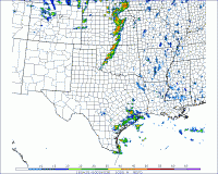
Jeff...the northern target has been perplexing me. What is driving the high dewpoints shown up there on the models? Is that ground moisture or moisture pooling of some sort? It seems like the 60s dews just appear up there magically.

Sent from my SM-G920I using Tapatalk
 
I'm very skeptical about any robust updrafts being able to develop south of the KS/OK border due to weak forcing and meager height falls. Greater convective coverage appears to be from central KS into eastern NE. Surface vorticity is also maximized in northwest to north-central KS as of 16z.

Best shot at a few photogenic supercells in my mind is up around the Hutchinson to Salina vicinity. Storm mode gets messier to the northeast and initiation is questionable down into northwest OK.
 
Dews are approaching 60 F already in north central Oklahoma, with Enid currently reporting 59, and appear to be increasing fairly rapidly. I'd expect some mixing to take place within the next couple hours, but the strong LLJ should continue to transport moisture northward. I don't think 61-62 F dews in south central KS by 00z are out of the question. This combined with relatively steep lapse rates and 45-50 kts of deep layer shear perpendicular to the boundary should be sufficient for discrete supercells. The tornado threat seems pretty low given the T-Td spreads until after sunset, and even then, the RAP and HRRR show a cap developing and keep temps well in the mid 80s after 7 pm, resulting in 30 degree spreads at sunset. I have a feeling the short range models are a little warm, as often seems to be the case. The NAM, GFS, SREF and NSSL WRF solutions have mid to upper 70s temps after 6 pm which result is much more favorable spreads. Overall the tornado threat seems pretty low looking at short range models, but I'm not sure they have a good handle on it with their discrepancy from the other models. Currently en route to Hutchinson, KS and will reevaluate along the way.
 
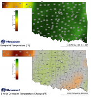
It appears the evolution may be on track regarding my previous post. Dewpoints are now reaching 60 at many mesonet sites in W OK, and a noticeable surge of 2-5 F has occurred with surface dewpoints since early this morning:

dewpoint_and_trend.png

One question that remains: how deep is this moisture going to get?

Also, since the current state already defies recent HRRR forecasts for moisture, I've decided you can pretty much throw out the HRRR's forecasts of storm initiation and location for this southern target. Haven't looked at N KS/E NE, so disregard that statement if you're targeting the northern end of this setup.
 
I'm very skeptical about any robust updrafts being able to develop south of the KS/OK border due to weak forcing and meager height falls. Greater convective coverage appears to be from central KS into eastern NE. Surface vorticity is also maximized in northwest to north-central KS as of 16z.

I disagree. Current SPC mesoanalysis shows 500 mb height falls of 60+ m over parts of NW OK/OK PH, with height falls of 30 m over a large portion of the southern Plains. I think large scale ascent will be sufficient, especially given current vis satellite shows the entire region almost completely clear with sfc temps already in the mid-upper 70s across parts of NW OK.
 
Surprised by the moisture return. Today still seems worth a drive, even if a bust. Storm motions don't seem too bad either further south, so I could take a photogenic storm. Would be excited for hail if I didn't just replace my windshield.

Sent from my XT1254 using Stormtrack mobile app
 
Currently sitting in Hutchinson, KS ready to make a play on the strengthening Cu on the dryline west of here. Thinking ill target any dominant supercell with enough clear air south of it. Very impressed by the dewpoint surges so far gotta love evapotranspiration. Just need the low lvl shear to bump up this evening.
 
Back
Top