James Gustina
Supporter
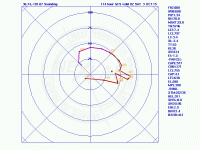
This is still in the medium-range (around 120 hours) but so far it appears pretty likely that a compact shortwave through the central High Plains at some point on Friday. The GFS currently has a pretty messy solution, with a lead impulse swinging through the night before and leaving a stalled cold front which limits the overall fetch and makes for a narrow moist axis out on the Llano in the Texas Panhandle (mid-upper 50s). Meanwhile, the Euro has been consistently progging the lead impulse to be out entering the Gulf on Thursday night but not meaningfully impacting the overall moisture profile (upper 50s/low 60s). The shortwave slowly edges onto the High Plains by Friday evening. In both solutions, the shear profile looks stellar. Both have a very strong low-level jet ramping up by 21Z out of the due S/SE. Excellent turning throughout the lowest 200mb with no discernible weakness is probably the best thing this "setup" has going for it right now. The moisture situation is going to be crucial as well as where the moist axis sets up. Upper 50s on the High Plains can get it done for supercells at the very least but instability also looks meager from the GFS' standpoint. Patiently waiting on today's 12Z data.

