• After witnessing the continued decrease of involvement in the SpotterNetwork staff in serving SN members with troubleshooting issues recently, I have unilaterally decided to terminate the relationship between SpotterNetwork's support and Stormtrack. I have witnessed multiple users unable to receive support weeks after initiating help threads on the forum. I find this lack of response from SpotterNetwork officials disappointing and a failure to hold up their end of the agreement that was made years ago, before I took over management of this site. In my opinion, having Stormtrack users sit and wait for so long to receive help on SpotterNetwork issues on the Stormtrack forums reflects poorly not only on SpotterNetwork, but on Stormtrack and (by association) me as well. Since the issue has not been satisfactorily addressed, I no longer wish for the Stormtrack forum to be associated with SpotterNetwork.

    I apologize to those who continue to have issues with the service and continue to see their issues left unaddressed. Please understand that the connection between ST and SN was put in place long before I had any say over it. But now that I am the "captain of this ship," it is within my right (nay, duty) to make adjustments as I see necessary. Ending this relationship is such an adjustment.

    For those who continue to need help, I recommend navigating a web browswer to SpotterNetwork's About page, and seeking the individuals listed on that page for all further inquiries about SpotterNetwork.

    From this moment forward, the SpotterNetwork sub-forum has been hidden/deleted and there will be no assurance that any SpotterNetwork issues brought up in any of Stormtrack's other sub-forums will be addressed. Do not rely on Stormtrack for help with SpotterNetwork issues.

    Sincerely, Jeff D.

2013-05-31 EVENT: KS, OK, MO, IL

Robert, where were you on US81 and what was the approximate time for the gif animation?

Looking at my own photos and correcting for how much the time on my camera is off I would estimate ~15min 20sec past the hour give or take a few seconds. I do not have a gps log but after looking at my photos and correlating them with satellite imagery I believe the images were taken near 35°26'18.58"N 97°56'14.45"W (edit: very confident the location is correct). We left this location and traveled south within seconds of the quoted time as well, we had traveled through El Reno and stayed on 81 the whole time. I have another image where the curtains obscure the tornado slightly less, but we were traveling so I did not include it in the gif.
 
Last edited by a moderator:
Long time lurker here, don't post much as I chase from a photographer's perspective and don't feel I have much to add meteorologically speaking, but figure if I can help piece together a time line or provide information I will try. We first saw the tornado touch down from the vantage point of Reno St (ave) and Airport road (facing west) and photographed it as it initially touched down until it became rain wrapped and started heading east. We headed East on El Reno rd and got caught up at the intersection of Reno and 81. We were south of the PD blocking the 81, but still got stuck behind a line of cars. Many chasers and locals; it appeared to me that people were simply confused on which direction to go at that intersection. The tornado was rapidly expanding behind us and closing in quickly, yet people were sitting at the stop sign with little sense of urgency. We sat there for a minute or so until we decided that we needed to get moving or we risked being caught in the rain/tornado. I went around the line of slow moving vehicles and crossed the 81 heading east on El Reno. We had a sense of urgency at this point but I wouldn't say we felt we were in danger. Unfortunately that quickly changed as the tornado expanded rapidly and overtook us.

At first we were just hit by what I assume was extremely strong inflow, but that quickly turned into us being in the tornado itself. We were still driving east, trying to get out of it but the strong winds coupled with the gravel road, lack of visibility and debris made it a slow going process; the vehicle was fish tailing as we were being blown around and extremely hard to control, the windshield wipers were on full blast but the wind forced them to stop working and become stuck in the up position, at which point the visibility out of the windshield became zero. The tornado began its shift to the north allowing us to escape the circulation heading east and turn south on Banner Rd. We stopped just north of the 15 to photograph and video the wedge tornado. I have short "time-lapse" video of the tornado before wedging out that I will post here in the next couple days.


Structure 3 Lightning by W.O.T. Photography, on Flickr


Tornado Twins by W.O.T. Photography, on Flickr

Looking NNW from Banner Road, just north of the intersection with 15th. This was within 5 minutes of us getting out of it


Wedge 3_ by W.O.T. Photography, on Flickr
 
Would like to reference Mike's full name, for showing his chase route on my El Reno map study. What is that?
 
Linked below is a spreadsheet file (in 3 formats) containing the time data for the events visible on my front and rear facing dash cameras during the El Reno tornado. These have been correlated and cross-checked with my GPS data. The three spreadsheet files are identical, but in different formats to ensure that they are readable by various software you may be using (OpenOffice, Excel and a plain-text CSV).

Please feel free to use this data to help sync with yours or further investigations of this event. Please do not broadcast or use this data commercially without permission.

http://stormhighway.com/may312013/elrenosequence-forrelease.ods
http://stormhighway.com/may312013/elrenosequence-forrelease.xls
http://stormhighway.com/may312013/elrenosequence-forrelease.csv

The still images referenced in the spreadheet are located at the following URLs:

Image E-5725 taken at 6:25:34 PM CDT:
Violent EF5 wedge tornado at El Reno, Oklahoma at close range :: Storms and Weather Photography by Dan Robinson

Image E-5726 taken at 6:25:40 PM CDT:
Violent EF5 wedge tornado at El Reno, Oklahoma at close range :: Storms and Weather Photography by Dan Robinson

My GPS log for the chase is also available for download:
http://stormhighway.com/may312013/elreno.gpl

Please let me know if you have any questions.
 
Last edited:
While painful to look at, it's important that we study this event so that we can better ourselves in the future. The following is a plot of storm chasers that were impacted by the May 31 El Reno tornado, resulting in damage to vehicles, injuries, or fatalities. Tornado location and size is approximated based on the preliminary damage survey. Level 2 base reflectivity may be delayed in each frame as well. Thanks to everyone who has contributed their GPS logs, and information on the event, that make this study possible. I should have a full animation of the event available on YouTube in the coming days.

1053245_594961297191001_96080173_o.jpg
 
Here's the animation I've been working on: A detailed look at the track of the El Reno EF5 and its tragic impacts on several groups of chasers including Tim and Paul Samaras, Carl Young, Mike Bettes and crew, Brandon Sullivan, Brett Wright, and Dan Robinson. This analysis also includes time lapsed footage of the storm and tornado, synchronized to radar and GPS positions. Many thanks to everyone who contributed their GPS logs, time stamped photos, accounts of where Tim, Paul, and Carl were, and annotated maps. This video wouldn't have been possible without that information:

Watch video >
 
Impeccable job Skip. Incredibly valuable analysis. I have questions about some of the GPS fixes for other chasers. I realize SN positions might be very highly interpolated, but there are a good number of green dots that appear to have sustained very direct hits. Are there any actual fixes (i.e. non-interpolated positions) that place any of these green dots within the tentatively defined circulation? I would be very curious to know particulars associated with these additional encounters.

List of possibly interesting encounters (time stamp indicates time in Skip's video):
5:47 - Chaser moving south at corner of S Fort Reno and Reuter Rd.
6:00 - Chaser drifting east along E1070 Reno Rd.
6:11 - Two chasers, one heading south on N2820 (S Country Club) and one heading east on what appears to be a road just north of 15 St SW.
6:17 - The chaser blasting east along E1070 nearing 81 is probably erroneous, based on speed, but it'd be great to have more fidelity on this one.
6:24 and 6:30 - Props to the 2 chasers who peeled off north at the last moment on the outskirts of the circulation. I'd be interested to know what visual cues lead to those decisions (since it forced them into the supercell core).
 
This is incredibly useful as a study in chaser/spotter behaviors and the dangers of high-end HP storms. Great job in presentation also.

The different loops really highlight the inexplicable behavior of TWC. I interpret it as an example of novice chasers confused by a rain-wrapped tornado, but even then I can't understand why they continued south when the storm was headed east and about to cross their escape route.
 
Thanks Skip!!! Although I do much more reading than writing here, I appreciate your work helping me understand this event.
 
Are there any actual fixes (i.e. non-interpolated positions) that place any of these green dots within the tentatively defined circulation? I would be very curious to know particulars associated with these additional encounters.

Absolutely. It would be difficult for me to show all the non-interpolated positions, but I was able to skim through them in the viewer quickly. There are several chasers that updated their position within the circle of the parent circulation, some very close to the center. I don't recognize many of the names, and am not going to try and track them down due to privacy concerns since the positions are coming from the Spotter Network data. We can only guess if they were experiencing significant tornadic winds at the time. Keep in mind that circle is a rough approximation, and that there were lots of subvortices dancing around within it. Like being in the bear's cage on other violent tornado producing supercells, it is definitely possible to be within the broader, parent circulation and not experience damaging, or significantly tornadic winds, provided you're lucky enough to miss the subvortices. Or they did experience extremely powerful winds and again just got very lucky. I suspect that's what happened with many of the "green dots." I also suspect that some of the green dots did sustain damage and injuries, and we either haven't heard about it, or they are choosing to keep it to themselves.

The different loops really highlight the inexplicable behavior of TWC. I interpret it as an example of novice chasers confused by a rain-wrapped tornado, but even then I can't understand why they continued south when the storm was headed east and about to cross their escape route.

In the video I didn't want to make any faulty assumptions or judgments. I have no idea what was going through people's heads at the time (I mean this in a neutral sense, I'm sure both good and bad decisions were made), or what was happening around them that led them to choose the decisions that they did.

Some patterns of general behavior seem to be emerging though that I might take a guess at. One of them that some chasers may be suffering from is something I've been referring to myself as "go-south-itis." This is not directed at any particular individual or group, but seemed to be a trend with this event. It seems to me that many chasers have it etched into their brains that they *must* go south to escape the tornado, even if that means racing the tornado to cross its path. When you lose this race, however, you're in real trouble (to say the least). Maybe it's because these chasers are usually east or south of the tornado and found themselves north of it in this situation (since it was initially a SE mover), and their escape routes almost always lead to the south. Maybe it's because they can see the clear air just a couple miles to the south and it looks so much more inviting than the green core to the north, despite the tornado between them and that clear air. Maybe they feel that they're guaranteed to take damage heading north into the core, whereas they feel they've got a decent shot at the gamble of racing the tornado instead. This was an extremely complex, and exceptional storm and situation, however. Many who bailed south and got hit, would have also been hit had they gone north, they just didn't have time at that point to clear the 2.6 mile wide circulation.

I think we might need to stress to chasers, newer ones especially, that you should never race the tornado, your escape route should never cross a tornado's path, and your escape route should take you directly away from the tornado. Another thing to keep in mind is that, even if you do win the race by heading south, you've still got to contend with the RFD after that. The RFD is often significantly more severe than the FFD. Head north, if you're north of the tornado and need to escape. So few people took 81 north when they should have. Or move to stay ahead of the tornado until you have time to take a north or south escape route. El Reno was moving less than 40 mph. If your road isn't a mud slick, and you're not trapped in the bear's cage, you should be able to put ground between yourself and the tornado by moving ahead of the tornado. Every incident that I've looked at, the chaser was either attempting to escape by crossing the tornado's path, or had no option to stay ahead of the tornado and had to cross it's path.
 
143e88eb32c3b568580e0bc5283dfc85.jpg


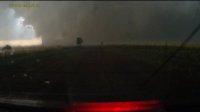
This is video from my front-facing and later rear-facing dash camera while escaping the May 31, 2013 EF5 El Reno, Oklahoma tornado in my Toyota Yaris on Reuter Road between 6:16PM and 6:30PM CDT. CDT time shown on-screen is based on GPS time, synced with US official time and accurate to the second. Road intersections are shown as the vehicle encounters them.

The dash cameras are both 1080i HD, and can be viewed in the full resolution in the Youtube player.

The audio contains what I am attempting to narrate for the main video camera. My voice transcription is as follows:

6:17:29 "I want to find an east road here, I'm getting a little to close. I need to start looking for the east (road) option". The tornado was moving east at this point. I didn't want to go farther south and risk not being able to reach the next east road option to the south after Reuter Road.

6:17:45 "Power flashes". The tornado is damaging the power lines up ahead and causing arcing. The streetlight goes out.

6:18:18 "New wall cloud". Another area of circulation was organizing to the north.

6:18:28 "The wedge is rain wrapped". Referring to the main wedge tornado about a mile to the south.

6:18:57 "I don't like getting in front of tornadoes I can't see, especially huge wedges". Referring to why I don't want to go farther south than Reuter Road.

6:19:56 "What is that? I don't like the looks of that" I am surprised to see what looks like the tornado to the south rapidly approaching the road. I had expected it to be well south of me and to the west.

6:20:18 "It looks like the tornado." I now realize what is happening.

6:21:03 "It's just off to the side of the road". Referring to the tornado, which I can see is now right on me.

6:21:53 "Come on, car!" The car is not maintaining speed in the strong headwinds, due to the traction control reducing power to the wheels as they slip on the gravel.

6:22:13 "The car won't go!"

6:23:12 "I've got to get out of whatever this is" I'm still in disbelief the tornado reached Reuter Road that fast. I was wondering if it was a second tornado that developed to the north of the wedge.

6:23:24 "The car just isn't going"

6:23:33 "Come on! Traction control OFF!" The entire time, I have been repeatedly hitting the traction control's manual override button to turn it off, but it is not working.

6:24:03 I step out of the car and get my first look back at what I had just escaped.

6:24:22 "I just drove through that"

6:24:44 "There's debris" There are small pieces of debris falling around me.

6:24:50 "Where is it? I can't see it" From the driver's side looking north and northwest, I can't yet make out the north edge of the tornado. I was looking back to see if it was safe to stop again.

See a more detailed account of this event here:

Close call with the historic 2.6-mile-wide El Reno, Oklahoma EF5 tornado :: May 31, 2013
 
Last edited:
Actually, watching it again, I don't think you would have made it if you were 30 seconds behind. I'm sorta surprised you didn't stop driving until you reached the Atlantic.
 
Head north, if you're north of the tornado and need to escape. So few people took 81 north when they should have. Or move to stay ahead of the tornado until you have time to take a north or south escape route. El Reno was moving less than 40 mph. If your road isn't a mud slick, and you're not trapped in the bear's cage, you should be able to put ground between yourself and the tornado by moving ahead of the tornado. Every incident that I've looked at, the chaser was either attempting to escape by crossing the tornado's path, or had no option to stay ahead of the tornado and had to cross it's path.

Or head E. Or, heck -- turn around and head back W! I'm surprised so few chasers took I40 eastward. Actually, scratch that -- I'm not that surprised. My situation was a little difference since I was in the radar truck which we typically only keep on paved roads. As such, it was a relatively easy decision to take I40 eastward from our early position (Jensen and Country Club Rd to the NE of the aiport). We knew we couldn't beat the tornado across US81, and we weren't confident in the paved vs. dirt/gravel/mud nature of any of the other east options. When I'm in my personal vehicle chasing for "hobby"/spotting purposes, I tend to avoid interstates in areas that don't have regular exits since I don't want to get caught on an interstate and waste time having to wait for an exit. In addition, since the tornado initially moved southeastward, I think I probably would have wanted to have lost a little latitude to avoid getting further into the FFD and losing the view of the tornado. It tough for me to go back and replay what I might have done if I were in a different capacity on 5/31 since it's easy to second-guess now that I know what happened.

I think one of the biggest "gotchas" with this tornado was the counterclockwise curvature to the path. Nearly all chasers started off in the "normal" location to the southeast of the updraft when it was along I40 before 6 pm. As the tornado developed and dropped southeastward, this meant that many chasers were in a progressively more north location relative to "normal" observation locations. You very nicely outlined some of the possible thoughts going through the heads of those who were in close proximity to the tornado that may have lead some to take great risk to get south. Mean right-moving supercell motion on this day, if I'm recalling the forecast hodographs and the 00z observed OUN sounding correctly, was supposed to be nearly due E or maybe even just N of due E, which I think many chasers did account for when setting up their initial observation locations.

At any rate, it seems apparent that many chasers ended up farther north / left-of-track than is typically desired. Most (unfortunately, not all) escaped eastward or southward without much harm, but there certainly were quite a few very close calls. Incidentally, I40 eastbound was clear in terms of traffic, and the nature of that route meant that we could safely get east at >65 mph and had nice observation points at exit ramps for a couple dozen miles. Visually, as well, the contrast was quite good, making for nice photo/video potential. I'm sure there are more cell-phone videos from I40 that I haven't seen from Joe Q Public that show some close calls, but it was nice to have a good view of the tornado and be on a paved, wide highway. As the tornado continued to turn farther to the left (SE to E to NE to N), the chasers who were N of the tornado and heading E, a plan that likely would have worked just fine if the tornado hadn't continued to turn left, progressively got closer and closer to the center of circulation.

As you noted, one of the biggest threats with the "go E" or "go N" option on 5/31 was getting bombed by hail and/or losing visibility of the tornado. We didn't encounter any hail during the chase. The most prominent polarimetric hail signature occurred during the early stage of the tornado -- I don't see particularly large areas of large hail in the data after the tornado crosses US81, though that certainly doesn't mean some big stones weren't in there! I do have a view of the east and northeast edge of the updraft from the edge of the udpraft, a location where I'd normally expect to be the "danger zone" for large hail. I'm sure many of us have been in a similar situation (i.e. *look up*, see visual vault region, think "Uh oh")...

I'm confident, too, that there was a general feeling that "it" wouldn't happen. Anyone who has chased for more than a few years has likely had a couple of "close calls". In the entirety of the chasing world, however, those close calls have been relatively inconsequential; there hadn't yet been much in the way of catastrophic consequences from the myriad of close calls or tornado intercepts over the years. The El Reno tornado was in a different league, however.
 
Last edited by a moderator:
Back
Top