• A friendly and periodic reminder of the rules we use for fostering high SNR and quality conversation and interaction at Stormtrack: Forum rules

    P.S. - Nothing specific happened to prompt this message! No one is in trouble, there are no flame wars in effect, nor any inappropriate conversation ongoing. This is being posted sitewide as a casual refresher.

2013-04-17 REPORTS: TX, OK, KS, MO, IL

Joined
Aug 16, 2009
Messages
814
Location
Amarillo, TX
Should be several reports looking at the amount of chasers that were out. I chased the storms steam rolling through the Lawton area before catching up to the storm on the red river at night. Saw a brief tornado with the first storm that came into Lawton. After that I tried dancing between the storms that kept coming in but no luck, so bailed to the south storm where we saw a brief glimpse of a tornado NW of Randlett, OK before it got rain wrapped. Somewhat of a frustrating day, but I'll accept it. I'll post more pics and a longer video when I have more time, for now y'all will have to deal with this short clip of the first Lawton tornado.

Watch video >
 
One of the more depressing chase days I can remember in a long time, due to a myriad of circumstances (blown potential, over a year since the last truly big Plains day, and especially the medium-range outlook right now). I wasn't completely sold on a big day when I left home, but I was leaning pretty heavily toward at least one storm that would still be remembered by this time next year. Instead, we got a day I'd like to forget already.

Much like April 14 of last year, I started out on the first storm of the day near Davidson and Frederick, then continually dropped down to the next storm in rapid succession all day as dictated by frustration and impatience. Unlike April 14, though, the tail-end Charlie did not have any real magic in store.

As the initial storm moved into Comanche Co., I found myself cut off by a road (E out of Manitou) that had been paved for 6-8 mi., then suddenly went to the worst kind of mud. I saw quite a few others who were in the same boat, and a good number of them continued on anyway; I have to wonder if they all made it, since I saw a lot of fishtailing and slamming on breaks in my rearview mirror while retreating back W to Manitou!

I quickly dropped SW and watched the next storm ramp up W of FDR. It looked marginally better than the first one had, but still rather disorganized and outflow-dominant.

2013-04-17_0872.jpg


Despite this storm's track lying perhaps 5-8 mi. to the NW of the first's, I knew the Manitou road was a no-go, so opted to take OK-5 E out of FDR and observe from well to the S. Before long, I was so disgusted by the storm's appearance that, despite an ongoing tornado warning, I blasted S again for the new dryline activity brewing in NW TX.

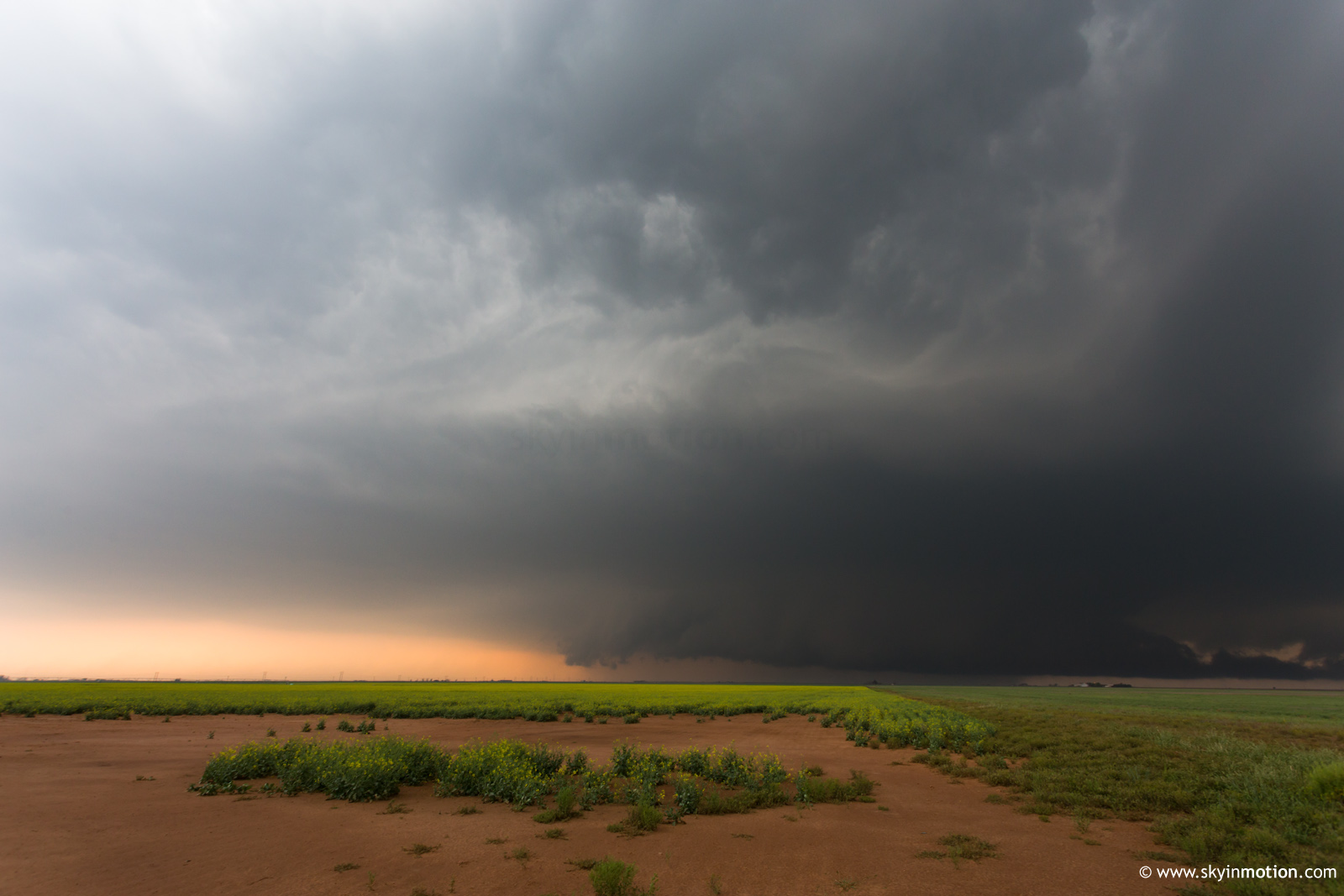
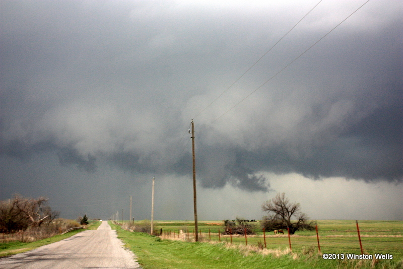
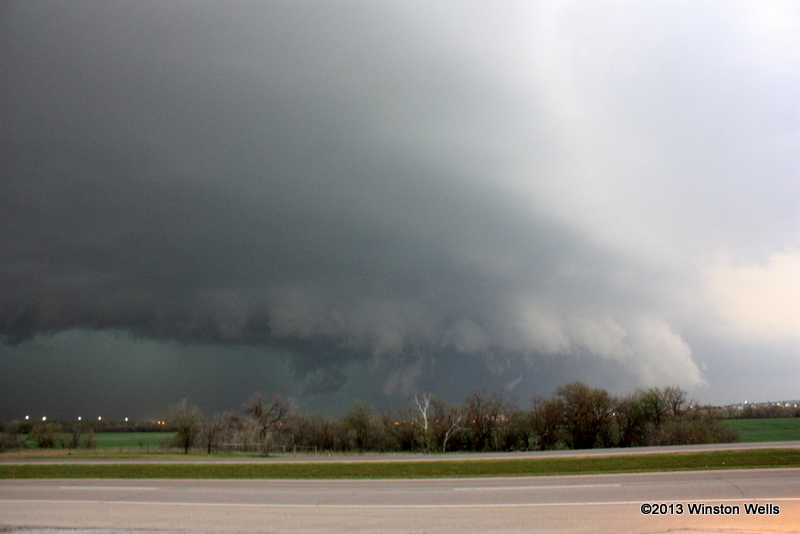
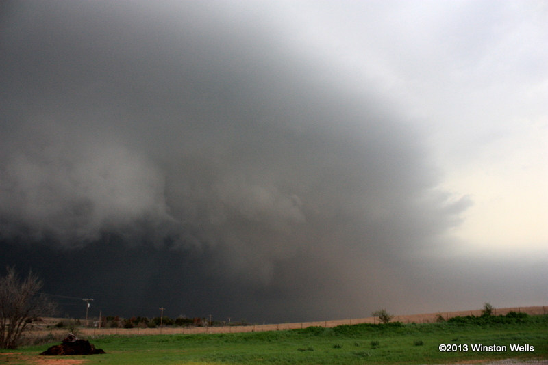
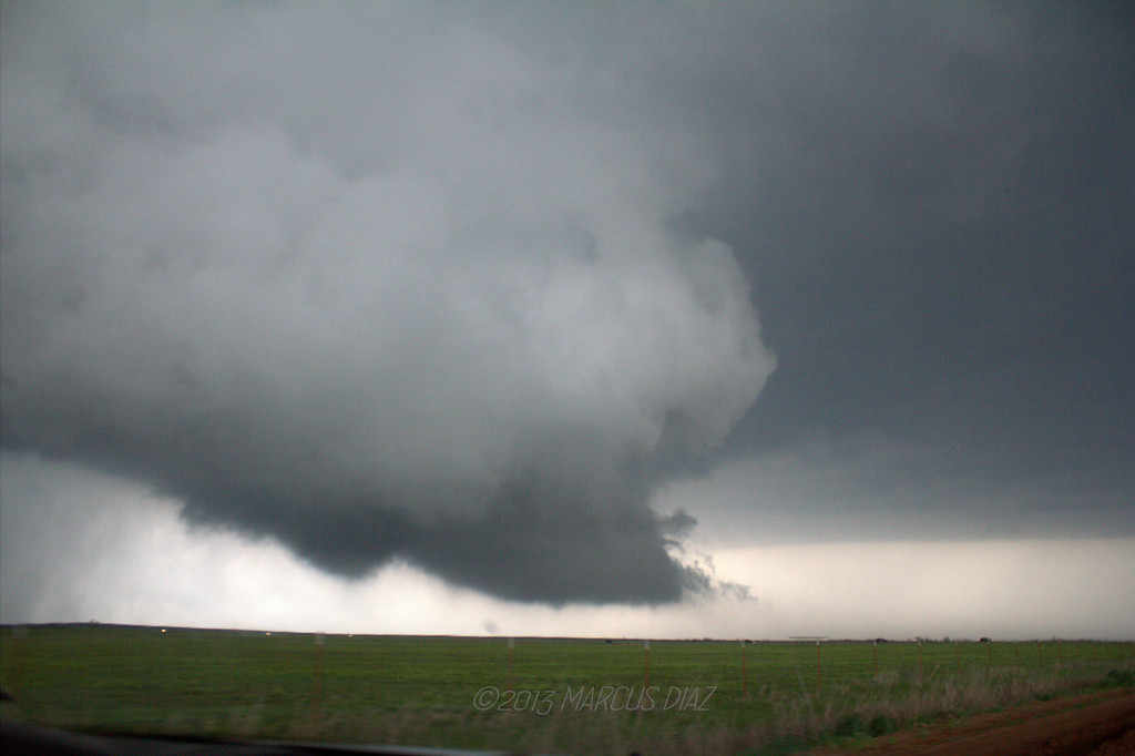
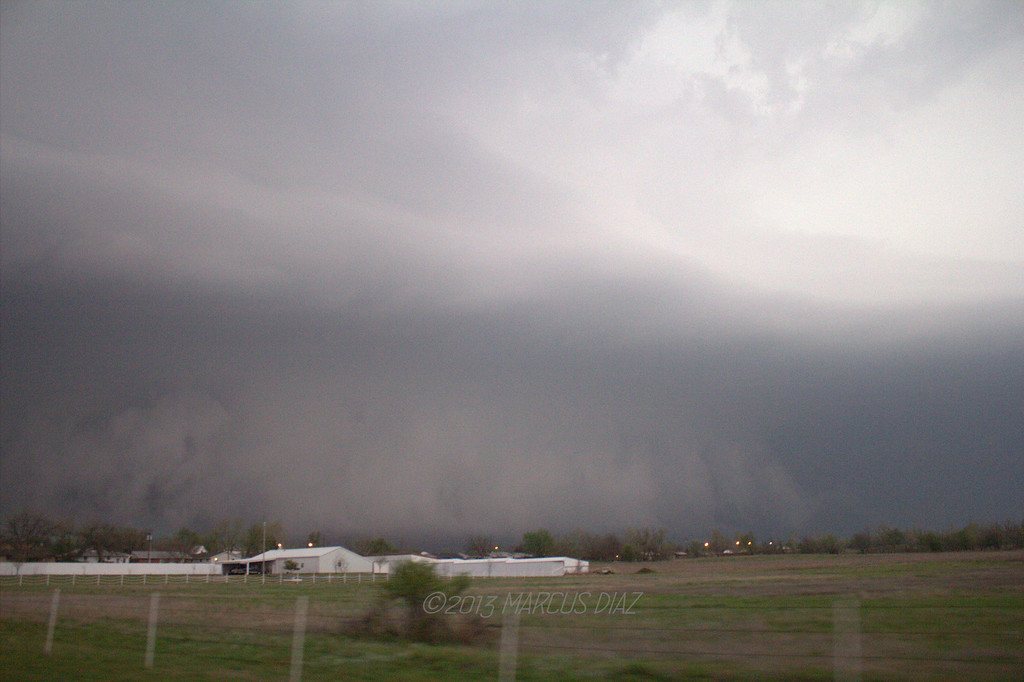
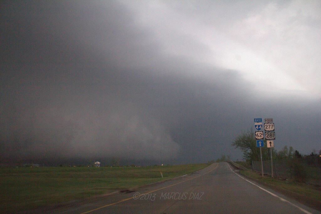
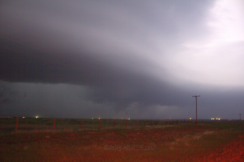
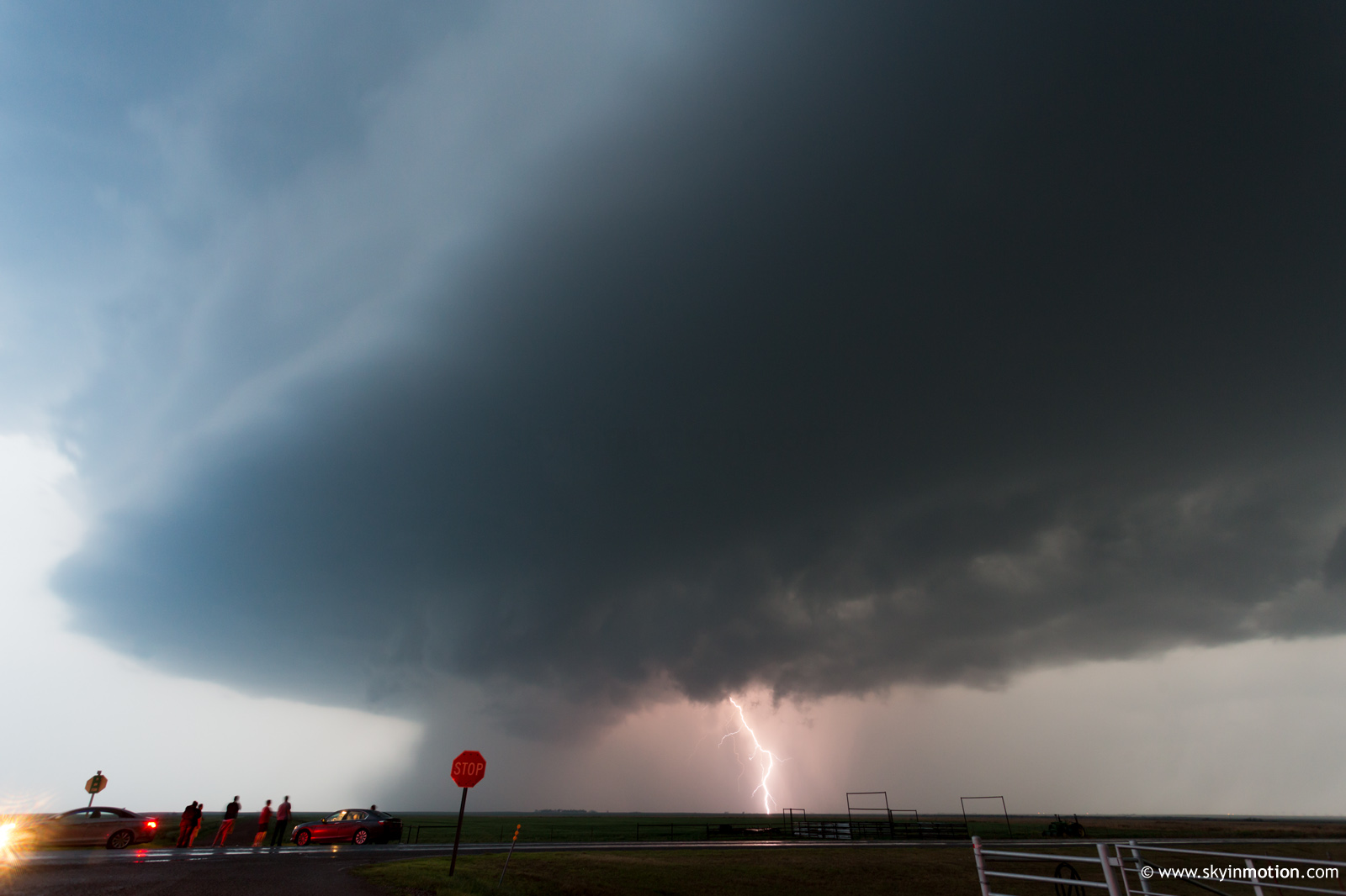
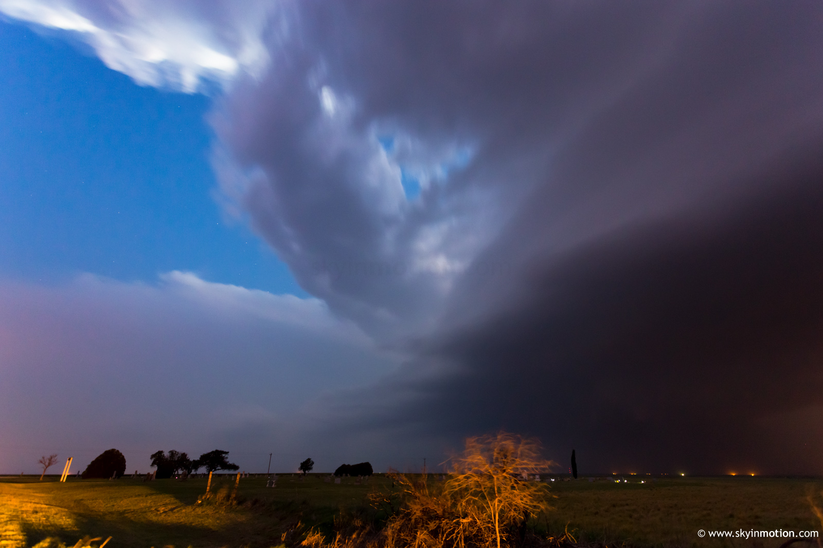
I was one of the first to arrive on the incipient Oklaunion/Davidson/Grandfield supercell as it was first organizing SW of Vernon. Unfortunately, it was quite slow to get its act together, likely owing in part to a merger. By the time it finally ramped up for real, it was bearing down on Oklaunion, and some portion of the hordes had arrived (still nothing compared to the lead storm, of course). Predictably, the storm spawned its only visible daylight tornado right along the Red River. Minutes earlier, chasers had been forced to choose between gambling on the next ~5 min. versus staying in good position for anything later on the OK side, and I wrongly chose the latter. I spent the next 15 min. in torrential rain and sporadic hail near and E of Davidson with others who'd made the same choice. When we finally emerged S of Hollister, a broad lowering was visible, but light was fleeting. I noticed what appeared to be much more distinct updraft structure almost overhead; that, combined with the rain-wrapped nature of the low-level meso, enticed me to blast E and try for the first decent stills of the day. I could never get quite far enough ahead of the behemoth to manage a whole-storm overview.

2013-04-18_0879.jpg


2013-04-18_0893.jpg


I'm sure there will be some good discussions regarding the failure modes for yesterday's potent-looking setup. Frontal position and the potential for undercutting was the foremost concern going into the day, but I don't think it entirely explains the lack of significant tornadoes, especially with the tail-end storm. My bet is on the flow weakness around 700 mb, as well as the veer-back-veer pattern with height there, which was exacerbated by 500 mb flow verifying more meridional than many models had indicated in the medium- and short-range.
 
Hi Marcus, thanks for posting the video. I hate to be the bearer of bad news, but I too was on this same storm but at a different vantage point. What you thought was a tornadic ground-swirl under cloud base rotation was actually, as I confirmed with powerful binoculars, a large female groundhog that was furiously digging out topsoil that had been blown into her den underground by strong outflow winds. I have never seen a groundhog in Oklahoma, much less anywhere else, throw dirt around with so much determination. It made me feel guilty for my lack of housecleaning skills.
Just kidding, Marcus....ith complete respect. OK MODS...whoever is working this piece go ahead and throw my butt in the penalty box...I'm guilty as charged. But I beg of you, please reinstate me prior to the end of May...because that's when I fly into the alley each spring to chase. This'll be my first infraction in quite a while. "All men lead a life of quiet desperation"...."I'm a victim of coicumstances".....yep...that sums it up. joel
 
It's very unlikely that I'll have an meaningfully-different chase report than most folks who chased the supercells SW of LAW yesterday, so I'll keep this short. I left with Howie and Jana during the early afternoon, targeting the southwestern OK portion of the stationary front. Storm were initiating when we left OUN, though they didn't really seem to "do" much before we arrived. Over the course of the next several hours from late afternoon through early evening, we observed the three supercells that traversed the Manitou to Lawton line. Overall, it was pretty "meh", though that's pretty easy to swallow considering our "chase" was only ~2 hours from Norman. We also watched the storm that dropped 2.5" hail near Rush Springs since we wanted to avoid the cores near I44 after sunset. We experienced very minor street flooding near Ninnekah and Chickasha as we took 81 back to I44, but, by the time we got to that area, the flooding wasn't very bad.


This is a variety of the S-shaped hodograph that I dread so much and that the NAM forecast soundings had been showing in the days leading up to the chase; this was the result of a distinct weakness in the 750-800 mb flow (levels that, unfortunately, aren't visible on any of the major model websites since that layer falls in between the "mandatory" levels of 850 mb and 700 mb). In addition, there is evidence of a veer-back-veer vertical profile, though it appears that this "S" had a larger contribution from the relative weakness in the 2-3 km AGL layer. I created this hodograph using data from the Purcell profiler valid 00 UTC 4/18/13 (i.e., yesterday evening) and used a ~25 kt southeasterly sfc wind (pretty common in southwestern OK) and a ~27 kt ENE storm motion. The 250 m and 750 m AGL datapoints weren't plotted for some reason, but they fall along the sfc-500-1000 m arc pretty much anyway. Note that negative SRH in the ~1.5-2.25 km layer. Yuck. Points are plotted every 250 m above the 1 km point.
phoca_thumb_l_041813_00utc_purcell_hodograph.png
 
I played the warm front in central Missouri in the Sedalia-Columbia area. Storms could not root on the boundary due to crossing it at too steep of an angle, and the boundary actually sinking south as a cold front thanks to ongoing storms in northern Missouri. The best sighting of the day was a nice wall cloud, albeit brief, at Sedalia. Photos here: http://stormhighway.com/blog2013/april1713a.shtml
 
Of the two cells that began the day I chose the closest to my position to begin with, which was the northern cell that passed through south of Hobart. After chasing it for a while to the northeast there was no way I could keep up with it so I moved south to the second cell which was the first cell to go through the Fredrick/Lawton area. Then another cell was developing to the west of that one and I chose to move towards it figuring there would be a lot less traffic (I was right). I had a straight shot to the storm on Baseline Rd then it inexplicably turned from paved to dirt/mud road...so I had to wait on it south of Indiahoma. This was the second cell that ended up going through the Lawton area. I then moved north to follow this storm and got into blinding rain on a north/south road south of Elgin so I had to sit and wait for the storm to pass before I could move northward. On the way home, I went through Chickasha and downtown power had been lost and dealt with flooding...somehow I made it through that. Quite an eventful day even though I didn't see any tornadoes.

6xrths.jpg


a0j8eb.jpg


9url2w.jpg


152di11.jpg
 
Drove back and forth all damn day between Fredrick and Lawton. Got on the first significant sup on the west side of Fredrick, and it looked as good as it would look all day for the first half hour, highlighted by a rapidly rotating wall cloud just east of town. Stayed with this storm for 90 minutes, finally bailing south of Sterling to turn back and grab the next sup coming down the same track. Drove back down to Faxon, where we sat in front of a church (for the 2nd time that day) and watched it roll in, much like the first. Followed it ENE along OK36 as we started hearing Jeff Piotrowski reporting the beginnings of a tornado west of Lawton (from our view, we had a messy core). Drove back to 44, jumped northbound, and raced back to OK7 (Lee Blvd), where we turned east. We drove a mile and then stopped in the parking of that giant church on the north side of the road. Looking west, we observed what looked like a fat cone funnel, with cloud tags rotating around it. Scud then formed below the funnel and condensed into what looked suspiciously like a tornado, lasting maybe a minute. Just to the left of this feature, we observed two power flashes inside a heavy precip core. Time stamp was 6:54pm via my vidcam. Sat too long and allowed the storm to get by us to the NE, causing us to miss our shot at the Sterling tornado. Decided to quit at dusk, and while driving home, saw the best looking sup of the day riding along the river, having produced perhaps the most significant tornado of the event (little did we know).

Overall, I guess we did pretty decent considering we were going visual most of the day, which was (at least early on) practically impossible with all the murky haze. Still waiting on details from the Lawton reports, but I've collaborated with a few chasers who had different angles and it's starting to look like we got a brief tornado in town with the power flashes we saw, and perhaps the scud as well.
 
Watched alongside other chase groups at the intersection of highways 65 and 17 in Sterling as a tornado moved to the west of town. SPC cites "numerous reports" on Hwy 17 and local police closed the road after power flashes in the valley to our west. It was too dark at this point (7:30-7:40 p.m. and east of the storm) and everything was rain-wrapped. All we could get was large-scale rotation, scud flying up into the rain-wrap, lights going out in the valley below us, and power flashes. No doubt there was a tornado in there, but I'm wondering if anyone happened to be on 17 west of Sterling and got a better look.
 
Had a very similar experience to Brett, although I was much later to get on that final storm coming out of Vernon. Data loss between Chattanooga and Faxon on OK-36 helped with that. Core punched that final storm from south of Frederick on 183 to east of Davidson on 70. Felt like we were the only ones on that road. Went east in pouring rain for what felt like forever. Stopped almost due south of Hollister and watched for 30 solid minutes, battling continued heavy rain despite being able to see into the rain-free air only a mile or two south of the highway. Never saw a damn thing of that storm when it was producing across the river. Decided not to play the danger game by letting the hook take over me on 70 west of Grandfield, so busted east through town on my way home. I could tell there was some great structure to that storm, but I could never get far enough ahead of it to make it worth it to stop to shoot pics. Barely made it out ahead of the core of it on 44 anyway.

Fun to get out there and navigate, but generally a disappointing chase.
 
921736_564205656933232_1542141905_o.jpg


Jennifer Brindley Ubl and I chased one of the initial cells that formed right on the Red River and chased it east of Lawton where it thoroughly gusted out. Fell back to the next cell in the line and chased that one until dark before calling it. Both cells exhibited terrific structure, but we didn't observe any of the reported bird farts on these cells, except a possible power flash north of Lawton we spotted while perched on a hill just east of town. Not going to count that one though. Also noted the largest chaser convergence I've seen since 2010. 1786 miles for the chase, almost 5000 for the season still no photogenic tornadoes for us. We'll keep trying though!
 
Started the day in Oklaunion. Pretty much danced back and forth between storms. Video is from the first storm ramping up before getting hit by RFD. Sorry for crappy video, Apparently I never adjusted the output setting for HD on my camera.
Watch video >
 
Last edited by a moderator:
I also opted for the warm front play. After briefly messing around with the mid-afternoon cell that tracked north of the front near Cooperton, I intercepted the lead supercell from southwest of Lawton as it approached the city. I took the following photograph and video from SW 82nd St about four miles south of Lee Blvd. The view in both is to the west. The video shows some rotation just as several chasers were reporting a rotating wall cloud on Spotter Network.

EtWqHu2.jpg


I then gradually repositioned a bit north to catch the second cell, eventually stopping in a parking lot at the intersection of Lee Blvd and Brentwood Blvd on the western edge of Lawton. I shot a bit of low-quality dashcam video from this location of the downdraft winds and power flashes as the core moved to the northeast. The view here is just south of due west:


Finally, I moved east with the horde through town on Lee Blvd and out OK-7. The first picture below looks north from OK-7 just east of Lawton; I took the second photo about three miles south of Sterling after turning north on OK-65.
h5hvg9B.jpg


NHDaEBw.jpg


I ended up after dark waiting on US 81 with several other chasers in Rush Springs for the core of the second cell to pass to the northeast before driving north to Chickasha and I-44. While the day was disappointing from a tornadic perspective, it was still a fun chase.
 
I chased these storms SW of Lawton, OK. The first part of the video is the 1st cell near Lawton that went tornado warned. We chased that until it became heavily rain wrapped and went south west to the storm behind it. We witnessed a beautiful wall cloud with this storm that had nice rotation. It put down a very brief spin up. We followed this cell into Lawton when it became tornado warned. We were right behind the tightening wall cloud when RFD started to wrap around it bring a cone funnel beneath it. We then got blasted by a rain curtain and strong winds that took away our visibility. Instead of punching through it, since we saw the funnel we went south and blasted to the east to get back in front of the area. Then we saw power flashes coming from the same area where we saw the cone funnel. Here is the video below....

Watch video >
 
Last edited by a moderator:
Chris Spannagle, Dan Miller, and I chased southwest Oklahoma with marginal success. The Vernon-Frederick-Lawton-Chickasha supercell formed around 1850Z in northeast Foard County, TX along the strong stationary front apparently at the triple point of the elevated dryline. The front was oriented NNE-SSW between Altus and Crowell which allowed the storm to move northeast into the warm sector. We intercepted it just northeast of Frederick, OK. The supercell underwent multiple occlusion cycles during which time the RFD would undercut its weak low-level mesocyclone. A new meso would then form along the RFD gust front back to the southwest during which time the low-level meso would be briefly surface-based and then the cycle would repeat. The supercell evolved into an HP northeast of Lawton and eventually got undercut by the strong, slow-moving cold front as it approached Chickasha.

A review of the RAP analysis soundings between 20-00Z at KLAW revealed very little 0-3km CAPE (weak low-level updraft) in combination with cold-air advection creating the dreaded S-shaped" hodograph (creating retarded stream-wise vorticity and weak storm-relative flow) between ~2 to 3.5 km. The helps explain why the storm was so anemic and messy.

We heard about the tornado reports near Lawton, so we retreated back southwest to catch the second training supercell as it approached the State Highway 17 a few miles west of Sterling, OK. It occluded a mile or two to our west and we later learned NWS Norman received tornado reports, but we didn't see a tornado through the murk. It's possible a brief touchdown could have occurred during the 60-90 seconds we repositioned to the east due to the RFD and rain curtains. I'd like to see some video confirmation though.

We drove home in perhaps the heaviest, blinding, wind-driven, rainfall I've every seen in 25 years of storm chasing between Rush Springs-Chickasha-Blanchard. I recently applied "Rain-X" to my windows and turned the wipers up to full-blast and even that became overwhelmed within 15 minutes. Chris, a Wisconsin native, described the visibility as like a blizzard. I almost hydroplaned off US 81 halfway between Rush Springs and Chickasha due in part to my balding tires. The roadway flooding on US81 got much worse on the south side of Chickasha where curbs retarded roadway run-off. I was forced to drive home at 40-45mph most of the way back to Norman. I'm just thankful we didn't have to drive home on the old twisty, windy, no shoulder Highway 9 between Chickasha-Blanchard like in the old days! Old-Time (pre-1999) Norman chasers know what I'm talking about.

Finally, the City of Norman activated its tornado sirens around ~9:15pm last night for no good reason. The National Weather Service Forecast Office at the Norman Weather Center never issued a tornado warning. I've lived in the Norman 40 of my 44 years and I have yet to figure out the City of Norman's policy for sounding its sirens. There's no rhyme or reason other than someone at the switch got "skeered." I still remember June 12, 2009, when Norman's tornado sirens weren't activated until about 10:40pm, 16 minutes after NWS Norman issued the tornado warning and 10 minutes after the tornado touched down. The sirens were sounded about the time the tornado ended. Meanwhile, they sometime *do* activate for marginally severe or non-severe wind and/or hail. This is all very disappointing considering my hometown located at the severe weather "Mecca" should be the world leader in this regard.
 
As promised, here's more stuff from my chase. We popped out the other side of the cold front near Childress and Quanah. After letting the first storm roll through Vernon, we waited northeast of town for the next storm that was exploding. Finally caught up to it northwest of Davidson and pretty much stayed within the bear's cage the whole time to Lawton. That's where most of my video comes from is from that storm.

This was somewhere northeast of Frederick. This was as close as a storm gets without producing (see the video)

IMG_2912-XL.jpg


Here we came back into Lawton for the next storm, which I believe was the one that hit the Goodyear Plant. Big scary meso over Ft Sill. After we were cored by this, it produced the tornado east of Elgin.

IMG_2954-XL.jpg

IMG_2956-XL.jpg


Here's an interesting pic, and would like to know if anyone can confirm this as a tornado? This was taken just north of Randlett, OK looking northwest. Another chaser said it was a cone tornado that was quickly wrapped in rain. I'd like to know if anyone else has any insight. I took 2 pics that were a good 15 second shutter and this feature was pretty much similar in shape in both pics before it wrapped in rain.

IMG_2976-XL.jpg


And here's the video from that day.

Watch video >
 
I enjoyed the day after coming up empty the day before down near Abilene. I was right under the rapidly developing first storm of the day when it sent out a surge of air that spun up two dust whirls, one of which crossed the road a couple hundred yards ahead of me. This storm was too far behind the front to ever do anything I thought but I stayed with it for a while and took this picture of precepitation and "mountains".


I then got on the next storm and I believe this was the first storm through Lawton. I had powerflashes W of my Location and N of Lawton as I was on interstate but assumed it was outflow wind. On East of lawton this storm devoloped a nasty looking inflow feature appeared to be sucking up dirt out of the fields. No big deal though, hadn't seen anything yet that scared me.


I waited on the next storm just E of Lawton. This was the scary one with a big nasty meso, a boiling mess of clouds and scud reaching out ahead of it. At one point I saw a lot of dust that seemed to be generated from under the meso West of Sterling and assumed their might have been a tornado, but I never layed eyes on it. Let the storm get a bit too far north of me to see into the notch. This was most likely a tornado, but I wonder if sometimes these low mesos don't kick up a lot of dust and even cause damage due to ground level turbulence and small vortices. But then I guess it could be labeled a tornado. I've enjoyed the good natured debate and comments. Everyone wanted to see a good tornado and there weren't many to be found.


I started off around the Edwardsville, IL area, then drifted N as the day went on, eventually meeting up with a Tor warned cell near Mt. Sterling around 8p CST. Witnessed multiple power flashes coming from my NW as I approached the city. Had either a VERY low hanging scud or possible funnel drift across the road in front of us, stopped for about 45 secs to a min to reconfirm position and radar, then continued N again to see a rotating wall cloud and large white cone funnel illuminated by a factory's parking lot lights. We let the storm get away because I didn't want to lose a windshield to the oncoming hail. After that, we drove to Ft. Wayne to set up for our PDS bust in S Indiana the next day.

Watch video >
unedited video. Encounter starts about 3:20. LOTS of swearing, I don't really care about what's on the audio of my dash cam because I usually just speed it up anyways, but I had someone with me who thought it would be a good idea to try and get out and go relieve himself with the storm bearing down on us. I got a good laugh out of it, but that's his last chase with me. Liability factor is just too high with him.
 
Had to redo my images a bit because the files I originally posted got corrupted on the hosting site. Thank god I had them backed up.

Day fell a bit short of what I was hoping because the group I was with was taking things extremely conservatively, but I still got some dang good photos.
dscn2348b.jpg


dscn2352ld.jpg


dscn2366yz.jpg


5cbaac7eec0d4c15a050ad9.jpg


I had to contrast enhance the crap out of that last one. We were sitting south of Lawton on SW 82nd Street watching the supercell move over and I'm pretty sure we caught the start of the tornado because there were power flashes about 1-2 minutes after that was taken.
 
Back
Top