Jeremy Perez
Supporter
Wow--I'm really late posting this. It takes me forever to edit images and video. Click images for larger versions. The full report and more images here: Rozel and Sanford, Kansas, Supercell and Tornadoes - May 18, 2013
This was the third day of a week-long trip to the plains. After car camping for the night, south of McCook Nebraska, I made my way south through Kansas, toward my initial target near the Kansas-Oklahoma border. Skies were clearing the further south I went, and really priming the atmosphere for storms later in the afternoon. As I adjusted back northeastward along the dryline from Ashland towards Greensburg, towers started going up. And then dying...leaving behind a bunch of sad orphan anvils.
The past couple days, I had been working on being conscious of foreground elements to complement the sky in any photographs. It's so easy to see this awesome sky and shoot with a bland, flat foreground that you don't notice how boring it is until later when you're processing images. So: mailboxes, wind turbines, farmsteads, any given stand of trees...I took them where I could get them. (Doesn't mean my heat-of-the-moment tornado & funnel photos always benefited from decent composition.)
Convection along the dryline (2052Z)

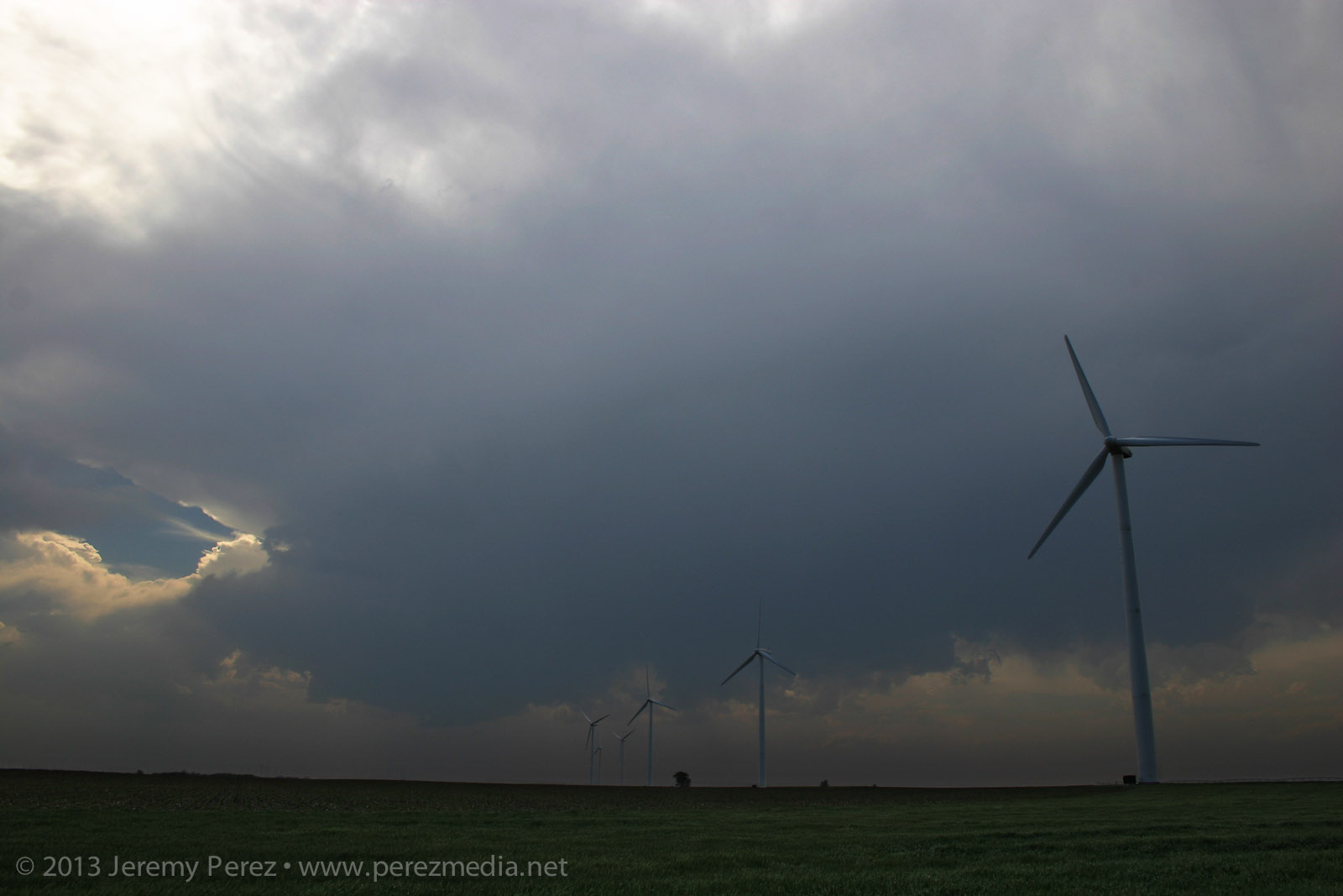
Finally a cell managed to outwit the cap near Spearville and the chase was on.
Developing supercell near Spearville, Kansas (2205Z)

As I made my way east of Kinsley, the cell started to get rooted into the boundary layer. And now we finally had a nice looking supercell with structure that really started to beef up. It had a bit of the mothership flavor to it. The way I see it, this is a Star Trek (The Next Generation) model dropping down out of the clouds. And because after the J. J. Abrams' reboot, Federation Starships goof around in the atmosphere these days like it weren't nothin' but a thing.
Panorama of the supercell near Offerle, Kansas (2310-2318Z)

I was working the dirt farm roads as much as possible, which turned out pretty nice as long as I was paralleling the storms. (I didn't get too comfy with those roads though when things were more inbound.) As I was driving north on 50th Avenue, about 4 miles west of Kinsley, I was surprised to see a little shear funnel up in the vault. It was very persistent and lasted several minutes.
Shear funnel in the vault (2326Z)

RFD was making various attempts at nudging into the base when another cell popped up and started encroaching from the south. I wasn't sure if it was going to wreck the leading cell or which base to focus on. So I split the difference and got a bit behind the lead cell I was originally pacing.
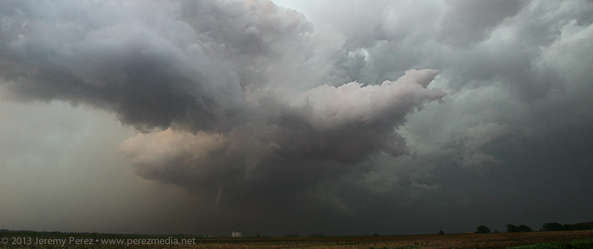
Cell merger under way (2345Z)

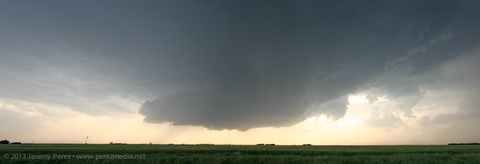
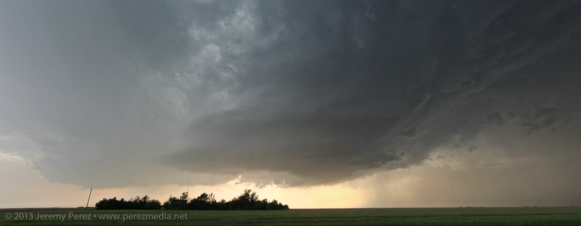
The lead cell ended up eating the trailing cell, and then it really took off. The RFD started making a major push and digging a deep pocket into the rain free base. Rotation started ramping up behind the clear slot and it was looking pretty imminent.
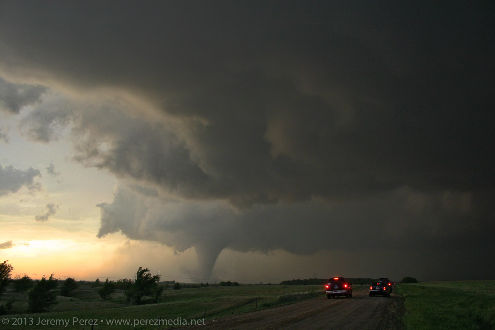
Rotating wall cloud south of Rozel, Kansas (0021Z)

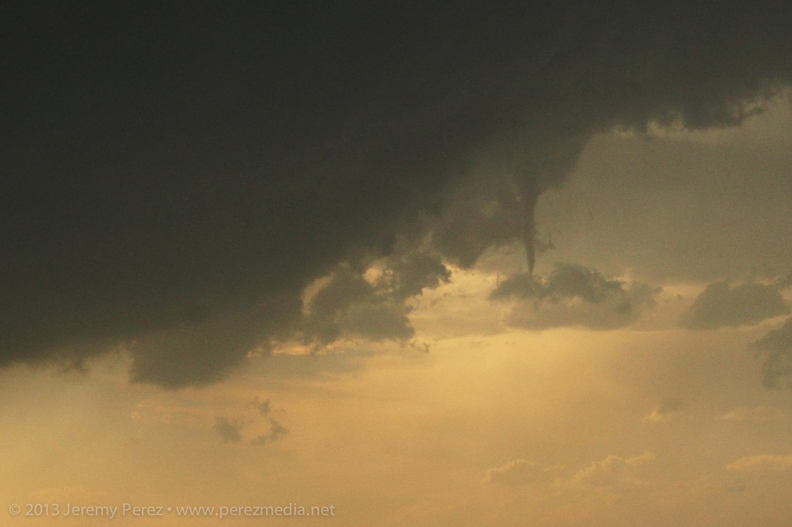
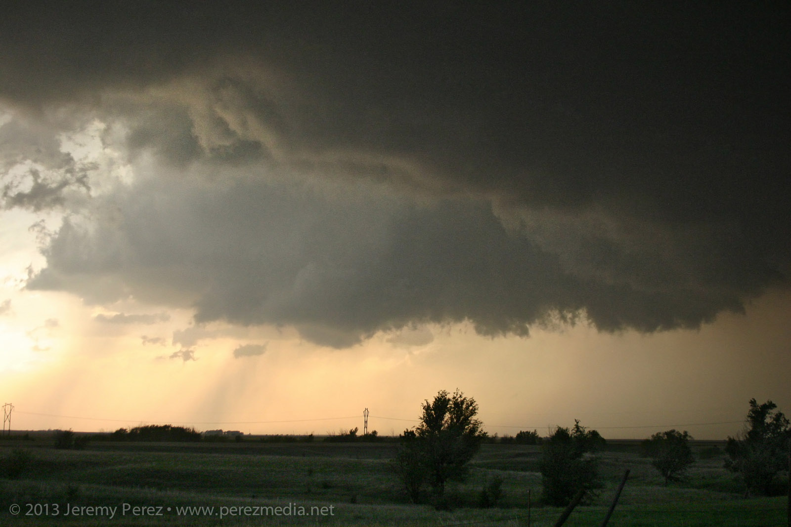
About 5 miles southwest of Rozel, it started winding up a funnel that gradually made its way to the ground and grew into a sturdy, long-lived tornado spinning away behind a remarkably clear RFD slot.
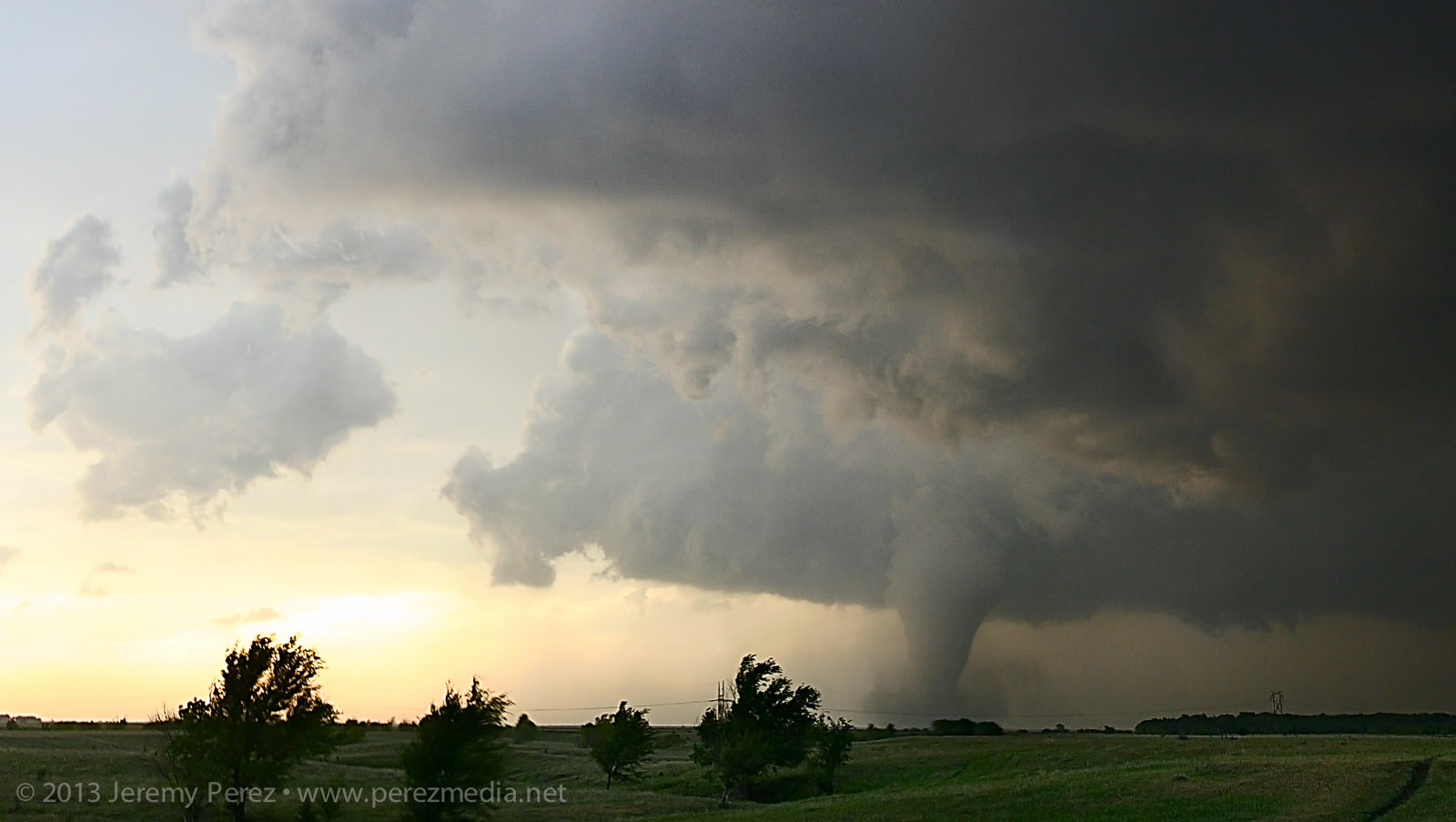
Developing condensation funnel (0025Z)

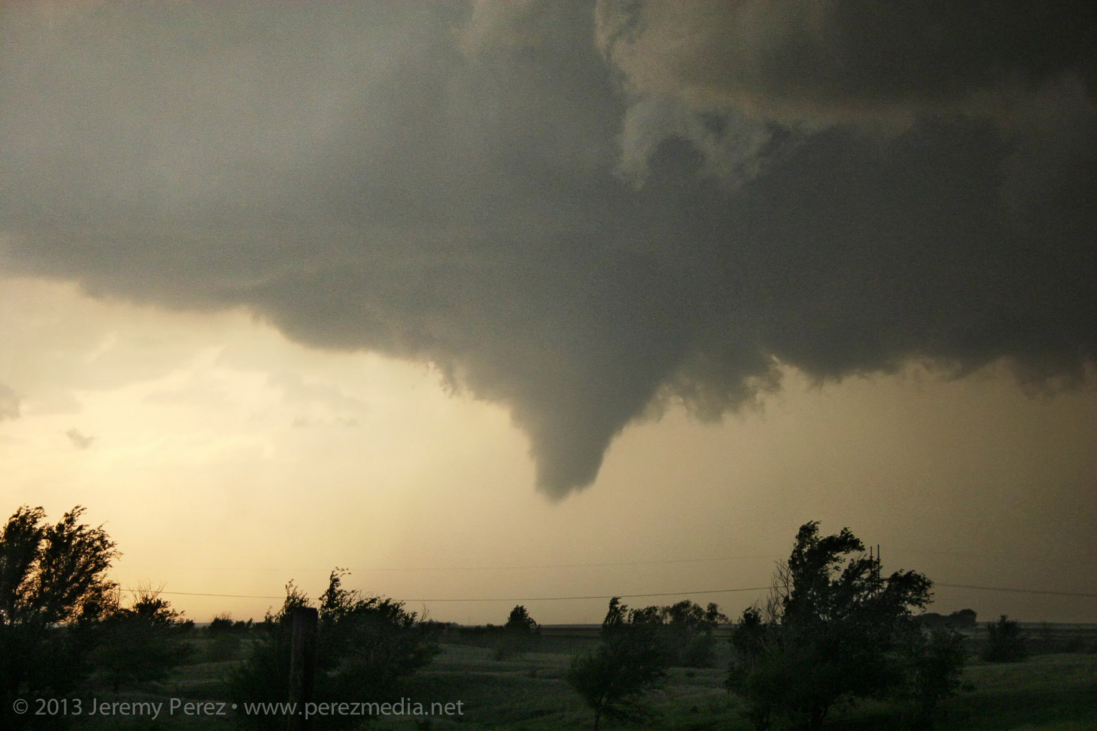
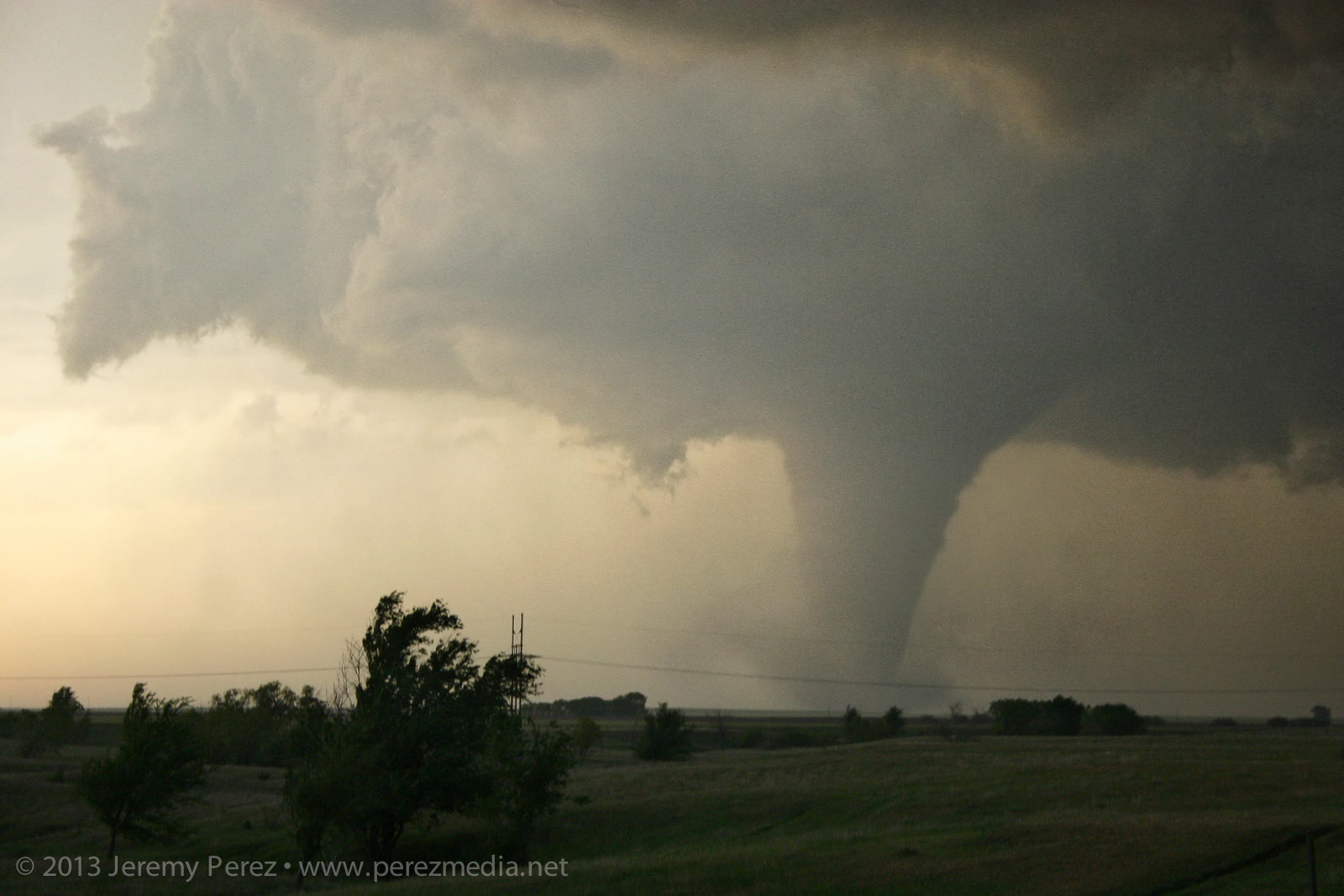
Rozel tornado (0032-0033Z)


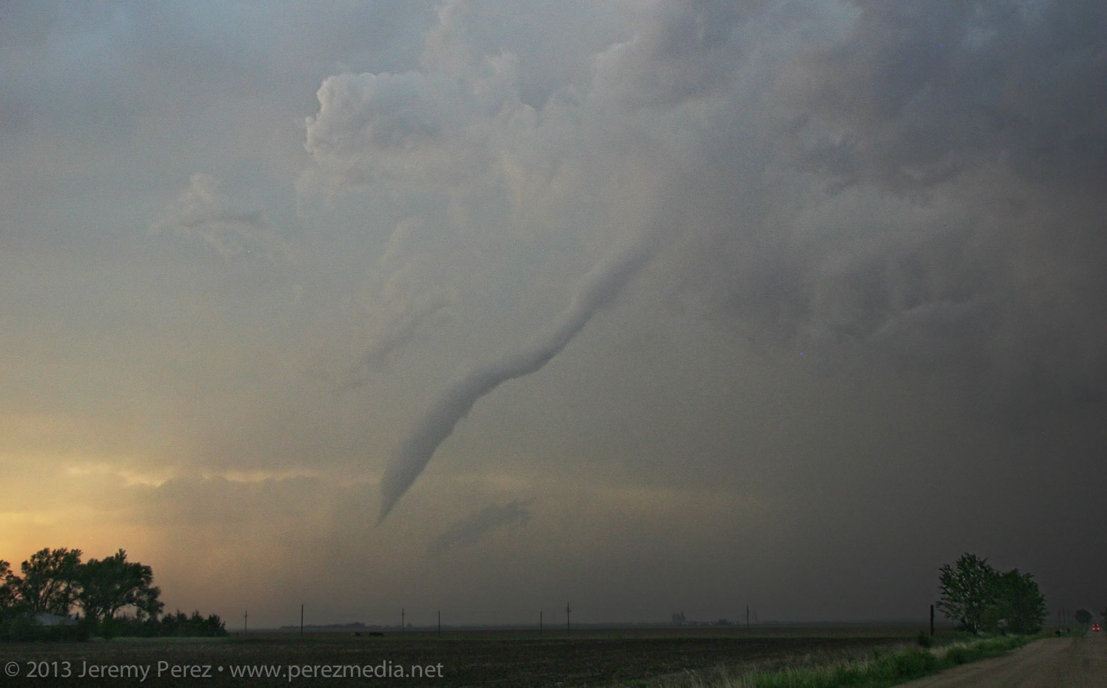
After photographing and filming it for several minutes, it started to dissipate. So, I moved up to keep pace, and noticed a new funnel condensing and then roping back out. This was actually still the original circulation, which was apparently still on the ground, and more of a last, condensational hurrah.
Rozel tornado ropes out (0050Z)

I made my way further east on L Road, another hefty funnel appeared to my northeast, near Sanford. Light was starting to fade and it was backed by its forward flank. So contrast was low, and camera noise was high. I sampled some frames from the video where lightning helped silhouette the tornado. It was interesting to watch the axis of the tornado move counterclockwise around the larger meso circulation. So it was drifting westward for a while before running its cycloid pattern back eastward.
Sanford tornado (0102-0104Z)


Sanford tornado panorama (0107Z)

It eventually started to rope out and bend back way to the west, lit by purple, turquoise and orange twilight colors. There's so much going on—I wish I'd have popped the camera on a tripod and gotten a decent low-ISO exposure. As it is, still lots of high-ISO noise so I could go hand-held.
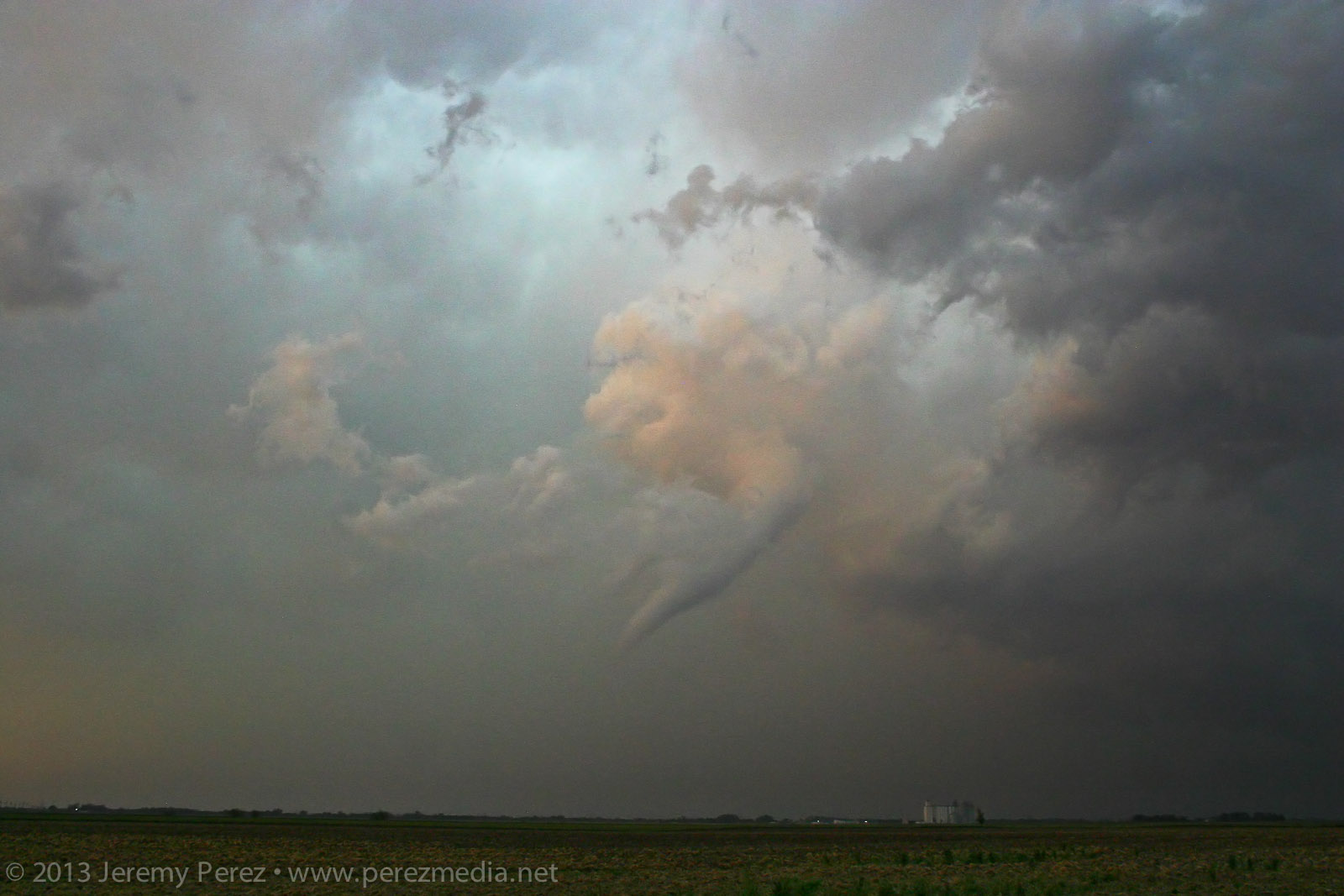
Weakening tornadic funnel drifts west of Sanford, Kansas (0110Z)

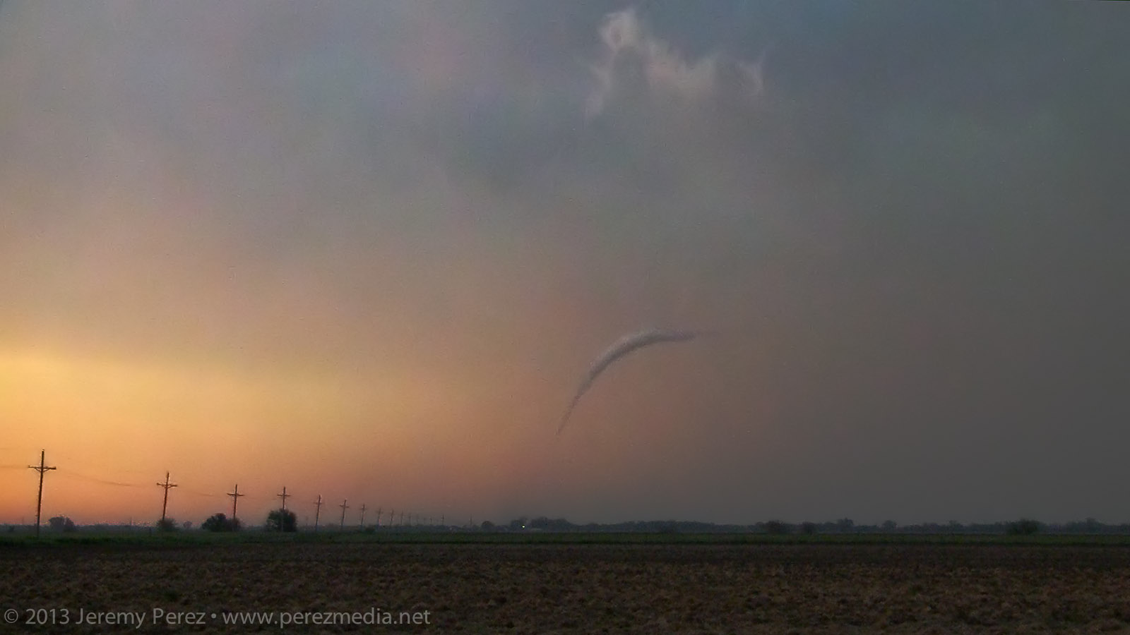
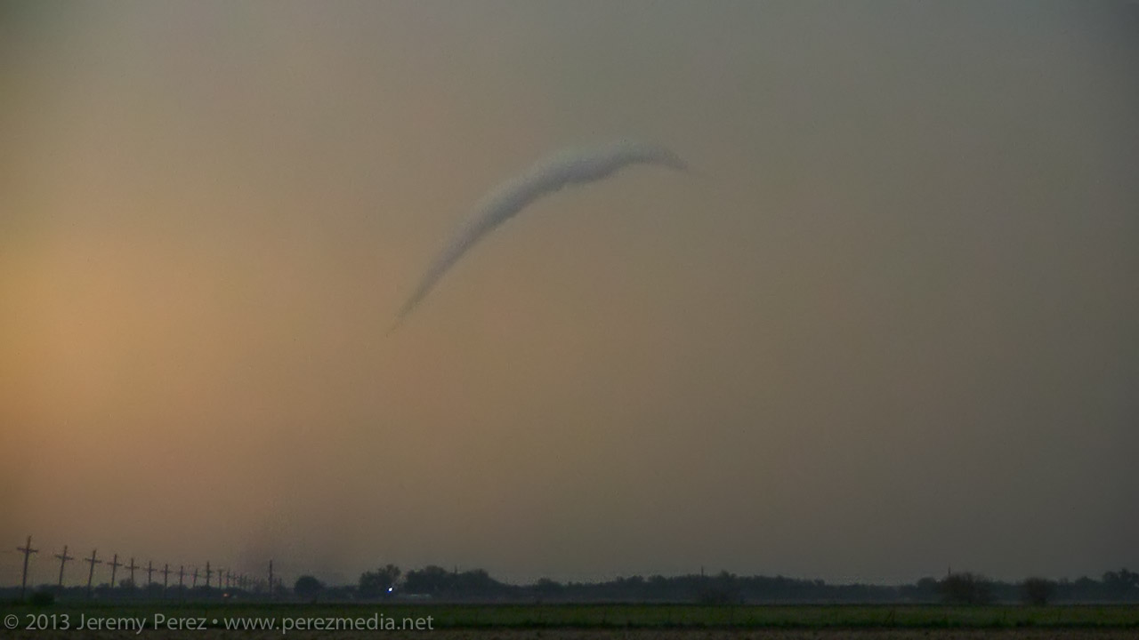
Just when I thought it was done, this floating earthworm of a funnel suddenly popped into view, off to the northwest. Just this cool little disembodied funnel twisting around, way west of its parent storm. Circulation was still on the ground as it drifted westward before finally winking out.
Sanford tornado ropeout


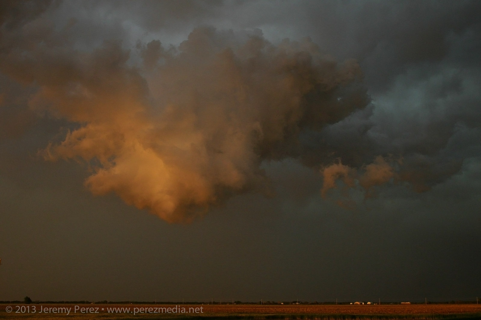
Sunset cloudscape over Sanford, Kansas

Although some farm buildings were damaged by the tornadoes, there were thankfully no injuries. It was an amazing spectacle. Slow storm speeds. Clear RFD. Incredible structure and an assortment of tornado morphologies. If only the next two days had worked out that way...
Chase video
Go to 02:12 to skip graphics and discussion of the meteorological setup.
Watch video >
This was the third day of a week-long trip to the plains. After car camping for the night, south of McCook Nebraska, I made my way south through Kansas, toward my initial target near the Kansas-Oklahoma border. Skies were clearing the further south I went, and really priming the atmosphere for storms later in the afternoon. As I adjusted back northeastward along the dryline from Ashland towards Greensburg, towers started going up. And then dying...leaving behind a bunch of sad orphan anvils.
The past couple days, I had been working on being conscious of foreground elements to complement the sky in any photographs. It's so easy to see this awesome sky and shoot with a bland, flat foreground that you don't notice how boring it is until later when you're processing images. So: mailboxes, wind turbines, farmsteads, any given stand of trees...I took them where I could get them. (Doesn't mean my heat-of-the-moment tornado & funnel photos always benefited from decent composition.)
Convection along the dryline (2052Z)
Finally a cell managed to outwit the cap near Spearville and the chase was on.
Developing supercell near Spearville, Kansas (2205Z)
As I made my way east of Kinsley, the cell started to get rooted into the boundary layer. And now we finally had a nice looking supercell with structure that really started to beef up. It had a bit of the mothership flavor to it. The way I see it, this is a Star Trek (The Next Generation) model dropping down out of the clouds. And because after the J. J. Abrams' reboot, Federation Starships goof around in the atmosphere these days like it weren't nothin' but a thing.
Panorama of the supercell near Offerle, Kansas (2310-2318Z)
I was working the dirt farm roads as much as possible, which turned out pretty nice as long as I was paralleling the storms. (I didn't get too comfy with those roads though when things were more inbound.) As I was driving north on 50th Avenue, about 4 miles west of Kinsley, I was surprised to see a little shear funnel up in the vault. It was very persistent and lasted several minutes.
Shear funnel in the vault (2326Z)
RFD was making various attempts at nudging into the base when another cell popped up and started encroaching from the south. I wasn't sure if it was going to wreck the leading cell or which base to focus on. So I split the difference and got a bit behind the lead cell I was originally pacing.
Cell merger under way (2345Z)
The lead cell ended up eating the trailing cell, and then it really took off. The RFD started making a major push and digging a deep pocket into the rain free base. Rotation started ramping up behind the clear slot and it was looking pretty imminent.
Rotating wall cloud south of Rozel, Kansas (0021Z)
About 5 miles southwest of Rozel, it started winding up a funnel that gradually made its way to the ground and grew into a sturdy, long-lived tornado spinning away behind a remarkably clear RFD slot.
Developing condensation funnel (0025Z)
Rozel tornado (0032-0033Z)
After photographing and filming it for several minutes, it started to dissipate. So, I moved up to keep pace, and noticed a new funnel condensing and then roping back out. This was actually still the original circulation, which was apparently still on the ground, and more of a last, condensational hurrah.
Rozel tornado ropes out (0050Z)
I made my way further east on L Road, another hefty funnel appeared to my northeast, near Sanford. Light was starting to fade and it was backed by its forward flank. So contrast was low, and camera noise was high. I sampled some frames from the video where lightning helped silhouette the tornado. It was interesting to watch the axis of the tornado move counterclockwise around the larger meso circulation. So it was drifting westward for a while before running its cycloid pattern back eastward.
Sanford tornado (0102-0104Z)


Sanford tornado panorama (0107Z)
It eventually started to rope out and bend back way to the west, lit by purple, turquoise and orange twilight colors. There's so much going on—I wish I'd have popped the camera on a tripod and gotten a decent low-ISO exposure. As it is, still lots of high-ISO noise so I could go hand-held.
Weakening tornadic funnel drifts west of Sanford, Kansas (0110Z)
Just when I thought it was done, this floating earthworm of a funnel suddenly popped into view, off to the northwest. Just this cool little disembodied funnel twisting around, way west of its parent storm. Circulation was still on the ground as it drifted westward before finally winking out.
Sanford tornado ropeout
Sunset cloudscape over Sanford, Kansas
Although some farm buildings were damaged by the tornadoes, there were thankfully no injuries. It was an amazing spectacle. Slow storm speeds. Clear RFD. Incredible structure and an assortment of tornado morphologies. If only the next two days had worked out that way...
Chase video
Go to 02:12 to skip graphics and discussion of the meteorological setup.
Watch video >


