12/19/06 - 12/22/06 FCST: NM / TX / OK / KS / CO / NE / SD / IA (WINTER PRECIP)

Joined
Feb 28, 2004
Messages
202
Location
Newport Beach, CA
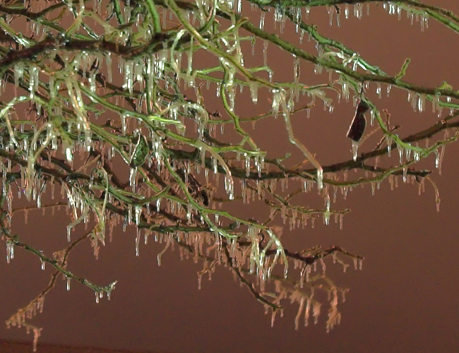
Winter Storm Watches have been posted for the Northern 2/3 of New Mexico in preparation for what, according to ABQ NWS, could be the most signifcant winter storm of the last several years.

Dynamics appear to be coming together to support a tremendous upslope snow event across favored areas (Eastern slopes) of the Jemez Mtns and Sangre De Cristo range. 2 feet+ of snow is currently being forecast between Monday night and Wednesday.

MAV guidance points to an all out Easterly flow assault on Northern New Mexico starting Monday night. 40-50mph sustained flow forecast on the lee side of the Central mtn chain.

I just moved from New Mexico, having lived in Los Alamos for 3 years. Los Alamos, located at 7400ft on the East side of the Jemez mtns, is in one of the most favored areas of upslope snow events. Should be interesting to watch this one unfold.

Los Alamos avg yrly snowfall is 60 inches. Winter of 05-06 saw only 4 inches! This storm, barring its effect on holiday travel, is certainly welcome news for local reservoirs.

Great link to multiple weather stations in favored upslope area:
http://www.weather.lanl.gov/
 
Unfortunately there is a warm layer hovering above most of the Texas Panhandle as evident on this mornings soundings. Looks like Amarillo and surrounding areas are in for a major ice storm with 1/2"-3/4" total ice by Wednesday morning. I am sure places like Raton pass along I-25 will be closed with 18-24 inches of powder (and the ski lodges shall rejoice!!) but anything SE of Dalhart will be a skating rink by Tuesday night. Further SE off the Caprock towards Childress it should remain liquid. I am really worried about the trees and powerlines in amarillo. This is alot like the january 29th,1999 ice storm that left places like Panhandle without power for a week and parts of amarillo dark for 2 days.
 
Last edited by a moderator:
Should be a mess across much of Southwest KS... QPF totals from the NAM and GFS are impressive with most of the precip along/west of Dodge City-Hays being ice of some fashion... mainly freezing rain in areas like Garden City-Dodge City up towards Wakeeney... then more of a sleet scenario west of there until you get closer to the Colorado border where it will finally change over to mostly snow. I'll be "blogging" this event on my website at www.underthemeso.com/blog focusing primarily on the SW KS aspect of this interesting winter storm.
 
My earlier suspicions have been confirmed. After the GFS and NAM-WRF swung away from a significant snowstorm yesterday, they have now realigned with the other models, and all are predicting a minimum 24 hour period of tremendous dynamics combined with abundant Gulf moisture to produce a heavy, wet, wind driven snow, unusual for this time of year but not unexpected given the recent springlike warmth.
It now appears that a powerful blizzard is going to strike eastern CO beginning tomorrow morning as the surface low moves out of northern NM and intensifies as surface cyclogenesis occurs over southwestern KS. The storm will peak in intensity overnight tomorrow and finally end midday Thursday. At this point it looks like my earlier snow total hunch is going to verify, as 8-16" of snow is forecast for the plains east of the I-25 Corridor.:)
The Front Range snow totals are a little more uncertain due to downsloping issues, however I still think a good 5-10" snowfall is likely there, with higher totals in both areas if the storm slows down at all or the winds are more easterly than currently forecast.
Visibilities and drifting are going to be a very significant concern with this system, as north/northwesterly winds of 20 to 35 mph with gusts to 50 mph are expected as the surface low intensifies. I frankly would not be surprised to see parts of eastern CO put under a Blizzard Watch later today or tonight. Travel will be difficult along the Front Range, and will likely become impossible late Wednesday afternoon through the nighttime hours and into Thursday morning east of the I-25 Corridor.
This storm is great news for the fact that not only are we going to get much needed moisture out of this storm, but with forecast daytime maximums remaining in the mid 30's up until Monday, this means we are going to have a VERY white Christmas this year! :D
Since Mike is covering Kansas, I'll continue to keep y'all up to date on what's going down in eastern Colorado.
If Tony L. or Chris R. show up in this thread at some point or another (which I know they will, eventually) I'll let them handle the Front Range aspects of this storm.
 
Mark, looks like the first thing I've seen you get right in a winter thread all year is either Chris or I chiming in on this storm! LOL Actually dude, you'll probably hit this one pretty well.

I won't hide my concern over the downsloping component which has been the number one 'if' this entire time. However, the models have slowed this system down enough where one has to take notice now. Winter Storm Watches have been issued along the Front Range where none were yesterday. My forecast as of this morning is sitting at 4-8" in the Denver area with higher amounts possible in orographically favored areas.

The models are pushing the low along the CO/NM border before swinging it northeast through Kansas which is in a much better position for Front Range snow. Good moisture wrapping around the low will feed into the upslope flow and help produce good amounts of snow.

The next issue is speed of this system. The models have trended this storm to be slower in its movement over the last couple of days. As of now, synoptic scale ingredients and orographics will lead to a period of about 10 to 12 hours of good snow potential before the system moves northeast of the region. Snow should begin falling lightly through tomorrow morning before the main punch arrives. I would anticipate the heavier snow falling through the day tomorrow and into tomorrow evening before the storm starts to move on. However, local orographics and ample moisture should at least keep light snow amounts going through Thursday.

As for the winds, mid-level winds are still being hinted at coming from a NW direction. This will hamper heavier snow to an extent, however, the placement of the 500mb low will keep a good, strong upslope flow going up there. Surface winds should be coming out of a generally eastly direction as the low moves somewhere along the CO/NM border. The winds should start to swing in a more favorable direction later tonight into tomorrow morning which will obviously coincide with the heavier snowfall potential.

Again, current thinking of 4-8" for the Metro area seems resonable given the current model output. Will see how the trends continue or change through tonight and into tomorrow to see how this will unfold.
 
Winter Storm Warnings now posted for the Front Range including the Denver-area for upwards of 20 inches of snow. A very quick turn-around from yesterday where it looked as if the area would fall victim to downsloping westerly winds. I'm still not 100% sold on Metro-area total just yet, but the way the models are trending this storm for us, it could get very interesting. The duration of this event which is getting longer as the storm slows will play a huge role in all of this. We shall see! I'm going to work down at KMGH - Channel 7 tomorrow morning before my evening shift at work to help with storm coverage.
 
Boy, did I ever nail this one on the head. It seems with every passing hour the forecasts for this storm get crazier. Blizzard warnings are now in effect for all of the Nebraska Panhandle/southeastern Wyoming/far northeastern CO. One to two feet of snow is expected, with 20-35 mph sustained north/northwesterly winds and gusts to 50 mph will create drifts of THREE TO SIX FEET across the region.:eek: This storm is going to be absolutely massive, it looks like travel is going to become impossible tomorrow anywhere in an area encompassed by Rapid City and Amarillo in the north and south and Denver and Omaha in the east and west. The Boulder, Cheyenne, Goodland and North Platte WFO's are not recommending any travel in their respective warning areas from Wednesday morning until Thursday afternoon due to the potential for whiteout conditions and significant drifting.
Blizzard conditions will persist across these areas until at least midday Thursday, if not late Thursday afternoon given how much the models are slowing this system with each consecutive run.
Given the potential for widespread 12" to 24" accumlations of wet, heavy snow in combination with the raging winds, this storm is going to paralyze the High Plains for at least two days, if not three. Primary roads are likely to be impassable until late Thursday afternoon/Thursday night, and some secondary roads may not get plowed until Friday or Saturday. Power outages seem almost certain, and some families in the most rural locals might not have power back until after Christmas.
I think this is going to be one of the fiercest blizzards we've seen in many, many years on the High Plains. At our farm, the pantry has enough food to last through a nuclear winter, the generator's been pulled out of the shed, gassed up and placed beside the house, and we have lots of extra blankets and flashlights. It's been a long time since we've had a storm like this, and we're ready for it.
 
This thread has been well represented by those in CO and KS so I figured I'd chime in from south-central NE, where precip type is a major question mark starting during the overnight hours into tommorrow.

Here in Hastings, as of 0z I am officially in an Ice Storm Warning for later tonight/tommorrow. However, the Ice Storm Warning only includes 5 counties in south central NE, and is only 2 tiers of counties across. The western and eastern sides are bordered by a Winter Storm Warning (ice + snow potential) and Freezing Rain Advisory, respectively. Needless to say, pinning down the ice potential is tricky with this system

The 23z ob here in HSI was 42/8 which yields an approximate surface wet bulb temp of 30 as depicted by SPC mesoanalysis graphics. All model soundings from earlier today (12 and 18z runs) are showing a very close call with the freezing mark at the surface...but these kind of T/Td depressions imply that evaporative cooling could play a definite role here. At any rate, gonna be very interesting to see if the relatively small Ice Storm Warning verifies for this area versus the other headlines just to the east and west.
 
In Amarillo we continue to experience moderate freezing rain with thunder and lightning. A large area of moderate storms is exploding to the SW of amarillo. The ground is still warm enough that the streets are just now starting to glaze but the trees, bridges, and powerlines are really taking a hit. A number of small towns around the panhandle are without power and Amarillo Fire dept is now responding to numerous "powerlines down" calls. WAA has actually made the temps go up to right at freezing the past few hrs even though the sun has gone down.

I-40 from Amarillo to Tuccumcari is now closed until tomorrow morning at the earliest. Still not expecting the change over to snow until after midnight which gives us another 4 hrs of ice. Atter that I expect 4-6 inches of snow in Amarillo

Latest Meso discussion from SPC shows icing rates of 0.1" per hour for the next 6 hrs. With the 1/4 to 1/2 inch we have already that will make around an inch of ice then covered with 1/2 ft of snow..
 
Last edited by a moderator:
Interesting report Jay, thanks... yeah, that kind of ice "carnage" is creeping well into far southwest KS now... with major accumulations of ice occuring now as far northeast as Garden City... Here in Dodge, we are sitting at 30-31F with a large area of rain taking aim... how long will we sit at 30F? That's the huge question for here in Dodge... I would expect us to creep up to 32-33 degrees by around 3am or so? Fun event!
 
One thing I was surprised at during the STL event was how efficiently the ice accreted even with temps hovering at 32F for most of the event. I had always assumed the colder the sfc temps were, the better - but it can crank out the icing even at the borderline 32.

The thundersnow and 'thundersleet' (and 'thunder-freezing rain') component of this storm is pretty amazing. The NDLN is lit up from NM into the OK panhandle, according to obs, most of it being in some form of frozen precip.

Just as fun to watch as a severe weather outbreak.
 
Here in the Lubbock area and south and east of Lubbock we haven't switched over to freezing rain/snow yet. There has been quite a bit of thunder from time to time, and a darn nice graupel dump that lasted about 10 minutes and coated thing to about 1/4 inch (it melted after that). It was nice and loud coming down though. It's 33 here at the house now...I suspect things will begin freezing in the next hour or so....currently raining moderately.

EDIT: 20 minutes after posting that we now have about half inch of VERY WET snow on the ground!
 
Last edited by a moderator:
Tornadoes Possible?

I've had my eye on this shortwave for a while and I think there is the slightest possibility of a small cold-core supercell and maybe a few weak tornadoes-event for the OK-KS border near Buffalo, OK.

The NAM is not forecasting CAPE, and I think the GFS is forecasting ~200 ML CAPE, but with the intense dynamics at play and steep lapse rates there may be a very small area of 500 J/kg of SBCAPE along a frontal boundary with upper 40 dewpoints.

You have to realize there will be intense vorticity advection with height combined with 500mb temps near minus 28 deg C and surface dewpoints possibly near 48 deg F and if a dry slot develops over the forecasted occluded boundary near the OK-KS border there may be a 2-hour window for a few very small supercells and possible weak tornadoes. Biggest destroyer of this scenario is the 'possible dry slot', because the dynamics mentioned there is a very high possibility there will not be a dry slot.
 
I'm not positive about how much snow fell in Los Alamos but I know that in White Rock the storm has been by most definitions a disappointment. So far grand total from this storm we have about an inch of snow on the ground, its still currently snowing lightly but it doesn't appear like it will pick up and drop the 2' that was once predicted.
 
One thing I was surprised at during the STL event was how efficiently the ice accreted even with temps hovering at 32F for most of the event. I had always assumed the colder the sfc temps were, the better - but it can crank out the icing even at the borderline 32.

We were hovering right at 32F here in Dodge City all night... this is the result.. up to 1/8" of ice accum on trees:

entry_20061220_2.jpg
 
Back
Top