• A friendly and periodic reminder of the rules we use for fostering high SNR and quality conversation and interaction at Stormtrack: Forum rules

    P.S. - Nothing specific happened to prompt this message! No one is in trouble, there are no flame wars in effect, nor any inappropriate conversation ongoing. This is being posted sitewide as a casual refresher.

09/13/2018 - Hurricane Florence

Joined
Jan 14, 2011
Messages
3,104
Location
St. Louis
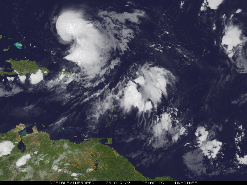
Figured it's past time to get this thread going for possibly the first major hurricane landfall in the Carolinas in 22 years.

A few notes regarding chasing in these areas:

Pros:

- a Wimington landfall would make chasing much easier as this is a large metro area with plenty of available shelter.

- No major bridges are necessary to reach the coast in the Wilmington area, meaning the chances of getting in/out are better.

- Morehead City to Myrtle Beach are fairly urbanized with a lot of road access and infrastructure, making for a large target area for shifts in the storm's track.

Cons:

- Landfall timing could be close to or after sunset.

- The Carolinas are notorious for tall trees that are long enough to block even major highways and interstates when they fall. Expect all routes out of the area, including those very far inland, to be blocked by trees for possibly a day or two after landfall.

As always, if you plan to chase Florence, please be aware of the planning and safety issues that come along with chasing a strong hurricane. This is not a tornado chase. Many things can go wrong and put you in peril, especially if you do not prepare. A general rule is at least 5 days of food and water per person and at least one extra tank of gas in cans (stored and safely secured outside of the vehicle).

If you have never chased a hurricane before, I would not recommend a major for your first one.

In any case, Chris Collura's primer on hurricane chasing is required reading:

https://stormtrack.org/community/threads/hurricane-chasing.5851/
 
I will be departing Tuesday evening for North Carolina to document this one with some others from Illinois here.... We did Irma last year and I’m expecting this to be worse in regards to storm surge and flooding. As Dan mentioned above, Wilmington area would be the easiest target for this one, but being several days out it’s impossible to nail a specific area. The outer banks will be off limits and I’m sure the bridges to those areas will be closed down once winds reach tropical storm force.

We are going to arrive fairly early to scope things out and get some shelter and a place to stay. I’d recommend anyone heading out to pack some non-parishables ahead of time and stock up on a couple gas cans worth of fuel. Fuel and food will be very difficult to come by once it gets close to crunch time from my experience. I hope everyone will remain safe and I hope the forecast isn’t as bad as it looks for the sake of the people that live there. It’s easy to get caught up in the adrenaline of storm chasing and forget that these events have huge implications for residents....even well after the storm passes. So I hope for the best in that regard. Be safe and best wishes to anyone that heads out.
 
Dan made some very good notes. Here are my issues:

1: You must be in the "on shore" winds sector if waves and surge is your goal. I ended up in offshore winds during Isabel and it sucked eggs. I believe the only location for an intercept is possibly Wilmington unless you want to be inland (boring). Wilmington is a really small target given the low end model accuracy this far out. My gut feeling is that Wilmington will end-up in offshore winds. Most hurricanes I've tracked along the east coast like to turn / wobble north before landfall.

2: There are NO substantial shelters (garages, etc.) along the coast from the SC border to Atlantic City. It's mostly homes, businesses, resorts and hotels with surface parking. I am not aware of a single multi story parking garage on the coast except in Myrtle Beach -- and that hotel will be closing / evacuated. Take a careful look at Google satellite mapping. If Florence comes in as a full blown Cat. 4 storm, you will not survive if you chase on the barrier islands and they could all be moon scaped.

3: Atlantic City / Norfolk: This region is second to New Orleans in flood potential from a major hurricane. The surge maps max out at a category 4 storm and indicates the entire city would be flooded, possibly for a long time, especially if Florence stalls as some models are showing.

4: There are other storms in the mix and they could land in more favorable chase locations.

5: Night-falling storm. Good chance. This also sucks.

Like Dan said, this is not a good storm to chase unless you have a lot of experience and don't mind being possibly trapped for days or weeks. I've already read social media posts from idiot chasers boasting about where they plan to go. RIP.
 
Last edited:
Models are starting to cluster more northward toward an Isabel-like track closer to Cape Hatteras with landfall solidly in the nighttime hours. As Warren pointed out, the Outer Banks have no substantial shelter or high ground. I would consider those locations an absolute no-go for a Cat 4 unless one is OK with losing their vehicle, cameras, computers and worse. The only other alternative for intercept in this area is *way* inland along the Highway 17 corridor. You probably won't need a parking garage for shelter at that point, but will be dodging trees left and right and could find yourself stranded for a very long time until the roads are cleared.

I was originally fighting an impulse to leave for this one, but it's looking less and less favorable for chasing in my opinion despite the likelihood of being a historic event.
 
Queen to rook level three. I love the chess game hurricanes offer when they are 3-4 days out and it's travel decision time. It's so much fun to alter flights, hotels and rental cars three or more times. I've had this gut feeling since the initial forecast that Florence would turn northward. The latest (12z) GFS suggests weaker ridging configuration and turns Florence further north / northeast, with either a Virginia Beach impact or possibly brushing the coast and stalling offshore in the doldrums. This would also alter the playtime to possibly daylight. Either way, I have to make the decision by late this evening.

Edit: The 5:00 p.m. NHC discussion is going to be very interesting.
 
Last edited:
Last GFS has a 900mb Florence doing a loop de loop along the coast then turning west into Cape Hat. GFS is either on drugs, or it's stalling out the storm over the gulf stream and going to town.
 

Attachments

  • us_model-en-087-0_modusa_2018091012_153_480_149.png
    us_model-en-087-0_modusa_2018091012_153_480_149.png
    341.4 KB · Views: 0
The GFS does not couple with the ocean, so it assumes water temps don't change under the hurricane. #DontUseIt

By the way if you're using GREarth or some websites like TropicalTIdbits you can see the combination of MESO1 and MESO2 satellite sectors to give us 30 second updates under 3 minutes old!
 
Hugo peaked at what, 20 feet of surge? This system could be in the same ballpark...

And then a possible stall/rainfall event just after landfall? Messy...
 
If it holds together it will be epic. The biggest issue I see right now with chasing is that this region does not have a lot of experience with major hurricanes (as opposed to the Gulf / Florida regions) so I expect some late hour panic by public officials who might close areas or roads that could trap you in an unfavorable location. It's also been my experience that pre-storm surges will close off routes early, like when I almost got tapped on Crystal Beach during Ike. This is similar to officials closing roads during a tornado. I have a good hotel with a garage in my target location, but any last minute evacuation could be a serious issue since going inland won't allow an escape.

I hope they have not waited too long to get people out.
 
MOV8-4.06L.GIF


Night landfall and possible category 5 hurricane? What is this? But majority of graphs show it as only category 4, so don’t hope for anything really good. Perhaps it will make history.
 
Interesting 11 p.m. discussion from the NHC regarding Florence. As my guess was right, the storm has been shifted further north. I would not be surprised to see the path moved even further north.

I have decided not to pursue this storm for multiple reasons including increasing possibilities of a night falling main event and the lack of multiple, safe intercept points. Nor do I want to be trapped in the region due to prolonged, epic flooding. I also want to be ready for a Gulf storm.

For those chasing, be safe. No storm is worth your life. Avoid the lure of those sandbars and watch for falling trees.
 
Experiencing a hurricane is definitely on my bucket list however, due to the possible magnitude that Florence may bring I do not feel comfortable choosing this one as my first. I worry that with some of the chasers going they might be biting off a little more than they can chew. For other chasers who have plenty of experience with canes, this is going to be epic for them. One thing that caught my eye was how rapidly it intensified on Monday. The GOES-16 shows warm SSTs all the way into the coast and the feeder bands going into it are pretty gnarly as well. The latest update from NHC has it at 130 mph and 950mb. I think that with SSTs as warm as they are that this thing may even get stronger before landfall. However, I do not believe all the media buzz that this could reach CAT5
 
Hurricanes were my “first love” growing up on Long Island; I was interested in them well before tornados, which were almost an afterthought at the time, like “it would be awesome to see one, one day...” I used to go to the beach during the “brush-by’s,” and in the aftermath of Hurricane Gloria in 1985 I even considered changing colleges to take up tropical meteorology. Well I never did that, fast forward 11 years and I was a CPA that had caught the Plains supercell and tornado chasing bug. [emoji57]

I never stopped being interested in hurricanes, but never seriously chased any, beyond visits to the NJ shore (now that I live near Philadelphia) when tropical systems would approach. A real hurricane chase is on my bucket list. But the whole thing seems logistically incomprehensible to me. I’ve seen police close roads and kick people off the boardwalk in central NJ during storms like Irene when there was no real storm surge threat. How the hell do you get into these places when there is a mandatory evacuation? I know some guys (Warren?) have press passes, but what about regular guys like me? Will a hotel allow you to stay if there is a mandatory evacuation? If not, then where else can you possibly go, other than a parking garage? And how many of those can be found in coastal sections, I mean we’re not talking about cities here... (Although, @Warren Faidley, you said there were no hotels with other than surface parking from the NC/SC border to Atlantic City, but what about VA Beach, don’t they have a few in the downtown area? Maybe Ocean City MD also?)

Bailing out of work without notice for an indeterminate amount of time is not possible for me at this stage of my life anyway, but I continue to dream about a hurricane chase and try to accumulate as much knowledge as I can in the hope that the day will come. But despite all the tips and advice out there, I am still perplexed by the questions above; I really haven’t seen anyone explain the practical logistics of exactly how they get into these areas and get around to adjust position when there are mandatory curfews etc. I hope those with experience will provide some insights. Thanks!
 
Hurricanes were my “first love” growing up on Long Island; I was interested in them well before tornados, which were almost an afterthought at the time, like “it would be awesome to see one, one day...” How the hell do you get into these places when there is a mandatory evacuation? I know some guys (Warren?) have press passes, but what about regular guys like me? Will a hotel allow you to stay if there is a mandatory evacuation? If not, then where else can you possibly go, other than a parking garage? And how many of those can be found in coastal sections, I mean we’re not talking about cities here... (Although, @Warren Faidley, you said there were no hotels with other than surface parking from the NC/SC border to Atlantic City, but what about VA Beach, don’t they have a few in the downtown area? Maybe Ocean City MD also?)

There is no one answer when describing how to chase hurricanes -- each one requires a customized assault. I personally like to be in the surge, with the heavy wind and all hell breaking lose. But this only works in a "controlled" environment, where I have multiple layers of painfully planned options for everything from a Cat-1 to a Cat-5. This started with Andrew and the 170+ gusts I encountered in a concrete parking garage. I was still cut by flying glass and took a pounding but it was the experience of a lifetime to be in the core of a Cat-5. For Florence, I spent days looking at satellite images of the NC coast and could not locate one position that offered direct access to the Atlantic shore with multiple layers of protection. (There was one location on Myrtle Beach but I think it will be in the offshore winds). My target was Virginia Beach and I had carefully organized multiple vantage points, where I could secure a vehicle 40 feet above sea level, loaded with food and water, then Uber around until the party started. (I found an Uber guy who wanted to chase until the storm hit). The other option was to stay inland near a marina, but everyone will be doing that and flood shots do not market well as everyone will have them. Inland locations also produce more flying debris. The great thing about working on the beach is that inbound winds may knock you to the ground but there is limited debris. I also like to be where no one else is shooting.

Picture: Lonely chaser Faidley vs. Hurricane Irma in Miami.

wf-irma.jpg
 
I went back on standby mode for chasing this yesterday due to the trends toward a daytime landfall. Early this morning was my go/no go decision, and I made the final call to stay home. There is just too much uncertainty regarding landfall at Cat 3+ intensity, if it even happens at all. The flooding will make last-minute repositioning impossible. The dramatic changes to each NHC update are telling - no steering flow means little predictability, I expect more major changes right up until 6 hours before landfall. With outer bands starting to encroach tomorrow afternoon and the center's approach not until Friday night, I seriously doubt that a target adjustment from Wilmington to Myrtle Beach will be possible should it become necessary.
 
@Warren Faidley thanks for the response but I am still unclear on the main question of exactly how you can get in these areas that are under mandatory evacuation? Even if you get there before the evacuation, are you allowed to stay as a non-resident? If you are trying to stay in a hotel, would you be allowed to remain there? Maybe nobody will find you in a parking garage, but if you try to reposition, assuming you could do so safely, wouldn’t law enforcement tell you to get your butt off the streets, or even arrest you if there is a curfew? Just trying to figure out how it works, knowing what a hassle it was dealing with law enforcement just to watch simple brush-by’s on the NJ coast with only minor flooding...
 
One of the last things on my bucket list is a hurricane. If I could look up at an eyewall and see a storm surge in person it would fill a big empty spot in my life that I’m dying to fill. I’m jealous of all the chasers who have been there and done that or are about to.
I’m not going to be one of the chasers getting to experience Florence though. My wife won’t let me. She’s fine with just about anything else, but is still putting her high heeled foot down when it comes to chasing hurricanes. It’s probably just as well because Florence doesn’t seem to be a good choice for a first timer. Good luck to everybody chasing this big girl!
 
@Warren Faidley thanks for the response but I am still unclear on the main question of exactly how you can get in these areas that are under mandatory evacuation?

James, in my experience, I have never had issues getting into an evacuated zone on a hurricane chase. The police usually block off bridges and routes to barrier islands or other highest-risk areas, but there are typically not any other roadblocks or checkpoints to speak of. The police do patrol the area and may stop to see what you are up to. This is one time that looking like the stereotypical chaser (decked-out vehicle) helps to reassure authorities that you are not up to no good and that you probably know what you are doing. I have never been asked to leave by authorities during any of my chases (4 hurricanes and 2 TSs).

Once the storm really gets cranking, no one is out, even law enforcement.
 
IMO it's looking more and more likely to make a direct hit on Wilmington, NC. I'm sure riding it out in a parking garage there will be possible. Getting out after the storm will be the hard part. Be prepared to be stranded there, possibly for days.
 
@Warren Faidley thanks for the response but I am still unclear on the main question of exactly how you can get in these areas that are under mandatory evacuation? Even if you get there before the evacuation, are you allowed to stay as a non-resident? If you are trying to stay in a hotel, would you be allowed to remain there? Maybe nobody will find you in a parking garage, but if you try to reposition, assuming you could do so safely, wouldn’t law enforcement tell you to get your butt off the streets, or even arrest you if there is a curfew? Just trying to figure out how it works, knowing what a hassle it was dealing with law enforcement just to watch simple brush-by’s on the NJ coast with only minor flooding...

I'm also a licensed EMT / Tactical EMS / in the State of Arizona. When I chase I serve two functions now days. Journalist and volunteer EMS afterwards if needed. I have both State EMT and press credentials. Having said this, post 911 saw an increase in the way police handle emergency situations. I've run into some LEO and security guys that don't give a f*** and just want you gone. OK fine. I go into stealth mode. This usually involves parking my vehicle in a safe place and I move myself to a hidden location I can work from -- for 24-48 hours if needed. This has only happen a few times. Once all hell starts, I pop out like a gopher and go to work. It's not that I'm trying to be tricky, it can be a matter of life or death. If they kick you out right before the storm and you have to move inland, you are screwed. (I also have a last ditch inland location just in case). My years as a newspaper journalist made me an expert at getting into closed scenes.
 
Am I the only one here observing what appears to be major weakening of Florence? That was on my list of concerns.

As of 00:00:30Z the IR satellite shows the eye almost completely detached (open) from the core.
 
Last edited:
IMO it's looking more and more likely to make a direct hit on Wilmington, NC. I'm sure riding it out in a parking garage there will be possible. Getting out after the storm will be the hard part. Be prepared to be stranded there, possibly for days.

NO. There are no above ground garages there according to everyone I asked. I also looked over Google earth and none of the usual buildings (hospitals, malls and hotels) have them. If you leave your vehicle in the open, it will likely be looted or float to Iceland.

Edit: I should also add that most garages fill up days before a major event from people storing extra cars and boats. In addition, most garages now seal / lock the garage down. Always carry bolt cutters.
 
Last edited:
Am I the only one here observing what appears to be major weakening of Florence? That was on my list of concerns.

As of 00:00:30Z the IR satellite shows the eye almost completely detached (open) from the core.

Some really weird dynamics over the past couple hours - Shortwave IR on GEOS-16 is really interesting.
 
Back
Top