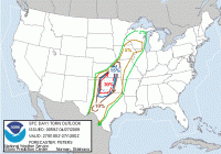
Worst SPC Bust Ever?

I like what Rich said about SPC not forecasting for chasers. I haven't seen a ton of it on this thread (although there was certainly some), but in the last couple years I've seen a lot of social media bashing of SPC outlooks when chasers come home disappointed. I feel it is really important to know how to forecast for yourself if you're going to be out. Besides, it's pretty funny to see how many great chase days or in areas away from the primary concern can come when SPC downplays an area.

Example: Sydney, Nebraska 5/19/14
20z Day 1 Outlook
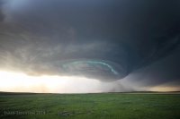
0ab92f77e4b30a14b7230a4e14273889.jpg
 
The models have been pretty divergent this year regarding mesoscale issues like early morning convection. That reduced the severe threat for a number of days. Not only that, but timing differences and extent of surface heating caused forecasting problems even on the day of a severe weather event.
 
I like what Rich said about SPC not forecasting for chasers. I haven't seen a ton of it on this thread (although there was certainly some), but in the last couple years I've seen a lot of social media bashing of SPC outlooks when chasers come home disappointed. I feel it is really important to know how to forecast for yourself if you're going to be out. Besides, it's pretty funny to see how many great chase days or in areas away from the primary concern can come when SPC downplays an area.

Example: Sydney, Nebraska 5/19/14
20z Day 1 Outlook
Great point Jared! I've had great chases on general thunder and the old 'see text' days. I also had a great chase on 5/19/14! Those storms were just asking for a camera to be present!
 
084e6f1ec9e17a75800f1632270c40d4.gif

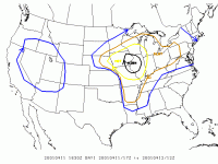
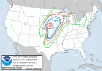
April 11, 2001- This is another big bust that I can remember (at least for IL). There were several tornadoes in Iowa this day on the western edge of the high risk area, however the Illinois portion busted pretty hard. I remember it being mostly cloudy all day over our area and rainy and that likely inhibited destabilization. This was opposed to Iowa that had a pretty good dry-slot that worked in and help clear things out in time for the show. It was also a very dynamic setup too, with most storms having low-topped characteristics. I would consider this a bust considering the heavily worded forecasts calling for potential of "strong to violent tornadoes" and "particularly damaging tornadoes" across into Northwest Illinois.

Here are the reports for the day, notice the clustering over Iowa. Most of these were rather weak tornadoes too with only one long track F3 occurring from N MO into S IA (occurring during the late morning hours too!!):


http://www.spc.noaa.gov/climo/reports/010411_rpts.gif

While most can probably argue this wasn't a bust per-say for the Iowa target, it was for the bulk of the High Risk area.
 
This was a bad one in terms of high risk tornado probability placement. I chased this stupid day too...

df76c1620d1de6be33448aea533c99b2.gif

View attachment 0a5734e5918a9fb8116ea23a67760238.gif
Funny thing about this day. We did a group forecast activity for this assignment. My group forecasted for that minimum in activity in southern Nebraska and our forecast lined up well with this forecaster's work. Only thing is, things just didn't work out. As for tornado potential in our area, things looked supportive of tornadoes, but storms didn't really occur in the region of greatest potential IIRC. There was a secondary max in tor potential to the east where the reports are, but we werent assigned that region.
 
I don't really consider cap busts much since the difference between a big event and a clear-sky bust can be razor thin sometimes (2002 was the year of the clear sky cap bust for me). As such, I think of "busts" as those events that significantly underwhelmed relative to the forecast when convective storms occurred. I'd really like to see the "perfect progs" / hindcasts for each event... I thought I saw a website that had perfect progs years ago, but I haven't seen it in probably 10 years.

Obvious preface: I'm not critiquing the forecasts or the forecasters. I would have many more "busts" if I had to publish a forecast several times a day every day of every year. That said, two significant "missed" high risks come to mind:
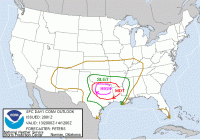
April 13th, 2007 -- http://www.spc.noaa.gov/exper/archive/event.php?date=20070413
This was actually an upgrade from MDT to HIGH on the 20z outlook. There was a decent tornado west of the high risk area, but the event as a whole was a lot less significant than forecast (i.e., 30% hatched tor prob).
Outlook: 4a5fdb535a0294964c033c5098be85f9.gif
Reports: View attachment 57b708a457ab8c23abfb91120dd1edb7.gif

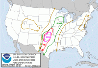
26 April 2009 -- http://www.spc.noaa.gov/exper/archive/event.php?date=20090426
I, along with chase partners, watched the Roll, OK, tornado from a relatively good perspective . Otherwise, given a 30% hatched tor prob that was actually expanded from the 20z to 01z outlook, this was a dud from a tornado standpoint.
Outlook: f79fc8165379a27e0e82dd2f6e894674.gif
Tor probs: 6148ce1094b07cc1cf405cf2f6dcd755.gif
Reports: View attachment 4550bb43aa62b64ecb22b3c1f6547988.gif
Note that most of these reports occurred during the afternoon, well before the 01z outlook that maintained 30% hatch tor probs in OK and KS and expanded them southwest into western north Texas.
 
Last edited:
Back
Top