The Perfect Chase Day

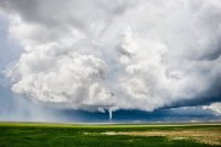
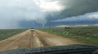
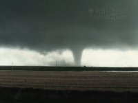
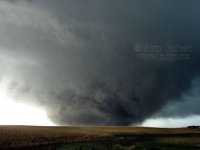
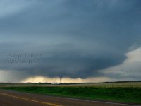
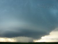
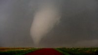
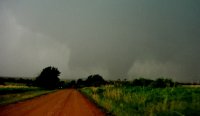
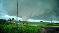
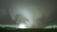
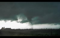
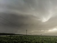
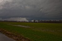
I have had a few days I would consider great days but May 9, 2015 has taken over for me as the best chase day. This day had about everything in one chase … There are many reasons why this has become the best ..

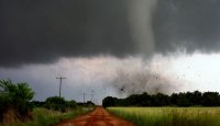
Great views of multiple tornadoes both day (Colorado) and nighttime (Kansas).
Tornadoes in two separate states on two separate supercells.
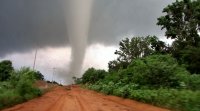
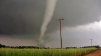
Clear up close view of the tornadoes especially the early white Eads ones.
Multiple tornadoes on the ground at the same time both day and night.
Was able to get very clear and great lighting video of the first and second Eads tornadoes. All tornadoes actually were clear of rain and obstructions.
Took my girlfriend and she saw her first tornadoes.
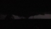
Saw multi-vortex and wedge tornadoes at night while in a completely safe position.Tornado #5.jpg
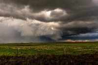
And really the #1 reason is that none of the tornadoes did any damage

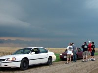
Here are a few photos obviously some are edited while others are screenshots.
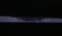
Tornado #11 12.jpg
 

Attachments

  • Tornado #2.jpg
    Tornado #2.jpg
    183 KB · Views: 204
  • Tornado #3 4.jpg
    Tornado #3 4.jpg
    156.7 KB · Views: 187
  • Tornado #13.jpg
    Tornado #13.jpg
    31.7 KB · Views: 124
It's a toss up between May 22, 2010 and June 17, 2010 for me.

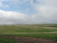
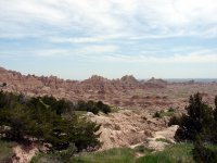
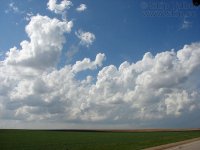
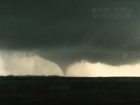
May 22 might come out on top just because it was the most perfectly well rounded start to end chase. It was my first time in South Dakota and it began with a trip through the Black Hills, badlands, and grasslands. We caught the storm at initiation from cumulus. There were a half dozen tornadoes of varying size and shape, and then textbook supercell structure. I think the tornado show was a little better on June 17, but May 22 was all around the most perfect chase day. That moment in front of the wedge is still one of the most intense of my life.

Traveling the beautiful plains, experiencing all the facets of a chase, and having some incredible, intense, and unforgettable experiences are what make a perfect chase day to me.

74b46132e383ba9c68d6a98b6b1c9bea.jpg
83b06968f000110ae43605f19f084daa.jpg
d917d93b08fcc1fe1a46b7a43fb4ce6e.jpg
16338ce6bb6ad1e65d43eb75fcb4ab9d.jpg
fcf1e433481324053b4177a479c642fa.jpg
db3ebfd8596431a93b36bc42202ba899.jpg
fdfeb28cd7ec6860cf019f67364fe468.jpg
5e2930e845344d57c1e5d1ca3150475e.jpg
1de758823117eb4b264e62d776d8e468.jpg
93c465dc2f211e2c47b92ba7a7f20f3e.jpg
Your time lapse videos of both events is "top shelf"!
 
For a theoretical, ideal chase day, it would be embarking on a marginal chase setup, far away from any metro areas and watching an intense, long-lived supercell evolve, even if it doesn't produce a tornado. There are messy days with tornadoes that were honestly not as rewarding as being one of the few chasers to witness an "isolated" supercell. I had a day like this on September 20th, 2015 and watching a supercell evolve for over four hours without seeing another chaser was one of my top chases of the year. No tornado? So what?

Don't get me wrong, I get a thrill out of chasing high-end, tornado outbreak setups, but there have been plenty of MRGL/SEE TEXT or SLGT risk days that produced highly photogenic storms. For me, there's also something about being on a storm that few other people are chasing. Chaser convergence isn't an issue and it's even more rewarding. I think back to the Big Spring, TX and Milnesand, NM days in 2015. A breathtaking tornado with only a few chasers hunting down storms.

Of the best chase days I've had, I would say they came back-to-back on June 16-17th, 2014. The Pilger day was an epic chase, especially considering I was on the Stanton EF-4 tornado before the twins and I saw a "spaceship" supercell later in the evening. The next day was essentially a repeat of "night of the twisters," watching a large tornado essentially sit and grind through a field, only to watch other tornadoes form into the night. Those days both targeted northeastern Nebraska, so there wasn't a ton of driving either. To top it off, June 18th wasn't very far away and produced another photogenic, long-lived tornado that I was able to chase.
 
I may never top May 24, 2008. After a rather disappointing outing in Kansas the previous day, I woke up in Cherokee, OK under a low cloud deck racing north with a persistent breeze from the east. I was chasing with my best friend Justin Teague and his late beagle affectionately known as "Charlie Pig".

This event was right in the middle of an ongoing tornado outbreak sequence which lasted from the 22nd-25th. Lots of chasers saw lots of tornadoes. To this point, our findings had been rather meager, a distant tornado and a brief spinup. May 24th featured a moderate risk in Nebraska with the slight risk trailing down the dryline into Oklahoma. The models were showing a classic setup in Nebraska closer to the low. The atmosphere decided to throw a wrench into everyone's plans with a massive overnight MCS in Kansas which completely turned over the atmosphere over the Sunflower State. As a result the deep tropical Gulf fetch which was forecast to advect into Nebraska had become bottled up in Oklahoma south of a deep outflow boundary which was located roughly along the HWY 412 corridor.

Prior engagements in Tulsa led us to not originally chase that Saturday in Nebraska, so the night before we drove back into Oklahoma to find a motel instead of getting into position for the next day's action like the rest of the migrating chase community. The moment I walked outside the motel into that muggy cool air and low-clouds streaming overhead, the anticipation and excitement we are all too familiar with set in. The draw of the chase was starting to tug at me. Justin and I drove down to Enid to get lunch and take a closer look at what kind of setup we were dealing with.

Central OK was right on the southern fringe of the stronger mid-level flow with H5 winds around 40kts. The outflow boundary showed up well on both surface and satellite. Impressive cloud streets were evident on both sides of the boundary with heating of the boundary layer well underway. Mesoanalysis showed an explosive thermodynamics with 4-5k SBCAPE and substantial SRH. The area was located under neutral height rises which meant any trigger would likely be related to mesoscale lift. The outflow boundary intersected a dryline in western Oklahoma. Convergence along these two boundaries combined with extreme buoyancy and a fairly weak cap made for a very potent localized tornado environment. Justin and I made a few quick calls to free up our schedules. After topping off the tank on my newly purchased Toyota 4Runner we set up just west of Enid in a part of Oklahoma which features some of the best chasing in the entire world. The terrain is mostly wide open and flat with a nearly perfect grid road network and excellent data network.

Two supercells formed in central Oklahoma. The first quickly went "tornado warned" as it crossed the outflow boundary. We toyed around with this storm for about half an hour before ditching it for a new cell going up to its southwest which was better positioned to latch onto the boundary instead of drifting too far into the stable air.
We were a bit late for the first tornado which has become known as the "Hog Farm" tornado. About 15 minutes after the first tornado lifted, the storm had cycled and a new tornado formed. We had a front row seat to this and a number of other tornadoes which formed in steady succession over the course of the next three hours. With an average motion between 10-20kts and a great road network we managed to get excellent, high contrast video footage. We witnessed 10 tornadoes this day of all shapes and sizes from a high contrast cone doing a drill press through groves of trees to a multiple vortex and a wedge nearly a mile wide.

Hennesey Tornado 5.jpghenessey tornado hi res.jpghenessey tornado hi res2.jpgmay 24 2008 tornado1.jpgmay 24 2008 tornado2.jpg
 
My "perfect" chase day is the image I've got for my avatar. July 16th 2015 here in Western Illinois. I think anything where I don't have to drive very far and I can still get top tier results, qualifies as "perfection" in my mind. I didn't have to drive far this day. We chased a supercell on the 13th up in LaSalle County, IL which never produced for us. I made a joke after the 13th busted, that the 16th would probably be the one to produce since it was a marginal setup (at least at first). We had clouds all morning on the 16th and a stout easterly wind (pretty strong for July), the warm front was lifting north by afternoon and we had managed to build in over 3K CAPE in addition to rather significant low level helicity values. I figured if we could get a storm to go up in that environment, there would be tornadoes, despite the SPC only going with a 2% bracket.

Sure enough we did and it produced numerous tornadoes from just across the Mississippi all the way almost to my back door (8 miles from my house!). We even had a point with 2 tornadoes on the ground at once from seperate mesocyclones. It was the first time in a long time, where I was actually concerned about getting hit by a tornado at my place, and if the storm would have cycled up again, I very well may have had that happen. Here are a couple grabs from that day: 82c69ca45c6caf024db09626e10fb9ad.jpg

8ba5ca7d4a5f5cfb3a36d74976ca1df5.jpg

d9094795f52b00c91629c8d6ddc19ffa.jpg

60ec97d12083286d946fee77f4bf3d07.jpg

Sorry for the size of the images, couldn't figure out how to get them smaller (couple of them are video grabs too fwiw). Also should note that this was one of 3 times last year where I was able to intercept tornadoes close to my home. I'm not sure I will see that happen again for a long time.
 
A perfect chase day to me would be one where my execution was as close to perfect as possible and it resulted in me seeing a large, photogenic tornado in an open area. This just recently happened after 6 years of chasing.

December 23rd, 2015. I left my house around 9 a.m with a target of Clarksdale, MS. Arrived around noon. Kicked back in a parking lot till storms starting firing just before 3 p.m. I had seen some stuff go up to my West in Arkansas that eventually produced a few tornadoes, but I stayed put and stuck to my original plan which was to get something coming up from the Southwest of me. I figured with fast storm speeds it would be best to get something from the Southwest, get in position, and let it pass me versus chasing after it.

Three storms started to form directly to my Southwest just like I imagined shortly before 3 p.m. Of the three, the middle one started exhibiting the best signs of a maturing supercell. This storm happened to be heading straight for my target area. I said to myself "that's the one". As it got closer it went severe warned. I always try to position near areas where I have good North-South and East-West options. I fired up the car and headed east for around 10 miles to get in good position. I found a nice opening (Not always easy to do in Mississippi) to park and wait on the storm. By this point it had gone tornado warned and had a reported tornado on it.

Within 5 minutes I could see a photogenic, almost mile wide wedge on the horizon. I was able to view it for almost 10 minutes from my position which wasn't bad considering 55mph storm motions. I was done with the chase by 3:45 p.m and home by 7:00 p.m. I could have kept chasing but I had gotten such great footage and had such a good time, I decided to call it a day and year. So I only had to go 3 hours from home and never had to venture more than 10 miles from my original target area to see my best tornado since 4/14/12. Add in the fact that it happened in one of the lowest tornado producing times of the year and I would say it was the perfect chase.

9c8300cfd1834231854d8b44a05b600a.jpg
 
Last edited:
Hard to pick one

March 18th 2012 Willow, OK for structure & setting up in great position to watch it.

April 14th 2012 Geneseo KS Soon as we got in position for this SUP it dropped the EF4. Caught Start to finish.

April 27th 2014 KS/MO border. Caught my Dad his first tornado. last day of the trip.

May 18th Rozel, KS Beautiful SUP and tornadoes. Plus, it was one of the most stressful & anxiety ridden waits. While stuff up North was getting reports of spin ups & South getting organized. I stuck it out and waited. https://youtu.be/sr10XGl4jNY
 
At the risk of being cussed off of storm track, Did anyone else have Rozel as their answer and now wants to change it to Simla? Because I'm changing my answer to Simla.
 
I'm so pissed about Simla...I was up in Rapid City on a trip with the wife...I live like 45 minutes from Simla. Ugh.

I've chased in your home town a couple of times. No winnage right there, but great storms. I'd take a bad storm day in Colorado over most of the good days I've had elsewhere on the plains. I've seriously considered becoming a Denver area resident more and more each time I get out there.
 
I've chased in your home town a couple of times. No winnage right there, but great storms. I'd take a bad storm day in Colorado over most of the good days I've had elsewhere on the plains. I've seriously considered becoming a Denver area resident more and more each time I get out there.
I'm originally from Michigan....only started chasing after I moved here. Love it here, weather awesome, views awesome. But it's getting crowded...
 
Hard to pick one

March 18th 2012 Willow, OK for structure & setting up in great position to watch it.

April 14th 2012 Geneseo KS Soon as we got in position for this SUP it dropped the EF4. Caught Start to finish.

April 27th 2014 KS/MO border. Caught my Dad his first tornado. last day of the trip.

May 18th Rozel, KS Beautiful SUP and tornadoes. Plus, it was one of the most stressful & anxiety ridden waits. While stuff up North was getting reports of spin ups & South getting organized. I stuck it out and waited. https://youtu.be/sr10XGl4jNY
Kansas-Missouri border is fairly long - can you be more specific?
 
Perfect and miserable, really...

May 8, 2009 was my perfect chase day. We had a historical Derecho that knocked out power for more than 3 weeks for some residents. Hundreds of thousands of trees were uprooted - southern IL is very wooded. Even to this day, you can still see many of the uprooted trees in certain parts of the area.

I chased one very weak, short lived tornado from this system and then took cover in a cemetery as 115 MPH straight line winds started rocking my truck like it was a tonka toy. I actually thought for a moment that a tornado was heading right for me, I'd never experienced a Derecho before. It was like a wall of white from what I can remember.

I got some video and photos but they were taken with a blackberry and so the quality is quite horrible.

Here is one of the videos, nothing fancy, bad quality as I said:


^the video might be kind of funny, I was a bit nervous lol, the scanner was going nuts... like listening to a scanner for Chicago or something!

Here is another crap quality video of the same event showing more of the wind as you can see the visibility out my window dramatically decreases. I added music because my narration is mainly just a bunch of profanity lol.

 
Back
Top