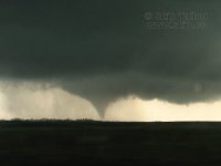
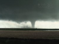
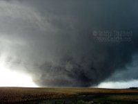
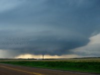
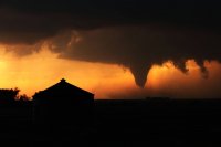
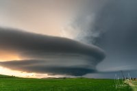
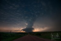
The Perfect Chase Day

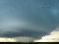
Being as though I drive quite a ways west from Milwaukee, WI for most of my chases, and many of them tend to be 1-2 day chase trip marathons due to work commitments, the biggest criteria I probably use to judge a chase is how lengthy and action packed the entire chase is. If I drive 10 hours to Grand Island, NE the night before a chase only to sit under a cap from morning until 6:30pm and then wind up with an incredibly photogenic storm or tornado just before dark, yes of course, that chase was more than worth the drive out. And I have come away with once in a lifetime type visuals and photos from such experiences. The May 26, 2013 LP mothership storm near Arcadia, NE comes immediately to mind. But as a whole, those chases don't hold a candle to ones that last 4-8 hours from mid afternoon into dark during which time I am witness to the same kind of action packed, awe inspiring visuals, for much of the day. It's just more bang for the buck. The second big criteria for me is how well my positioning was on the storms that day and how well I made out in documenting the experience, whether it be photos or video. The former having a large role in the success of the latter.

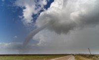
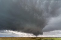
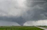
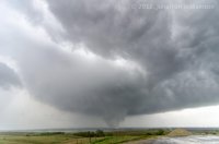
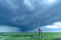
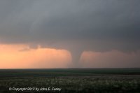
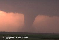
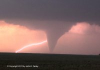
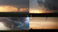
Using the above criteria, I would have to say it's a toss up for me between November 7, 2011 and April 14, 2012. Both days featured several hours worth of action packed chasing that included great storm structure and tornadoes of all shapes and sizes. November 7, 2011 featured one prolific tornado producing machine of a supercell in southwest OK. And on April 14, 2012, I was able to witness one major tornado on three separate supercells while stairstepping down a line from northern KS into central KS. And both days, I was able to come away with photos and video that I was proud of, so the documentation part was also satisfied for me. Hindsight is always 20/20, and I can look back on every chase and nit pick at decisions that were made or positioning on storms, etc., and these chase days aren't exempt from that self criticism. However, I would repeat these days exactly as I experienced them again in a heartbeat.

November 7, 2011
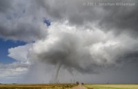
c2d077d8f2b7c62316548c08b7ac5f5b.jpg

6cd89497769fb63ace93b2851f1f64a7.jpg

59606742cbb8d77eb45caa9f4d810c97.jpg

April 14, 2014
61c3c29ce28cb117b9f3b62bb4d0a779.jpg

8fb4455cd6daf7c0659e85cf7289ef82.jpg

9c8664aade97a11df704c18e91aa9031.jpg
 
Beware: my post will have a touch of humble bragging. Deal with it :cool:

So my perfect chase day is one I constantly talk about. And its been my avatar since right after it happened. So here's the story. Back in late May 2010, I was doing pretty well. New job that let me chase when I asked, and I was racking up some nice tubes in the panhandle area blah blah blah.... It was truly, in my opinion, THE perfect chase.

WZWApYh.gif


Im only kidding. I expressed my jealousy earlier in chat. :(
 
Last edited by a moderator:
My perfect chase day was the same as yours, Adam - May 18, 2013. A big part of that was being patient and avoiding getting suckered south to the storms in OK. I started to do so 2 or 3 times, but each time at the last minute I thought, NO, don't leave this storm - it looks decent and is moving into a better environment. Once I saw the shear funnel south of Kinsley, I knew I was with this storm for the day, for better or worse. And it ended up far better than I could have ever imagined.

bec6a4529169a4e166c4d1a5e45eddab.jpg

b86885d5a7e43f932da6534b80ae469f.jpg

And my first lightning-and-tornado capture:

c77ea29e5d9a6b1191e03f6248980eb0.jpg

Only thing that kept it from being 100% perfect is that, trying to get a room for the night ahead of the chaser hordes, I left the storm when the Rozel tornado ended and missed the Sanford one. But still my best chase ever!

One other day deserving of honorable mention - September 29, 2014, when 30 miles from my home in Pagosa Springs, CO, chasing on impulse after noticing a REALLY good looking storm on radar (which was well west of the SPC slight risk that day), I caught the second tornado on record in Rio Arriba County, NM, at around 8,000 feet above sea level and west of the Continental Divide:

991216600eb5f99c50f5d59a4ebf3d86.jpg

Given where it occurred, it is not too surprising that I was the only chaser who witnessed this tornado, and so far as I know, I have the only picture or video of it.
 
It's a toss up between May 22, 2010 and June 17, 2010 for me.

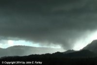
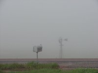
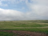
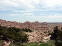
May 22 might come out on top just because it was the most perfectly well rounded start to end chase. It was my first time in South Dakota and it began with a trip through the Black Hills, badlands, and grasslands. We caught the storm at initiation from cumulus. There were a half dozen tornadoes of varying size and shape, and then textbook supercell structure. I think the tornado show was a little better on June 17, but May 22 was all around the most perfect chase day. That moment in front of the wedge is still one of the most intense of my life.

Traveling the beautiful plains, experiencing all the facets of a chase, and having some incredible, intense, and unforgettable experiences are what make a perfect chase day to me.

74b46132e383ba9c68d6a98b6b1c9bea.jpg
83b06968f000110ae43605f19f084daa.jpg
d917d93b08fcc1fe1a46b7a43fb4ce6e.jpg
16338ce6bb6ad1e65d43eb75fcb4ab9d.jpg
fcf1e433481324053b4177a479c642fa.jpg
db3ebfd8596431a93b36bc42202ba899.jpg
fdfeb28cd7ec6860cf019f67364fe468.jpg
5e2930e845344d57c1e5d1ca3150475e.jpg
1de758823117eb4b264e62d776d8e468.jpg
93c465dc2f211e2c47b92ba7a7f20f3e.jpg
 
Can't do it. Chasing is my life, and there are too many great memories. No human being has any right to see all the stuff I have seen. It's not fair. If you want to see my vids: https://www.youtube.com/user/ChaseTheSky/videos

I never even bothered to post the Pilger stuff yet. I don't know why. Special credit goes to Shane and David D for the inspiration they have given me.
 
Rozel is very hard to beat. Showed up to watch the CU field, Got a sunburn, Picked a storm out of the ether...Stuck with it. I even "called" it at one point before it really had any precip. Watched the cell merger, Tornado....move...Tornado....move....Tornado....move....Tornado....Followed by sunset/mammatus, Lightning+Rainbow, amazing sunset....Heat increased suddenly after the storm and we watched a landspout spin up at dusk right around my car and a few other chasers in the area (Lasted about 2 minutes), too dark to shoot. Met new people, High-fived total strangers, etc. However I don't have that many tornado days under my belt...had I been on time to Bowdle I'd probably have a different answer.

0402ae4208c5bfe714221f5fd7716ee0.jpg

f51082802fe64e6f71fd6584a125fc25.jpg

6e0d541fda2472ee98bf67573b19e2ef.jpg

45f3d60887a9755d5bb5d141af118eab.jpg

f204be041b02bf72c60d6f6fcf776efb.jpg
 
Ah, these are always tough to choose. I probably have three chases I'd consider near perfect, both for quality tornadoes as well as execution. April 14, 2012, May 22, 2010 and May 24, 2010. I'll let Jonathan Williamson's post for 4/14/12 speak for me since we were chasing together that day. Skip's post about Bowdle is similar to my experience so I'll post about the Howes, SD tornado which is the source of one of my most iconic photos.

IMG_1151.jpg

(nevermind that timestamp, it's always been wrong and I keep forgetting to fix it, this was definitely May 24th lol)

This is one of my all-time favorite chase days because the terrain was beautiful, the tornado very high contrast and rain free and mostly moved over open fields like in the photo above. My execution was near perfect this day as I was able to witness this tornado from genesis. This was my rookie chase season and I was just coming off the unbelievable Bowdle chase two days earlier and I think this is the chase where I started to become comfortable with edging closer to the tornado. As this one continued north towards the highway I drove east to get close to the crossing point where I pulled up behind Bill Hark and watched this tornado cross just a hundred yards or so behind a church just up the road. I'll always remember the power of the inflow into this tornado as it was difficult to stand and in one of my shots a photographer a bit further up is leaning into the wind with their legs braced to not get blown over.

IMG_1158.jpg


and while this cone was going on, to the right was a second, needle rope satellite tornado

IMG_1160.jpg


This was my last chase day in a two week vacation and I was just completely blown away (ha!) to end it on this note. A complete write-up of this day is available at http://www.nicknoltewx.com/blog/2010/05/24/may-24-2010-howes-south-dakota/
 
The perfect chase day for me obviously involves plenty of tornadoes, and living in Illinois, anytime I don't have to leave the state and can see tornadoes and still sleep in my own bed is appreciated.

I think posting in this thread most people who know me can assume where I'm going with this. My favorite chase day is a day that I'm not sure I'll ever top as far as multiple large photogenic tornadoes close to home. That'd be June 7th 2008.

I had been chasing absolutely relentlessly during the last half of May and first week of June. After several marathon chase days to Kansas/Colorado and back to Illinois with several sleepless nights on the highway I was just about spent. June 7th was actually a moderate risk day in Iowa, but I just wasn't feeling it. I hate Iowa, and after already having a career year under my belt I wasn't in the mood to risk a trip to the cursed state. Instead, I found an early afternoon Cubs game on WGN, ordered a pizza, and figured I would take a nap. But of course, I couldn't keep myself away from my laptop and decided to see how things were looking in Iowa as I had several friends chasing out that way. It didn't take long before northern Illinois suddenly caught my attention. We'd had several rounds of very loud morning thunderstorms in the area, and there was a vague residual boundary draped just too my north. We had 4500 j/kg of surface based cape, and helicity along the boundary was somewhere around 450 m2/s2. Good old early June midwest air with something like 85/70 and southeast flow at the surface along the boundary and a stronger than forecast shortwave approaching from Iowa. Okay, you have my attention.

The only problem was a fairly stout cap. I wasn't entirely sure a storm would actually develop to utilize that air. I decided I would hold my ground in front of the TV until I saw some sign that a storm was going to go up. Eventually a cu field started forming, so I got the chase gear together and tossed it in the car. Back in front of the TV I went... but then a few radar returns started appearing just to my northwest, one of which developed a hook echo while still basically a rain shower. In the car I was blasting up Interstate 57. You just don't ignore an environment like that.

I picked up the storm near Kankakee, southwest of Chicago, and the second I emerged from the precipitation core the storm planted a wedge. That was good enough for me, but the storm just kept going. It cycled like I have never seen a storm cycle before, wedge after wedge. Aside from maybe the formation of the Joplin tornado, I have never seen a handoff between wedges as quickly as this storm was performing. There is some video from a kid and his dad out there that shows a RFB one second, they turn a corner and 10 seconds later there is a well established wedge. I almost couldn't tell where one tornado was leaving off and a new one was forming. This wasn't multiple versions of the same circulation either, they were full occlusions followed by rapid formation of new mesocyclones. I feel like I'm writing on more than people care to read with a thread full of such amazing photos, so I'll just share my results and shut up. Needless to say though - it was an enjoyable hour drive home.

attachment.php
attachment.php
attachment.php
attachment.php
attachment.php


Here's a condensed video compilation from the day. I wished I'd been able to tripod the video at times, but being unprepared I began filming the first tornado and realized I had essentially no battery remaining. So the video camera was plugged into my inverter the entire time (which was also shorting out, causing the annoying beeping noise in the video)


Attachments

  • 1june7.jpg
    1june7.jpg
    7.9 KB · Views: 274
  • 2june7.jpg
    2june7.jpg
    10.2 KB · Views: 275
  • 3june7.jpg
    3june7.jpg
    7 KB · Views: 273
  • 4june7.jpg
    4june7.jpg
    8.7 KB · Views: 276
  • 5june7.jpg
    5june7.jpg
    9.9 KB · Views: 274
Really not sure why the board won't let me edit my post right now without telling me that my post is too short... but here is the youtube video that is associated with the above post. Not sure it was playing correctly in the original post but the board won't let me edit it without telling me that my post is not 20 characters long.

https://www.youtube.com/watch?v=jzYtTtBr3h0
 
I might be the only person to pick a day from 2009, but April 29 (east of Plainview, TX) really was it. Not too far from home, nailed the forecast, got close to the tornado, heard it, high contrast, and barely any chasers around.

Target was only about and hour and half from my house. Slept in till almost 11. Got up and check the forecast to see the obvious boundary across the dryline right up next to the Caprock. Get on the storm from when it first went up and get to enjoy hundreds of gustnadoes. I almost gave up on the storm thinking it had already crossed the boundary, so I go to bail east to other storms drops a funnel right in front of me. I pull over in a field and watch it drop right in front of me. I let it cross the road a 1/4 mile front of me, bringing power lines down near where Ben Holcomb, David Drummond, and Reed Timmer amough others that were along that road. Got to hear the waterfall soon after that and actually got it on video. After passing south of me it turns super high contrast and has a twin come down next to it. On top of doing most things right this day, had some really good luck to top it off.

I got hundreds of great pictures from this day. To see more, go here.


Video from April 29, 2009 -
Watch video >
 
Andrew June 7th 08 will forever be a top day for me as well. Simply the fact it was such a rare, iconic event so close to home. Everyone who knows me knows my story. I had oral surgery that morning so I couldn't be out in Iowa in the MDT risk, otherwise I probably would have. I was still very much a noob then, so only knew the very basics of forecasting. While recovering on meds, spitting up blood I saw the storm form on radar and reports spilling in. I was dizzy, could barely focus, in a crap-ton of pain. I thought "bah, typical spotters reporting scud tags."

Then the hail core beefed up on GR3 and I thought "sure, a core punch sounds fun." While I was getting ready to leave I heard YOUR report come over the radio. It was at that point I knew this was for real and I kicked it into high gear and the rest is history. Close to home tornadoes always hold a special place in ones heart, though for me the day largely fell on just plain ole fashioned dumb luck. This was also my first significant tornado, at this point I had traveled to the plains for 2 years and came up short with anything truly spectacular. I saw some tornadoes, but either brief bird-farts, low contrast or far away. I never thought my first true, good encounter with a tornado would be 15 miles from where I live.

amazingmesouj7.jpg

tornado1qz8.jpg

tornadopowerdj8.jpg
 
Thanks, everyone, for the great shots. Bennington was one of my favorite chase days - and Rozel one of my worst because I left Greensburg and went south - but I want to go back to the remarkable last week of May in 2004 for my perfect chase day. May 24, 2004 was a high risk day with a 25% hatched tornado bullseye over southeastern Nebraska, southwestern Iowa, and northwestern Missouri. We started the day in Beatrice. By early afternoon we were between towers to our west and a group to our east over Iowa. A supercell began to mature out of the field to our west and quickly went TOR-warned, so off we went. When we intercepted it just west of Chester, NE there were two tornadoes on the ground. Here's a shot of the main one. This looks northwest from NE-8 just west of U.S. 81:

ZRxFZ7X.jpg


This tornado gradually roped out as another funnel appeared a bit to the south and west:

O0BVzjz.jpg


We then bolted south on U.S. 81 into Kansas in order to re-intercept the cell as it moved slowly to the southeast. This shot looks northwest from U.S. 36 just west of Belleville, KS:

exMCgUm.jpg


Once we were in position, the storm then produced its last tornado on cue - a beautiful, graceful elephant trunk - in an open field just to our north:

jSYEosj.jpg


That's Brian Morganti's Tempest Tours van in the foreground. The show was over, but it was only about 4 p.m., so we decided to head further southeast after a line of storms that started to fire over eastern Kansas. Here's the flanking line:

xdNQLsP.jpg


We ended this perfect chase day with a great lightning display in Lyndon, KS. I was very much the noob at the time, and I foolishly thought that most days would be like this. HA!
 
While Rozel and Bennington are my top tornado days, vying for the top spot on my list is actually not a tornado day.

The LP supercell in Arcadia, NE on May 26, 2013 was pretty perfect for a non-tornadic storm. Slow-moving, easy to position around, and at the right time of day to get some good lighting on the incredible structure and the crazy lightning that it spat out. From the well-defined, isolated updraft to the blanket of mammatus that stretched over the whole scene, the storm was just a thing of beauty. Add frequent, intense lightning around all sides of the storm, it was a lightning photographer's dream capturing those bolts with that structure.

While I did not have an adequate camera of my own at the time, I did get some nice screen grabs from my video, including this one (which, admittedly, is two frames stacked so I could get the low-light exposure on the left/west side of the storm):

4ITS5kR.png


Watch video >
 
^^ I'll give a BIG plus one to May 26, 2013 as well, Mark. That's also my favorite non-tornado day by far. That storm was already gorgeous to behold at sunset, but after dark it went absolutely bonkers structure-wise as it began to shrivel up and die. I'm just glad I learned a big lesson after seeing Mike H's "tidal wave" shots from the 2011 McCook, NE supercell after dark and decided to stick around and watch the show for this one.

db975843d54a1174281ce77030d2b156.jpg

f6aabaa4f29dd07c848858a924558e43.jpg
 
Back
Top