Warren Faidley
Supporter
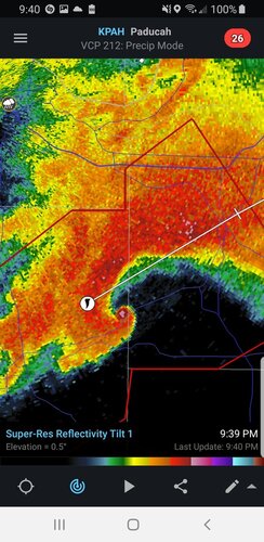
Looking like a record-setting, deadly tornado event tonight in AK, TN, MO and KY. Details to follow as information is confirmed, including a record 282 mph 5k ft. gate to gate Doppler velocity signature. Tornado just moved through Mayfield, KY (pop. 9,800 in 2019).