NCDC Java NEXRAD Viewer

Joined
Dec 8, 2003
Messages
802
Location
Bridge Creek, OK
I figured a few of you may be interested in this software. It is written in JAVA so it uses more RAM but it does almost the same thing that GRLEVEL2 does. Best yet its FREE!

http://www.ncdc.noaa.gov/oa/radar/jnx/

More Info: http://www.ncdc.noaa.gov/oa/radar/jnx/jnxv-basics.php

Image of the Beatrice Supercell 4/15/06 using this software. WOW!
Biatrice, NE Supercell Level II.jpg


Mick
 
Last edited by a moderator:
I hate to rain on the parade and I don't want to start the public-private discussion again.

That said, there have been several threads in recent months regarding the perception of too little funding for NOAA. Where in their mission statement does it say they are to be software developer and distributor?

If they focused their resources on their core mission, they would be more effective at it and funding would not be as much of a concern.

Finally, there is no such thing as "free." We pay for it every April 15.

Mike
 
Ok I guess I will be a little nicer... I have no idea why you (Mike) would even try to make this topic into a serious debatable subject, but I will just leave it at that.

Mick
 
Last edited by a moderator:
Thanks for the link! Will have to check out the software. :cool:

EDIT - WOW This is amazing sofware! It's so cool how no matter how far you zoom in, the background maps don't get blurry, and the smoothing in this program is great! I give this software 2 thumbs up!!
 
Last edited by a moderator:
Very nice! But too slow - takes too long to load/change views to really spend much time browsing. With data back to 1995, it's probably a good thing it is painfully slow otherwise I'd be sitting here all night looking at old radar from chases past. Definately a good resource that I'll keep handy!
 
Yeah Mike, Dan it is slower, but that is the down side of using Java. The good thing is though that just about anyone who has Java on their computer can run this application. Surprisingly though it runs pretty fast on my desktop.

I was just curious if anyone had any issues with the smoothing feature. All four of my computers can use the smoothing feature regardless of the video hardware installed.

Mick
 
That is another nice thing about it. GRLevel3 will not show smoothing on my home PC due to the video hardware, but this app will.

It will be nice to be able to finally go back and get radar for most of my past chase reports. For that I think I can deal with the slowness, especially after seeing these few examples.

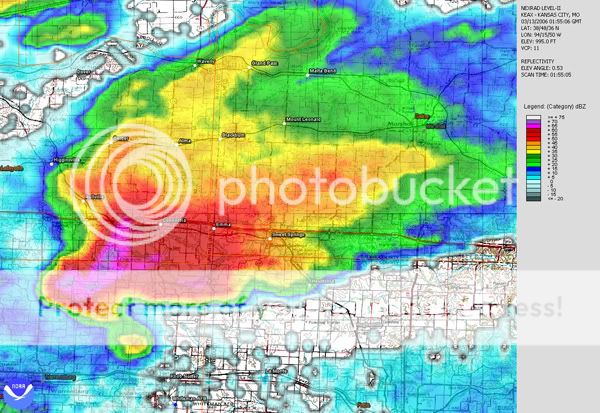
Here are a few grabs from the Perryville MO-Murphysboro IL storm on 9/22:

2132z2t.jpg
2122zvelt.jpg


2132zt.jpg
2138zt.jpg


Larger grabs:
http://wvlightning.com/sept2206/2132z2.jpg
http://wvlightning.com/sept2206/2132zvel.jpg
http://wvlightning.com/sept2206/2132z.jpg
http://wvlightning.com/sept2206/2138z.jpg
http://wvlightning.com/sept2206/2122zvel.jpg
 
Last edited by a moderator:
Let's not get confused with a static data viewer as opposed to a live data viewer. GRLevel3 is primarily a "Live" Data Viewer for Level III data coming from NOAA Servers at appox. 5 to 10 minute intervals.

GRLevel2 is primarily (or at least it used to be) a static Level II information viewer importing past or archived data very much the same way this Java Application is doing. However, I believe GRLevel2 is Live data capable.

Now, because the GRLevelX series of programs are run on your local computer, they require certain hardware specifications to perform certain advanced functions. Java Applications, on the other hand, are generally Server side applications in which you are veiwing the output on your local computer via the internet.

The speed to which you are referring is largely dependent upon internet usage and server resources available to run the programming that creates the image(s) you want to view.

All that said (and some one PLEASE correct me if my statements above are wrong!), it really depends on what you want to do with either the GRLevelX series, or the New Java Application. Obviously, budget minded folks would seriously look at the NOAA Java Application. I don't know the "real" differences between the two areas as far as what's available in features, but if I were looking to do research on a particular event, I think my vote would be got the GRLevelX series, especially GRLevel2 or the AE version.

Just my thoughts on the subject. Both have their place and both have their value. It really depends on what you want to use the data for.

John Diel
 
Wow. This is the long-track tornadic supercell that hit Charleston, WV on June 2, 1998. I know if I'd had GrLevelx I'd already be able to do this, but I chased this day and I never got to see ther radar of this storm until now. Mickey thanks again for posting this!!!!

1952zt.jpg
1947zvelt.jpg


http://wvlightning.com/june298/1947z.jpg
http://wvlightning.com/june298/1947zns.jpg
http://wvlightning.com/june298/1947zvel.jpg
http://wvlightning.com/june298/1952z.jpg
http://wvlightning.com/june298/1952zs.jpg
http://wvlightning.com/june298/1952zvel.jpg
http://wvlightning.com/june298/2002z.jpg
 
GRLevelX apps are all intended for live data and/or archived and work well in both modes.

Don't forget one of the most useful features (IMO) -- dynamic placefiles! Being able to plot near real-time surface (ASOS, mesonet, etc) observations, SPC products, satellite imagery, and other data is extremely beneficial and unique (I think) to GRx programs.
 
Just an update of this software. Does not support Live data but very cool for archived data.

http://www.ncdc.noaa.gov/oa/wct/index.php

Very cool, thanks. One thing I noticed (and this may be due to my own inexperience using this software) is that if you choose to enter the HAS job number to view the NCDC data on the site without downloading it, the program doesn't seem to recognize the gzip format. If I download and extract them it works fine. The tutorial seemed to indicate you could do this but I may be missing something. This was with the beta version 3.1.0 so that may have something to do with it as well.
 
Back
Top