Simone Lussardi
EF2
Hi there, ")
After days of pouring rain in the past weeks (the wettest year since a 1998) we get now a very strong SW monsoon surge, which brings a nice setup in southern China. Strong LLJ, presence of flow at the above level. The only weakness at the moment is the absence of a trough at the middle levels, with weak too flow. As GPT heights will fall with time, flow will increase also in the middle level.
This situation is going to last for... at least 7 days !! Yesterday I noticed the forming of many almost horizontal updraft, some with horizontal weak rotation in them.
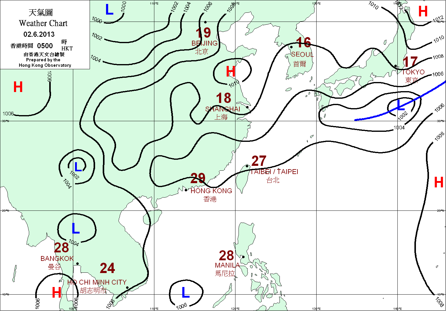
The situation (08:00 AM local time):

Already got numerous small storms firing up all around the area, especially to the north where the middle atmosphere is moving more. Here the sfc situation:
That monsoon low to my W-NW is forecast to remain there for quite a long time...
Also of interest to note how the winds back during the day. This is usual down here and can lead to very strong SRH:

This was 08:00 PM local time of yesterday.
Any evolution I'll post here.
Now:
Updated: 10:00 AM CST on June 19, 2005
Observed at Guangzhou, Guangdong (History)
Elevation: 26 ft / 8 m
88 °F / 31 °C
Mostly Cloudy
Heat Index: 102 °F / 39 °C
Humidity: 75%
Dew Point: 79 °F / 26 °C
Wind: 9 mph / 14 km/h from the SW
Pressure: 29.68 in / 1005 hPa
http://www.weatherunderground.com/cgi-bin/...query=GUANGZHOU
:wink:
After days of pouring rain in the past weeks (the wettest year since a 1998) we get now a very strong SW monsoon surge, which brings a nice setup in southern China. Strong LLJ, presence of flow at the above level. The only weakness at the moment is the absence of a trough at the middle levels, with weak too flow. As GPT heights will fall with time, flow will increase also in the middle level.
This situation is going to last for... at least 7 days !! Yesterday I noticed the forming of many almost horizontal updraft, some with horizontal weak rotation in them.
The situation (08:00 AM local time):
Already got numerous small storms firing up all around the area, especially to the north where the middle atmosphere is moving more. Here the sfc situation:
That monsoon low to my W-NW is forecast to remain there for quite a long time...
Also of interest to note how the winds back during the day. This is usual down here and can lead to very strong SRH:
This was 08:00 PM local time of yesterday.
Any evolution I'll post here.
Now:
Updated: 10:00 AM CST on June 19, 2005
Observed at Guangzhou, Guangdong (History)
Elevation: 26 ft / 8 m
88 °F / 31 °C
Mostly Cloudy
Heat Index: 102 °F / 39 °C
Humidity: 75%
Dew Point: 79 °F / 26 °C
Wind: 9 mph / 14 km/h from the SW
Pressure: 29.68 in / 1005 hPa
http://www.weatherunderground.com/cgi-bin/...query=GUANGZHOU
:wink:


