Ethan Schisler
EF5
I know there were a few people that chased yesterday so I figured I'd throw a reports thread in here. I didn't wake up until around 11am because I'd been out late the night before shooting lightning and then the previous morning I was down near Quincy chasing tornado warned storms late, so I hadn't chased the previous evenings tornadoes. I figured I might as well go out. I liked the fact we had strong southerly surface flow gusting in the upper 20 mph range at times, moisture was great, lapse rates weren't awesome, there was ample shear with 0-1km shear near 35 knots and 0-1km SRH around 300 on the late morning VWP from ILX. So I bolted out the door with my one camera and the lens attached to it from the day before and headed east. Tornado watch was issued and I headed toward Lincoln.
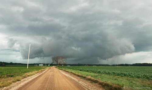
I debated about heading N or S. There were numerous tornado warnings NE of me and the low level shear was better with better critical angles, but I also saw a nice discrete supercell down by Jacksonville along with a line of cells going up to the W. One caught my eye SW of Petersburg and would pass close to Mason City where I had been about 30 minutes prior (grr). So I decided to actually head S a bit and then W and intercepted the first storm around Greenview, IL around 2pm. It was a gnarly looking HP supercell and had a rotating wall cloud on it. I was wondering why it wasn't tornado warned at the time, but I also didn't have great signal.
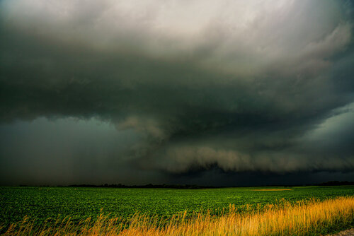
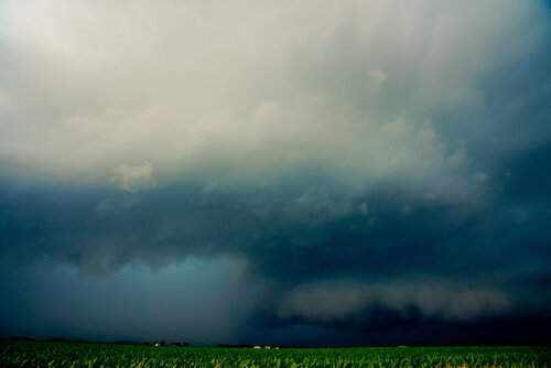
I really regret not grabbing my 12-24mm lens here, the updraft above me was pretty sculped out. I couldn't even capture it with my phone's pano setting.
I went N and E and followed this for a while. It produced a funnel cloud near Middletown that came 1/2 way down near the wind farms, but I couldn't confirm a tornado and RFD wrapped it in rain.
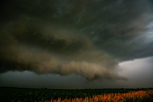
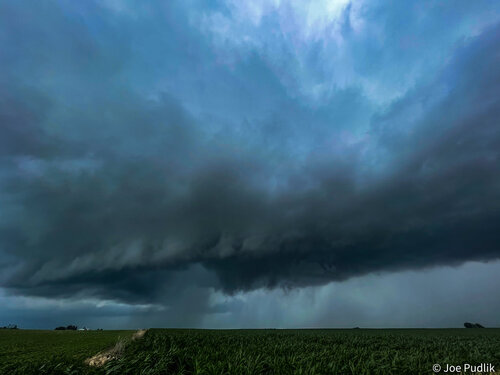
Some more dramatic HP structure that IL is known for
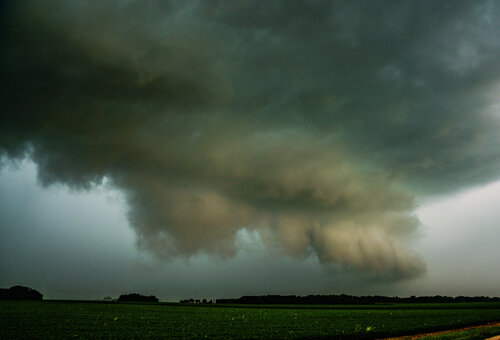
And at this point it is dead.
I headed southwest and caught the original Jacksonville storm as the tornado warning expired. It had decent structure near Williamsville, but was clear it was not going to be living much longer.
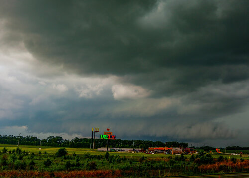
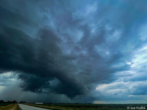
The cell back to its SW though near Sherman was gaining strength and my phone went off for a tornado warning. I caught visual of it just NE of Sherman looking SW and it had a rotating wall cloud with scud being pulled in and huge RFD core. I didn't have long before I would be engulfed by severe winds. I noted strong rotation, but couldn't confirm anything again.
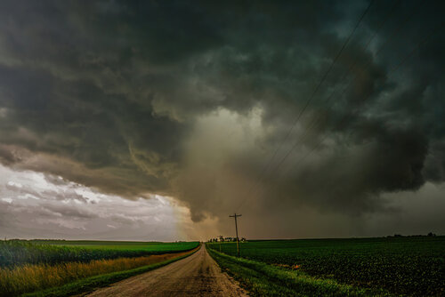
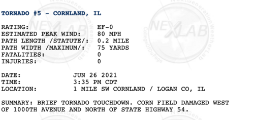
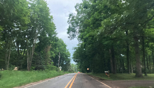
I headed northeast toward Mount Pulaski. When I passed through Buffalo Hart though I had a large rotating wall cloud and thought I was going to at least get a weak tornado, which there very well may have been. I had numerous rotating rain curtains and in town there was easily 70 mph winds with trees blowing down, dust being blown out of the grain elevators and coming off the roofs of the buildings. I had to dodge some downed trees on Highway 54. I got to Mount Pulaski and got visual of the storm. It had pretty much gone outflow at that point. My phone went off for another tornado warning, but I turned the car around and went home. It was a good enough day for me. A couple dramatic HP supercells, some strong wind, and several close attempts. It was good enough for me for a 2 hour drive from home.
I debated about heading N or S. There were numerous tornado warnings NE of me and the low level shear was better with better critical angles, but I also saw a nice discrete supercell down by Jacksonville along with a line of cells going up to the W. One caught my eye SW of Petersburg and would pass close to Mason City where I had been about 30 minutes prior (grr). So I decided to actually head S a bit and then W and intercepted the first storm around Greenview, IL around 2pm. It was a gnarly looking HP supercell and had a rotating wall cloud on it. I was wondering why it wasn't tornado warned at the time, but I also didn't have great signal.


I really regret not grabbing my 12-24mm lens here, the updraft above me was pretty sculped out. I couldn't even capture it with my phone's pano setting.
I went N and E and followed this for a while. It produced a funnel cloud near Middletown that came 1/2 way down near the wind farms, but I couldn't confirm a tornado and RFD wrapped it in rain.

Some more dramatic HP structure that IL is known for

And at this point it is dead.
I headed southwest and caught the original Jacksonville storm as the tornado warning expired. It had decent structure near Williamsville, but was clear it was not going to be living much longer.

The cell back to its SW though near Sherman was gaining strength and my phone went off for a tornado warning. I caught visual of it just NE of Sherman looking SW and it had a rotating wall cloud with scud being pulled in and huge RFD core. I didn't have long before I would be engulfed by severe winds. I noted strong rotation, but couldn't confirm anything again.

I headed northeast toward Mount Pulaski. When I passed through Buffalo Hart though I had a large rotating wall cloud and thought I was going to at least get a weak tornado, which there very well may have been. I had numerous rotating rain curtains and in town there was easily 70 mph winds with trees blowing down, dust being blown out of the grain elevators and coming off the roofs of the buildings. I had to dodge some downed trees on Highway 54. I got to Mount Pulaski and got visual of the storm. It had pretty much gone outflow at that point. My phone went off for another tornado warning, but I turned the car around and went home. It was a good enough day for me. A couple dramatic HP supercells, some strong wind, and several close attempts. It was good enough for me for a 2 hour drive from home.


