Classic supercell 100km west of Sydney 7th February 2007

Joined
Feb 27, 2004
Messages
220
Location
Australia
Hi,
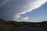
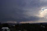
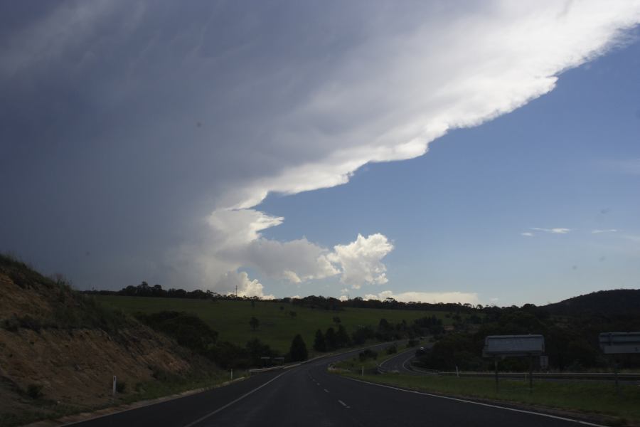
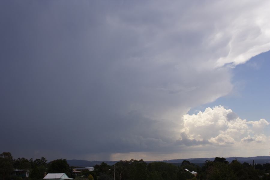
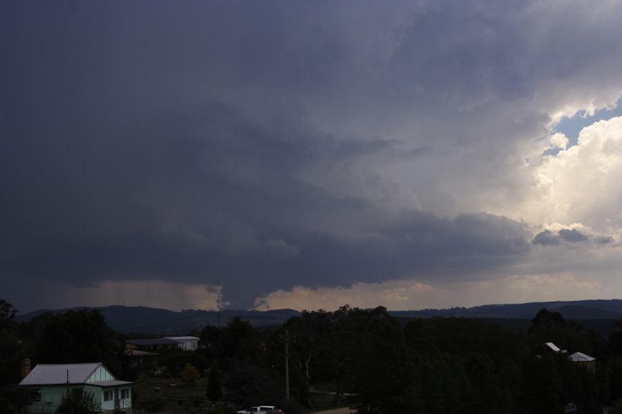
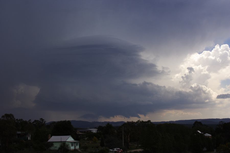
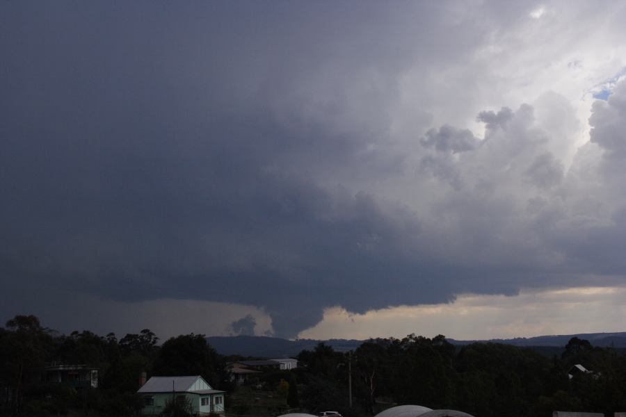
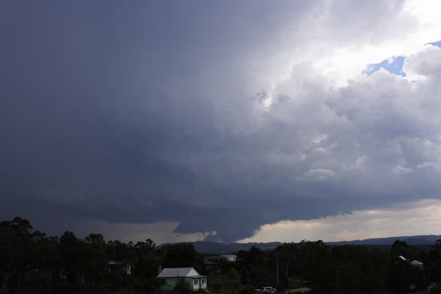
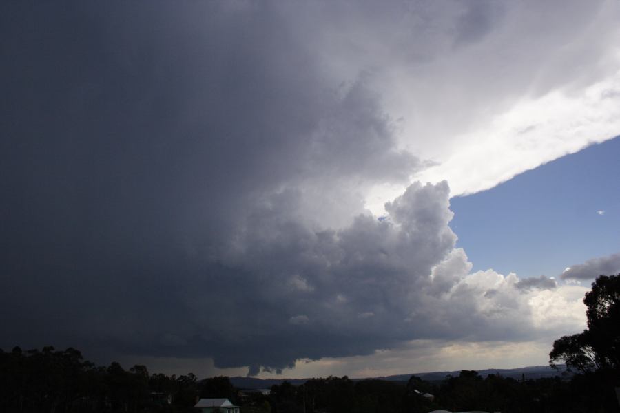
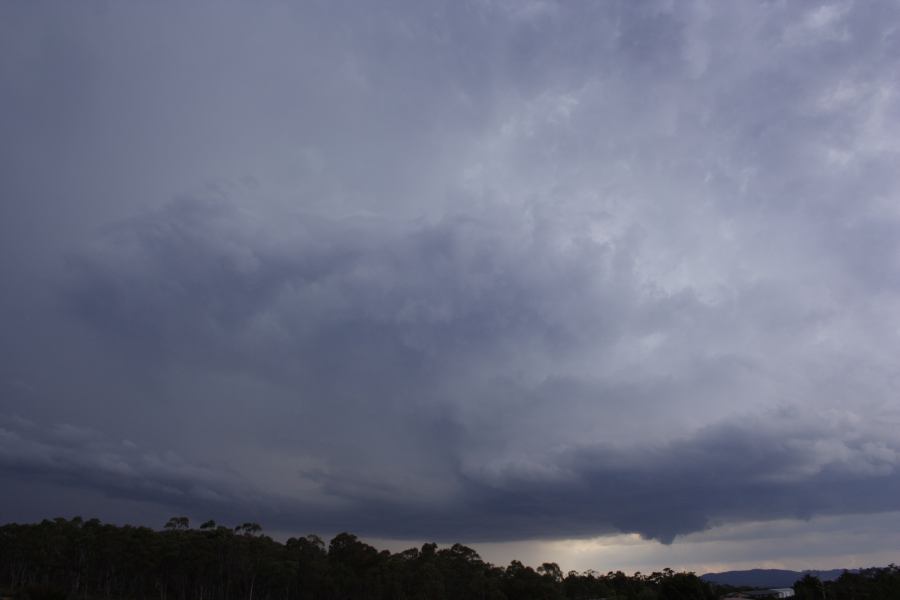
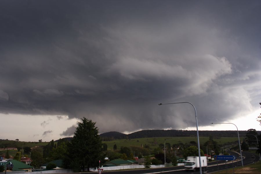
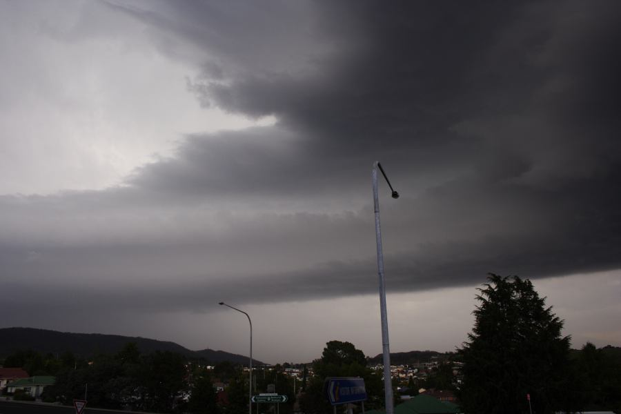
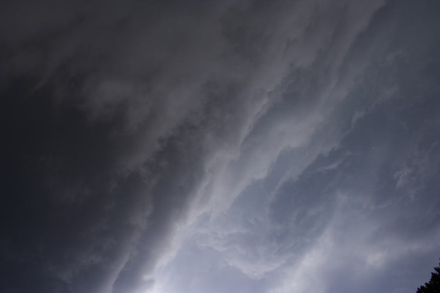
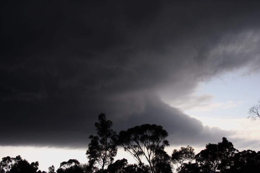
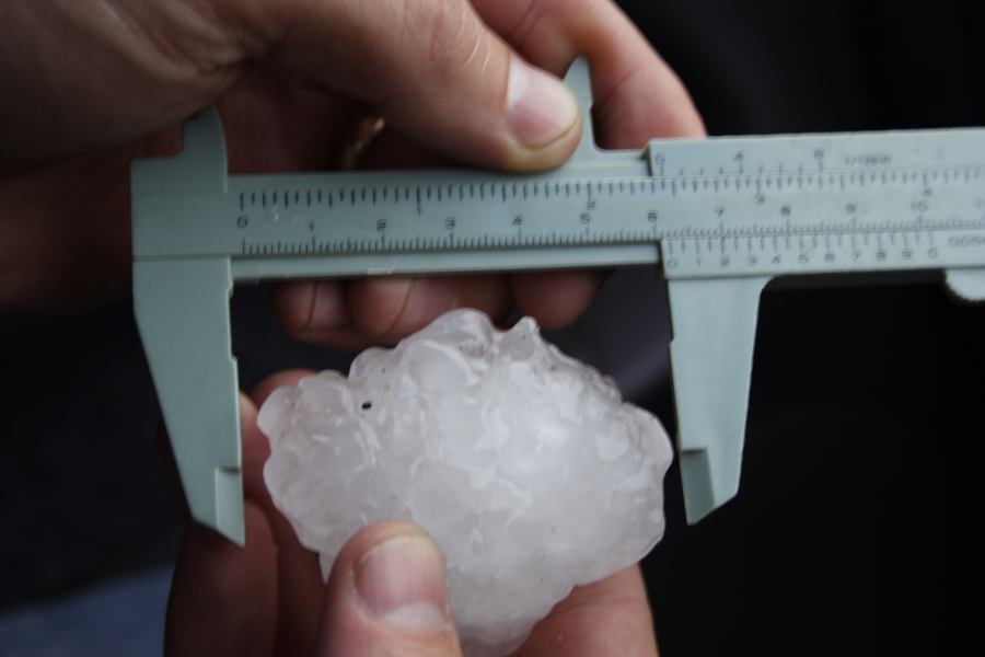
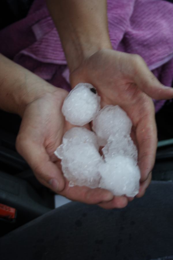
I must say this for Australia is very unusual and the most impressive classic supercell I have observed whilst chasing. It was also great that the chase distance was relatively low - not much more than a quarter tanks of fuel used. It's rotation was in Australian terms was strong and certainly would have been tornado warned had it occurred in the US.


http://www.australiasevereweather.com/photography/photos/2007/0207jd64.jpg
The adrenalin is still pumping!
Regards,
Jimmy Deguara


This beaver tail was so large I could not fit on frame being close up though it was very thick! The storm at this point was showing serious rotation!
 
Last edited by a moderator:
Absolutely incredible, and this is one more thing that makes Australia more like America, it just rotates backwards for us and yall drive on the other side of the road. I've been there on vacation before, lovely country, reminded me of America, well done.
 
First picture here shows the mesocyclone overhead rapidly rotating


beaver tail extended 10km out from the storm!

hailstones to 6cm in diameter as the vault passed over followed by the core

Actually Justin, I would suggest that this is the best classic supercell we have ever observed in this country. Most of the time, supercells become outflow dominant pretty quickly but this one didn't for a change making it a remarkable event and very close to producing a tornado.

The whole sequence is here:

http://www.australiasevereweather.com/photography/photos/2007/jd20070207.html

Our forum discussions with more video stills and so forth are in this thread:

http://www.australiasevereweather.com/forum/index.php?topic=344

Regards,

Jimmy Deguara
 
Last edited by a moderator:
I'm sure if it was daylight, I would have seen something like that in Andalusia,FL the night of the 2nd, you can read my account in the chase reports forum. I admit, those are incredible pics, I haven't seen something like that since I was home in Nashville for April 7th!, excellent job. Shoot, I might come to Australia for a different reason than seeing toilets go the wrong way.
 
Incredible pictures, that storm is beautiful and the pictures by Jimmy look like a tornado is on the ground. Awesome structure especially with the beaver/inflow tail.

Amazing... We should have that here in the Northern Hemisphere in approx 1-2 months.
 
Hi Jimmy! I'm glad that australian storm season is flying out! I love that kind of classic structure, and I see also an interesting lowering under the updraft: difficult to call it tornado but it's impressive anyway. Awesome pics.;)
 
Jimmy got it again, awesome catch, mate! Congrats on this amazing supercell, that inflow/beaver tail is simply awesome! How interesting to see those "mirrored" storms there.

Good luck and stay safe until May, ya know where ya'll find me :D
 
Beautiful storm! Was the tornadic-looking lowering in fact tornadic? You haven't said that it was so I'm guessing it was not, but either way it's hard to tell from still photos.
 
I am guessing the topographic features induced condensation leading to the base. I don't believe there was rapid rotation for a tornado to develop. There was no screaming inflow. This is the difference between the Great Plains and the hills (this region varied from 900m to 1290m at the highest point where this feature occurred).

Quite impressive. You will note that rotation seemed to increase as it passed overhead. The timelapse speed up ratio was significantly reduced at this stage!

Regards,

Jimmy Deguara
 
Wow---Pass me my blood pressure meds!

Thanks for posting the video to go along with the excellent stills. I'd have trouble sleeping after viewing that one.

The various wall clouds and lowerings certainly looked like they meant business---have you saved any radar or surface data?
 
Wow, great timelapse there Jimmy. That was a nicely rotating supercell. It looks like it tried to tornado many times there as it was sucking scud right off the ground.
 
Hi,

Yes the wall clouds developed rather rapidly and it was good to see separation. We don't know what happened once the storm left us as it would have taken 2 hours to get to the position of the next road in front of it. Even though this was very close to Sydney region (population 4 million), the national park NW of Sydney where this storm passed through has no roads due to the very rugged terrain. We didn't even bother giving chase. I just realised though that we may have been able to track the storm and watch from under the base.

Here is a radar prepared by Michael Bath (radar is supplied courtesy of the Bureau of Meteorology). Note a hook on the first storm as it passed through Lithgow - this was the region atht etime of increased rotation

http://australiasevereweather.com/storm_news/2007/radar/20070207/sydney128.htm

We had a second cell pass over and dump copious amounts of hail up to at least 3cm perhaps larger.

More data supplied here:

http://www.australiasevereweather.com/forum/index.php?topic=344.0

One of the differences on this day compared to others seems to be the 850hPa winds. Usually our soundings see a turning quickly to the NW and this does not allow favourable turning as was observed in this event.

Regards,

Jimmy Deguara
 
Last edited by a moderator:
Back
Top